Conostom
Hill, Mountain in Ross-shire
Scotland
Conostom
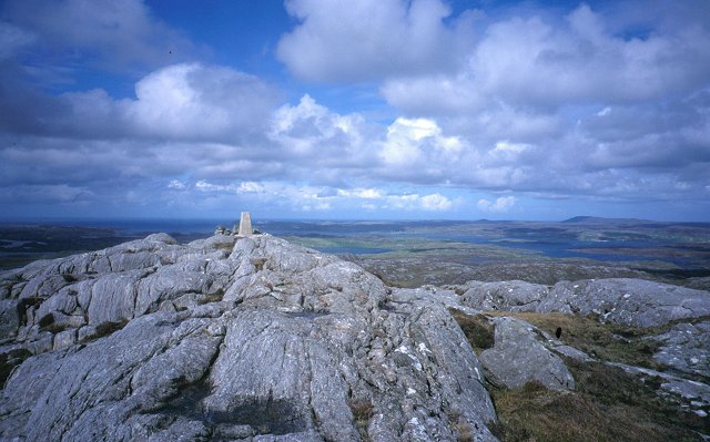
Conostom is a hill located in Ross-shire, Scotland. Standing at an elevation of approximately 600 meters, it is a prominent feature of the landscape in the area. The hill is part of the larger mountain range known as the Northwest Highlands, which spans across the Scottish Highlands.
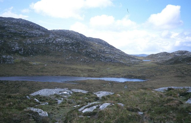
Conostom is characterized by its rugged and rocky terrain, typical of the Scottish Highlands. The hill is covered in heather and grasses, which add to its natural beauty. The slopes of Conostom are steep and can be challenging to climb, making it a popular destination for hikers and mountaineers seeking a thrilling adventure.
From the summit of Conostom, breathtaking panoramic views of the surrounding landscape can be enjoyed. On clear days, it is possible to see the neighboring peaks, lochs, and glens, creating a picturesque scene that attracts nature enthusiasts and photographers alike.
The hill is also home to a variety of wildlife, including red deer, mountain hares, and various bird species. It is not uncommon to spot these animals during a hike up Conostom, offering visitors a chance to experience the natural biodiversity of the area.
Conostom is easily accessible, with several trails and paths leading up to its summit. However, it is important to note that proper hiking gear and navigation skills are necessary to ensure a safe and enjoyable experience.
If you have any feedback on the listing, please let us know in the comments section below.
Conostom Images
Images are sourced within 2km of 58.167564/-6.8203283 or Grid Reference NB1629. Thanks to Geograph Open Source API. All images are credited.
Conostom is located at Grid Ref: NB1629 (Lat: 58.167564, Lng: -6.8203283)
Unitary Authority: Na h-Eileanan an Iar
Police Authority: Highlands and Islands
What 3 Words
///stores.saturate.fracture. Near Carloway, Na h-Eileanan Siar
Nearby Locations
Related Wikis

Callanish VIII
The Callanish VIII stone setting is one of many megalithic structures around the better-known (and larger) Calanais I on the west coast of the Isle of...

Eilean Chearstaidh
Eilean Kearstay (Scottish Gaelic: Eilean Chearstaigh) is an uninhabited island in Loch Roag in the Outer Hebrides of Scotland. It lies south east of Great...

Callanish Stones
The Callanish Stones (or "Callanish I": Scottish Gaelic: Clachan Chalanais or Tursachan Chalanais) are an arrangement of standing stones placed in a cruciform...

Gisla Hydro-Electric Scheme
Gisla Hydro-Electric Scheme was a small scheme promoted by the North of Scotland Hydro-Electric Board on the Isle of Lewis, Outer Hebrides, Scotland. It...
Nearby Amenities
Located within 500m of 58.167564,-6.8203283Have you been to Conostom?
Leave your review of Conostom below (or comments, questions and feedback).