Sròn na Gaoith
Landscape Feature in Ross-shire
Scotland
Sròn na Gaoith
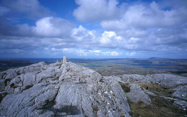
Sròn na Gaoith is a prominent landscape feature located in Ross-shire, Scotland. It is a mountain ridge that stretches approximately 7 kilometers in length and reaches an elevation of 3,228 feet (984 meters). The name "Sròn na Gaoith" translates to "nose of the wind" in Scottish Gaelic, which is fitting considering its exposed and windswept nature.
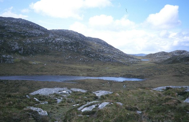
The ridge is part of the Cairngorms National Park and offers stunning panoramic views of the surrounding landscape. It is composed of rugged terrain, with steep slopes and rocky outcrops, making it a challenging but rewarding destination for hikers and mountaineers. The summit of Sròn na Gaoith offers breathtaking vistas of the nearby Loch Eanaich and the surrounding mountains, including Braeriach, the third-highest peak in Scotland.
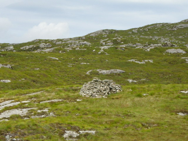
The landscape of Sròn na Gaoith is characterized by its diverse flora and fauna. The lower slopes are covered in heather and grasses, while the upper reaches are home to alpine plants and mosses. The ridge also provides a habitat for various bird species, including golden eagles and peregrine falcons.
Due to its remote location and rugged terrain, access to Sròn na Gaoith requires some level of experience and preparation. However, it is a popular destination for outdoor enthusiasts seeking a challenging and rewarding adventure in the Scottish Highlands. Whether it is for hiking, mountaineering, or simply enjoying the breathtaking scenery, Sròn na Gaoith offers an unforgettable experience for nature lovers.
If you have any feedback on the listing, please let us know in the comments section below.
Sròn na Gaoith Images
Images are sourced within 2km of 58.158665/-6.8189689 or Grid Reference NB1629. Thanks to Geograph Open Source API. All images are credited.
Sròn na Gaoith is located at Grid Ref: NB1629 (Lat: 58.158665, Lng: -6.8189689)
Unitary Authority: Na h-Eileanan an Iar
Police Authority: Highlands and Islands
What 3 Words
///eyeful.photocopy.include. Near Carloway, Na h-Eileanan Siar
Nearby Locations
Related Wikis

Gisla Hydro-Electric Scheme
Gisla Hydro-Electric Scheme was a small scheme promoted by the North of Scotland Hydro-Electric Board on the Isle of Lewis, Outer Hebrides, Scotland. It...

Callanish VIII
The Callanish VIII stone setting is one of many megalithic structures around the better-known (and larger) Calanais I on the west coast of the Isle of...

Eilean Chearstaidh
Eilean Kearstay (Scottish Gaelic: Eilean Chearstaigh) is an uninhabited island in Loch Roag in the Outer Hebrides of Scotland. It lies south east of Great...

Callanish Stones
The Callanish Stones (or "Callanish I": Scottish Gaelic: Clachan Chalanais or Tursachan Chalanais) are an arrangement of standing stones placed in a cruciform...
Have you been to Sròn na Gaoith?
Leave your review of Sròn na Gaoith below (or comments, questions and feedback).