Cnoc Mora
Hill, Mountain in Ross-shire
Scotland
Cnoc Mora
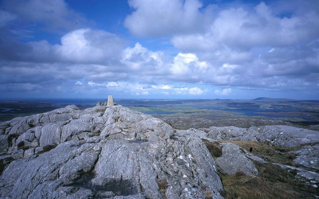
Cnoc Mora is a prominent hill located in the county of Ross-shire, in the Scottish Highlands. Rising to an elevation of 558 meters (1,831 feet), it is considered one of the notable hills in the region. Its name is derived from the Gaelic language, with "Cnoc" meaning hill and "Mora" meaning big, indicating its notable size.
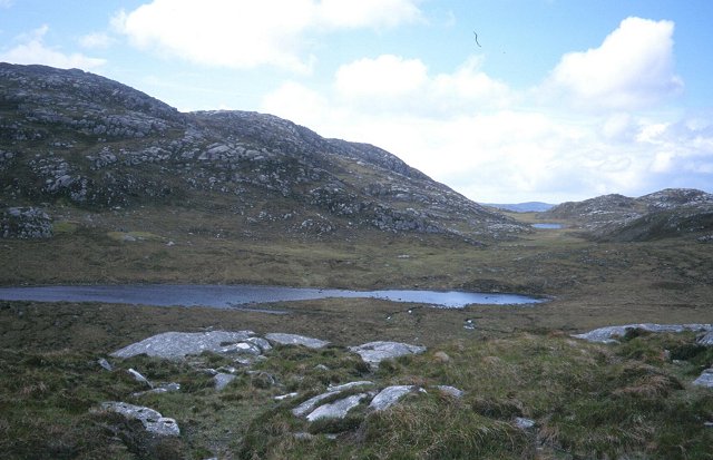
Situated near the village of Ullapool, Cnoc Mora offers breathtaking panoramic views of the surrounding landscape. On a clear day, visitors can enjoy vistas stretching across the nearby Loch Broom and the mountainous terrain that characterizes the region. The hill's location in the Scottish Highlands provides an opportunity for hikers and outdoor enthusiasts to explore the wilderness and experience the stunning natural beauty of the area.
Cnoc Mora is accessible via various hiking trails that wind through the rugged terrain. The climb to the summit is challenging but rewarding, with stunning vistas awaiting those who reach the top. The hill is also a popular spot for birdwatching, offering opportunities to observe various species of birds in their natural habitat.
Due to its location in Ross-shire, Cnoc Mora is a popular destination for both locals and tourists seeking outdoor activities and a chance to immerse themselves in the stunning Scottish landscape. Its combination of scenic beauty, challenging terrain, and rich biodiversity make it an attractive destination for nature lovers and adventure seekers alike.
If you have any feedback on the listing, please let us know in the comments section below.
Cnoc Mora Images
Images are sourced within 2km of 58.180827/-6.8230812 or Grid Reference NB1631. Thanks to Geograph Open Source API. All images are credited.
Cnoc Mora is located at Grid Ref: NB1631 (Lat: 58.180827, Lng: -6.8230812)
Unitary Authority: Na h-Eileanan an Iar
Police Authority: Highlands and Islands
What 3 Words
///prelude.inflation.gone. Near Carloway, Na h-Eileanan Siar
Nearby Locations
Related Wikis

Callanish VIII
The Callanish VIII stone setting is one of many megalithic structures around the better-known (and larger) Calanais I on the west coast of the Isle of...

Eilean Chearstaidh
Eilean Kearstay (Scottish Gaelic: Eilean Chearstaigh) is an uninhabited island in Loch Roag in the Outer Hebrides of Scotland. It lies south east of Great...

Dun Bharabhat, Great Bernera
Dun Bharabhat (or Dun Baravat) is an Iron Age galleried dun or "semi-broch" situated on the island of Great Bernera near Lewis in Scotland (grid reference...
Fuaigh Beag
Fuaigh Beag or Vuia Be(a)g is an island in the Outer Hebrides. It is off the west coast of Lewis near Great Bernera in Loch Roag. Its name means "little...
Nearby Amenities
Located within 500m of 58.180827,-6.8230812Have you been to Cnoc Mora?
Leave your review of Cnoc Mora below (or comments, questions and feedback).