Mullach Mòr

Hill, Mountain in Argyllshire

Scotland

Mullach Mòr

Rinn Thorbhais By following the sheep tracks you can just make it into the grid square, and then you reach a very bracing location.  Well on windy day like this it is. The sheep line on the rocks above looking on interestedly!
Rinn Thorbhais Credit: Roger McLachlan

Mullach Mòr is a prominent hill located in the region of Argyllshire, in southwestern Scotland. With an elevation of 847 meters (2,779 feet), it stands as one of the highest peaks in the area and offers stunning panoramic views of the surrounding landscape.

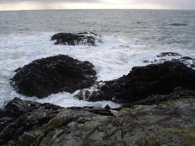
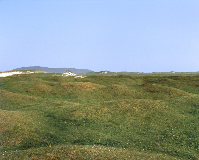
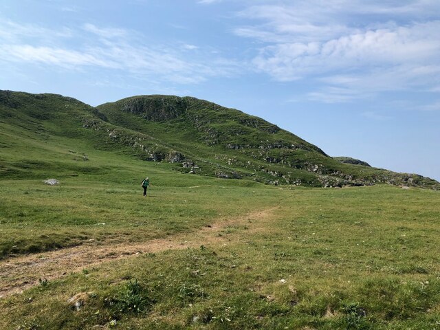
Situated in the Grampian Mountains, Mullach Mòr is part of a range known for its rugged and dramatic terrain. The hill is characterized by steep slopes, rocky outcrops, and scattered patches of heather and grasses. Its summit is marked by a prominent cairn, which serves as a navigational aid for hikers and mountaineers.

Access to Mullach Mòr is primarily gained from the nearby village of Inverlochy. From there, a well-defined path leads visitors through a beautiful glen before ascending the hill. The route is challenging but rewarding, offering glimpses of cascading waterfalls and picturesque lochs along the way.

Mullach Mòr is a popular destination for outdoor enthusiasts, attracting hikers, climbers, and nature lovers from near and far. The hill provides various routes catering to different levels of experience, allowing visitors to choose their preferred level of challenge. On clear days, the summit offers breathtaking views of Loch Linnhe and the nearby islands of Mull and Lismore.

With its striking beauty and unique natural features, Mullach Mòr is an exceptional destination for those seeking adventure and tranquility in the heart of Scotland's stunning landscape.

If you have any feedback on the listing, please let us know in the comments section below.
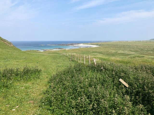
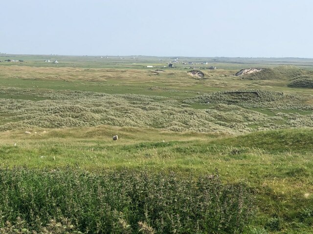
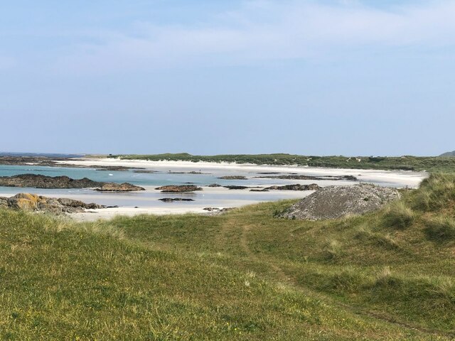
Mullach Mòr Images

Images are sourced within 2km of 56.46143/-6.9723987 or Grid Reference NL9341. Thanks to Geograph Open Source API. All images are credited.

Rinn Thorbhais By following the sheep tracks you can just make it into the grid square, and then you reach a very bracing location.  Well on windy day like this it is. The sheep line on the rocks above looking on interestedly!
Rinn Thorbhais
By following the sheep tracks you can just make it into the grid square, and then you reach a very bracing location. Well on windy day like this it is. The sheep line on the rocks above looking on interestedly!
Tiree - Dunan Nighean - view WNW Looking across  Balephuil Bay to Ceann a' Mhara from Dunan Nighean near Balephuil with the sands of Tràigh Bhi on the right. The coast here at Dunan Nighean is very indented with many tiny rocky coves and inlets.
Tiree - Dunan Nighean - view WNW
Looking across Balephuil Bay to Ceann a' Mhara from Dunan Nighean near Balephuil with the sands of Tràigh Bhi on the right. The coast here at Dunan Nighean is very indented with many tiny rocky coves and inlets.
Tiree - Abhain a' Bhèidhe Abhain a' Bhèidhe trickles to Tràigh Bhi through dunes south of Loch a' Phuill
Tiree - Abhain a' Bhèidhe
Abhain a' Bhèidhe trickles to Tràigh Bhi through dunes south of Loch a' Phuill
Tiree - Tràigh Bhi - view westwards Looking along the sands of Tràigh Bhi westwards with the promontory of Ceann a' Mhara delimiting the western end of Balephuil Bay.
For the view in the opposite direction, see <a href="https://www.geograph.org.uk/photo/6909792">NL9540 : Tiree - Tràigh Bhi - view ESE</a>
Tiree - Tràigh Bhi - view westwards
Looking along the sands of Tràigh Bhi westwards with the promontory of Ceann a' Mhara delimiting the western end of Balephuil Bay. For the view in the opposite direction, see NL9540 : Tiree - Tràigh Bhi - view ESE
Tiree - Tràigh Bhi - view ESE The view in the opposite direction to <a href="https://www.geograph.org.uk/photo/6909782">NL9540 : Tiree - Tràigh Bhi - view westwards</a> along the beach towards the settlement of Balephuil. The radome atop Ben Hynish can be seen centre image.
Tiree - Tràigh Bhi - view ESE
The view in the opposite direction to NL9540 : Tiree - Tràigh Bhi - view westwards along the beach towards the settlement of Balephuil. The radome atop Ben Hynish can be seen centre image.
Tiree - Bogha Ruadh from Tràigh Bhi A view of the straggly rocks of Bogha Ruadh from the beach of Tràigh Bhi
Tiree - Bogha Ruadh from Tràigh Bhi
A view of the straggly rocks of Bogha Ruadh from the beach of Tràigh Bhi
Tiree - The eastern coast of Ceann a' Mhara  Looking across Balephuil Bay from the coastal slopes of Ceann a' Mhara with Ben Hynish in the distance.
Tiree - The eastern coast of Ceann a' Mhara
Looking across Balephuil Bay from the coastal slopes of Ceann a' Mhara with Ben Hynish in the distance.
Tiree - Tràigh Bhi from coast above Bogha Ruadh The grassy lower slopes of Ceann a' Mhara looking over the rocks of Bogha Ruadh to the sands of Tràigh Bhi
Tiree - Tràigh Bhi from coast above Bogha Ruadh
The grassy lower slopes of Ceann a' Mhara looking over the rocks of Bogha Ruadh to the sands of Tràigh Bhi
Tiree - Dunes above Tràigh Bhi  These undulating dunes rise many metres/feet above the sands of Tràigh Bhi and extend a long way inland becoming expanses of machair
Tiree - Dunes above Tràigh Bhi
These undulating dunes rise many metres/feet above the sands of Tràigh Bhi and extend a long way inland becoming expanses of machair
Grassy Dunes In the centre of an extensive area of sand dunes. Carnan Mor in the background with the radar station just visible.
From a print, date approximate.
Grassy Dunes
In the centre of an extensive area of sand dunes. Carnan Mor in the background with the radar station just visible. From a print, date approximate.
Tràigh Bhì View towards Beinn Ceann a' Mhara
Tràigh Bhì
View towards Beinn Ceann a' Mhara
Tràigh Bhì A celebrated beach on the south west corner of Tiree.
Tràigh Bhì
A celebrated beach on the south west corner of Tiree.
Tràigh Bhì A celebrated beach on the south west corner of Tiree.
Tràigh Bhì
A celebrated beach on the south west corner of Tiree.
Fence above Tràigh nan Gilean Grazings on Beinn Ceann a' Mhara.
Fence above Tràigh nan Gilean
Grazings on Beinn Ceann a' Mhara.
Dunes, Barrapol A big area of cattle grazed sand dunes, southwest Tiree.
Dunes, Barrapol
A big area of cattle grazed sand dunes, southwest Tiree.
Gate, Tràigh nan Gilean A way through the barbed wire cattle fences. From here it is an easy walk over to Tràigh Bhì.
Gate, Tràigh nan Gilean
A way through the barbed wire cattle fences. From here it is an easy walk over to Tràigh Bhì.
Tràigh nan Gilean
Tràigh nan Gilean
Beinn Ceann a' Mhara The hilly southwest corner of Tiree.
Beinn Ceann a' Mhara
The hilly southwest corner of Tiree.
Show me another place!

Mullach Mòr is located at Grid Ref: NL9341 (Lat: 56.46143, Lng: -6.9723987)

Unitary Authority: Argyll and Bute

Police Authority: Argyll and West Dunbartonshire

What 3 Words

///meaty.bunch.station. Near Scarinish, Argyll & Bute

Related Wikis

Mannal

Mannal is a coastal hamlet on the west side of Hynish Bay, on the island of Tiree, Scotland. The township of Mannal lies on the southwest corner of Tiree...

Tiree Music Festival

Tiree Music Festival is a Scottish folk music festival held annually on the Island of Tiree in the Inner Hebrides. The festival was founded in 2010 by...

Tiree Airport

Tiree Airport (Scottish Gaelic: Port-adhair Thiriodh) (IATA: TRE, ICAO: EGPU) is located 2.5 nautical miles (4.6 km; 2.9 mi) north northeast of Balemartine...

Nearby Amenities

Located within 500m of 56.46143,-6.9723987
Natural: cave_entrance
Lat/Long: 56.4601185/-6.9788354
Natural: cave_entrance
Lat/Long: 56.4618928/-6.977973
The data included in this document is from www.openstreetmap.org. The data is made available under ODbL.

Have you been to Mullach Mòr?

Leave your review of Mullach Mòr below (or comments, questions and feedback).