Knock Hungavat

Hill, Mountain in Inverness-shire

Scotland

Knock Hungavat

Blathaisbhal stone row A stone row composed of three stones. Like most rows it is far from straight (Scale 1m).
<span class="nowrap"><a title="https://stonerows.wordpress.com/gazetteer/region/western-isles/blashaval/" rel="nofollow ugc noopener" href="https://stonerows.wordpress.com/gazetteer/region/western-isles/blashaval/">Link</a><img style="margin-left:2px;" alt="External link" title="External link - shift click to open in new window" src="https://s1.geograph.org.uk/img/external.png" width="10" height="10"/></span>
Blathaisbhal stone row Credit: Sandy Gerrard

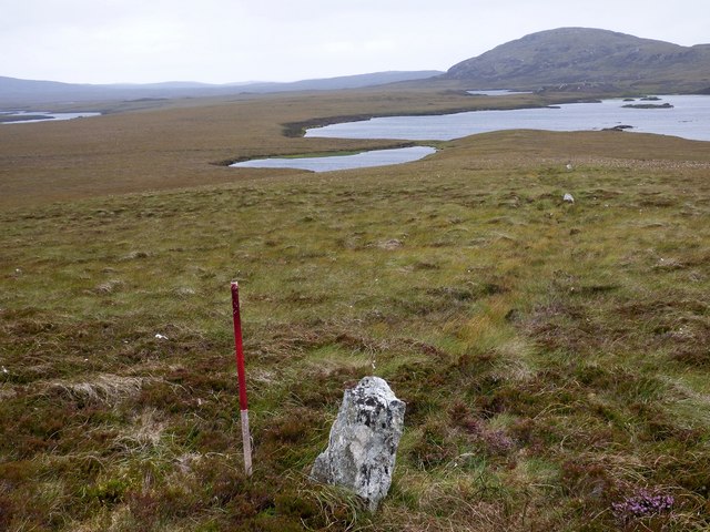
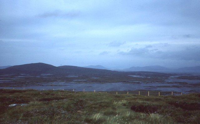
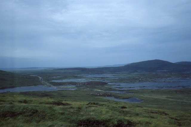
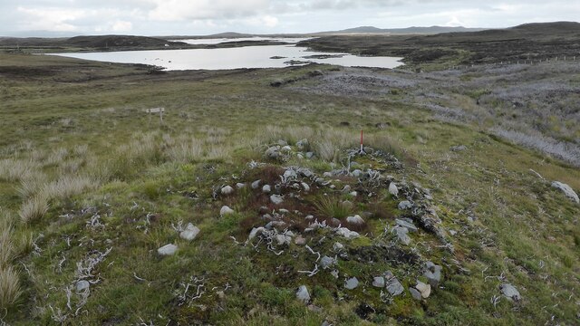
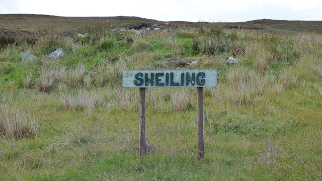
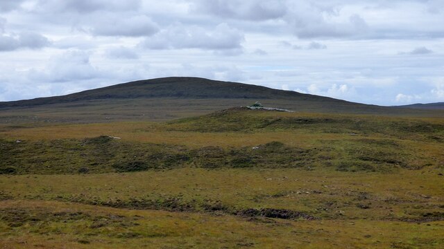
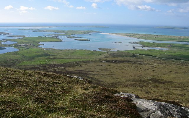
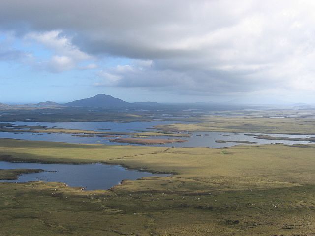
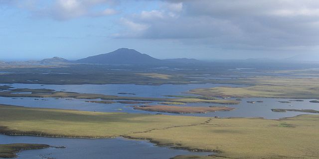
Knock Hungavat is a prominent hill located in Inverness-shire, Scotland. Standing at an elevation of approximately 659 meters (2,162 feet), it is considered one of the notable mountains in the area. Situated in the remote and picturesque Scottish Highlands, Knock Hungavat offers breathtaking panoramic views of the surrounding landscape, making it a popular destination for outdoor enthusiasts and hikers.

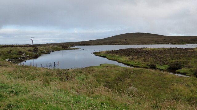
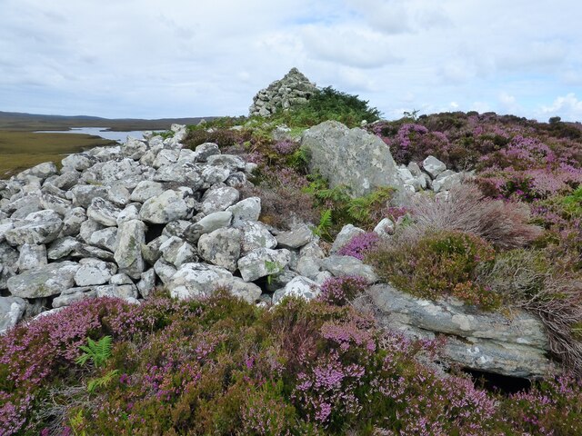
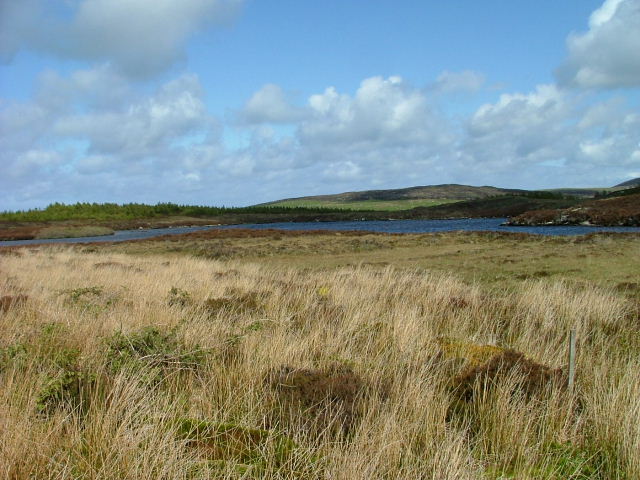
The hill is characterized by its steep and rugged slopes, covered in grass and heather. Its summit offers a commanding viewpoint, providing visitors with stunning vistas of the nearby glens, lochs, and rolling hills. On a clear day, one can even catch a glimpse of the distant Ben Nevis, the highest mountain in the British Isles.

Access to Knock Hungavat is generally facilitated by well-marked hiking trails that wind their way up the hill. These trails are suitable for various skill levels, although caution is advised due to the changeable weather conditions and potential hazards such as loose rocks. The ascent can be challenging, but the rewarding views at the top make it all worthwhile.

The surrounding area is rich in wildlife, with the hill providing a habitat for a variety of bird species, including golden eagles and peregrine falcons. In addition, the hillside is dotted with sheep and grazing deer, adding to the natural beauty of the landscape.

Overall, Knock Hungavat is a noteworthy hill in Inverness-shire, offering outdoor enthusiasts the opportunity to immerse themselves in the stunning scenery of the Scottish Highlands while enjoying a challenging and rewarding hike.

If you have any feedback on the listing, please let us know in the comments section below.

Knock Hungavat Images

Images are sourced within 2km of 57.631948/-7.2385655 or Grid Reference NF8772. Thanks to Geograph Open Source API. All images are credited.

Blathaisbhal stone row A stone row composed of three stones. Like most rows it is far from straight (Scale 1m).
<span class="nowrap"><a title="https://stonerows.wordpress.com/gazetteer/region/western-isles/blashaval/" rel="nofollow ugc noopener" href="https://stonerows.wordpress.com/gazetteer/region/western-isles/blashaval/">Link</a><img style="margin-left:2px;" alt="External link" title="External link - shift click to open in new window" src="https://s1.geograph.org.uk/img/external.png" width="10" height="10"/></span>
Blathaisbhal stone row
A stone row composed of three stones. Like most rows it is far from straight (Scale 1m). LinkExternal link
On Blathaisbhal A fine appreciation of the mix of land and water that is North Uist.   I always think of North Uist as a reverse of the Stockholm Archipelago - more land than water, just rather than the other way around.
On Blathaisbhal
A fine appreciation of the mix of land and water that is North Uist. I always think of North Uist as a reverse of the Stockholm Archipelago - more land than water, just rather than the other way around.
A865 below Blathaisbhal
Airigh Nan Luchag shieling A ruined shieling (Scale 1m). <span class="nowrap"><a title="https://canmore.org.uk/site/123341/north-uist-airigh-nan-luchag" rel="nofollow ugc noopener" href="https://canmore.org.uk/site/123341/north-uist-airigh-nan-luchag">Link</a><img style="margin-left:2px;" alt="External link" title="External link - shift click to open in new window" src="https://s1.geograph.org.uk/img/external.png" width="10" height="10"/></span>
Airigh Nan Luchag shieling
A ruined shieling (Scale 1m). LinkExternal link
Airigh Nan Luchag shieling Shielings are often difficult to spot but this one comes with its own signpost. <span class="nowrap"><a title="https://canmore.org.uk/site/123341/north-uist-airigh-nan-luchag" rel="nofollow ugc noopener" href="https://canmore.org.uk/site/123341/north-uist-airigh-nan-luchag">Link</a><img style="margin-left:2px;" alt="External link" title="External link - shift click to open in new window" src="https://s1.geograph.org.uk/img/external.png" width="10" height="10"/></span>
Airigh Nan Luchag shieling
Shielings are often difficult to spot but this one comes with its own signpost. LinkExternal link
Sea loch at Aileodair View from the loch side picnic area.
Sea loch at Aileodair
View from the loch side picnic area.
Barpa nam Feannag Chambered Long Cairn View of the chamber at the eastern end of the mound <span class="nowrap"><a title="https://www.megalithic.co.uk/article.php?sid=48278" rel="nofollow ugc noopener" href="https://www.megalithic.co.uk/article.php?sid=48278">Link</a><img style="margin-left:2px;" alt="External link" title="External link - shift click to open in new window" src="https://s1.geograph.org.uk/img/external.png" width="10" height="10"/></span>
Barpa nam Feannag Chambered Long Cairn
View of the chamber at the eastern end of the mound LinkExternal link
Barpa nam Feannag Chambered Long Cairn The hill beyond the cairn is Sgealtrabhal <span class="nowrap"><a title="https://www.megalithic.co.uk/article.php?sid=48278" rel="nofollow ugc noopener" href="https://www.megalithic.co.uk/article.php?sid=48278">Link</a><img style="margin-left:2px;" alt="External link" title="External link - shift click to open in new window" src="https://s1.geograph.org.uk/img/external.png" width="10" height="10"/></span>
Barpa nam Feannag Chambered Long Cairn
The hill beyond the cairn is Sgealtrabhal LinkExternal link
North from Crògearraidh Mòr This picture shows much of the square, moorland sloping up to the sharp summit of Crògearraidh Mòr (180m). Beyond are the beaches and lagoons of the north coast. North Uist is an island, barely above the water and land and water are very much mixed up.
North from Crògearraidh Mòr
This picture shows much of the square, moorland sloping up to the sharp summit of Crògearraidh Mòr (180m). Beyond are the beaches and lagoons of the north coast. North Uist is an island, barely above the water and land and water are very much mixed up.
Sea loch at Aileodair The furthest north-west reach of Loch Portain.
Sea loch at Aileodair
The furthest north-west reach of Loch Portain.
Lochan by Aileodair A fresh water lochan in the foreground, with the tidal water of Loch Portain beyond.
Lochan by Aileodair
A fresh water lochan in the foreground, with the tidal water of Loch Portain beyond.
Loch na Creige The hill in the distance is Leathbhal.
Loch na Creige
The hill in the distance is Leathbhal.
Stone Quarry By the A865 Trunk Road.
Stone Quarry
By the A865 Trunk Road.
Blashaval trig OS name for the trig.
Blashaval trig
OS name for the trig.
Loch na Madadh The north west corner of this sea loch. In the distance to the left can be seen the hills of Skye
Loch na Madadh
The north west corner of this sea loch. In the distance to the left can be seen the hills of Skye
Quarry, Crògearraidh Mòr Gneiss quarry, probably serving construction on the Uists.
Quarry, Crògearraidh Mòr
Gneiss quarry, probably serving construction on the Uists.
South from Crògearraidh Mòr The confused, half loch, half bog interior of North Uist, with a view southwards from Crògearraidh Mòr. The nearby loch is Loch Hungabhat and the large Loch Fada is behind it.
South from Crògearraidh Mòr
The confused, half loch, half bog interior of North Uist, with a view southwards from Crògearraidh Mòr. The nearby loch is Loch Hungabhat and the large Loch Fada is behind it.
Loch Fada The water in the centre of the photo is Loch Fada, a very complicated loch. This low lying gneiss plain is a very confused mix of fresh, salt and bog water (There may even be some dry land!) and really needs to host a canoe orienteering event sometime.
Loch Fada
The water in the centre of the photo is Loch Fada, a very complicated loch. This low lying gneiss plain is a very confused mix of fresh, salt and bog water (There may even be some dry land!) and really needs to host a canoe orienteering event sometime.
Show me another place!

Knock Hungavat is located at Grid Ref: NF8772 (Lat: 57.631948, Lng: -7.2385655)

Unitary Authority: Na h-Eileanan an Iar

Police Authority: Highlands and Islands

What 3 Words

///reefs.defeated.attends. Near Lochmaddy, Na h-Eileanan Siar

Related Wikis

Na Fir Bhrèige

Na Fir Bhrèige (pronounced [nə fiɾʲ ˈvɾʲeːkʲə]; can be translated from Gaelic into English as "The False Men") is a set of three standing stones on the...

Ceallasaigh Mòr

Ceallasaigh Mòr (or Keallasay More) is a low-lying island in Loch Maddy off North Uist in the Outer Hebrides of Scotland. This an area of shallow lagoons...

Loch Sgadabhagh

Loch Sgadabhagh or Loch Scadavay is a body of water on the island of North Uist, Scotland. The name may be of Old Norse derivation meaning "lake of tax...

Ceallasaigh Beag

Ceallasaigh Beag (or Keallasay Beg) is a low-lying island in Loch Maddy off North Uist in the Outer Hebrides of Scotland. This an area of shallow lagoons...

Nearby Amenities

Located within 500m of 57.631948,-7.2385655
Note: no barb wire on fence here
Lat/Long: 57.6326361/-7.2399146
Note: no barb wire on fence here
Lat/Long: 57.6342012/-7.2402022
Note: no barb wire on fence here
Lat/Long: 57.6358802/-7.2412847
The data included in this document is from www.openstreetmap.org. The data is made available under ODbL.

Have you been to Knock Hungavat?

Leave your review of Knock Hungavat below (or comments, questions and feedback).