Mullach a' Lusgan

Hill, Mountain in Inverness-shire

Scotland

Mullach a' Lusgan

Sotun Summit, Berneray/Bearnaraigh A five island expedition from Castlebay on Boy James. This is a picture of the misty grassy summit of Berneray/Bearnaraigh called Sotan. Although a rock 2 metres north of lighthouse perimeter wall at NL 54867 80229 is highest point but not yet officially ratified.
Name: Sotan
Hill number: 1632
Height: 193m / 633ft
Area: 24D: Barra to Barra Head
Class: Ma,1
Grid ref: NL 55353 79980
Summit feature: no feature
Drop: 193m
Col: Sea
Sotun Summit, Berneray/Bearnaraigh Credit: Rude Health

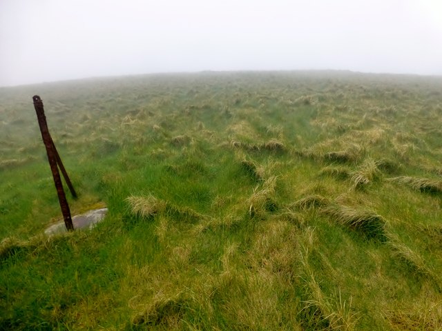
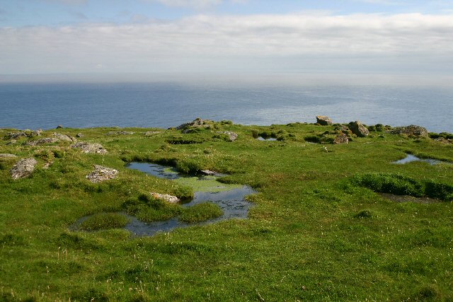
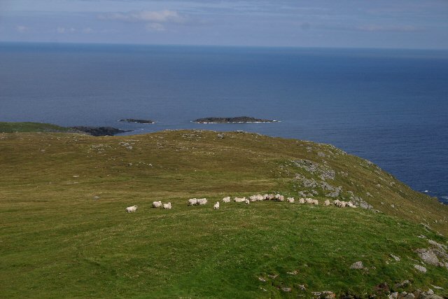
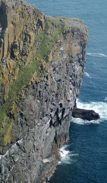
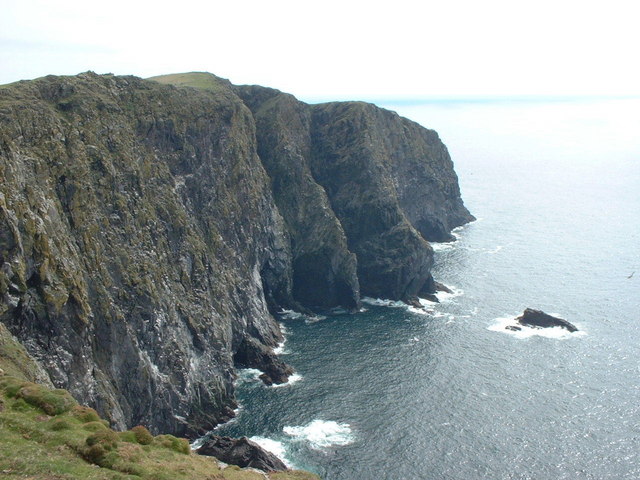
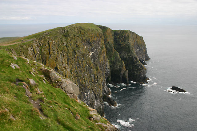
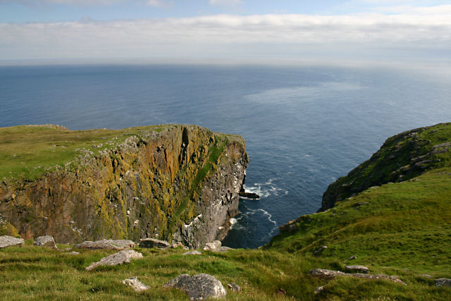
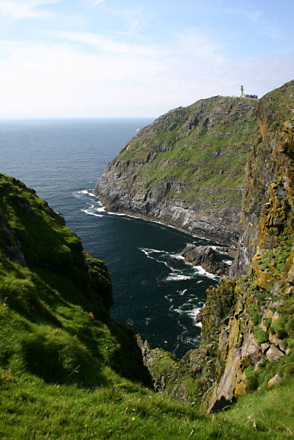
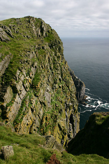
Mullach a' Lusgan is a prominent hill located in Inverness-shire, Scotland. With an elevation of approximately 788 meters (2,585 feet), it is considered one of the significant mountains in the region. Situated near the small village of Fort Augustus, Mullach a' Lusgan offers breathtaking panoramic views of the surrounding landscape.

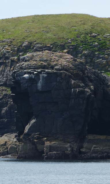
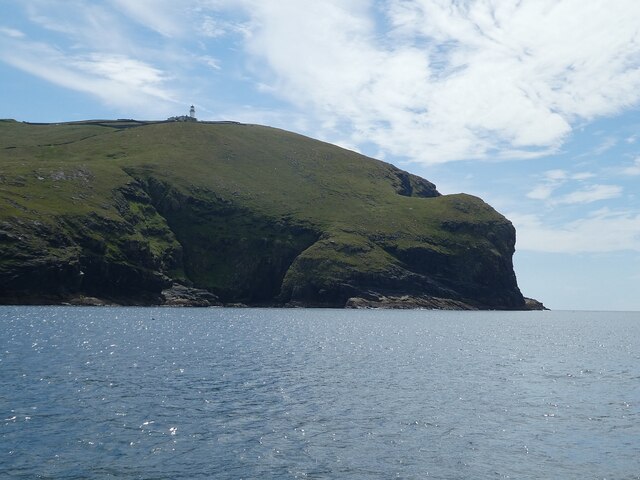
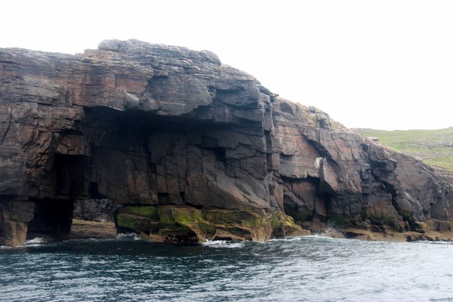
The hill is part of the Grampian Mountains, a range known for its rugged terrain and natural beauty. Mullach a' Lusgan is characterized by its steep slopes and rocky outcrops, making it a challenging yet rewarding destination for hikers and mountaineers. As climbers ascend the hill, they are rewarded with stunning vistas of Loch Ness, the famous freshwater loch that stretches for approximately 37 kilometers (23 miles).

The summit of Mullach a' Lusgan provides a vantage point for observing the diverse flora and fauna that thrive in the area. The hill is home to a variety of plant species, including heather and grasses, which create a vibrant and colorful landscape. Wildlife such as red deer, mountain hares, and golden eagles can also be spotted in the vicinity.

Due to its picturesque location and accessibility, Mullach a' Lusgan attracts outdoor enthusiasts and nature lovers throughout the year. It offers a range of outdoor activities, including hiking, climbing, and wildlife watching. The hill provides a challenging yet rewarding experience for those seeking to explore the stunning Scottish Highlands.

If you have any feedback on the listing, please let us know in the comments section below.

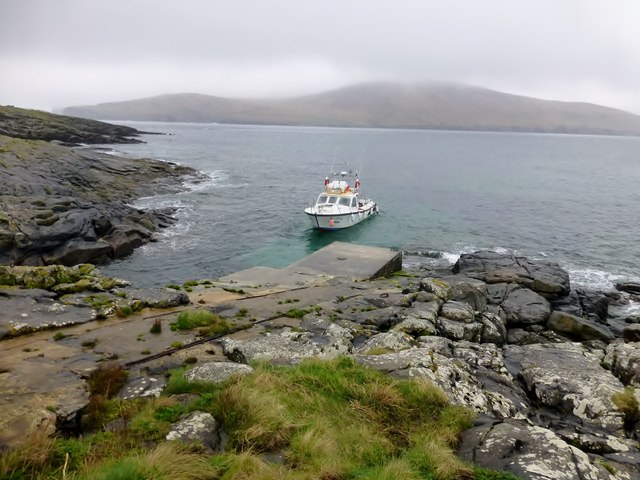
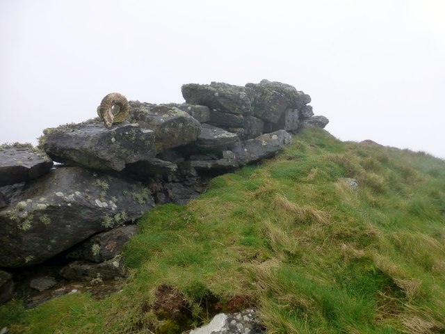
Mullach a' Lusgan Images

Images are sourced within 2km of 56.782943/-7.6358069 or Grid Reference NL5579. Thanks to Geograph Open Source API. All images are credited.

Sotun Summit, Berneray/Bearnaraigh A five island expedition from Castlebay on Boy James. This is a picture of the misty grassy summit of Berneray/Bearnaraigh called Sotan. Although a rock 2 metres north of lighthouse perimeter wall at NL 54867 80229 is highest point but not yet officially ratified.
Name: Sotan
Hill number: 1632
Height: 193m / 633ft
Area: 24D: Barra to Barra Head
Class: Ma,1
Grid ref: NL 55353 79980
Summit feature: no feature
Drop: 193m
Col: Sea
Sotun Summit, Berneray/Bearnaraigh
A five island expedition from Castlebay on Boy James. This is a picture of the misty grassy summit of Berneray/Bearnaraigh called Sotan. Although a rock 2 metres north of lighthouse perimeter wall at NL 54867 80229 is highest point but not yet officially ratified. Name: Sotan Hill number: 1632 Height: 193m / 633ft Area: 24D: Barra to Barra Head Class: Ma,1 Grid ref: NL 55353 79980 Summit feature: no feature Drop: 193m Col: Sea
Berneray/Bearnaraigh - an aerial view from the south From about 36000ft heading west, about 30min after leaving Edinburgh
Berneray/Bearnaraigh - an aerial view from the south
From about 36000ft heading west, about 30min after leaving Edinburgh
Sotan, Berneray Seen from near the lighthouse. Sotan is a couple of metres higher than the lighthouse, and the highest point of the island.
Sotan, Berneray
Seen from near the lighthouse. Sotan is a couple of metres higher than the lighthouse, and the highest point of the island.
Sloc na Sealbhaig The precipitous cliffs east of the lighthouse on Berneray.
Sloc na Sealbhaig
The precipitous cliffs east of the lighthouse on Berneray.
Mullach a' Lusgan, Berneray These rock pools are on top of the cliffs at Barra Head, the southernmost point of the Outer Hebrides.
Mullach a' Lusgan, Berneray
These rock pools are on top of the cliffs at Barra Head, the southernmost point of the Outer Hebrides.
Cuiveg Point, Berneray In Gaelic, 'Rubha Cuabhaig', this south-eastern tip of Berneray is populated only by a flock of extremely shaggy sheep.
Cuiveg Point, Berneray
In Gaelic, 'Rubha Cuabhaig', this south-eastern tip of Berneray is populated only by a flock of extremely shaggy sheep.
Rubha Ghralish, Berneray The seabird cliffs at Rubha Ghralish
Rubha Ghralish, Berneray
The seabird cliffs at Rubha Ghralish
Sloc na Sealbhaig This inlet is at the foot of the 180m cliffs to the south east of the lighthouse. Just round the cliffs is Barra Head, the most southerly point on Berneray, which is the most southerly island in the Outer Hebrides (not on Barra at all).
Sloc na Sealbhaig
This inlet is at the foot of the 180m cliffs to the south east of the lighthouse. Just round the cliffs is Barra Head, the most southerly point on Berneray, which is the most southerly island in the Outer Hebrides (not on Barra at all).
Barra Head, Berneray The southernmost point of the Outer Hebrides.
Barra Head, Berneray
The southernmost point of the Outer Hebrides.
Sloc Voacligeo, Berneray This inlet lies to the west of Barra Head.
Sloc Voacligeo, Berneray
This inlet lies to the west of Barra Head.
Sloc na Sealbhaig, Berneray Steep cliffs on Berneray's southern coast. The lighthouse at Skate Point can be seen in the distance.
Sloc na Sealbhaig, Berneray
Steep cliffs on Berneray's southern coast. The lighthouse at Skate Point can be seen in the distance.
Headland immediately west of Barra Head, Berneray Almost the southernmost tip of the Outer Hebrides (Barra Head, just to the east, is the southernmost point).
Headland immediately west of Barra Head, Berneray
Almost the southernmost tip of the Outer Hebrides (Barra Head, just to the east, is the southernmost point).
Gèarum Beag - Sphinx-like rock This rock feature looks to me as though Marty Feldman had posed for a Scottish version of the Sphinx.
Gèarum Beag - Sphinx-like rock
This rock feature looks to me as though Marty Feldman had posed for a Scottish version of the Sphinx.
Berneray (Barra Head) - western promontories There are many islands in the Hebrides with the name 'Berneray' or 'Bernera' - this one is the southernmost of all the islands of the Outer Hebrides and is more commonly known as 'Barra Head' (not to be confused with the island of Barra itself, some way to the north).
<a href="https://www.geograph.org.uk/photo/6891885">NL5480 : Barra Head Lighthouse</a> can be seen perched atop the promontory.
Berneray (Barra Head) - western promontories
There are many islands in the Hebrides with the name 'Berneray' or 'Bernera' - this one is the southernmost of all the islands of the Outer Hebrides and is more commonly known as 'Barra Head' (not to be confused with the island of Barra itself, some way to the north). NL5480 : Barra Head Lighthouse can be seen perched atop the promontory.
Barra Head Lighthouse The lighthouse on Barra Head was constructed in 1833 by the famous lighthouse designer Robert Stevenson. At 208m (682') focal height it has the most elevated light of all Scottish (and probably UK) lighthouses, though the tower itself is only 18m (59')
It had resident lighthouse keepers up until its automation on 23rd October 1980
Wikipedia article here: <span class="nowrap"><a title="https://en.wikipedia.org/wiki/Barra_Head_Lighthouse" rel="nofollow ugc noopener" href="https://en.wikipedia.org/wiki/Barra_Head_Lighthouse">Link</a><img style="margin-left:2px;" alt="External link" title="External link - shift click to open in new window" src="https://s1.geograph.org.uk/img/external.png" width="10" height="10"/></span>
See also <a href="https://www.geograph.org.uk/photo/6891883">NL5480 : Berneray (Barra Head) - western promontories</a>
Barra Head Lighthouse
The lighthouse on Barra Head was constructed in 1833 by the famous lighthouse designer Robert Stevenson. At 208m (682') focal height it has the most elevated light of all Scottish (and probably UK) lighthouses, though the tower itself is only 18m (59') It had resident lighthouse keepers up until its automation on 23rd October 1980 Wikipedia article here: LinkExternal link See also NL5480 : Berneray (Barra Head) - western promontories
Gèarum Beag a rock islet off Mingulay
Pier At Berneray/Bearnaraigh Thirteen Marilyn baggers were dropped of at this rather slippy pier to explore this lovely island of Berneray/Bearnaraigh. This pier helped service the lighthouse.
Pier At Berneray/Bearnaraigh
Thirteen Marilyn baggers were dropped of at this rather slippy pier to explore this lovely island of Berneray/Bearnaraigh. This pier helped service the lighthouse.
Alternative High Point Of Berneray/Bearnaraigh Alternative island high point could be the rock 2m N of lighthouse perimeter wall at NL 54867 80229 is highest point but not yet officially ratified.
Alternative High Point Of Berneray/Bearnaraigh
Alternative island high point could be the rock 2m N of lighthouse perimeter wall at NL 54867 80229 is highest point but not yet officially ratified.
Show me another place!

Mullach a' Lusgan is located at Grid Ref: NL5579 (Lat: 56.782943, Lng: -7.6358069)

Unitary Authority: Na h-Eileanan an Iar

Police Authority: Highlands and Islands

What 3 Words

///aware.fidgeted.jazzy. Near CastleBay, Na h-Eileanan Siar

Related Wikis

Barra Head

Barra Head, also known as Berneray (Scottish Gaelic: Beàrnaraigh; Scots: Barra Heid), is the southernmost island of the Outer Hebrides in Scotland. Within...

Barra Head Lighthouse

Barra Head Lighthouse on Barra Head identifies the southern entrance to The Minch, roughly halfway between the Eilean Glas and Rinns of Islay lighthouses...

Arnamul

Arnamul (Scottish Gaelic: Arnamuil) is a stack off the west coast of Mingulay in the Western Isles, Scotland. Although precipitous, sheep were grazed on...

Barra Isles

The Barra Isles, also known as the Bishop's Isles, are a small archipelago in the Outer Hebrides of Scotland. They lie south of the island of Barra, for...

Related Videos

Explore the Outer Hebrides' Mingulay in 360° VR | #MustSeaScotland

Whether you're watching the sunset dip and dance over ancient standing stones; sinking your toes into some of the world's best ...

Huge Seal Colony

Tracks our cruise in the western isles Barra, Vatersay, Mingualay . Follow our continuing sailing adventures.

Behind the Scenes of our Mingulay 360° Video | #MustSeaScotland

Step behind the scenes of the creation of our #MustSeaScotland 360 degree video on the isle of Mingulay and see how we ...

Island Of Mingulay On Visit To The Outer Hebrides Of Scotland

Tour Scotland travel video, with Scottish music, of the Island of Mingulay on visit to the Outer Hebrides. Mingulay, Scottish Gaelic: ...

Nearby Amenities

Located within 500m of 56.782943,-7.6358069
Ceann Bharraigh
Name En: Barra Head
Name Gd: Ceann Bharraigh
Name Sco: Barra Heid
Natural: cape
Lat/Long: 56.7791238/-7.6364648
Man Made: water_well
Lat/Long: 56.7851239/-7.6395182
Natural: rock
Lat/Long: 56.7829154/-7.6360405
Natural: rock
Lat/Long: 56.7868207/-7.6344506
Natural: rock
Lat/Long: 56.7869934/-7.6343635
Natural: rock
Lat/Long: 56.7872714/-7.633943
Natural: rock
Lat/Long: 56.7866094/-7.6330388
Natural: rock
Lat/Long: 56.7868327/-7.6326073
Natural: rock
Lat/Long: 56.7868283/-7.6326355
Natural: rock
Lat/Long: 56.7867168/-7.6326931
Natural: rock
Lat/Long: 56.7868953/-7.6335306
Natural: rock
Lat/Long: 56.7869917/-7.6335394
Natural: rock
Lat/Long: 56.7843363/-7.6326314
Natural: rock
Lat/Long: 56.7843947/-7.6327776
Natural: rock
Lat/Long: 56.7847131/-7.6306225
Natural: rock
Lat/Long: 56.7848283/-7.6343206
Natural: rock
Lat/Long: 56.785504/-7.6351158
Natural: rock
Lat/Long: 56.7854891/-7.6375831
Natural: rock
Lat/Long: 56.7861232/-7.6306687
Natural: rock
Lat/Long: 56.7871183/-7.634047
Natural: rock
Lat/Long: 56.7871616/-7.6340899
Natural: rock
Lat/Long: 56.7868803/-7.6342646
Natural: rock
Lat/Long: 56.7864663/-7.6325215
Natural: rock
Lat/Long: 56.7864759/-7.6326951
Natural: rock
Lat/Long: 56.7821073/-7.6293819
Natural: rock
Lat/Long: 56.7824377/-7.6316782
Natural: rock
Lat/Long: 56.7824441/-7.6317232
Natural: rock
Lat/Long: 56.7826171/-7.6318415
Natural: rock
Lat/Long: 56.781518/-7.6338378
Natural: rock
Lat/Long: 56.7819126/-7.6331712
Natural: rock
Lat/Long: 56.7839528/-7.6345606
Natural: rock
Lat/Long: 56.7840823/-7.6297843
Natural: rock
Lat/Long: 56.7840609/-7.6298024
Natural: rock
Lat/Long: 56.7839981/-7.6300579
Natural: rock
Lat/Long: 56.7785909/-7.6360885
Natural: rock
Lat/Long: 56.778666/-7.6360321
Natural: rock
Lat/Long: 56.7787777/-7.6357532
Natural: rock
Lat/Long: 56.7787634/-7.6358008
Natural: rock
Lat/Long: 56.7787681/-7.6358833
Natural: rock
Lat/Long: 56.7796254/-7.6388622
Natural: rock
Lat/Long: 56.7796482/-7.6388448
Natural: rock
Lat/Long: 56.7796592/-7.6388656
Natural: rock
Lat/Long: 56.7796677/-7.638889
Natural: rock
Lat/Long: 56.7805435/-7.6386624
Natural: rock
Lat/Long: 56.7801283/-7.6383586
Natural: rock
Lat/Long: 56.780218/-7.6384364
Natural: rock
Lat/Long: 56.7819445/-7.6370832
Natural: rock
Lat/Long: 56.7816025/-7.6340289
Natural: rock
Lat/Long: 56.7827275/-7.6347547
Natural: rock
Lat/Long: 56.7816558/-7.6338545
Natural: rock
Lat/Long: 56.7816227/-7.6339236
Natural: rock
Lat/Long: 56.7816231/-7.6340148
Natural: rock
Lat/Long: 56.7818443/-7.6338954
Natural: rock
Lat/Long: 56.7819456/-7.6337399
Natural: rock
Lat/Long: 56.7819993/-7.6334857
Natural: rock
Lat/Long: 56.7819684/-7.6334361
Natural: rock
Lat/Long: 56.782349/-7.6348557
Natural: rock
Lat/Long: 56.7819736/-7.6339913
Natural: rock
Lat/Long: 56.7826579/-7.6335943
Natural: rock
Lat/Long: 56.7827722/-7.6336071
Natural: rock
Lat/Long: 56.7847822/-7.6343286
Natural: rock
Lat/Long: 56.7822689/-7.6336011
Natural: rock
Lat/Long: 56.7825709/-7.6343735
Natural: rock
Lat/Long: 56.7825687/-7.6298158
Natural: rock
Lat/Long: 56.7826693/-7.6298198
Natural: rock
Lat/Long: 56.7827644/-7.6295026
Natural: rock
Lat/Long: 56.782968/-7.629911
Natural: rock
Lat/Long: 56.783037/-7.630017
Natural: rock
Lat/Long: 56.7828735/-7.6304575
Natural: rock
Lat/Long: 56.782929/-7.6305125
Natural: rock
Lat/Long: 56.7831329/-7.6306365
Natural: rock
Lat/Long: 56.780632/-7.6427447
Natural: rock
Lat/Long: 56.7818163/-7.6436345
Natural: rock
Lat/Long: 56.7822873/-7.641883
Natural: rock
Lat/Long: 56.782659/-7.6407847
Natural: rock
Lat/Long: 56.7825132/-7.6377947
Natural: rock
Lat/Long: 56.7824658/-7.6379368
Natural: rock
Lat/Long: 56.7824603/-7.6382547
Natural: rock
Lat/Long: 56.7823901/-7.6387831
Natural: rock
Lat/Long: 56.7825132/-7.6391787
Natural: rock
Lat/Long: 56.782616/-7.6399324
Natural: rock
Lat/Long: 56.7824017/-7.6367443
Natural: rock
Lat/Long: 56.7823839/-7.636874
Natural: rock
Lat/Long: 56.7823997/-7.6358427
Natural: rock
Lat/Long: 56.7827758/-7.6329654
Natural: rock
Lat/Long: 56.7830414/-7.6322204
Natural: rock
Lat/Long: 56.7831233/-7.6319609
Natural: rock
Lat/Long: 56.7831454/-7.6316907
Natural: rock
Lat/Long: 56.7830741/-7.6317014
Natural: rock
Lat/Long: 56.781496/-7.6300143
Natural: rock
Lat/Long: 56.7818296/-7.6306057
Natural: rock
Lat/Long: 56.7819276/-7.629683
Natural: rock
Lat/Long: 56.7820592/-7.6297896
Natural: rock
Lat/Long: 56.782/-7.6297823
Natural: rock
Lat/Long: 56.7850966/-7.6312816
Natural: rock
Lat/Long: 56.7811081/-7.6392129
Natural: rock
Lat/Long: 56.7804292/-7.6373944
Natural: rock
Lat/Long: 56.7806812/-7.6378182
Natural: rock
Lat/Long: 56.7788348/-7.6367332
Natural: rock
Lat/Long: 56.7788091/-7.6376572
Natural: rock
Lat/Long: 56.7790575/-7.6378034
Natural: rock
Lat/Long: 56.7795365/-7.6384807
Natural: rock
Lat/Long: 56.779563/-7.6384941
Natural: rock
Lat/Long: 56.779571/-7.6384002
Natural: rock
Lat/Long: 56.780017/-7.6383747
Natural: rock
Lat/Long: 56.7798392/-7.6382875
Natural: rock
Lat/Long: 56.7797275/-7.6383814
Natural: rock
Lat/Long: 56.7797217/-7.6384042
Natural: rock
Lat/Long: 56.7793425/-7.6383036
Natural: rock
Lat/Long: 56.779488/-7.6383331
Natural: rock
Lat/Long: 56.7794109/-7.6382084
Natural: rock
Lat/Long: 56.7794983/-7.6382808
Natural: rock
Lat/Long: 56.7795424/-7.6382151
Natural: rock
Lat/Long: 56.7794763/-7.638191
Natural: rock
Lat/Long: 56.7793859/-7.6381186
Natural: rock
Lat/Long: 56.7794513/-7.6379778
Natural: rock
Lat/Long: 56.7794167/-7.637963
Natural: rock
Lat/Long: 56.7791765/-7.6369746
Natural: rock
Lat/Long: 56.779004/-7.6371084
Natural: rock
Lat/Long: 56.779067/-7.6371788
Natural: rock
Lat/Long: 56.7790582/-7.637331
Natural: rock
Lat/Long: 56.7792004/-7.6374956
Natural: rock
Lat/Long: 56.779236/-7.6374326
Natural: rock
Lat/Long: 56.7792252/-7.6374862
Natural: rock
Lat/Long: 56.7791864/-7.6373494
Natural: rock
Lat/Long: 56.7826546/-7.6350126
The data included in this document is from www.openstreetmap.org. The data is made available under ODbL.

Have you been to Mullach a' Lusgan?

Leave your review of Mullach a' Lusgan below (or comments, questions and feedback).