Sotan

Hill, Mountain in Inverness-shire

Scotland

Sotan

Sotun Summit, Berneray/Bearnaraigh A five island expedition from Castlebay on Boy James. This is a picture of the misty grassy summit of Berneray/Bearnaraigh called Sotan. Although a rock 2 metres north of lighthouse perimeter wall at NL 54867 80229 is highest point but not yet officially ratified.
Name: Sotan
Hill number: 1632
Height: 193m / 633ft
Area: 24D: Barra to Barra Head
Class: Ma,1
Grid ref: NL 55353 79980
Summit feature: no feature
Drop: 193m
Col: Sea
Sotun Summit, Berneray/Bearnaraigh Credit: Rude Health

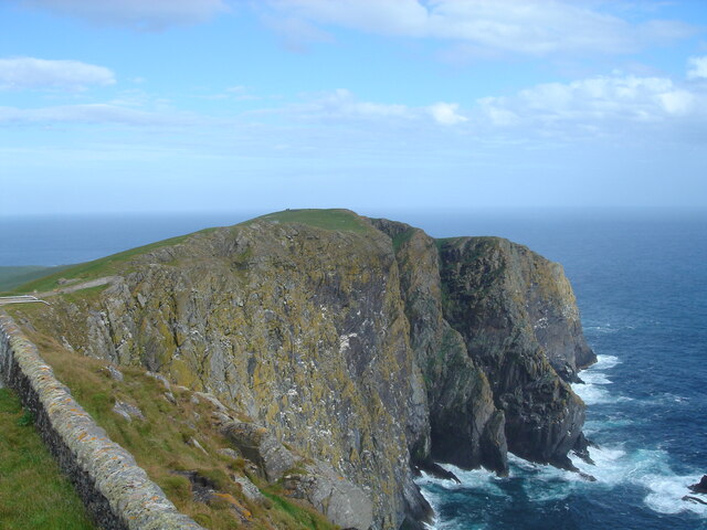
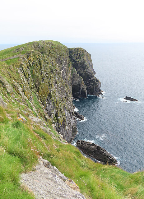
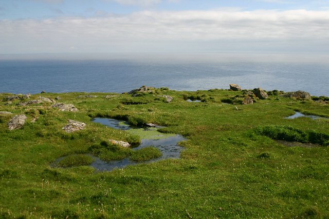
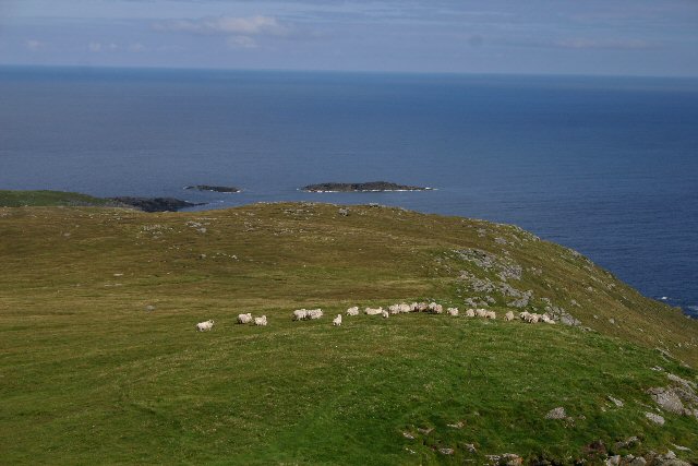
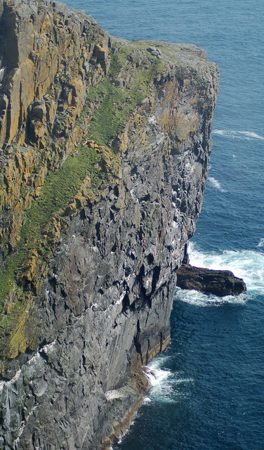
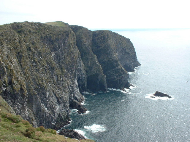
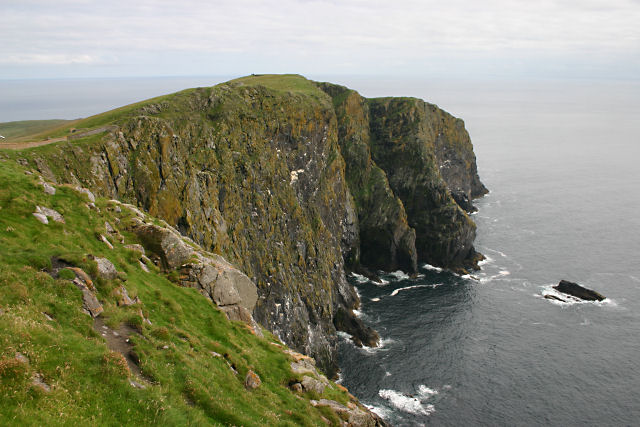
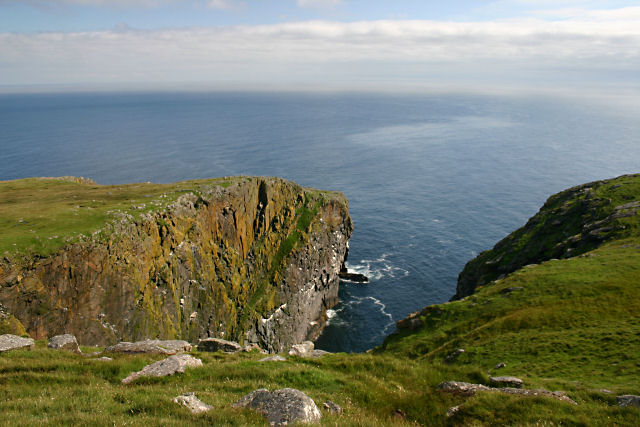
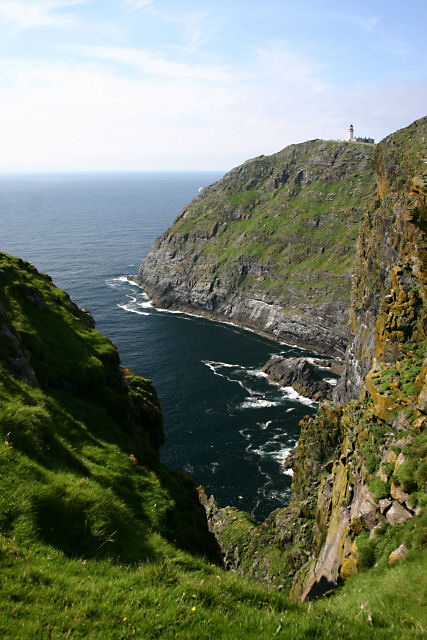
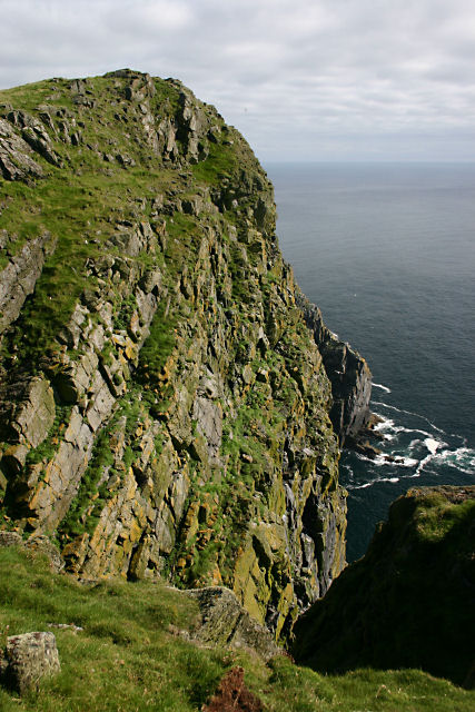
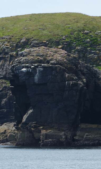
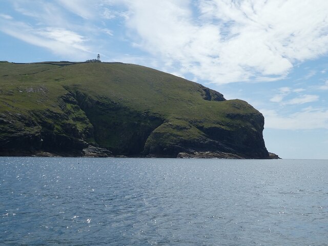
Sotan is a prominent hill located in Inverness-shire, Scotland. Standing at an elevation of 1,881 feet (573 meters), it offers stunning panoramic views of the surrounding countryside and the nearby Loch Ness. The hill is a popular destination for hikers and outdoor enthusiasts looking to explore the rugged Scottish landscape.

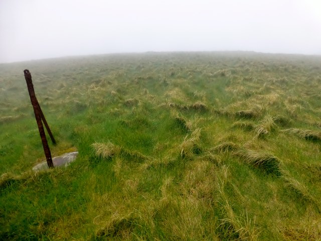
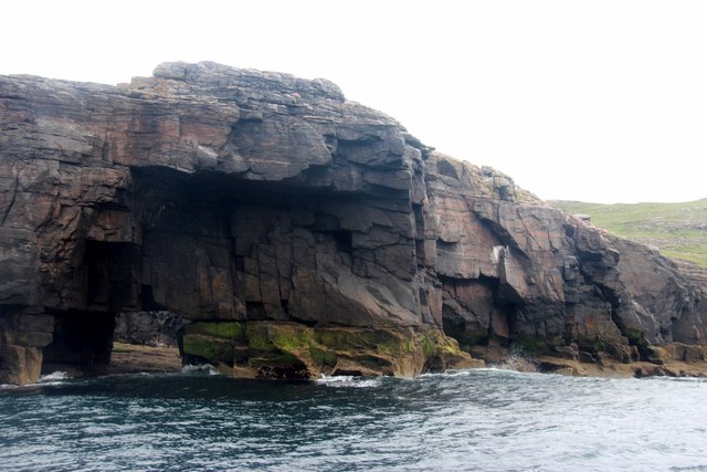
Sotan is known for its challenging terrain, with steep inclines and rocky outcrops that provide a thrilling adventure for those seeking a more strenuous hike. The hill is also home to a variety of wildlife, including red deer, mountain hares, and various bird species, making it a great spot for nature enthusiasts.

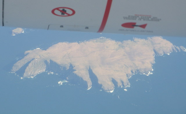
The summit of Sotan offers breathtaking views of the surrounding mountains and valleys, making it a popular spot for photographers and nature lovers alike. On a clear day, visitors can see for miles around, taking in the beauty of the Scottish Highlands.

Overall, Sotan is a must-visit destination for those looking to experience the natural beauty and rugged terrain of Inverness-shire. Whether you're a seasoned hiker or just looking for a peaceful retreat in nature, Sotan has something to offer for everyone.

If you have any feedback on the listing, please let us know in the comments section below.
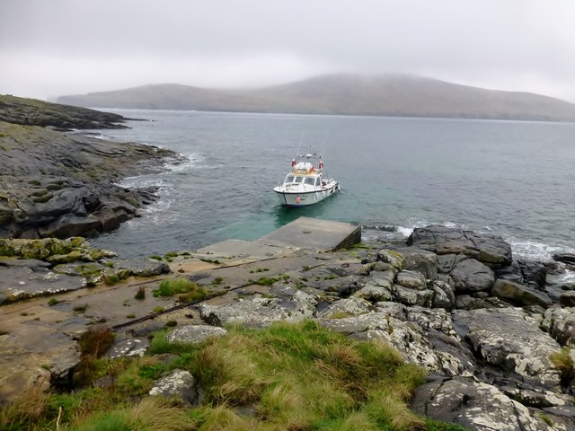
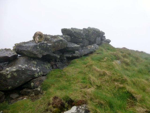
Sotan Images

Images are sourced within 2km of 56.783186/-7.6441407 or Grid Reference NL5579. Thanks to Geograph Open Source API. All images are credited.

Sotun Summit, Berneray/Bearnaraigh A five island expedition from Castlebay on Boy James. This is a picture of the misty grassy summit of Berneray/Bearnaraigh called Sotan. Although a rock 2 metres north of lighthouse perimeter wall at NL 54867 80229 is highest point but not yet officially ratified.
Name: Sotan
Hill number: 1632
Height: 193m / 633ft
Area: 24D: Barra to Barra Head
Class: Ma,1
Grid ref: NL 55353 79980
Summit feature: no feature
Drop: 193m
Col: Sea
Sotun Summit, Berneray/Bearnaraigh
A five island expedition from Castlebay on Boy James. This is a picture of the misty grassy summit of Berneray/Bearnaraigh called Sotan. Although a rock 2 metres north of lighthouse perimeter wall at NL 54867 80229 is highest point but not yet officially ratified. Name: Sotan Hill number: 1632 Height: 193m / 633ft Area: 24D: Barra to Barra Head Class: Ma,1 Grid ref: NL 55353 79980 Summit feature: no feature Drop: 193m Col: Sea
Berneray/Bearnaraigh - an aerial view from the south From about 36000ft heading west, about 30min after leaving Edinburgh
Berneray/Bearnaraigh - an aerial view from the south
From about 36000ft heading west, about 30min after leaving Edinburgh
Sotan, Berneray Seen from near the lighthouse. Sotan is a couple of metres higher than the lighthouse, and the highest point of the island.
Sotan, Berneray
Seen from near the lighthouse. Sotan is a couple of metres higher than the lighthouse, and the highest point of the island.
Sloc na Sealbhaig The precipitous cliffs east of the lighthouse on Berneray.
Sloc na Sealbhaig
The precipitous cliffs east of the lighthouse on Berneray.
Mullach a' Lusgan, Berneray These rock pools are on top of the cliffs at Barra Head, the southernmost point of the Outer Hebrides.
Mullach a' Lusgan, Berneray
These rock pools are on top of the cliffs at Barra Head, the southernmost point of the Outer Hebrides.
Cuiveg Point, Berneray In Gaelic, 'Rubha Cuabhaig', this south-eastern tip of Berneray is populated only by a flock of extremely shaggy sheep.
Cuiveg Point, Berneray
In Gaelic, 'Rubha Cuabhaig', this south-eastern tip of Berneray is populated only by a flock of extremely shaggy sheep.
Rubha Ghralish, Berneray The seabird cliffs at Rubha Ghralish
Rubha Ghralish, Berneray
The seabird cliffs at Rubha Ghralish
Sloc na Sealbhaig This inlet is at the foot of the 180m cliffs to the south east of the lighthouse. Just round the cliffs is Barra Head, the most southerly point on Berneray, which is the most southerly island in the Outer Hebrides (not on Barra at all).
Sloc na Sealbhaig
This inlet is at the foot of the 180m cliffs to the south east of the lighthouse. Just round the cliffs is Barra Head, the most southerly point on Berneray, which is the most southerly island in the Outer Hebrides (not on Barra at all).
Barra Head, Berneray The southernmost point of the Outer Hebrides.
Barra Head, Berneray
The southernmost point of the Outer Hebrides.
Sloc Voacligeo, Berneray This inlet lies to the west of Barra Head.
Sloc Voacligeo, Berneray
This inlet lies to the west of Barra Head.
Sloc na Sealbhaig, Berneray Steep cliffs on Berneray's southern coast. The lighthouse at Skate Point can be seen in the distance.
Sloc na Sealbhaig, Berneray
Steep cliffs on Berneray's southern coast. The lighthouse at Skate Point can be seen in the distance.
Headland immediately west of Barra Head, Berneray Almost the southernmost tip of the Outer Hebrides (Barra Head, just to the east, is the southernmost point).
Headland immediately west of Barra Head, Berneray
Almost the southernmost tip of the Outer Hebrides (Barra Head, just to the east, is the southernmost point).
Gèarum Beag - Sphinx-like rock This rock feature looks to me as though Marty Feldman had posed for a Scottish version of the Sphinx.
Gèarum Beag - Sphinx-like rock
This rock feature looks to me as though Marty Feldman had posed for a Scottish version of the Sphinx.
Berneray (Barra Head) - western promontories There are many islands in the Hebrides with the name 'Berneray' or 'Bernera' - this one is the southernmost of all the islands of the Outer Hebrides and is more commonly known as 'Barra Head' (not to be confused with the island of Barra itself, some way to the north).
<a href="https://www.geograph.org.uk/photo/6891885">NL5480 : Barra Head Lighthouse</a> can be seen perched atop the promontory.
Berneray (Barra Head) - western promontories
There are many islands in the Hebrides with the name 'Berneray' or 'Bernera' - this one is the southernmost of all the islands of the Outer Hebrides and is more commonly known as 'Barra Head' (not to be confused with the island of Barra itself, some way to the north). NL5480 : Barra Head Lighthouse can be seen perched atop the promontory.
Barra Head Lighthouse The lighthouse on Barra Head was constructed in 1833 by the famous lighthouse designer Robert Stevenson. At 208m (682') focal height it has the most elevated light of all Scottish (and probably UK) lighthouses, though the tower itself is only 18m (59')
It had resident lighthouse keepers up until its automation on 23rd October 1980
Wikipedia article here: <span class="nowrap"><a title="https://en.wikipedia.org/wiki/Barra_Head_Lighthouse" rel="nofollow ugc noopener" href="https://en.wikipedia.org/wiki/Barra_Head_Lighthouse">Link</a><img style="margin-left:2px;" alt="External link" title="External link - shift click to open in new window" src="https://s1.geograph.org.uk/img/external.png" width="10" height="10"/></span>
See also <a href="https://www.geograph.org.uk/photo/6891883">NL5480 : Berneray (Barra Head) - western promontories</a>
Barra Head Lighthouse
The lighthouse on Barra Head was constructed in 1833 by the famous lighthouse designer Robert Stevenson. At 208m (682') focal height it has the most elevated light of all Scottish (and probably UK) lighthouses, though the tower itself is only 18m (59') It had resident lighthouse keepers up until its automation on 23rd October 1980 Wikipedia article here: LinkExternal link See also NL5480 : Berneray (Barra Head) - western promontories
Gèarum Beag a rock islet off Mingulay
Pier At Berneray/Bearnaraigh Thirteen Marilyn baggers were dropped of at this rather slippy pier to explore this lovely island of Berneray/Bearnaraigh. This pier helped service the lighthouse.
Pier At Berneray/Bearnaraigh
Thirteen Marilyn baggers were dropped of at this rather slippy pier to explore this lovely island of Berneray/Bearnaraigh. This pier helped service the lighthouse.
Alternative High Point Of Berneray/Bearnaraigh Alternative island high point could be the rock 2m N of lighthouse perimeter wall at NL 54867 80229 is highest point but not yet officially ratified.
Alternative High Point Of Berneray/Bearnaraigh
Alternative island high point could be the rock 2m N of lighthouse perimeter wall at NL 54867 80229 is highest point but not yet officially ratified.
Show me another place!

Sotan is located at Grid Ref: NL5579 (Lat: 56.783186, Lng: -7.6441407)

Unitary Authority: Na h-Eileanan an Iar

Police Authority: Highlands and Islands

What 3 Words

///trustees.prompts.paler. Near CastleBay, Na h-Eileanan Siar

Related Wikis

Barra Head

Barra Head, also known as Berneray (Scottish Gaelic: Beàrnaraigh; Scots: Barra Heid), is the southernmost island of the Outer Hebrides in Scotland. Within...

Barra Head Lighthouse

Barra Head Lighthouse on Barra Head identifies the southern entrance to The Minch, roughly halfway between the Eilean Glas and Rinns of Islay lighthouses...

Arnamul

Arnamul (Scottish Gaelic: Arnamuil) is a stack off the west coast of Mingulay in the Western Isles, Scotland. Although precipitous, sheep were grazed on...

Barra Isles

The Barra Isles, also known as the Bishop's Isles, are a small archipelago in the Outer Hebrides of Scotland. They lie south of the island of Barra, for...

Nearby Amenities

Located within 500m of 56.783186,-7.6441407
Sotan
Corbett: no
Ele: 193
Graham: no
Marilyn: yes
Munro: no
Natural: peak
Prominence: 193
Wikidata: Q1732919
Wikipedia: en:Barra Head
Lat/Long: 56.7830923/-7.6450263
Man Made: water_well
Lat/Long: 56.7851239/-7.6395182
Natural: rock
Lat/Long: 56.7829154/-7.6360405
Natural: rock
Lat/Long: 56.7854891/-7.6375831
Natural: rock
Lat/Long: 56.7805435/-7.6386624
Natural: rock
Lat/Long: 56.7801283/-7.6383586
Natural: rock
Lat/Long: 56.780218/-7.6384364
Natural: rock
Lat/Long: 56.7819445/-7.6370832
Natural: rock
Lat/Long: 56.780632/-7.6427447
Natural: rock
Lat/Long: 56.7818163/-7.6436345
Natural: rock
Lat/Long: 56.7822873/-7.641883
Natural: rock
Lat/Long: 56.782659/-7.6407847
Natural: rock
Lat/Long: 56.7825132/-7.6377947
Natural: rock
Lat/Long: 56.7824658/-7.6379368
Natural: rock
Lat/Long: 56.7824603/-7.6382547
Natural: rock
Lat/Long: 56.7823901/-7.6387831
Natural: rock
Lat/Long: 56.7825132/-7.6391787
Natural: rock
Lat/Long: 56.782616/-7.6399324
Natural: rock
Lat/Long: 56.7824017/-7.6367443
Natural: rock
Lat/Long: 56.7823839/-7.636874
Natural: rock
Lat/Long: 56.7811081/-7.6392129
Natural: rock
Lat/Long: 56.7806812/-7.6378182
Natural: rock
Lat/Long: 56.780017/-7.6383747
The data included in this document is from www.openstreetmap.org. The data is made available under ODbL.

Have you been to Sotan?

Leave your review of Sotan below (or comments, questions and feedback).