School Plantation

Downs, Moorland in Suffolk East Suffolk

England

School Plantation

Moth Sculpture One of a series of sculptures along the Sandlings Walk.
Moth Sculpture Credit: Jon Hopkins

School Plantation is a scenic and historical area located in Suffolk, England. Situated in the eastern part of the county, it encompasses the Downs and Moorland regions. The plantation is known for its diverse and lush vegetation, making it an ideal spot for nature enthusiasts and hikers.

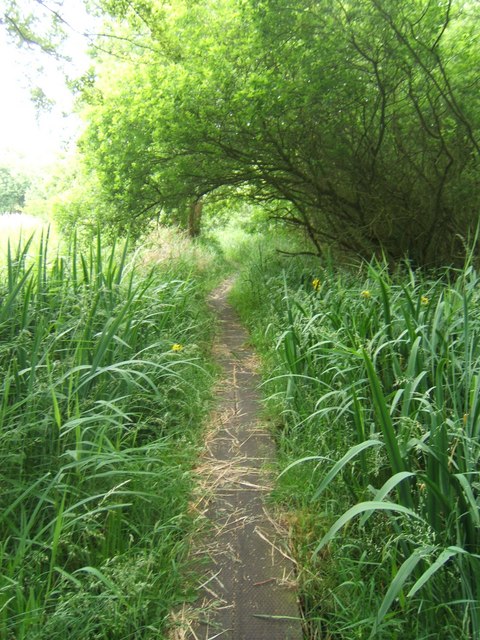
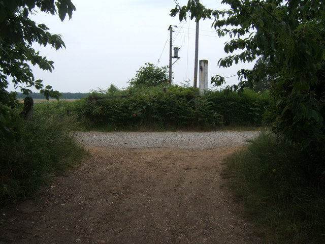
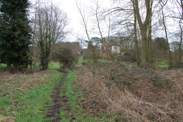
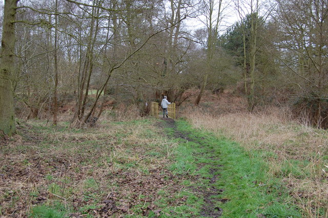
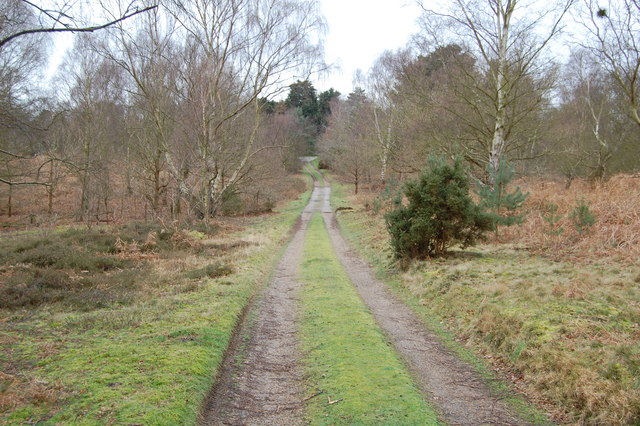
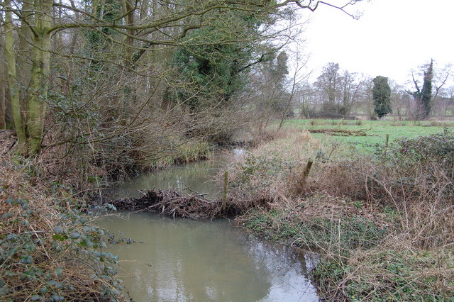
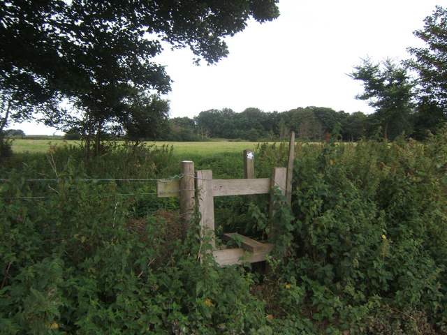
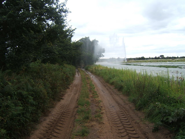
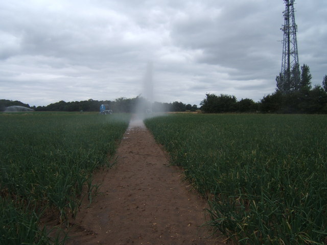
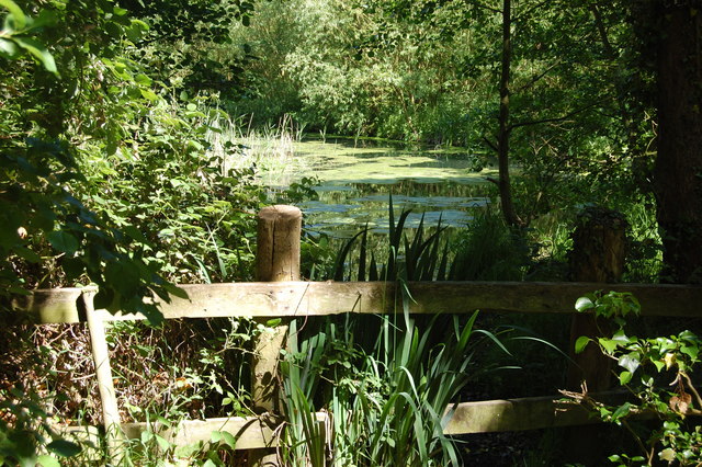
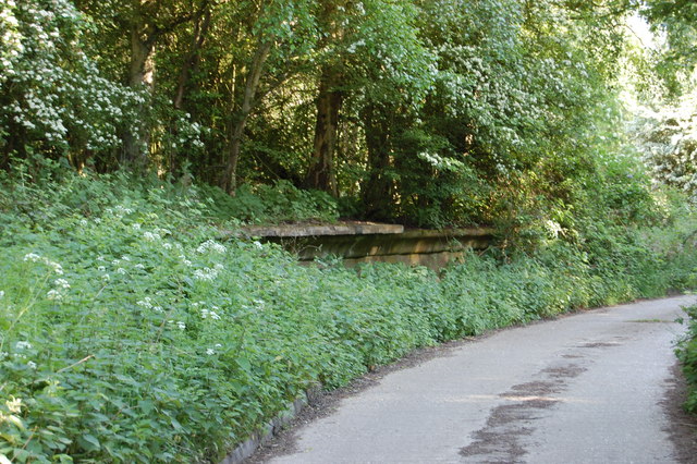
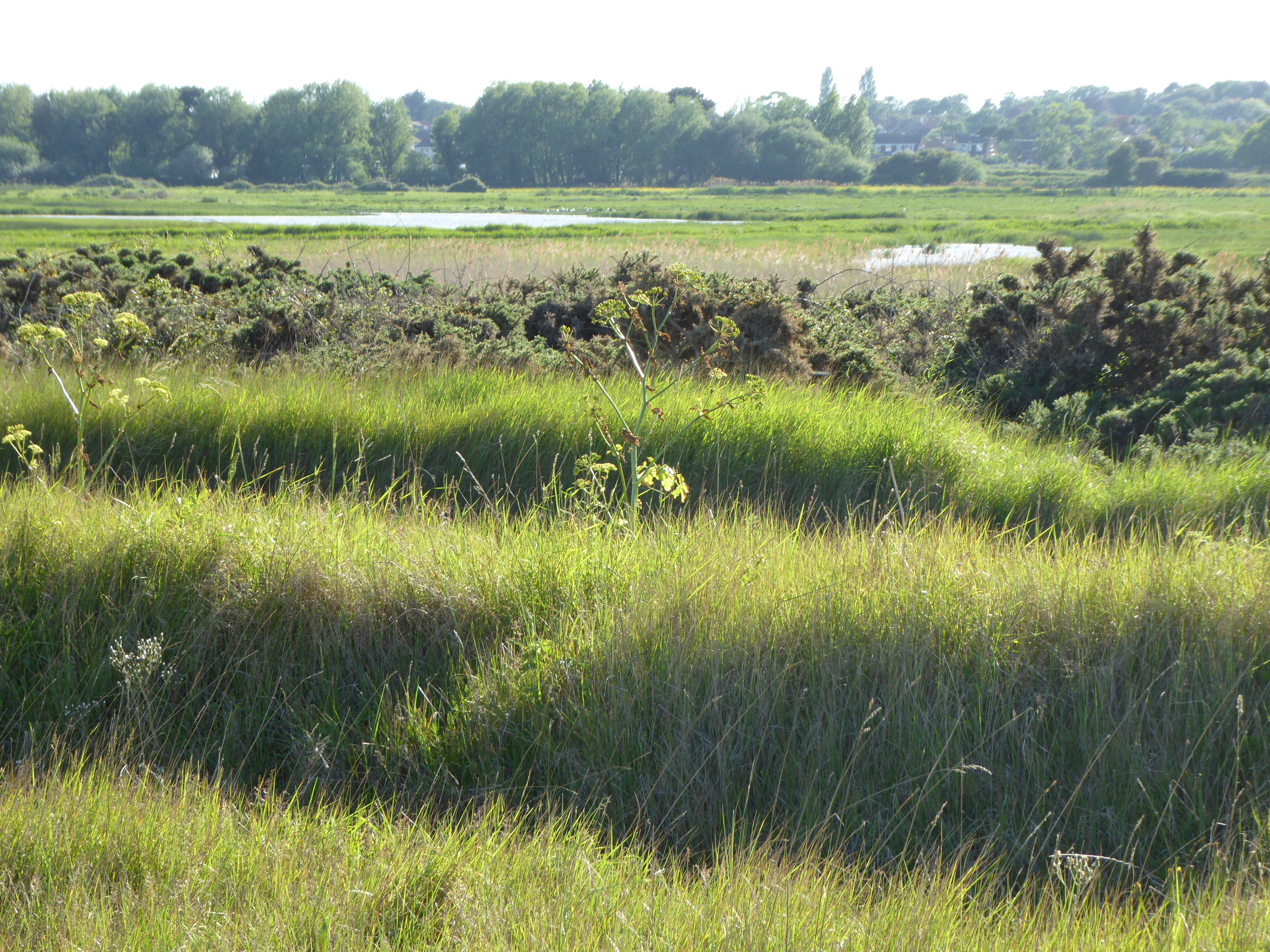
Covering a vast area, School Plantation offers a variety of landscapes, including rolling hills, dense forests, and open meadows. The Downs section of the plantation is characterized by its gently sloping hills, while the Moorland area features more rugged terrain with heather-covered moors and small streams meandering through the landscape.

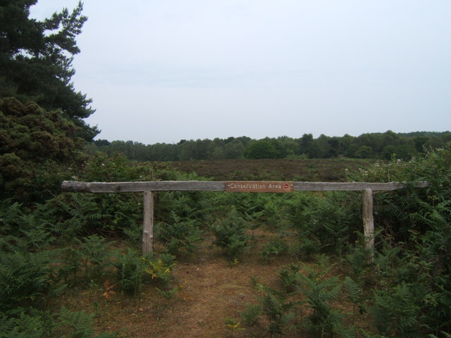
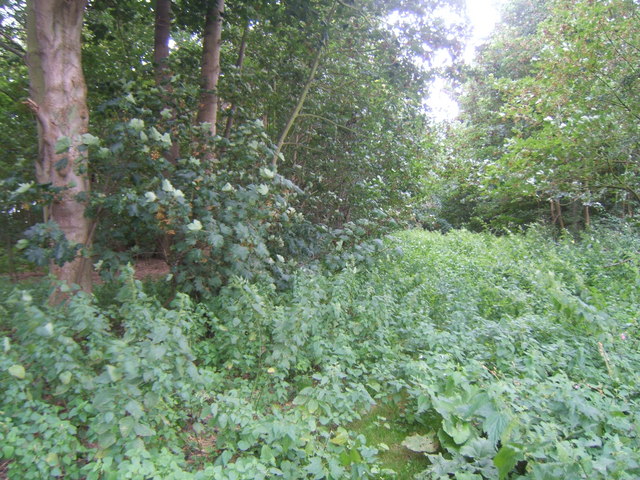
The plantation is home to a wide range of plant and animal species, including various types of wildflowers, oak and beech trees, and numerous bird species. It provides a habitat for rare and protected wildlife, such as the Dartford warbler and the silver-studded blue butterfly.

In addition to its natural beauty, School Plantation boasts a rich historical background. It is believed that the area has been used for agriculture since medieval times, with evidence of ancient farming practices still visible today. The site also holds remnants of a Roman settlement, further adding to its historical significance.

Visitors to School Plantation can enjoy walking trails and designated paths that allow them to explore the plantation at their own pace. The area provides a peaceful and tranquil setting, ideal for picnics, wildlife spotting, and connecting with nature.

Overall, School Plantation in Suffolk offers a captivating blend of natural beauty and historical significance, making it a must-visit destination for those seeking both outdoor adventure and cultural exploration.

If you have any feedback on the listing, please let us know in the comments section below.

School Plantation Images

Images are sourced within 2km of 52.189069/1.5801924 or Grid Reference TM4460. Thanks to Geograph Open Source API. All images are credited.

Moth Sculpture One of a series of sculptures along the Sandlings Walk.
Moth Sculpture
One of a series of sculptures along the Sandlings Walk.
Footpath crossing Looking along the line of a footpath crossing the Sandlings Walk, which runs from left to right. See <a href="https://www.geograph.org.uk/photo/66499">TM4559 : Moth Sculpture</a>
Footpath crossing
Looking along the line of a footpath crossing the Sandlings Walk, which runs from left to right. See TM4559 : Moth Sculpture
Track off Sandlings Walk Leading to Chapel Farm
Track off Sandlings Walk
Leading to Chapel Farm
Radio mast by Sandlings Walk
Track leading off Sandlings Walk by Round Covert Sandlings Walk runs left to right across the picture.
Track leading off Sandlings Walk by Round Covert
Sandlings Walk runs left to right across the picture.
Footbridge over stream
Footpath The footpath across this marshy area is made of old railway sleepers laid end to end.
Footpath
The footpath across this marshy area is made of old railway sleepers laid end to end.
Footpath junction near Thorpeness The path running left to right follows the course of a dismantled railway. The remains of a level crossing gate are still embedded in the hedge straight ahead.
Footpath junction near Thorpeness
The path running left to right follows the course of a dismantled railway. The remains of a level crossing gate are still embedded in the hedge straight ahead.
North Warren RSPB Conservation area near B1122
Footpath leading to Bird's Farm, Aldringham
Footbridge over Hundred River , Aldringham
Track near Aldringham
Hundred River, Aldringham
Footpath through Miller's Covert You needed not to mind about nettle stings to get through here!
Footpath through Miller's Covert
You needed not to mind about nettle stings to get through here!
Stile at 'The Belts'.
Farm track and footpath near Ten Acre covert It needed careful timing to dodge the irrigation spray!
Farm track and footpath near Ten Acre covert
It needed careful timing to dodge the irrigation spray!
Footpath across field Had to dodge the irrigation spray.
Footpath across field
Had to dodge the irrigation spray.
Meare backwater Quiet, shady corner of the otherwise busy lake
Meare backwater
Quiet, shady corner of the otherwise busy lake
Show me another place!

School Plantation is located at Grid Ref: TM4460 (Lat: 52.189069, Lng: 1.5801924)

Administrative County: Suffolk

District: East Suffolk

Police Authority: Suffolk

What 3 Words

///vehicle.crucially.botanists. Near Leiston, Suffolk

Related Wikis

Aldringham

Aldringham is a village in the Blything Hundred of Suffolk, England. The village is located 1 mile (1½ km) south of Leiston and 3 miles (4½ km) northwest...

Thorpeness railway station

Thorpeness railway station served the seaside resort of Thorpeness in Suffolk, England. It was opened in 1914 by the Great Eastern Railway on its 8.5-mile...

Alde Valley Academy

Alde Valley Academy is a secondary school with academy status in Leiston in the English county of Suffolk. It has approximately 500 pupils aged 11 to...

Leiston - Aldeburgh

Leiston - Aldeburgh is a 534.8-hectare (1,322-acre) biological Site of Special Scientific Interest which stretches from Aldeburgh to Leiston in Suffolk...

Nearby Amenities

Located within 500m of 52.189069,1.5801924
Bus Stop
Parrot & Punchbowl
Bus: yes
Naptan AtcoCode: 390060178
Naptan Bearing: N
Naptan CommonName: Parrot & Punchbowl
Naptan Indicator: N-bound
Naptan Landmark: Parrot & Punchbowl
Naptan NaptanCode: sufgmwgp
Naptan Street: Aldeburgh Road
Naptan Verified: no
Public Transport: platform
Shelter: yes
Source: naptan_import
Lat/Long: 52.1928024/1.5777412
Bus Stop
Parrot & Punchbowl
Naptan AtcoCode: 390060179
Naptan Bearing: S
Naptan CommonName: Parrot & Punchbowl
Naptan Indicator: S-bound
Naptan Landmark: Parrot & Punchbowl
Naptan NaptanCode: sufgmwgt
Naptan Street: Aldeburgh Road
Naptan Verified: no
Public Transport: platform
Shelter: yes
Source: naptan_import
Lat/Long: 52.1927528/1.5780011
Bus Stop
Parrot & Punchbowl
Naptan AtcoCode: 390060943
Naptan Bearing: NW
Naptan CommonName: Parrot & Punchbowl
Naptan Indicator: W-bound
Naptan Landmark: Parrot & Punchbowl
Naptan NaptanCode: sufjmapt
Naptan Street: B1353
Naptan Verified: no
Source: naptan_import
Lat/Long: 52.1930361/1.5780666
Bus Stop
Logwood
Bus: yes
Naptan AtcoCode: 390061114
Naptan Bearing: N
Naptan CommonName: Logwood
Naptan Indicator: opp
Naptan Landmark: Logwood
Naptan NaptanCode: sufjtadw
Naptan Street: Aldeburgh Road
Naptan Verified: no
Public Transport: platform
Source: naptan_import
Lat/Long: 52.186119/1.5780948
Bus Stop
Logwood
Bus: yes
Naptan AtcoCode: 390061115
Naptan Bearing: S
Naptan CommonName: Logwood
Naptan Indicator: adj
Naptan Landmark: Logwood
Naptan NaptanCode: sufjtaga
Naptan Street: Aldeburgh Road
Naptan Verified: no
Public Transport: platform
Source: naptan_import
Lat/Long: 52.1864115/1.5781761
Bench
Lat/Long: 52.192847/1.5780021
Tourism: village_sign
Lat/Long: 52.1929042/1.577977
Historic: archaeological_site
Note: Tumuli
Lat/Long: 52.1915865/1.5787934
Post Box
Collection Times: Mo-Fr 10:00; Sa 10:00
Post Box Type: lamp
Ref: IP16 4619
Royal Cypher: EIIR
Royal Cypher Wikidata: Q33102113
Lat/Long: 52.1878859/1.5775489
Bus Stop
Parrot & Punchbowl
Naptan AtcoCode: 390060942
Naptan Bearing: SE
Naptan CommonName: Parrot & Punchbowl
Naptan Indicator: E-bound
Naptan Landmark: Parrot & Punchbowl
Naptan NaptanCode: sufjmapm
Naptan Street: B1353
Naptan Verified: no
Public Transport: platform
Source: naptan_import
Lat/Long: 52.1931324/1.5780865
Bus Stop
Aldringham Court
Bus: yes
Public Transport: platform
Lat/Long: 52.1892979/1.5772888
Bus Stop
Aldringham Court
Bus: yes
Public Transport: platform
Lat/Long: 52.1890612/1.5776244
The data included in this document is from www.openstreetmap.org. The data is made available under ODbL.

Have you been to School Plantation?

Leave your review of School Plantation below (or comments, questions and feedback).