Hempstead

Settlement in Kent

England

Hempstead

Georgian Way, Wigmore
Georgian Way, Wigmore Credit: Chris Whippet

Hempstead is a small village located in the county of Kent, in southeastern England. Situated just 2 miles east of Gillingham, the village is part of the Medway unitary authority. With a population of around 2,500 residents, Hempstead is a close-knit community that offers a peaceful and picturesque setting.

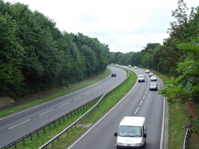
The village is known for its beautiful countryside, with rolling hills and scenic landscapes that attract nature enthusiasts and hikers. The area is also well-connected, with the M2 motorway passing nearby, providing easy access to London and other major cities in the region.

Hempstead has a long and rich history, dating back to Roman times. The village is home to several historical landmarks, including the Grade I listed All Saints' Church, which dates back to the 14th century. The church is known for its stunning architecture and houses a number of notable features, such as medieval wall paintings and a rare Norman baptismal font.

In terms of amenities, Hempstead offers a range of local services and facilities to its residents. These include a primary school, a village hall, a pub, and a convenience store. The village also benefits from its proximity to Gillingham, which offers a wider range of shops, restaurants, and leisure activities.

Overall, Hempstead is a charming village that offers a peaceful and idyllic lifestyle. With its rich history, beautiful countryside, and convenient location, it is a sought-after place to live for those seeking a tranquil rural setting within easy reach of urban amenities.

If you have any feedback on the listing, please let us know in the comments section below.
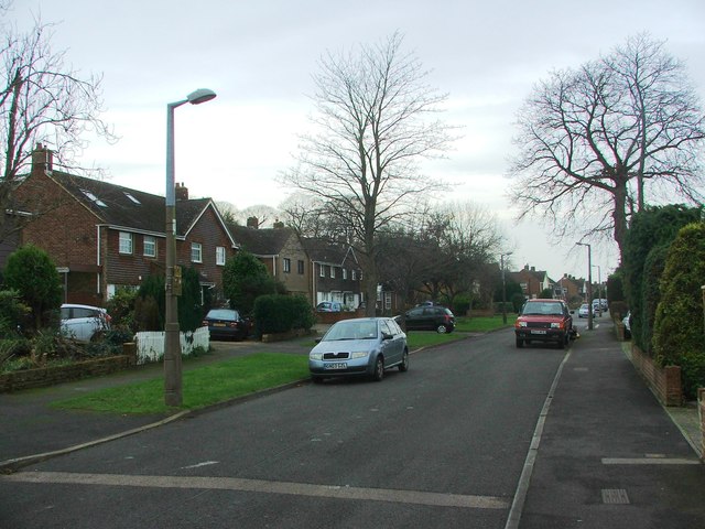
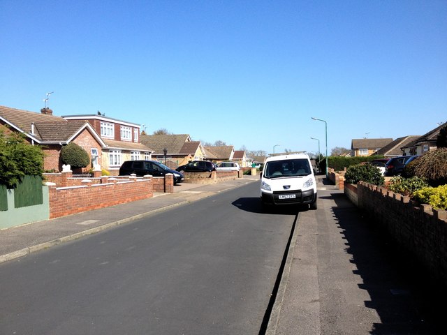
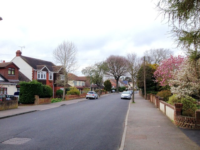
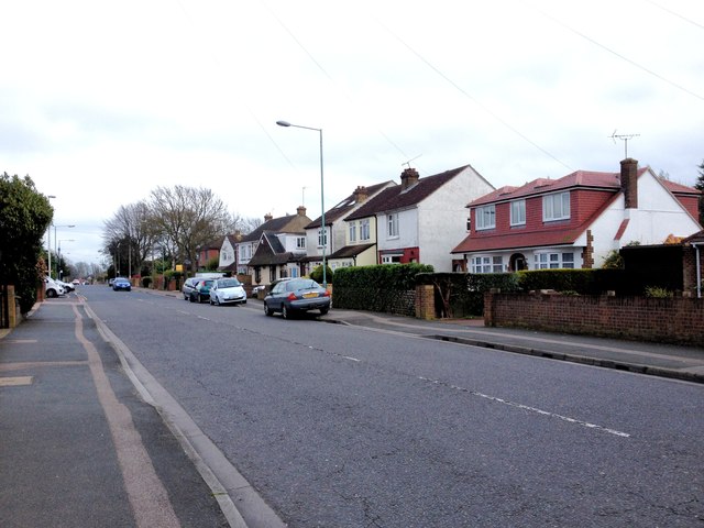
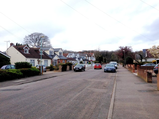
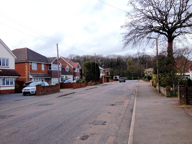
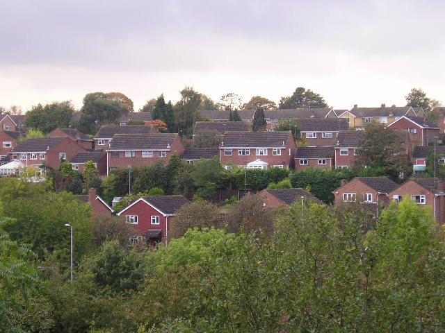
Hempstead Images

Images are sourced within 2km of 51.352427/0.563932 or Grid Reference TQ7864. Thanks to Geograph Open Source API. All images are credited.

Georgian Way, Wigmore
Prinys Drive, Wigmore
Hanover Drive, Wigmore
Prinys Drive, Wigmore
Georgian Way, Wigmore
Bredhurst Road, Wigmore
Fairview Avenue, Wigmore
St. Margaret's Drive, Wigmore
Carvoran Way, Wigmore
Edwards Close, Wigmore
Lakewood Drive, Wigmore
Bredhurst Road, Wigmore
Tanglewood Close, Wigmore
Woodside, Wigmore
Woodside, Wigmore
Springvale, Wigmore
Springvale, Wigmore
Springvale, Wigmore
Springvale, Wigmore
Show me another place!

Hempstead is located at Grid Ref: TQ7864 (Lat: 51.352427, Lng: 0.563932)

Unitary Authority: Medway

Police Authority: Kent

What 3 Words

///corrosive.evolution.shadow. Near Rainham, Kent

Nearby Locations

Hempstead

Related Wikis

Hempstead, Kent

Hempstead is a village near Gillingham, Kent in South East England. Historically a small hamlet, Hempstead grew throughout the 20th century to become part...
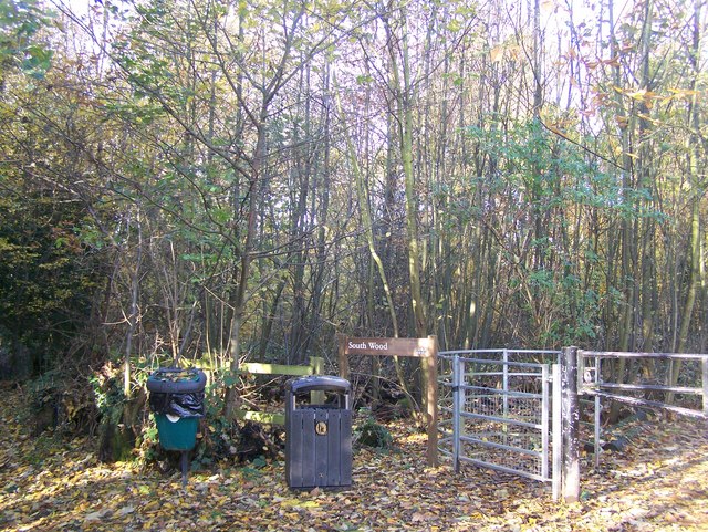
South Wood

South Wood is a 6.6-hectare (16-acre) Local Nature Reserve in Hempstead, south of Gillingham in Kent. It is owned and managed by Medway Council.This wood...

Capstone Farm Country Park

Capstone Farm Country Park is in Chatham, Kent, Medway, in Kent, England. A former farm converted into a landscaped park and open-space area. This park...

A278 road

The A278 (Hoath Way) is a road running north–south in north Kent, England. The whole length of the road is dual carriageway, within Medway Council but...

Nearby Amenities

Located within 500m of 51.352427,0.563932
Pub
The Flying Saucer
Addr City: Gillingham
Addr Housenumber: 140
Addr Postcode: ME7 3RH
Addr Street: Hempstead Road
Brand: Greene King
Brand Wikidata: Q5564162
Fhrs Authority: Medway
Fhrs Id: 605607
Fhrs Inspectiondate: 2015-09-06
Fhrs Rating: 4
Website: https://www.greeneking.co.uk/pubs/kent/flying-saucer
Lat/Long: 51.3522745/0.5707198
Bus Stop
Dukes Meadow Drive Shepherds Gate
Bus: yes
Naptan AtcoCode: 249000000180
Naptan Bearing: S
Naptan CommonName: Dukes Meadow Drive Shepherds Gate
Naptan Indicator: Opp
Naptan Landmark: Shepherds Gate
Naptan NaptanCode: chadpgt
Naptan PlusbusZoneRef: MEDWAY
Naptan Street: Dukes Meadow Drive
Naptan Verified: no
Public Transport: platform
Source: naptan_import
Lat/Long: 51.349895/0.5688767
Bus Stop
Dukes Meadow Drive Shepherds Gate
Bus: yes
Naptan AtcoCode: 249000000181
Naptan Bearing: N
Naptan CommonName: Dukes Meadow Drive Shepherds Gate
Naptan Indicator: adj
Naptan Landmark: Shepherds Gate
Naptan NaptanCode: chadpgw
Naptan PlusbusZoneRef: MEDWAY
Naptan Street: Dukes Meadow Drive
Naptan Verified: no
Public Transport: platform
Source: naptan_import
Lat/Long: 51.3504321/0.5689929
Bus Stop
Post Office
Bus: yes
Naptan AtcoCode: 249000000182
Naptan Bearing: NE
Naptan CommonName: Post Office
Naptan Indicator: adj
Naptan Landmark: Post Office
Naptan NaptanCode: chadpja
Naptan PlusbusZoneRef: MEDWAY
Naptan Street: Dukes Meadow Drive
Naptan Verified: no
Public Transport: platform
Source: naptan_import
Lat/Long: 51.3513781/0.570554
Bus Stop
Post Office
Bus: yes
Naptan AtcoCode: 249000000183
Naptan Bearing: SW
Naptan CommonName: Post Office
Naptan Indicator: opp
Naptan Landmark: Post Office
Naptan NaptanCode: chadpjd
Naptan PlusbusZoneRef: MEDWAY
Naptan Street: Dukes Meadow Drive
Naptan Verified: no
Public Transport: platform
Source: naptan_import
Lat/Long: 51.3512533/0.5705039
Bus Stop
Greenfinches
Bus: yes
Naptan AtcoCode: 249000000184
Naptan Bearing: N
Naptan CommonName: Greenfinches
Naptan Indicator: opp
Naptan Landmark: Horseshoe Close
Naptan NaptanCode: chadpjg
Naptan PlusbusZoneRef: MEDWAY
Naptan Street: Dukes Meadow Drive
Naptan Verified: no
Public Transport: platform
Source: naptan_import
Lat/Long: 51.3512302/0.5666389
Bus Stop
Greenfinches
Bus: yes
Naptan AtcoCode: 249000000185
Naptan Bearing: S
Naptan CommonName: Greenfinches
Naptan Indicator: adj
Naptan Landmark: Greenfinches
Naptan NaptanCode: chadpjm
Naptan PlusbusZoneRef: MEDWAY
Naptan Street: Dukes Meadow Drive
Naptan Verified: no
Public Transport: platform
Source: naptan_import
Lat/Long: 51.351518/0.5666407
Bus Stop
Dukes Meadow Drive
Bus: yes
Naptan AtcoCode: 249000000186
Naptan Bearing: N
Naptan CommonName: Dukes Meadow Drive
Naptan Indicator: o/s 18
Naptan Landmark: Pear Tree Lane
Naptan NaptanCode: chadpjp
Naptan PlusbusZoneRef: MEDWAY
Naptan Street: Dukes Meadow Drive
Naptan Verified: no
Public Transport: platform
Source: naptan_import
Lat/Long: 51.3547596/0.5656441
Bus Stop
Dukes Meadow Drive
Bus: yes
Naptan AtcoCode: 249000000187
Naptan Bearing: S
Naptan CommonName: Dukes Meadow Drive
Naptan Indicator: o/s 25
Naptan Landmark: Pear Tree Lane
Naptan NaptanCode: chadpjt
Naptan PlusbusZoneRef: MEDWAY
Naptan Street: Dukes Meadow Drive
Naptan Verified: no
Public Transport: platform
Source: naptan_import
Lat/Long: 51.3550269/0.5657595
Bus Stop
Flying Saucer
Bus: yes
Naptan AtcoCode: 249000000531
Naptan Bearing: S
Naptan CommonName: Flying Saucer
Naptan Indicator: adj
Naptan Landmark: Flying Saucer PH
Naptan NaptanCode: chagmtw
Naptan PlusbusZoneRef: MEDWAY
Naptan Street: Hempstead Road
Naptan Verified: no
Public Transport: platform
Source: naptan_import
Lat/Long: 51.3522051/0.5708115
Bus Stop
Flying Saucer
Bus: yes
Naptan AtcoCode: 249000000532
Naptan Bearing: N
Naptan CommonName: Flying Saucer
Naptan Indicator: opp
Naptan Landmark: Flying Saucer PH
Naptan NaptanCode: chagmwa
Naptan PlusbusZoneRef: MEDWAY
Naptan Street: Hempstead Road
Naptan Verified: no
Public Transport: platform
Source: naptan_import
Lat/Long: 51.3519009/0.5709136
Post Box
Operator: Royal Mail
Post Box Type: pillar
Ref: ME7 104
Lat/Long: 51.351793/0.5707785
Post Office
Hempstead Post Office
Addr City: Gillingham
Addr Postcode: ME7 3QE
Branch: Hempstead
Brand: Post Office
Brand Wikidata: Q1783168
Check Date: 2020-02-20
Contact Website: https://www.postoffice.co.uk/branch-finder/076941x/hempstead
Ref Pol Id: 702
Lat/Long: 51.351758/0.5705524
Barrier: entrance
Lat/Long: 51.3531494/0.5697896
Turning Circle
Lat/Long: 51.3505442/0.5664748
Co-op Food
Addr City: Gillingham
Addr Housenumber: 142
Addr Postcode: ME7 3QE
Addr Street: Hempstead Road
Brand: Co-op Food
Brand Wikidata: Q3277439
Brand Wikipedia: en:Co-op Food
Fhrs Authority: Medway
Fhrs Id: 778597
Fhrs Inspectiondate: 2016-11-07
Fhrs Rating: 5
Operator: The Co-operative Group
Operator Wikidata: Q117202
Shop: convenience
Website: https://www.coop.co.uk/store-finder/ME7-3QE/142-hempstead-road
Lat/Long: 51.3518245/0.5706949
Doctors
Hempstead Medical Centre
Healthcare: doctor
Lat/Long: 51.3516775/0.5706167
Pharmacy
Hempstead Pharmacy
Addr Housenumber: 148b
Addr Street: Hempstead Road
Dispensing: no
Healthcare: pharmacy
Lat/Long: 51.3515049/0.5708251
Restaurant
Zaffran Indian Restaurant
Addr City: Gillingham
Addr Housenumber: 146
Addr Postcode: ME7 3QE
Addr Street: Hempstead Road
Cuisine: indian
Fhrs Authority: Medway
Fhrs Id: 580524
Fhrs Inspectiondate: 2015-05-22
Fhrs Rating: 4
Level: 0
Lat/Long: 51.3516022/0.5706824
Pear Tree Ln Hemp
Location Transition: yes
Material: wood
Operator: UK Power Networks
Power: pole
Ref: 311955
Transformer: distribution
Lat/Long: 51.3559009/0.5672201
Turning Circle
Lat/Long: 51.3533271/0.5682608
Cafe
Lat/Long: 51.3557261/0.5597311
Generator Method: photovoltaic
Generator Output Electricity: yes
Generator Source: solar
Generator Type: solar_photovoltaic_panel
Location: roof
Power: generator
Lat/Long: 51.3527501/0.5693391
Generator Method: photovoltaic
Generator Output Electricity: yes
Generator Source: solar
Generator Type: solar_photovoltaic_panel
Location: roof
Power: generator
Lat/Long: 51.3527518/0.5695027
Generator Method: photovoltaic
Generator Output Electricity: yes
Generator Source: solar
Generator Type: solar_photovoltaic_panel
Location: roof
Power: generator
Lat/Long: 51.3527518/0.5670297
Generator Method: photovoltaic
Generator Output Electricity: yes
Generator Source: solar
Generator Type: solar_photovoltaic_panel
Location: roof
Power: generator
Lat/Long: 51.3499459/0.5678719
Generator Method: photovoltaic
Generator Output Electricity: yes
Generator Source: solar
Generator Type: solar_photovoltaic_panel
Location: roof
Power: generator
Lat/Long: 51.3499325/0.5679443
Generator Method: photovoltaic
Generator Output Electricity: yes
Generator Source: solar
Generator Type: solar_photovoltaic_panel
Location: roof
Power: generator
Lat/Long: 51.3500816/0.5681938
Generator Method: photovoltaic
Generator Output Electricity: yes
Generator Source: solar
Generator Type: solar_photovoltaic_panel
Location: roof
Power: generator
Lat/Long: 51.3501335/0.5680999
Generator Method: photovoltaic
Generator Output Electricity: yes
Generator Source: solar
Generator Type: solar_photovoltaic_panel
Location: roof
Power: generator
Lat/Long: 51.3495154/0.5677378
Generator Method: photovoltaic
Generator Output Electricity: yes
Generator Source: solar
Generator Type: solar_photovoltaic_panel
Location: roof
Power: generator
Lat/Long: 51.3552359/0.5634999
Generator Method: photovoltaic
Generator Output Electricity: yes
Generator Source: solar
Generator Type: solar_photovoltaic_panel
Location: roof
Power: generator
Lat/Long: 51.3545525/0.5684486
Generator Method: photovoltaic
Generator Output Electricity: yes
Generator Source: solar
Generator Type: solar_photovoltaic_panel
Location: roof
Power: generator
Lat/Long: 51.3554604/0.5678666
Generator Method: photovoltaic
Generator Output Electricity: yes
Generator Source: solar
Generator Type: solar_photovoltaic_panel
Location: roof
Power: generator
Lat/Long: 51.3553599/0.5652809
Generator Method: photovoltaic
Generator Output Electricity: yes
Generator Source: solar
Generator Type: solar_photovoltaic_panel
Location: roof
Power: generator
Lat/Long: 51.35472/0.5653238
Generator Method: photovoltaic
Generator Output Electricity: yes
Generator Source: solar
Generator Type: solar_photovoltaic_panel
Location: roof
Power: generator
Lat/Long: 51.3535718/0.5649564
Generator Method: photovoltaic
Generator Output Electricity: yes
Generator Source: solar
Generator Type: solar_photovoltaic_panel
Location: roof
Power: generator
Lat/Long: 51.3535056/0.5649188
Generator Method: photovoltaic
Generator Output Electricity: yes
Generator Source: solar
Generator Type: solar_photovoltaic_panel
Location: roof
Power: generator
Lat/Long: 51.3537317/0.565592
Generator Method: photovoltaic
Generator Output Electricity: yes
Generator Source: solar
Generator Type: solar_photovoltaic_panel
Location: roof
Power: generator
Lat/Long: 51.3527066/0.5654767
Bench
Lat/Long: 51.3558891/0.5593542
Bench
Lat/Long: 51.3558322/0.5596289
Bench
Lat/Long: 51.3558094/0.5595785
Bench
Lat/Long: 51.3557772/0.5596192
Entrance: yes
Lat/Long: 51.3555822/0.5599106
The data included in this document is from www.openstreetmap.org. The data is made available under ODbL.

Have you been to Hempstead?

Leave your review of Hempstead below (or comments, questions and feedback).