Hempstead

Settlement in Essex Uttlesford

England

Hempstead

'The Bluebell Inn', Hempstead, Essex This 16th century historic country inn was the birthplace of Dick Turpin, the notorious highwayman, in 1705.
'The Bluebell Inn', Hempstead, Essex Credit: Robert Edwards

Hempstead is a charming village located in the county of Essex, England. Situated approximately 40 miles northeast of London, it is nestled amidst the picturesque countryside of the region. With a population of around 800 residents, Hempstead boasts a close-knit community and a peaceful atmosphere.

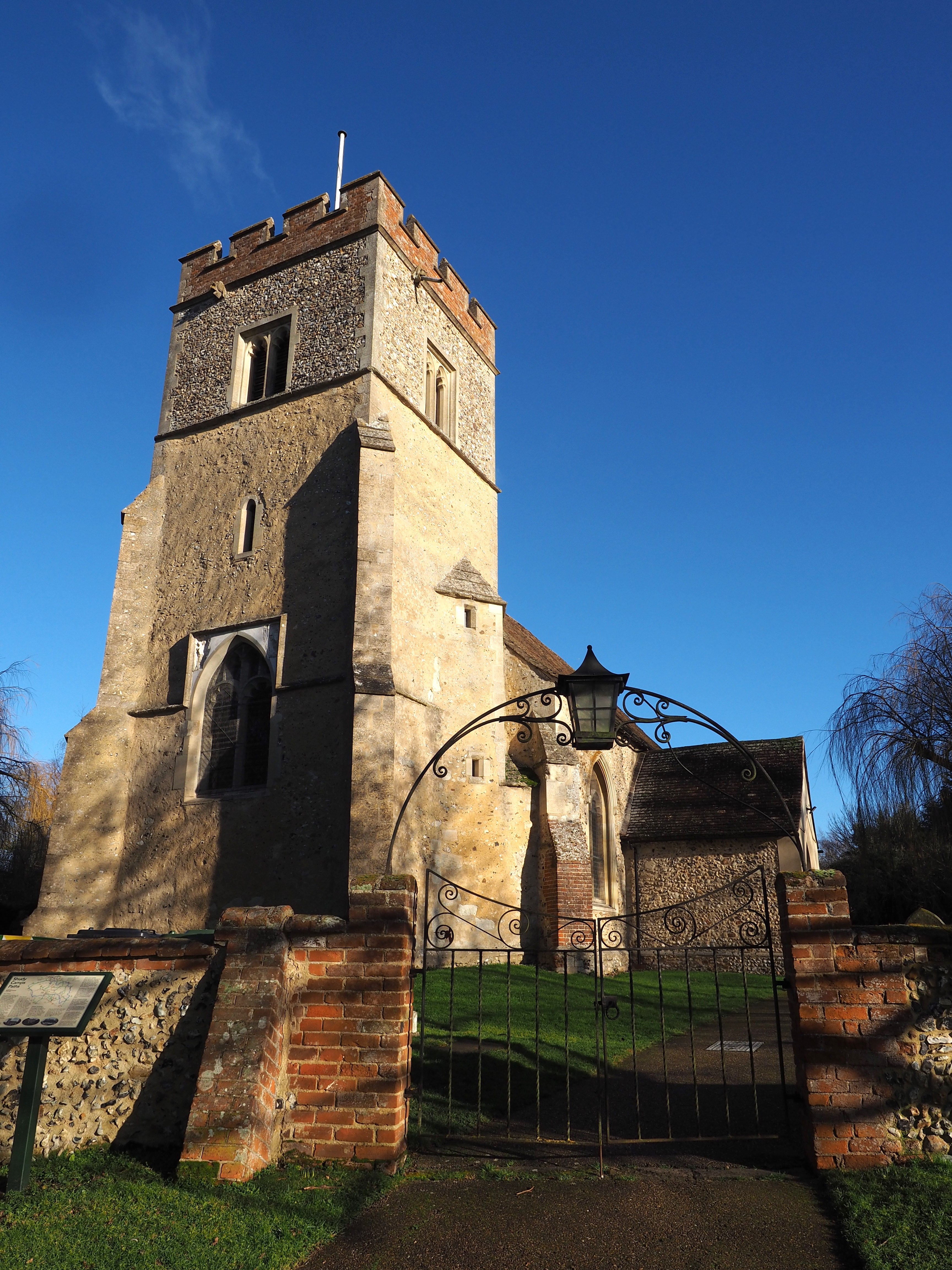
The village is renowned for its rich history, dating back to the medieval period. One of its most notable landmarks is the St. Andrew's Church, a beautiful 12th-century structure that stands as a testament to the village's architectural heritage. Visitors can explore the church's intricate details and learn about its historical significance.

Nature enthusiasts will find solace in Hempstead's verdant surroundings. The area is dotted with lush green fields, offering ample opportunities for countryside walks and outdoor activities. The nearby River Blackwater adds to the village's charm, providing a tranquil setting for fishing or simply enjoying the scenic views.

Hempstead is home to a vibrant community, with various local events and activities bringing residents together. The annual Hempstead Fayre is a highlight of the village's social calendar, featuring traditional festivities, live music, and stalls selling local produce.

Despite its rural setting, Hempstead benefits from its proximity to nearby towns and cities. Chelmsford, the county town of Essex, is just a short drive away and offers a wider range of amenities, including shopping centers, restaurants, and cultural attractions.

Overall, Hempstead, Essex presents an idyllic setting for those seeking a peaceful village lifestyle amidst the natural beauty of the English countryside.

If you have any feedback on the listing, please let us know in the comments section below.

Hempstead Images

Images are sourced within 2km of 52.016616/0.37897844 or Grid Reference TL6338. Thanks to Geograph Open Source API. All images are credited.

'The Bluebell Inn', Hempstead, Essex This 16th century historic country inn was the birthplace of Dick Turpin, the notorious highwayman, in 1705.
'The Bluebell Inn', Hempstead, Essex
This 16th century historic country inn was the birthplace of Dick Turpin, the notorious highwayman, in 1705.
Road junction for the B.1055, near Great Sampford, Essex
The B1055 as it enters Hempstead, Essex
Ruses Farm, just northeast of Hempstead, Essex This is a view from the B.1054
Ruses Farm, just northeast of Hempstead, Essex
This is a view from the B.1054
Greenlane at Free Roberts The entrance to a well maintained byway at a small hamlet called Free Roberts.
Greenlane at Free Roberts
The entrance to a well maintained byway at a small hamlet called Free Roberts.
Deadwood and coppice - Hempstead wood Decaying oak stumps among coppice stools in an ancient wood.
Deadwood and coppice - Hempstead wood
Decaying oak stumps among coppice stools in an ancient wood.
St Andrew, Hempstead, Essex - Tower
St Andrew, Hempstead, Essex
St Andrew, Hempstead, Essex - East end
St Andrew, Hempstead, Essex - Monument
St Andrew, Hempstead, Essex - Crypt
Howe Lane, heading towards Hempstead
Footpath to Holbrook Wood
Wincelow Hall Road
Wincelow Hall Road
Road junction at Hempstead Looking across the B.1054 to Wincelow Hall Road.
Road junction at Hempstead
Looking across the B.1054 to Wincelow Hall Road.
Farmhouse at Godfrey's Farm
Show me another place!

Hempstead is located at Grid Ref: TL6338 (Lat: 52.016616, Lng: 0.37897844)

Administrative County: Essex

District: Uttlesford

Police Authority: Essex

What 3 Words

///tuned.rewrites.mallets. Near Steeple Bumpstead, Essex

Nearby Locations

Hempstead

Related Wikis

Hempstead, Essex

Hempstead is a village and civil parish in the Uttlesford district of Essex, England. The village is 7 miles (11 km) east from Saffron Walden and 6 miles...

Radwinter

Radwinter is a village and a civil parish on the B1053 road, in the Uttlesford district of the county of Essex, England. The population in the 2011 census...

RAF Great Sampford

Royal Air Force Great Sampford or more simply RAF Great Sampford is a former Royal Air Force satellite station located 1.7 miles (2.7 km) west of Great...

Shudy Camps

Shudy Camps is a village in the south-east corner of Cambridgeshire, England, near the border of Essex and Suffolk, and is part of the Chilford Hundred...

Nearby Amenities

Located within 500m of 52.016616,0.37897844
Hempstead
Is In: Essex,England,UK
Place: village
Source: npe
Lat/Long: 52.0177539/0.3787814
Bus Stop
Bluebell Inn
Bus: yes
Naptan AtcoCode: 1500IM1907
Naptan Bearing: SW
Naptan CommonName: Bluebell Inn
Naptan Indicator: o/s
Naptan Landmark: Bluebell Inn
Naptan NaptanCode: esxdgawm
Naptan Street: High Street
Naptan Verified: no
Public Transport: platform
Source: naptan_import
Lat/Long: 52.0164503/0.3788158
Bus Stop
Bluebell Inn
Bus: yes
Naptan AtcoCode: 1500IM1907AA
Naptan Bearing: NE
Naptan BusStopType: CUS
Naptan CommonName: Bluebell Inn
Naptan Indicator: Opp
Naptan Landmark: Bluebell Inn
Naptan NaptanCode: esxgptdp
Naptan Street: High Street
Naptan Verified: no
Public Transport: platform
Source: naptan_import
Lat/Long: 52.016523/0.3787759
Post Box
Post Box Type: lamp
Ref: CB10 27
Royal Cypher: EIIR
Royal Cypher Wikidata: Q33102113
Lat/Long: 52.0170131/0.3793206
Telephone
Booth: K6
Covered: booth
Phone: +44 1799 599441
Lat/Long: 52.0169311/0.3792518
Crossing
Lat/Long: 52.0163767/0.3822831
Bench
Lat/Long: 52.0169949/0.3792702
The data included in this document is from www.openstreetmap.org. The data is made available under ODbL.

Have you been to Hempstead?

Leave your review of Hempstead below (or comments, questions and feedback).