Godwick Moor

Downs, Moorland in Norfolk Breckland

England

Godwick Moor

A1065, South Raynham The A1065 is an important route through the centre of Norfolk. It starts on the infamous Five Ways roundabout at Barton Mills, leaving the A11, and heads up through countryside for nearly 40 miles, crossing the A47 at Swaffham en route, until it ends on the A148 just outside Fakenham.
A1065, South Raynham Credit: David Dixon

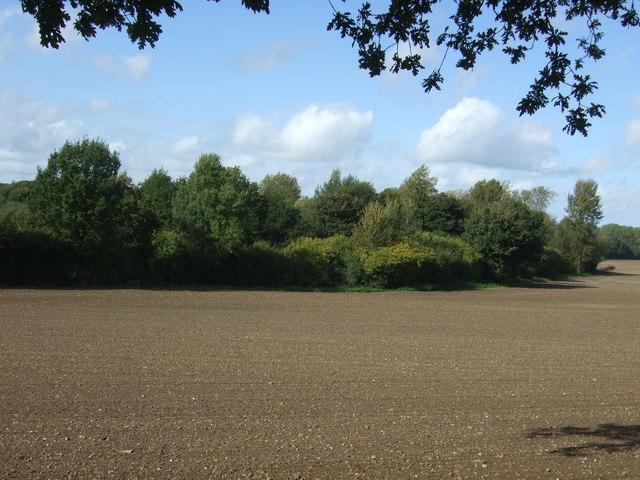
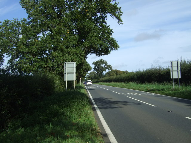
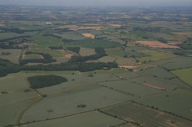
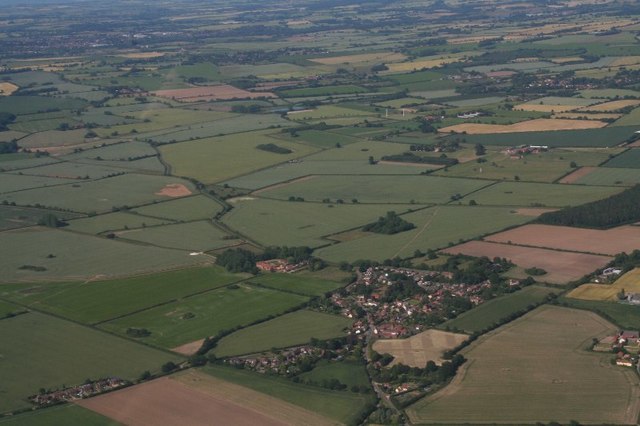
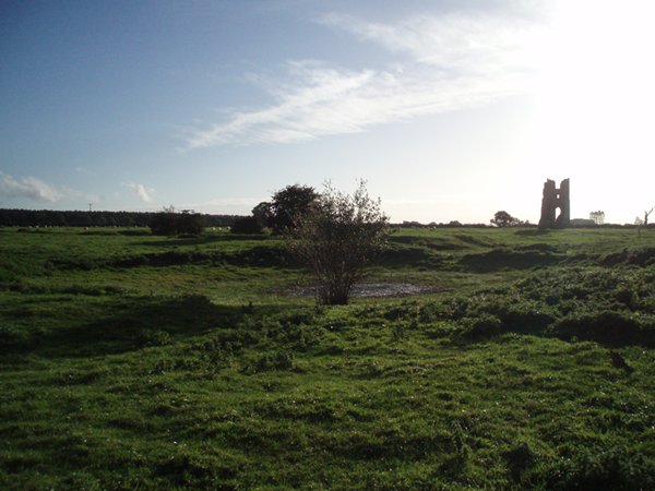
Godwick Moor is a vast expanse of low-lying land located in the county of Norfolk, England. Covering an area of approximately 300 hectares, the moor is situated near the village of Tittleshall, about 20 kilometers north-west of the town of Dereham. The landscape of Godwick Moor is characterized by its flat and open terrain, making it an ideal habitat for various species of wildlife and plants.

The moorland is predominantly composed of wet grassland, interspersed with numerous small pools and marshy areas. These wet habitats provide a haven for a diverse range of plants, including several species of sedges, reeds, and rushes. The moor is also home to a variety of bird species, such as lapwings, snipes, and redshanks, which are attracted to the wetland environment.

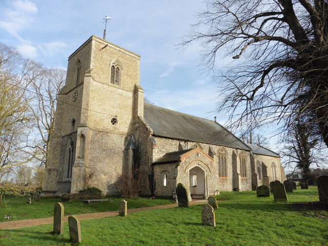
In addition to its natural beauty, Godwick Moor also holds historical significance. It was once part of a large medieval estate owned by the Godwick Manor, which dates back to the 12th century. Ruins of a medieval chapel can still be found on the moor, providing a glimpse into its past.

Today, Godwick Moor is a protected site, recognized for its ecological importance. It is managed by local conservation bodies and is accessible to the public, offering opportunities for nature walks and birdwatching. The tranquil and unspoiled landscape of Godwick Moor provides a peaceful retreat for visitors, enabling them to appreciate the beauty of Norfolk's countryside.

If you have any feedback on the listing, please let us know in the comments section below.

Godwick Moor Images

Images are sourced within 2km of 52.76919/0.80622379 or Grid Reference TF8922. Thanks to Geograph Open Source API. All images are credited.
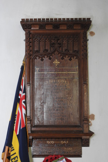
A1065, South Raynham The A1065 is an important route through the centre of Norfolk. It starts on the infamous Five Ways roundabout at Barton Mills, leaving the A11, and heads up through countryside for nearly 40 miles, crossing the A47 at Swaffham en route, until it ends on the A148 just outside Fakenham.
A1065, South Raynham
The A1065 is an important route through the centre of Norfolk. It starts on the infamous Five Ways roundabout at Barton Mills, leaving the A11, and heads up through countryside for nearly 40 miles, crossing the A47 at Swaffham en route, until it ends on the A148 just outside Fakenham.
Mercedes Actros on the A1065 near to South Raynham Mercedes Actros, HGV AY64 LZT, heading south on the A1065 at South Raynham.
Mercedes Actros on the A1065 near to South Raynham
Mercedes Actros, HGV AY64 LZT, heading south on the A1065 at South Raynham.
Northbound A1065, South Raynham Service Station The A1065 is an important route through the centre of Norfolk. It starts on the infamous Five Ways roundabout at Barton Mills, leaving the A11, and heads up through countryside for nearly 40 miles, crossing the A47 at Swaffham en route, until it ends on the A148 just outside Fakenham.
Northbound A1065, South Raynham Service Station
The A1065 is an important route through the centre of Norfolk. It starts on the infamous Five Ways roundabout at Barton Mills, leaving the A11, and heads up through countryside for nearly 40 miles, crossing the A47 at Swaffham en route, until it ends on the A148 just outside Fakenham.
Southbound A1065, South Raynham Service Station The A1065 is an important route through the centre of Norfolk. It starts on the infamous Five Ways roundabout at Barton Mills, leaving the A11, and heads up through countryside for nearly 40 miles, crossing the A47 at Swaffham en route, until it ends on the A148 just outside Fakenham.
Southbound A1065, South Raynham Service Station
The A1065 is an important route through the centre of Norfolk. It starts on the infamous Five Ways roundabout at Barton Mills, leaving the A11, and heads up through countryside for nearly 40 miles, crossing the A47 at Swaffham en route, until it ends on the A148 just outside Fakenham.
Entering South Raynham Looking north east on Swaffham Road (A1065).
Entering South Raynham
Looking north east on Swaffham Road (A1065).
Service station on Swaffham Road (A1065), South Raynham
Swaffham Road (A1065), South Raynham Looking north east.
Swaffham Road (A1065), South Raynham
Looking north east.
Field and woodland near the River Wensum Off the A1065.
Field and woodland near the River Wensum
Off the A1065.
A1065 towards Fakenham Looking north east.
A1065 towards Fakenham
Looking north east.
Norman's Burrow Wood east of South Raynham: aerial 2018
Tittleshall: aerial 2018
Old Milepost by the A1065, Raynham Parish Cast iron post by the A1065, in parish of RAYNHAM (NORTH NORFOLK District), 70yds South of farm track and pillbox, on the verge, on West side of road. NCC-ci-PB2, erected by the County Council in the 20th century. 

Inscription reads:-
: TO / FAKENHAM / 4 / MILES : : NCC / MAIN ROAD / EAST RAYNHAM : : TO / SWAFFHAM / 12 / MILES :
Maker:-
: PERTWEE & BACK / YARMOUTH. :

Milestone Society National ID: NO_FS04.
Old Milepost by the A1065, Raynham Parish
Cast iron post by the A1065, in parish of RAYNHAM (NORTH NORFOLK District), 70yds South of farm track and pillbox, on the verge, on West side of road. NCC-ci-PB2, erected by the County Council in the 20th century. Inscription reads:- : TO / FAKENHAM / 4 / MILES : : NCC / MAIN ROAD / EAST RAYNHAM : : TO / SWAFFHAM / 12 / MILES : Maker:- : PERTWEE & BACK / YARMOUTH. : Milestone Society National ID: NO_FS04.
Tittleshall, St Mary
Direction Sign – Signpost Located on the grass triangle at the centre of the junction of Fakenham Road and Church Lane in Tittleshall parish. 3 arms and annulus finial. 

Milestone Society National ID: NO_TF8921
Direction Sign – Signpost
Located on the grass triangle at the centre of the junction of Fakenham Road and Church Lane in Tittleshall parish. 3 arms and annulus finial. Milestone Society National ID: NO_TF8921
Battlefield Cross of Private Lionel Kenelm Digby The cross bears the following words "R.I.P. - In Loving Memory of - 38456 Pte. L. K. DIGBY - 7th Norfolk Regiment - Killed in Action - October 20th 1918."
On the foot it records "Erected by IIII Hallamshires."
Although he was in the Norfolk Regiment he was fighting alongside the 4th Hampshires at the time he was killed.
Son of Reginald and Caroline Grace Digby, of Geashill Castle, King's Co.  Rector of Tittleshall.
[The barons Digby were the largest landowners in King's County at the time, with 29,722 acres] 
The Cross stands on what was the stairs to the Rood Loft against the north wall.
Battlefield Cross of Private Lionel Kenelm Digby
The cross bears the following words "R.I.P. - In Loving Memory of - 38456 Pte. L. K. DIGBY - 7th Norfolk Regiment - Killed in Action - October 20th 1918." On the foot it records "Erected by IIII Hallamshires." Although he was in the Norfolk Regiment he was fighting alongside the 4th Hampshires at the time he was killed. Son of Reginald and Caroline Grace Digby, of Geashill Castle, King's Co. Rector of Tittleshall. [The barons Digby were the largest landowners in King's County at the time, with 29,722 acres] The Cross stands on what was the stairs to the Rood Loft against the north wall.
Tittleshall War Memorial The memorial which is located in Tittleshall St. Mary's church bears the same names as the memorial south of the village at the Fakenham Road junction with Heath Lane. <a title="https://www.geograph.org.uk/photo/6487204" href="https://www.geograph.org.uk/photo/6487204">Link</a>
Tittleshall War Memorial
The memorial which is located in Tittleshall St. Mary's church bears the same names as the memorial south of the village at the Fakenham Road junction with Heath Lane. Link
Tittleshall village sign The sign is at the southern end of the High Street and bears the date 1953.
Tittleshall village sign
The sign is at the southern end of the High Street and bears the date 1953.
Tittleshall village sign The sign is at the southern end of the High Street and bears the date 1953, and was erected to commemorate the Queen’s coronation.  <a title="https://www.geograph.org.uk/photo/6796700" href="https://www.geograph.org.uk/photo/6796700">Link</a>
Tittleshall village sign
The sign is at the southern end of the High Street and bears the date 1953, and was erected to commemorate the Queen’s coronation. Link
Show me another place!

Godwick Moor is located at Grid Ref: TF8922 (Lat: 52.76919, Lng: 0.80622379)

Administrative County: Norfolk

District: Breckland

Police Authority: Norfolk

What 3 Words

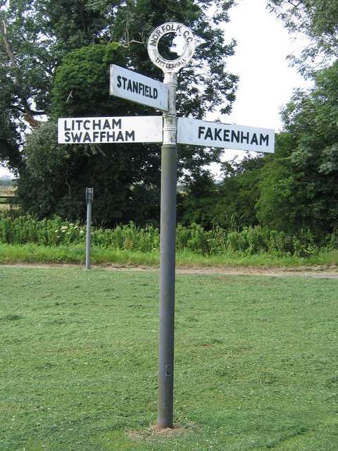
///nickname.indicates.dude. Near Fakenham, Norfolk

Nearby Locations

Godwick Moor

Related Wikis

Pattesley

Pattesley is a village in the English county of Norfolk, about one mile (1.6 km) south of the village of Oxwick. It consists of a few scattered houses...
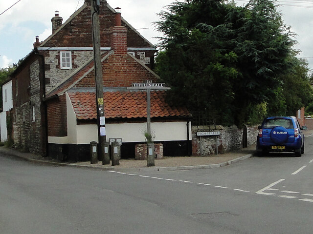
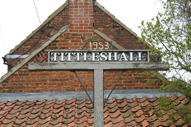
Tittleshall

Tittleshall is a village and civil parish in the English county of Norfolk. == Location == The village and parish of Tittleshall has an area of 1376 hectares...

Godwick

Godwick is a deserted village in the county of Norfolk. Its location was south of Fakenham between the villages of Tittleshall and Whissonsett. There are...
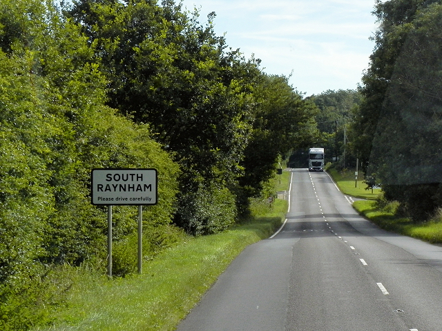
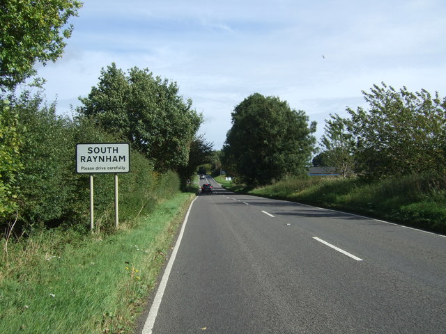
South Raynham

South Raynham is a village and former civil parish, now in the parish of Raynham, in the North Norfolk district, in the county of Norfolk, England. It...

River Wensum SSSI

The River Wensum SSSI is a 'whole river' Site of Special Scientific Interest located on the River Wensum that flows through the English county of Norfolk...

Wellingham

Wellingham is a village and civil parish in the English county of Norfolk. It covers an area of 4.39 km2 (1.69 sq mi) and had a population of 55 in 27...

Raynham, Norfolk

Raynham is a civil parish in the English county of Norfolk, consisting of the villages of South, East and West Raynham. It covers an area of 16.75 km2...

East Raynham

East Raynham is a village and former civil parish, now in the parish of Raynham, in the North Norfolk district, in the county of Norfolk, England. It is...

Nearby Amenities

Located within 500m of 52.76919,0.80622379
Power: tower
Lat/Long: 52.7692406/0.800961
Power: tower
Lat/Long: 52.7712463/0.8043298
Power: tower
Lat/Long: 52.7731221/0.807527
Power: pole
Lat/Long: 52.766183/0.8030079
Power: pole
Lat/Long: 52.7672023/0.8039753
Power: pole
Lat/Long: 52.7682063/0.8049308
Power: pole
Lat/Long: 52.7692357/0.805933
Power: pole
Lat/Long: 52.7702312/0.8068233
Power: pole
Lat/Long: 52.7713141/0.8073593
Power: pole
Lat/Long: 52.7723885/0.8078254
The data included in this document is from www.openstreetmap.org. The data is made available under ODbL.

Have you been to Godwick Moor?

Leave your review of Godwick Moor below (or comments, questions and feedback).