Tenterden Vineyard Park

Downs, Moorland in Kent Ashford

England

Tenterden Vineyard Park

Coneyboro Wood
Coneyboro Wood Credit: N Chadwick

Tenterden Vineyard Park is a picturesque holiday destination nestled in the heart of Kent, England. Surrounded by the stunning landscapes of the Downs and Moorland, this vineyard park offers a unique and tranquil setting for visitors to enjoy.

The park is located on a working vineyard, offering guests the opportunity to experience the beauty and intricacies of wine production firsthand. The vineyard spans across acres of rolling hills, showcasing rows of meticulously maintained vines that produce a variety of high-quality wines.

Accommodation options at Tenterden Vineyard Park include luxury lodges and static caravans, all designed with comfort and relaxation in mind. Each accommodation unit is fully equipped with modern amenities, ensuring a comfortable and enjoyable stay for guests.

Visitors can take part in guided tours of the vineyard, learning about the winemaking process from grape to bottle. Wine tastings are also available, allowing guests to sample the vineyard's award-winning wines and appreciate their unique flavors.

The park's location in the Kent countryside offers ample opportunities for outdoor activities. Guests can explore the surrounding Downs and Moorland through walking or cycling, taking in the breathtaking views and discovering the diverse wildlife that inhabits the area.

Tenterden Vineyard Park also features a restaurant and bar, serving delicious meals made with locally sourced ingredients. The on-site shop offers a selection of wines and other local produce for visitors to take home as souvenirs.

Overall, Tenterden Vineyard Park provides a serene and idyllic getaway for those seeking a taste of the Kent countryside and a glimpse into the world of winemaking.

If you have any feedback on the listing, please let us know in the comments section below.

Tenterden Vineyard Park Images

Images are sourced within 2km of 51.040833/0.69798901 or Grid Reference TQ8930. Thanks to Geograph Open Source API. All images are credited.

Coneyboro Wood
Coneyboro Wood
Coneyboro Wood
Coneyboro Wood
High Weald Landscape Trail The High Weald Landscape Trail (HWLT) is a 90 mile route between Horsham, West Sussex and Rye, East Sussex, designed to pass through the main landscape types of the High Weald Area of Outstanding Natural Beauty (AONB). It does not follow the highest ground, and the eastern section is only a few feet above sea level. It keeps to the northern edge of the High Weald except in the west where it runs close to the southern edge for a short distance.
It is a trail of regional importance supported by the High Weald Forum and local authorities in East and West Sussex, and Kent. The route is well signposted. It follows public rights of way and roads with the occasional permissive path.
The geology is alternating sandstones and clays, and the latter can be very muddy in wet conditions so boots are a must except in very dry weather. Some sections become very overgrown in summer with nettles and brambles.
High Weald Landscape Trail
The High Weald Landscape Trail (HWLT) is a 90 mile route between Horsham, West Sussex and Rye, East Sussex, designed to pass through the main landscape types of the High Weald Area of Outstanding Natural Beauty (AONB). It does not follow the highest ground, and the eastern section is only a few feet above sea level. It keeps to the northern edge of the High Weald except in the west where it runs close to the southern edge for a short distance. It is a trail of regional importance supported by the High Weald Forum and local authorities in East and West Sussex, and Kent. The route is well signposted. It follows public rights of way and roads with the occasional permissive path. The geology is alternating sandstones and clays, and the latter can be very muddy in wet conditions so boots are a must except in very dry weather. Some sections become very overgrown in summer with nettles and brambles.
Footbridge, High Weald Landscape Trail The High Weald Landscape Trail (HWLT) is a 90 mile route between Horsham, West Sussex and Rye, East Sussex, designed to pass through the main landscape types of the High Weald Area of Outstanding Natural Beauty (AONB). It does not follow the highest ground, and the eastern section is only a few feet above sea level. It keeps to the northern edge of the High Weald except in the west where it runs close to the southern edge for a short distance.
It is a trail of regional importance supported by the High Weald Forum and local authorities in East and West Sussex, and Kent. The route is well signposted. It follows public rights of way and roads with the occasional permissive path.
The geology is alternating sandstones and clays, and the latter can be very muddy in wet conditions so boots are a must except in very dry weather. Some sections become very overgrown in summer with nettles and brambles.
Footbridge, High Weald Landscape Trail
The High Weald Landscape Trail (HWLT) is a 90 mile route between Horsham, West Sussex and Rye, East Sussex, designed to pass through the main landscape types of the High Weald Area of Outstanding Natural Beauty (AONB). It does not follow the highest ground, and the eastern section is only a few feet above sea level. It keeps to the northern edge of the High Weald except in the west where it runs close to the southern edge for a short distance. It is a trail of regional importance supported by the High Weald Forum and local authorities in East and West Sussex, and Kent. The route is well signposted. It follows public rights of way and roads with the occasional permissive path. The geology is alternating sandstones and clays, and the latter can be very muddy in wet conditions so boots are a must except in very dry weather. Some sections become very overgrown in summer with nettles and brambles.
Trees by Tilder Gill
Stile by the High Weald Landscape Trail
Farmland by Tilder Gill
High Weald Landscape Trail The High Weald Landscape Trail (HWLT) is a 90 mile route between Horsham, West Sussex and Rye, East Sussex, designed to pass through the main landscape types of the High Weald Area of Outstanding Natural Beauty (AONB). It does not follow the highest ground, and the eastern section is only a few feet above sea level. It keeps to the northern edge of the High Weald except in the west where it runs close to the southern edge for a short distance.
It is a trail of regional importance supported by the High Weald Forum and local authorities in East and West Sussex, and Kent. The route is well signposted. It follows public rights of way and roads with the occasional permissive path.
The geology is alternating sandstones and clays, and the latter can be very muddy in wet conditions so boots are a must except in very dry weather. Some sections become very overgrown in summer with nettles and brambles.
High Weald Landscape Trail
The High Weald Landscape Trail (HWLT) is a 90 mile route between Horsham, West Sussex and Rye, East Sussex, designed to pass through the main landscape types of the High Weald Area of Outstanding Natural Beauty (AONB). It does not follow the highest ground, and the eastern section is only a few feet above sea level. It keeps to the northern edge of the High Weald except in the west where it runs close to the southern edge for a short distance. It is a trail of regional importance supported by the High Weald Forum and local authorities in East and West Sussex, and Kent. The route is well signposted. It follows public rights of way and roads with the occasional permissive path. The geology is alternating sandstones and clays, and the latter can be very muddy in wet conditions so boots are a must except in very dry weather. Some sections become very overgrown in summer with nettles and brambles.
Herons Oast Twin round kiln oast house.
Herons Oast
Twin round kiln oast house.
Stile, High Weald Landscape Trail The High Weald Landscape Trail (HWLT) is a 90 mile route between Horsham, West Sussex and Rye, East Sussex, designed to pass through the main landscape types of the High Weald Area of Outstanding Natural Beauty (AONB). It does not follow the highest ground, and the eastern section is only a few feet above sea level. It keeps to the northern edge of the High Weald except in the west where it runs close to the southern edge for a short distance.
It is a trail of regional importance supported by the High Weald Forum and local authorities in East and West Sussex, and Kent. The route is well signposted. It follows public rights of way and roads with the occasional permissive path.
The geology is alternating sandstones and clays, and the latter can be very muddy in wet conditions so boots are a must except in very dry weather. Some sections become very overgrown in summer with nettles and brambles.
Stile, High Weald Landscape Trail
The High Weald Landscape Trail (HWLT) is a 90 mile route between Horsham, West Sussex and Rye, East Sussex, designed to pass through the main landscape types of the High Weald Area of Outstanding Natural Beauty (AONB). It does not follow the highest ground, and the eastern section is only a few feet above sea level. It keeps to the northern edge of the High Weald except in the west where it runs close to the southern edge for a short distance. It is a trail of regional importance supported by the High Weald Forum and local authorities in East and West Sussex, and Kent. The route is well signposted. It follows public rights of way and roads with the occasional permissive path. The geology is alternating sandstones and clays, and the latter can be very muddy in wet conditions so boots are a must except in very dry weather. Some sections become very overgrown in summer with nettles and brambles.
Herons Oast Twin round kiln oast house.
Herons Oast
Twin round kiln oast house.
Dried up pond
Dried up pond
Herons Oast Twin round kiln oast house.
Herons Oast
Twin round kiln oast house.
Herons Oast and Dumbourne Farmhouse Twin round kiln oast house.
Herons Oast and Dumbourne Farmhouse
Twin round kiln oast house.
Flat farmland near Dumbourne
Farmland south of Dumbourne
Countryside south of Dumbourne
Drainage ditch
Drainage ditch
Show me another place!

Tenterden Vineyard Park is located at Grid Ref: TQ8930 (Lat: 51.040833, Lng: 0.69798901)

Administrative County: Kent

District: Ashford

Police Authority: Kent

What 3 Words

///central.flicked.extremely. Near Tenterden, Kent

Related Wikis

Chapel Down

Chapel Down based in Tenterden in Kent, is an English vineyard and winemaker. It is the largest producer of English wine, with over 950 acres under vine...

Small Hythe

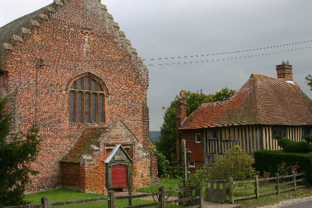
Small Hythe (or Smallhythe) is a hamlet near Tenterden in Kent, England. The population is included in Tenterden. It stood on a branch of the Rother estuary...

Smallhythe Place

Smallhythe Place in Small Hythe, near Tenterden in Kent, is a half-timbered house built in the late 15th or early 16th century and since 1947 cared for...

Leigh Green

Leigh Green is a hamlet 2 miles (3 km) southeast of the town of Tenterden in Kent, England .

Wittersham

Wittersham is a small village and civil parish in the borough of Ashford in Kent, England. It is part of the Isle of Oxney. == History == The Domesday...

Reading Street, Ashford

Reading Street is a hamlet approximately 3 miles (4.8 km) south east of Tenterden in Kent, England. It is situated on the B2080 road between Tenterden...

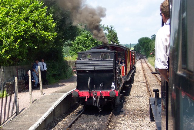
Wittersham Road railway station

Wittersham Road is a railway station on the Kent and East Sussex Railway. It is located to the north-east of the level crossing on Maytham Road which links...

Tenterden Town Hall

Tenterden Town Hall is a municipal building in the High Street in Tenterden, Kent, England. The structure, which is the meeting place of Tenterden Town...

Nearby Amenities

Located within 500m of 51.040833,0.69798901
Bus Stop
Small Hythe, Church
Bus: yes
Flag: no
Naptan AtcoCode: 2400A072670A
Naptan Bearing: S
Naptan BusStopType: CUS
Naptan CommonName: Church
Naptan Indicator: adj
Naptan Landmark: Church
Naptan NaptanCode: kntgdwdw
Naptan Street: Small Hythe Road
Naptan Verified: no
Public Transport: platform
Source: naptan_import
Lat/Long: 51.0399031/0.6992858
Post Box
Collection Times: Mo-Fr 09:00; Sa 07:00; Su off
Colour: red
Operator: Royal Mail
Operator Wikidata: Q638098
Post Box Type: lamp
Ref: TN30 259
Royal Cypher: EIIR
Lat/Long: 51.0402296/0.6991868
Small Hythe
Place: hamlet
Lat/Long: 51.0406189/0.6993588
Smallhythe Place
Operator: National Trust
Tourism: attraction
Lat/Long: 51.038321/0.6995017
Restaurant
The Swan
Lat/Long: 51.0411513/0.698128
Defibrillator
Booth: K6
Covered: booth
Defibrillator Location: inside old red phone box in Small Hythe
Disused Amenity: telephone
Emergency: defibrillator
Man Made: telephone_box
Lat/Long: 51.0420081/0.6997264
The data included in this document is from www.openstreetmap.org. The data is made available under ODbL.

Have you been to Tenterden Vineyard Park?

Leave your review of Tenterden Vineyard Park below (or comments, questions and feedback).