Bodney Warren

Downs, Moorland in Norfolk Breckland

England

Bodney Warren

Rough grazing on north side of B1108 The B1108 here is west of Watton and among lands used by the MOD. The rough road heading north in the image may well see farm, estate and military use.
Rough grazing on north side of B1108 Credit: Trevor Littlewood

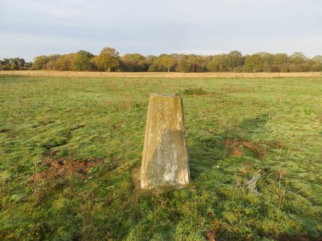
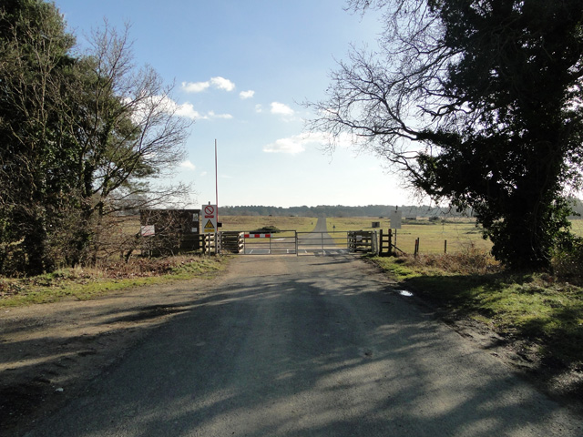
Bodney Warren, located in Norfolk, England, is a vast expanse of open land encompassing both downs and moorland. This area is renowned for its natural beauty and rich biodiversity, making it a popular destination for nature enthusiasts and outdoor adventurers.

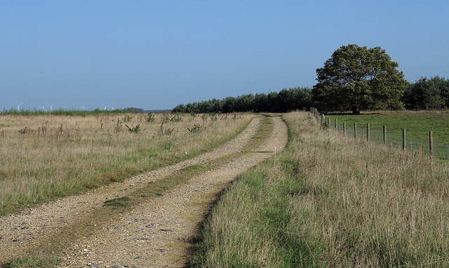
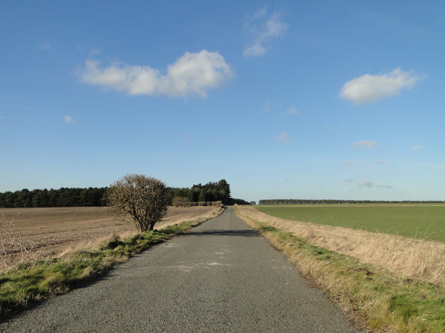
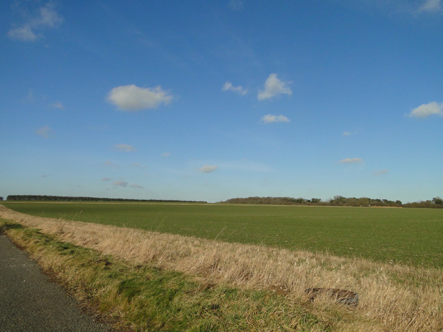
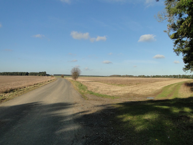
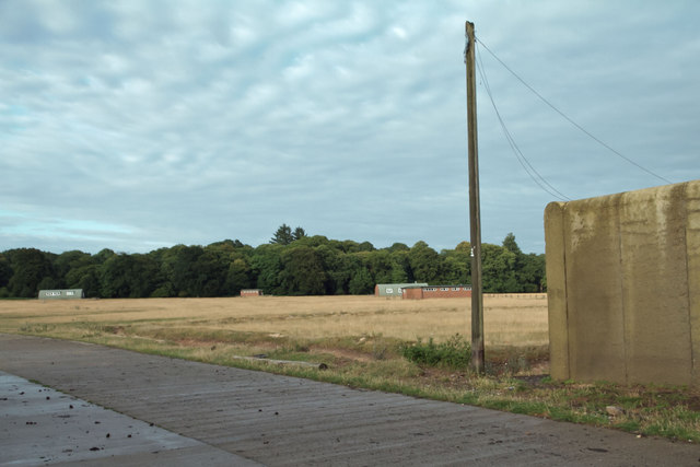
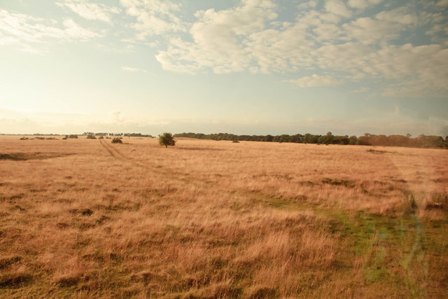
The downs of Bodney Warren offer stunning panoramic views of the surrounding countryside, with rolling hills and lush green fields stretching as far as the eye can see. The landscape is characterized by gentle slopes and chalky soil, creating a unique environment that supports a variety of plant and animal species. Visitors can spot an array of wildflowers, such as harebells and cowslips, while birdwatchers may be lucky enough to catch a glimpse of skylarks and meadow pipits soaring through the skies.

In contrast, the moorland section of Bodney Warren presents a different but equally captivating scenery. Here, visitors will find vast expanses of heather-covered moors, interspersed with patches of gorse and bracken. This habitat provides a haven for species such as adders, stonechats, and curlews, which thrive in the moorland's unique conditions.

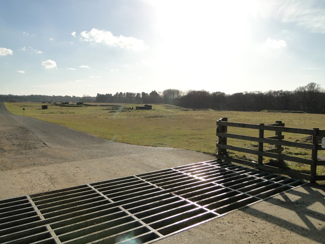
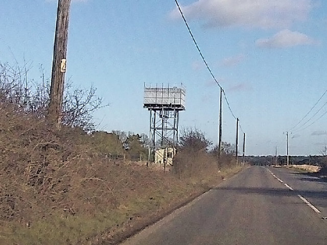
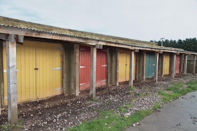
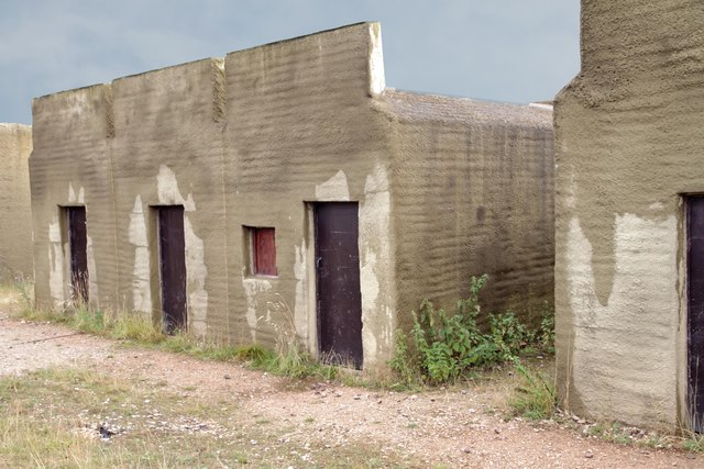
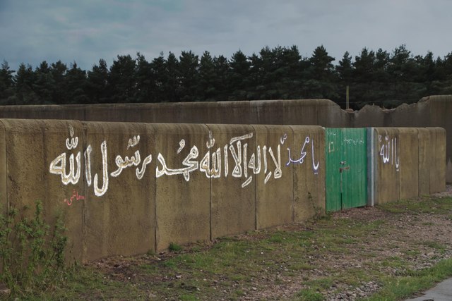
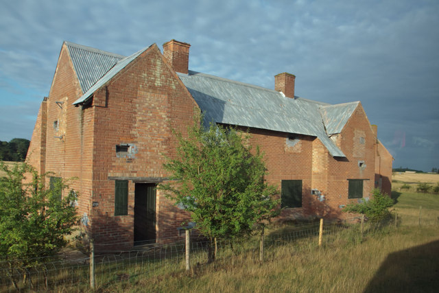
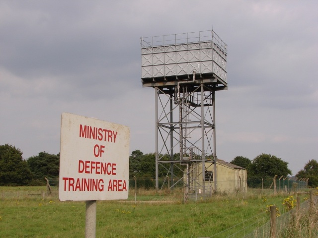
Bodney Warren is not only a place of natural beauty but also holds historical significance. During World War II, the area was used as an airfield by the Royal Air Force, and remnants of this wartime activity can still be seen today.

Overall, Bodney Warren in Norfolk offers a captivating blend of downs and moorland landscapes, providing a haven for wildlife and a picturesque setting for visitors to explore and appreciate.

If you have any feedback on the listing, please let us know in the comments section below.

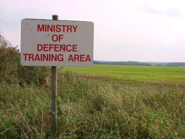
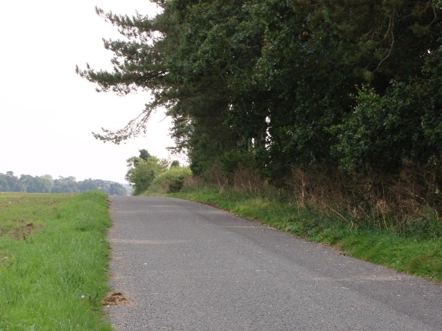
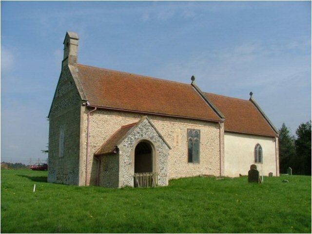
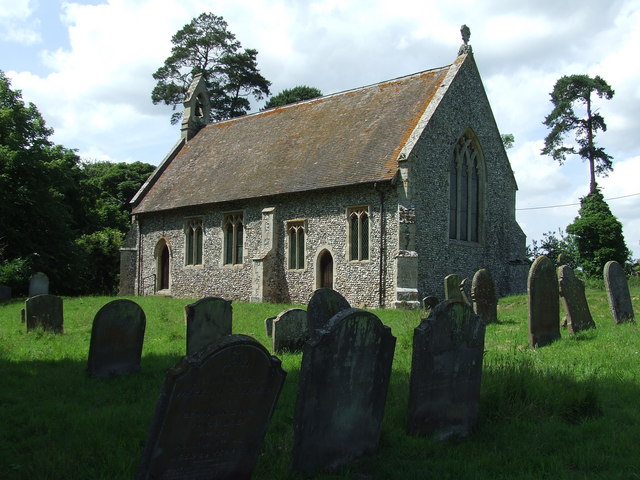
Bodney Warren Images

Images are sourced within 2km of 52.540566/0.7187099 or Grid Reference TL8497. Thanks to Geograph Open Source API. All images are credited.

Rough grazing on north side of B1108 The B1108 here is west of Watton and among lands used by the MOD. The rough road heading north in the image may well see farm, estate and military use.
Rough grazing on north side of B1108
The B1108 here is west of Watton and among lands used by the MOD. The rough road heading north in the image may well see farm, estate and military use.
Ordnance Survey Triangulation Pillar near the Water Tower at South Bodney Looking north-westward.
Ordnance Survey Triangulation Pillar near the Water Tower at South Bodney
Looking north-westward.
Junction of the B1108 and Smuggler's Lane
Smuggler's Road
Smuggler's Road
Winter cereal crop beside Smuggler's Road
Guarded entrance to the firing range STANTA stands for STANford Training Area situated roughly TL 8495. 
The area was established in 1942 when a battle training area was required and a 'Nazi village' established. Military exercises were already taking place in the area; tanks had deployed to Thetford in the First World War. The complete takeover involved the complete evacuation of the villages of Buckenham Tofts, Langford, Stanford, Sturston, Tottington and West Tofts. The occupants of the houses were all rehoused in the belief that they would be allowed to return after the war. However the site was so valuable to the military that they have taken up permanent occupancy.  
The area was used during the run-up to the D-Day invasion and since then has hosted many exercises. 
The battle area includes four historic churches; the one at West Tofts was restored by Pugin and a new "church" forms part of the specially constructed village of Eastmere. Eastmere was originally built to give soldiers experience of fighting on the northern European plains.
There is a short landing strip for Harrier aircraft at TL 8332 9704
As a live firing area, access is not allowed without special permission from the Army. In the main this is limited to a number of tours a year and compassionate grounds for former residents of the villages or their relatives.
The area forms part of the distinctive Breckland landscape region, a gorse-covered sandy heath which offers poor agricultural opportunities but farms are still active and sheep graze within its confines. Arguably, its use as a military training area has safeguarded a substantial archaeological landscape. It is the home of a wealth of rare species of flora and fauna already lost in other parts of the country. Parts of the training area are designated Site of Special Scientific Interest (SSSI).
The battle area was used in the filming of many of the episodes of the TV comedy series, Dad's Army.
Guarded entrance to the firing range
STANTA stands for STANford Training Area situated roughly TL 8495. The area was established in 1942 when a battle training area was required and a 'Nazi village' established. Military exercises were already taking place in the area; tanks had deployed to Thetford in the First World War. The complete takeover involved the complete evacuation of the villages of Buckenham Tofts, Langford, Stanford, Sturston, Tottington and West Tofts. The occupants of the houses were all rehoused in the belief that they would be allowed to return after the war. However the site was so valuable to the military that they have taken up permanent occupancy. The area was used during the run-up to the D-Day invasion and since then has hosted many exercises. The battle area includes four historic churches; the one at West Tofts was restored by Pugin and a new "church" forms part of the specially constructed village of Eastmere. Eastmere was originally built to give soldiers experience of fighting on the northern European plains. There is a short landing strip for Harrier aircraft at TL 8332 9704 As a live firing area, access is not allowed without special permission from the Army. In the main this is limited to a number of tours a year and compassionate grounds for former residents of the villages or their relatives. The area forms part of the distinctive Breckland landscape region, a gorse-covered sandy heath which offers poor agricultural opportunities but farms are still active and sheep graze within its confines. Arguably, its use as a military training area has safeguarded a substantial archaeological landscape. It is the home of a wealth of rare species of flora and fauna already lost in other parts of the country. Parts of the training area are designated Site of Special Scientific Interest (SSSI). The battle area was used in the filming of many of the episodes of the TV comedy series, Dad's Army.
Stubble field beside Smuggler's Road
Cattle grid with the STANTA firing range beyond STANTA stands for STANford Training Area situated roughly TL 8495. 
The area was established in 1942 when a battle training area was required and a 'Nazi village' established. Military exercises were already taking place in the area; tanks had deployed to Thetford in the First World War. The complete takeover involved the complete evacuation of the villages of Buckenham Tofts, Langford, Stanford, Sturston, Tottington and West Tofts. The occupants of the houses were all rehoused in the belief that they would be allowed to return after the war. However the site was so valuable to the military that they have taken up permanent occupancy.  
The area was used during the run-up to the D-Day invasion and since then has hosted many exercises. 
The battle area includes four historic churches; the one at West Tofts was restored by Pugin and a new "church" forms part of the specially constructed village of Eastmere. Eastmere was originally built to give soldiers experience of fighting on the northern European plains.
There is a short landing strip for Harrier aircraft at TL 8332 9704
As a live firing area, access is not allowed without special permission from the Army. In the main this is limited to a number of tours a year and compassionate grounds for former residents of the villages or their relatives.
The area forms part of the distinctive Breckland landscape region, a gorse-covered sandy heath which offers poor agricultural opportunities but farms are still active and sheep graze within its confines. Arguably, its use as a military training area has safeguarded a substantial archaeological landscape. It is the home of a wealth of rare species of flora and fauna already lost in other parts of the country. Parts of the training area are designated Site of Special Scientific Interest (SSSI).
The battle area was used in the filming of many of the episodes of the TV comedy series, Dad's Army.
Cattle grid with the STANTA firing range beyond
STANTA stands for STANford Training Area situated roughly TL 8495. The area was established in 1942 when a battle training area was required and a 'Nazi village' established. Military exercises were already taking place in the area; tanks had deployed to Thetford in the First World War. The complete takeover involved the complete evacuation of the villages of Buckenham Tofts, Langford, Stanford, Sturston, Tottington and West Tofts. The occupants of the houses were all rehoused in the belief that they would be allowed to return after the war. However the site was so valuable to the military that they have taken up permanent occupancy. The area was used during the run-up to the D-Day invasion and since then has hosted many exercises. The battle area includes four historic churches; the one at West Tofts was restored by Pugin and a new "church" forms part of the specially constructed village of Eastmere. Eastmere was originally built to give soldiers experience of fighting on the northern European plains. There is a short landing strip for Harrier aircraft at TL 8332 9704 As a live firing area, access is not allowed without special permission from the Army. In the main this is limited to a number of tours a year and compassionate grounds for former residents of the villages or their relatives. The area forms part of the distinctive Breckland landscape region, a gorse-covered sandy heath which offers poor agricultural opportunities but farms are still active and sheep graze within its confines. Arguably, its use as a military training area has safeguarded a substantial archaeological landscape. It is the home of a wealth of rare species of flora and fauna already lost in other parts of the country. Parts of the training area are designated Site of Special Scientific Interest (SSSI). The battle area was used in the filming of many of the episodes of the TV comedy series, Dad's Army.
Braithwaite water tower at Bodney
Afghan village, STANTA "Shops" in the village used for troop training prior to deployment
Afghan village, STANTA
"Shops" in the village used for troop training prior to deployment
Afghan village, STANTA A "family compound". The buildings are made from shipping containers covered with wood and then sprayed with concrete.
Afghan village, STANTA
A "family compound". The buildings are made from shipping containers covered with wood and then sprayed with concrete.
Afghan village, STANTA The compound walls are about seven feet high, with single storey buildings within.  The compounds are separated by tracks about ten feet wide, which make excellent killing zones.
Afghan village, STANTA
The compound walls are about seven feet high, with single storey buildings within. The compounds are separated by tracks about ten feet wide, which make excellent killing zones.
View North West from Afghan village The buildings are facilities for a former airstrip and are now used for ablutions etc
View North West from Afghan village
The buildings are facilities for a former airstrip and are now used for ablutions etc
Derelict council houses
Breckland landscape, STANTA
Wr Twr Water tower and treatment plant supplying potable water to the troops at nearby Bodney Camp.
Wr Twr
Water tower and treatment plant supplying potable water to the troops at nearby Bodney Camp.
MOD Training area Looking south west over the river Wissey valley to the Danger Area lying just beyond the trees.
MOD Training area
Looking south west over the river Wissey valley to the Danger Area lying just beyond the trees.
Smugglers' Road Old road leading past Bodney Warren inside the Danger Area. The road is used by both the military and farmers.
Smugglers' Road
Old road leading past Bodney Warren inside the Danger Area. The road is used by both the military and farmers.
Show me another place!

Bodney Warren is located at Grid Ref: TL8497 (Lat: 52.540566, Lng: 0.7187099)

Administrative County: Norfolk

District: Breckland

Police Authority: Norfolk

What 3 Words

///racked.bungalows.petrified. Near Mundford, Norfolk

Nearby Locations

Bodney Warren

Related Wikis

Langford, Norfolk

Langford is a village and former civil parish, now in the parish of Ickburgh, in the Breckland district, in the county of Norfolk, England. The village...

Old Bodney Camp

Old Bodney Camp is a 32.8-hectare (81-acre) biological Site of Special Scientific Interest west of Little Cressingham in Norfolk. It is part of the Breckland...

Bodney

Bodney is a village and former civil parish, now in the parish of Hilborough, in the Breckland district, in the county of Norfolk, England. In 1931 the...

Buckenham Tofts

Buckenham Tofts (or Buckenham Parva; Little Buckenham) is a former civil parish, now in the parish of Stanford, in the Breckland district, in the county...

Have you been to Bodney Warren?

Leave your review of Bodney Warren below (or comments, questions and feedback).