Alder Fen

Downs, Moorland in Suffolk West Suffolk

England

Alder Fen

Derelict building, Sedge Fen A roof-less derelict building near the railway in Sedge Fen - possibly soon to be demolished.
Derelict building, Sedge Fen Credit: Ajay Tegala

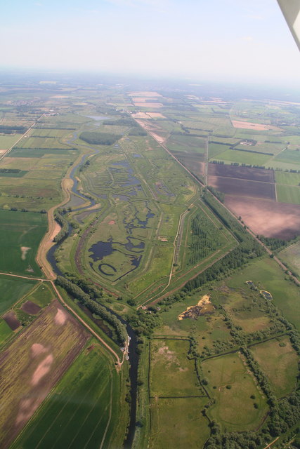
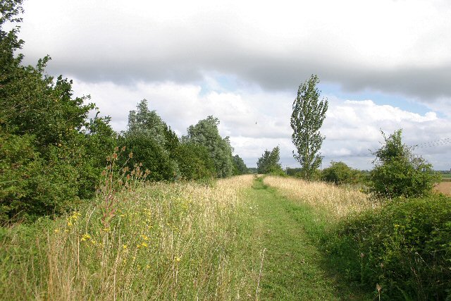
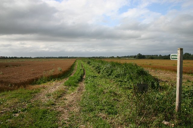
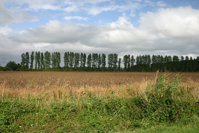
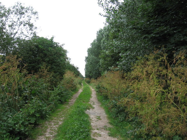
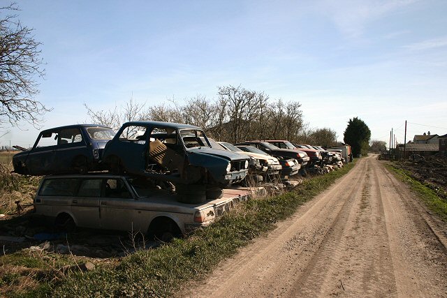
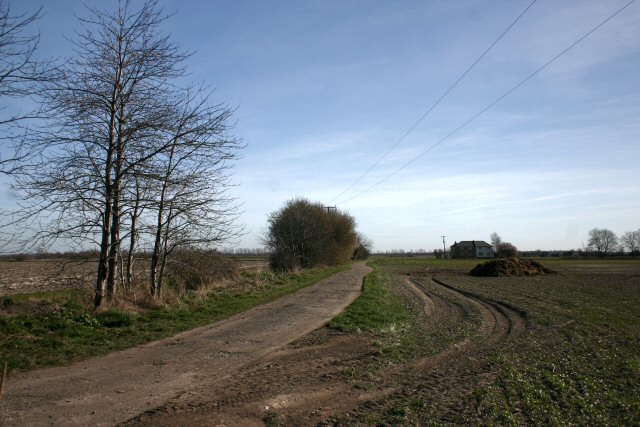
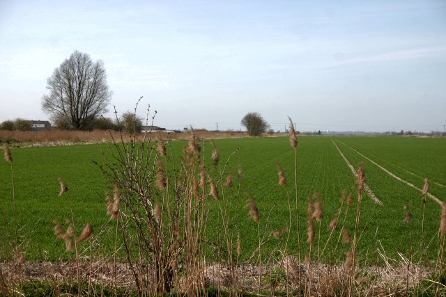
Alder Fen is a picturesque nature reserve located in Suffolk, England. Spanning over an area of downs and moorland, this tranquil landscape offers a diverse range of flora and fauna. The fen is situated on a low-lying area, providing a unique habitat for various wetland species.

The reserve is known for its rich biodiversity, with a wide variety of plant life. The fen is covered in lush grasses, sedges, and rushes, creating a vibrant green carpet. It is also home to several rare species of orchids, which bloom in the summer months, adding bursts of color to the landscape.

Alder Fen is a haven for birdwatching enthusiasts, as it attracts a multitude of bird species. Visitors can spot reed warblers, bitterns, and marsh harriers among the reed beds. The open moorland areas are frequented by skylarks and stonechats, adding to the vibrant avian life of the reserve.

The reserve is also teeming with various mammals, including otters, water voles, and foxes. The wetland habitat provides an ideal environment for these creatures, allowing them to thrive in their natural surroundings.

Alder Fen offers several walking trails and observation points, providing visitors with the opportunity to explore and appreciate the beauty of the reserve. Interpretive boards along the trails offer information about the unique ecosystem and its inhabitants, enhancing the educational experience.

With its diverse array of plant and animal life, Alder Fen is a must-visit destination for nature lovers and those seeking a peaceful retreat in the heart of Suffolk's countryside.

If you have any feedback on the listing, please let us know in the comments section below.

Alder Fen Images

Images are sourced within 2km of 52.431709/0.46972758 or Grid Reference TL6884. Thanks to Geograph Open Source API. All images are credited.

Derelict building, Sedge Fen A roof-less derelict building near the railway in Sedge Fen - possibly soon to be demolished.
Derelict building, Sedge Fen
A roof-less derelict building near the railway in Sedge Fen - possibly soon to be demolished.
Farmland south of Newmans Drove Typical fenland scenery west of Lakenheath.
Farmland south of Newmans Drove
Typical fenland scenery west of Lakenheath.
New Bridleway details When rights of way were formalised they were done county by county. Different counties had different levels of enthusiasm, with several paths stopping at the Suffolk border. This path had a gap in it as it dipped into Suffolk but this has now been filled.
New Bridleway details
When rights of way were formalised they were done county by county. Different counties had different levels of enthusiasm, with several paths stopping at the Suffolk border. This path had a gap in it as it dipped into Suffolk but this has now been filled.
Botany Bay by Little Ouse River
Little Ouse River With Botany Bay the other side.
Little Ouse River
With Botany Bay the other side.
Lakenheath Fen Nature Reserve and Little Ouse River: aerial 2015
Flood prevention bank at Newmans Drove The land either side of this bank is very low-lying (2 metres above sea-level).  The bank rises a further three metres above the surrounding land, limiting any flooding to a relatively small area.
Flood prevention bank at Newmans Drove
The land either side of this bank is very low-lying (2 metres above sea-level). The bank rises a further three metres above the surrounding land, limiting any flooding to a relatively small area.
Bridleway at Newmans Drove The flatlands around Lakenheath are intersected with old tracks such as this.
Bridleway at Newmans Drove
The flatlands around Lakenheath are intersected with old tracks such as this.
Poplars used as windbreak These poplars lie east-west, forming a windbreak in these low-lying fields west of Lakenheath.
Poplars used as windbreak
These poplars lie east-west, forming a windbreak in these low-lying fields west of Lakenheath.
Stallode Wash Looking NNW along the Hereward Way at Stallode Wash
Stallode Wash
Looking NNW along the Hereward Way at Stallode Wash
Sedge Fen The white soil is unusual in the Fens; here it is caused by shell marl, remains of the former lake Redmere which used to cover this area. This part of Fenland is at sea-level, despite being some 40 miles from the sea.
Sedge Fen
The white soil is unusual in the Fens; here it is caused by shell marl, remains of the former lake Redmere which used to cover this area. This part of Fenland is at sea-level, despite being some 40 miles from the sea.
Track to Sedge Fen The usual dark brown fen soil is replaced here by white shell marl.
Track to Sedge Fen
The usual dark brown fen soil is replaced here by white shell marl.
Not snow, but shell marl The fields at Sedge Fen are almost pure white, due to the shell marl on the surface. This is a residue from the former lake known as Redmere, which used to cover this low-lying area.
Not snow, but shell marl
The fields at Sedge Fen are almost pure white, due to the shell marl on the surface. This is a residue from the former lake known as Redmere, which used to cover this low-lying area.
Field and ditch at Sedge Fen Looking north from the no-through road at Sedge Fen.
Field and ditch at Sedge Fen
Looking north from the no-through road at Sedge Fen.
Scrapyard at Sedge Fen This doesn't appear to be a proper scrapyard, more of a dumping ground at the end of a no-through road.
Scrapyard at Sedge Fen
This doesn't appear to be a proper scrapyard, more of a dumping ground at the end of a no-through road.
Track and ditch at Alder Fen Drainage ditches have to kept clear in this low-lying fenland area.
Track and ditch at Alder Fen
Drainage ditches have to kept clear in this low-lying fenland area.
Track to Russell Farm This track, which is also a cycle route, links two minor roads at Sedge Fen.
Track to Russell Farm
This track, which is also a cycle route, links two minor roads at Sedge Fen.
Farmland at Decoy Fen Looking westwards across open farmland.
Farmland at Decoy Fen
Looking westwards across open farmland.
Show me another place!

Alder Fen is located at Grid Ref: TL6884 (Lat: 52.431709, Lng: 0.46972758)

Administrative County: Suffolk

District: West Suffolk

Police Authority: Suffolk

What 3 Words

///wealth.defers.splints. Near Lakenheath, Suffolk

Nearby Locations

Shepherds' Fen Alder Fen

Related Wikis

Stallode Wash, Lakenheath

Stallode Wash, Lakenheath is a 34.1-hectare (84-acre) biological Site of Special Scientific Interest north-west of Lakenheath in Suffolk.This is grassland...

Lakenheath Poor's Fen

Lakenheath Poor's Fen is a 5.2-hectare biological Site of Special Scientific Interest west of Lakenheath in Suffolk.This is mainly fen with diverse flora...

Lakenheath Fen RSPB reserve

Lakenheath Fen RSPB reserve is located on the Norfolk/Suffolk border in England, between Lakenheath and Hockwold cum Wilton adjacent to Lakenheath railway...

Undley bracteate

The Undley bracteate is a 5th-century bracteate found in Undley Common, near Lakenheath, Suffolk. It bears the earliest known inscription that can be argued...

Lakenheath F.C.

Lakenheath Football Club is a football club based in Lakenheath, Suffolk, England. They are currently members of the Eastern Counties League Premier Division...

Shippea Hill railway station

Shippea Hill railway station (originally Mildenhall Road and later Burnt Fen) is on the Breckland Line in the east of England, serving the Burnt Fen area...

Lackford Hundred

Lackford was a hundred of Suffolk, consisting of 83,712 acres (338.77 km2).The hundred fills the north western corner of Suffolk and is triangular in shape...

Lakenheath

Lakenheath is a village and civil parish in the West Suffolk district of Suffolk in eastern England. It has a population of 4,691 according to the 2011...

Have you been to Alder Fen?

Leave your review of Alder Fen below (or comments, questions and feedback).