Shepherds' Fen

Downs, Moorland in Suffolk West Suffolk

England

Shepherds' Fen

Farmland south of Newmans Drove Typical fenland scenery west of Lakenheath.
Farmland south of Newmans Drove Credit: Stephen McKay

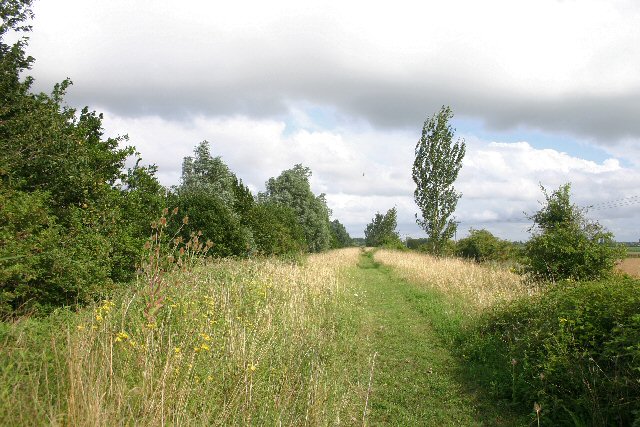
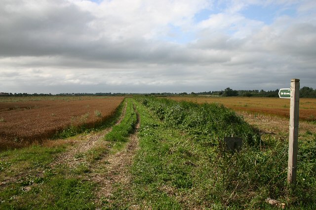
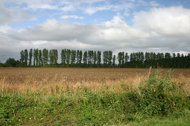
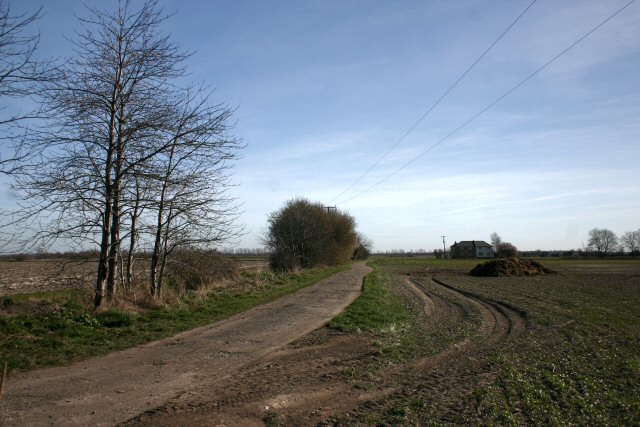
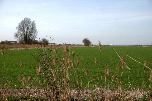
Shepherds' Fen is a picturesque area located in Suffolk, England. It is known for its diverse landscape, which includes downs, moorland, and fenland. The fenland is characterized by its marshy and wet conditions, making it a unique habitat for various plant and animal species.

The downs in Shepherds' Fen are rolling hills covered in lush green grass. They offer breathtaking views of the surrounding countryside and are popular among hikers and nature enthusiasts. The moorland, on the other hand, is a vast expanse of open, wild land. It is covered in heather and gorse, providing a beautiful contrast to the downs.

The area is home to a diverse range of wildlife, including rare bird species such as the bittern and marsh harrier. The fenland is also known for its abundance of dragonflies and other insects, which thrive in the wet conditions.

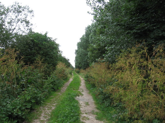
Shepherds' Fen is a haven for outdoor activities such as walking, birdwatching, and photography. There are several well-maintained footpaths and trails that allow visitors to explore the area and take in its natural beauty.

The fenland in Shepherds' Fen is also of significant ecological importance. It acts as a natural floodplain, absorbing excess water during periods of heavy rain and protecting surrounding areas from flooding.

Overall, Shepherds' Fen is a captivating natural landscape that offers a diverse range of habitats and activities for visitors to enjoy. Its unique combination of downs, moorland, and fenland make it a must-visit destination for nature lovers and outdoor enthusiasts alike.

If you have any feedback on the listing, please let us know in the comments section below.

Shepherds' Fen Images

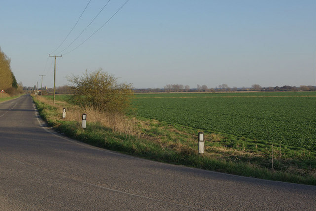
Images are sourced within 2km of 52.434797/0.48414204 or Grid Reference TL6884. Thanks to Geograph Open Source API. All images are credited.

Farmland south of Newmans Drove Typical fenland scenery west of Lakenheath.
Farmland south of Newmans Drove
Typical fenland scenery west of Lakenheath.
Little Ouse River Bordering Lakenheath RSPB reserve.
Little Ouse River
Bordering Lakenheath RSPB reserve.
Little Ouse River With grazing cows and a slightly confused young Greylag Goose.
Little Ouse River
With grazing cows and a slightly confused young Greylag Goose.
Lakenheath RSPB reserve The reserve has recreated an extensive reedbed from what was previously vegetable fields (and before the drainage a few centuries ago was part of a huge wetland)
Lakenheath RSPB reserve
The reserve has recreated an extensive reedbed from what was previously vegetable fields (and before the drainage a few centuries ago was part of a huge wetland)
Joist Fen Lakenheath RSPB reserve, with a maturing reedbed. Compare with <a href="https://www.geograph.org.uk/photo/495533">TL6985 : Joist Fen</a>.
Joist Fen
Lakenheath RSPB reserve, with a maturing reedbed. Compare with TL6985 : Joist Fen.
Lakenheath Fen Nature Reserve and Little Ouse River: aerial 2015
Flood prevention bank at Newmans Drove The land either side of this bank is very low-lying (2 metres above sea-level).  The bank rises a further three metres above the surrounding land, limiting any flooding to a relatively small area.
Flood prevention bank at Newmans Drove
The land either side of this bank is very low-lying (2 metres above sea-level). The bank rises a further three metres above the surrounding land, limiting any flooding to a relatively small area.
Bridleway at Newmans Drove The flatlands around Lakenheath are intersected with old tracks such as this.
Bridleway at Newmans Drove
The flatlands around Lakenheath are intersected with old tracks such as this.
Poplars used as windbreak These poplars lie east-west, forming a windbreak in these low-lying fields west of Lakenheath.
Poplars used as windbreak
These poplars lie east-west, forming a windbreak in these low-lying fields west of Lakenheath.
Stallode Wash Looking NNW along the Hereward Way at Stallode Wash
Stallode Wash
Looking NNW along the Hereward Way at Stallode Wash
Joist Fen Joist Fen drainage channels near Lakenheath
Joist Fen
Joist Fen drainage channels near Lakenheath
Track and ditch at Alder Fen Drainage ditches have to kept clear in this low-lying fenland area.
Track and ditch at Alder Fen
Drainage ditches have to kept clear in this low-lying fenland area.
Track to Russell Farm This track, which is also a cycle route, links two minor roads at Sedge Fen.
Track to Russell Farm
This track, which is also a cycle route, links two minor roads at Sedge Fen.
Farmland at Decoy Fen Looking westwards across open farmland.
Farmland at Decoy Fen
Looking westwards across open farmland.
Railway lines and level crossing at Decoy Fen The railway line from Ely towards Thetford is dead straight for several miles between Prickwillow and Lakenheath, as it cuts across flat fenland.
Railway lines and level crossing at Decoy Fen
The railway line from Ely towards Thetford is dead straight for several miles between Prickwillow and Lakenheath, as it cuts across flat fenland.
Lakenheath New Lode This lode, or drain, is a tributary of the Little Ouse River, at Decoy Fen, west of Lakenheath.
Lakenheath New Lode
This lode, or drain, is a tributary of the Little Ouse River, at Decoy Fen, west of Lakenheath.
Lakenheath New Lode Viewed from the footbridge across the river.
Lakenheath New Lode
Viewed from the footbridge across the river.
Lakenheath New Lode Looking downstream towards the junction with the Little Ouse River. The roots of two large trees blown over in recent storms can be seen on the far bank, showing the chalky soil that prevails in this area.
Lakenheath New Lode
Looking downstream towards the junction with the Little Ouse River. The roots of two large trees blown over in recent storms can be seen on the far bank, showing the chalky soil that prevails in this area.
Show me another place!

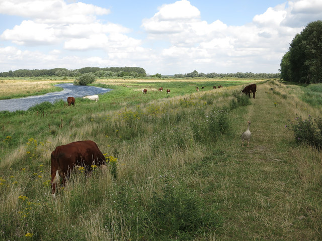
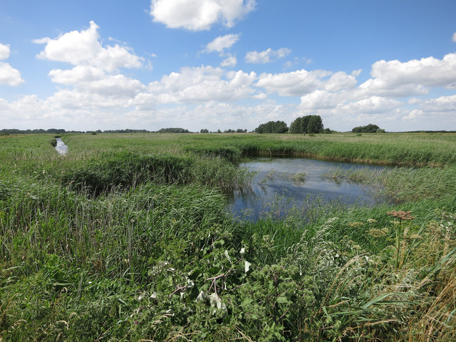
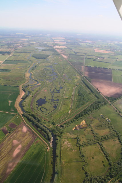
Shepherds' Fen is located at Grid Ref: TL6884 (Lat: 52.434797, Lng: 0.48414204)

Administrative County: Suffolk

District: West Suffolk

Police Authority: Suffolk

What 3 Words

///fells.evaded.rebel. Near Lakenheath, Suffolk

Nearby Locations

Alder Fen Shepherds' Fen

Related Wikis

Stallode Wash, Lakenheath

Stallode Wash, Lakenheath is a 34.1-hectare (84-acre) biological Site of Special Scientific Interest north-west of Lakenheath in Suffolk.This is grassland...

Lakenheath Fen RSPB reserve

Lakenheath Fen RSPB reserve is located on the Norfolk/Suffolk border in England, between Lakenheath and Hockwold cum Wilton adjacent to Lakenheath railway...

Lakenheath Poor's Fen

Lakenheath Poor's Fen is a 5.2-hectare biological Site of Special Scientific Interest west of Lakenheath in Suffolk.This is mainly fen with diverse flora...

Lakenheath F.C.

Lakenheath Football Club is a football club based in Lakenheath, Suffolk, England. They are currently members of the Eastern Counties League Premier Division...

Have you been to Shepherds' Fen?

Leave your review of Shepherds' Fen below (or comments, questions and feedback).