Wet Wood

Downs, Moorland in Sussex Wealden

England

Wet Wood

Dundale Road This road leads from Hawkenbury Road, towards Kipping's Cross.
On the left is Brown's Wood and Oxpasture Wood is on the right.
Dundale Road Credit: David Anstiss

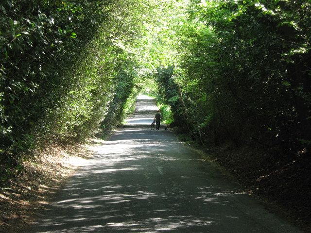
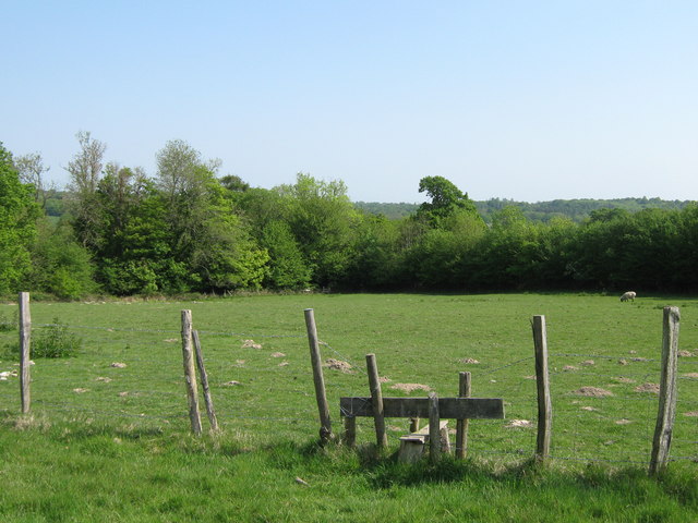
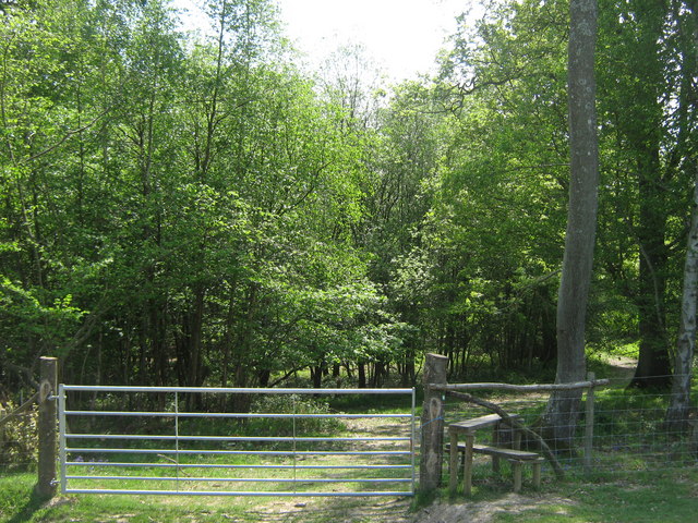
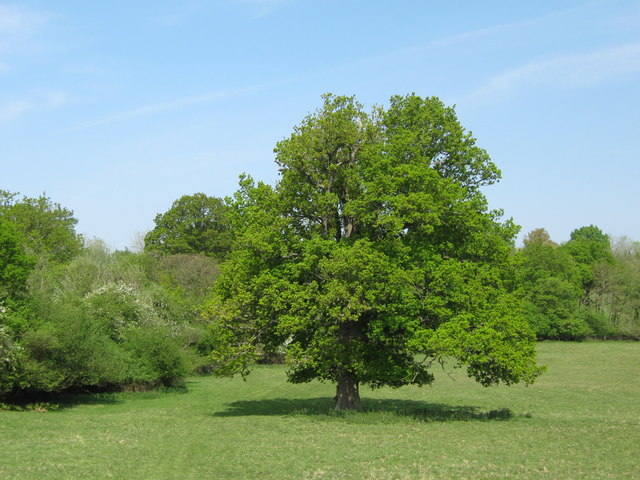
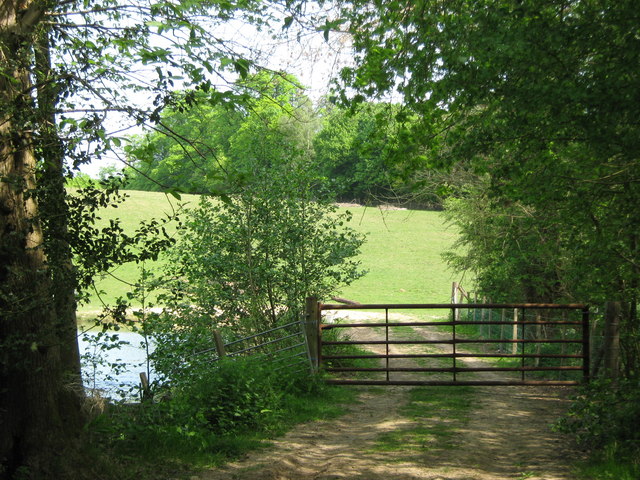
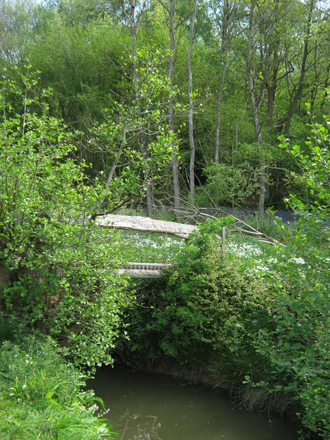
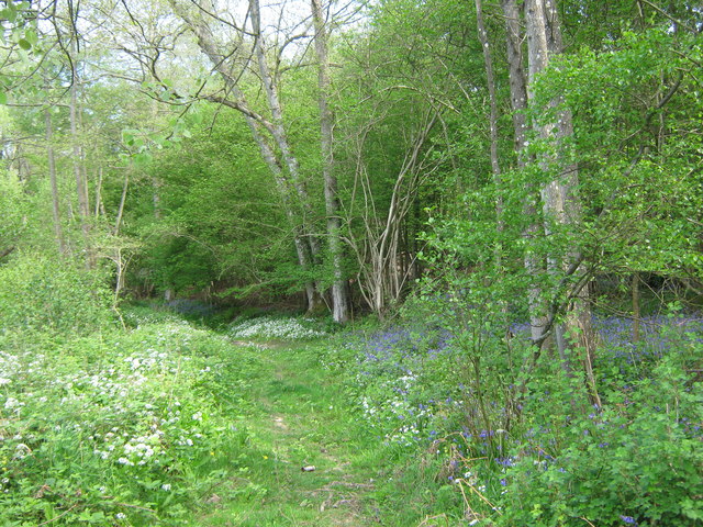
Wet Wood, located in Sussex, England, is a picturesque area situated within the South Downs National Park. This region is renowned for its diverse landscape, including wetlands, downs, and moorland. Wet Wood, as the name suggests, is characterized by its damp and lush environment, offering a unique habitat for various flora and fauna.

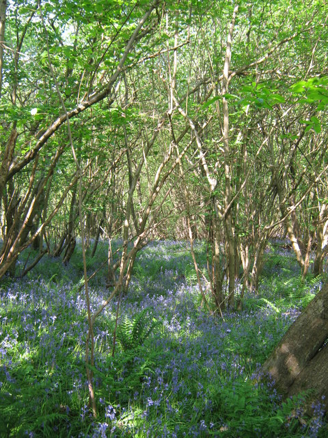
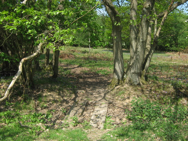
The wood itself is predominantly composed of deciduous trees, such as oak, beech, and birch, which thrive in the damp conditions. These trees create a dense canopy that provides shelter and shade for the undergrowth below. Mosses and ferns carpet the forest floor, adding to the enchanting atmosphere.

Wet Wood is also home to a wide range of wildlife. Bird enthusiasts can spot species like woodpeckers, owls, and warblers, as well as waterfowl attracted to the nearby wetlands. The wetland areas are teeming with life, supporting a diverse array of insects, amphibians, and small mammals.

For outdoor enthusiasts, Wet Wood offers numerous trails and footpaths that wind through the woodland, providing opportunities for leisurely walks and hikes. The surrounding South Downs area is also ideal for activities such as cycling, horse riding, and bird watching.

In addition to its natural beauty, Wet Wood holds historical significance. The area has evidence of human habitation dating back thousands of years, with archaeological finds revealing Neolithic and Iron Age settlements. Exploring the wood allows visitors to connect with the past and appreciate the rich cultural heritage of the region.

Overall, Wet Wood in Sussex is a captivating destination where nature lovers can immerse themselves in a diverse and thriving ecosystem, while also discovering the area's historical roots.

If you have any feedback on the listing, please let us know in the comments section below.

Wet Wood Images

Images are sourced within 2km of 51.118676/0.32783511 or Grid Reference TQ6338. Thanks to Geograph Open Source API. All images are credited.

Dundale Road This road leads from Hawkenbury Road, towards Kipping's Cross.
On the left is Brown's Wood and Oxpasture Wood is on the right.
Dundale Road
This road leads from Hawkenbury Road, towards Kipping's Cross. On the left is Brown's Wood and Oxpasture Wood is on the right.
Stile near Brown's Wood This stile is on a Natural England permissive path from Dundale Road towards the wood in the background.
Stile near Brown's Wood
This stile is on a Natural England permissive path from Dundale Road towards the wood in the background.
Bluebells in Brown's Wood As seen from a permissive path near Dundale Road.
Bluebells in Brown's Wood
As seen from a permissive path near Dundale Road.
Track into Brown's Wood As seen from Hawkenbury Road. Track leads towards the River Teise.
Track into Brown's Wood
As seen from Hawkenbury Road. Track leads towards the River Teise.
Woodland Cabin near Sunningyle Farm Near Rushet Wood is a field with a group of holiday homes. Luxury camping style.
Woodland Cabin near Sunningyle Farm
Near Rushet Wood is a field with a group of holiday homes. Luxury camping style.
Stile and gate near Rushet Wood This stile is on a Natural England permissive path into the Wood and towards the River Teise.
Stile and gate near Rushet Wood
This stile is on a Natural England permissive path into the Wood and towards the River Teise.
Footbridge near Rushet Wood This bridge leads over a field drain near the wood. Currently it is dried out.
The bridge is used by a Natural England permissive path between the River Teise and Rushet Wood (in the background).
Footbridge near Rushet Wood
This bridge leads over a field drain near the wood. Currently it is dried out. The bridge is used by a Natural England permissive path between the River Teise and Rushet Wood (in the background).
Oak Tree near Rushet Wood This tree is beside a Natural England permissive path from the River Teise towards the wood (in the background).
Oak Tree near Rushet Wood
This tree is beside a Natural England permissive path from the River Teise towards the wood (in the background).
Gate near River Teise This gate is used by a Natural England permissive path leading from the Coneyburrow Wood beside the river, towards Rushet Wood near Dundale Road.
On the left is a small pond on the river.
Gate near River Teise
This gate is used by a Natural England permissive path leading from the Coneyburrow Wood beside the river, towards Rushet Wood near Dundale Road. On the left is a small pond on the river.
Footbridge over River Teise This bridge is used by a Natural England permissive path, leading over the river towards Furnace Wood.
Footbridge over River Teise
This bridge is used by a Natural England permissive path, leading over the river towards Furnace Wood.
Woodland Track in Furnace Wood This track leads from Bayham Lake through Furnace Wood towards Brown's Lodge.
On the left are masses of Wild Garlic and on the right (under the trees) are bluebells.
Woodland Track in Furnace Wood
This track leads from Bayham Lake through Furnace Wood towards Brown's Lodge. On the left are masses of Wild Garlic and on the right (under the trees) are bluebells.
Bluebells in Furnace Wood  As seen from the woodland track beside the wood.
Bluebells in Furnace Wood
As seen from the woodland track beside the wood.
Track in Furnace Wood This track leads from Tollslye Cottage near Bayham Lake, through the wood towards Brown's Lodge on Dundale Road.
Track in Furnace Wood
This track leads from Tollslye Cottage near Bayham Lake, through the wood towards Brown's Lodge on Dundale Road.
River Teise in Furnace Wood This long river flows from Great Bayhall Farm through the wood towards Bayham Lake. The section from Dundale Road towards the lake is also the country boundary. The wild garlic and bluebells are in Kent, across the river is East Sussex.
River Teise in Furnace Wood
This long river flows from Great Bayhall Farm through the wood towards Bayham Lake. The section from Dundale Road towards the lake is also the country boundary. The wild garlic and bluebells are in Kent, across the river is East Sussex.
Wild Garlic in Jews Wood As seen from a track leading into the wood. On the right are a few bluebells.
Wild Garlic in Jews Wood
As seen from a track leading into the wood. On the right are a few bluebells.
Track junction in Jews Wood A woodland track from Oxpasture Wood leads straight on towards Tollslye Cottage and Bayham Abbey. The track on the right climbs up and around to Bayham Lake.
Track junction in Jews Wood
A woodland track from Oxpasture Wood leads straight on towards Tollslye Cottage and Bayham Abbey. The track on the right climbs up and around to Bayham Lake.
Track in Jews Wood This track leads from Oxpasture Wood, towards Bayham Lake.
Track in Jews Wood
This track leads from Oxpasture Wood, towards Bayham Lake.
Long Track in Jews Wood This very long straight track leads from Bayham Abbey and Lake towards Oxpasture Wood.
Long Track in Jews Wood
This very long straight track leads from Bayham Abbey and Lake towards Oxpasture Wood.
Show me another place!

Wet Wood is located at Grid Ref: TQ6338 (Lat: 51.118676, Lng: 0.32783511)

Administrative County: East Sussex

District: Wealden

Police Authority: Sussex

What 3 Words

///think.smoke.object. Near Pembury, Kent

Related Wikis

Tunbridge Wells (UK Parliament constituency)

Tunbridge Wells is a constituency in Kent represented in the House of Commons of the UK Parliament since 2005 by Greg Clark, a Conservative who served...

Bayham Old Abbey

Bayham Old Abbey is an English Heritage property, located near Lamberhurst, Kent, England. Founded c. 1208 through a combination of the failing Premonstratensian...

Lamberhurst Quarter

Lamberhurst Quarter is a hamlet on the A21 road, in the English county of Kent. It is near the village of Lamberhurst. == References == http://getamap...

Frant railway station

Frant railway station is on the Hastings line in East Sussex, England, and serves the civil parish of Frant (although the station is actually located some...

Pembury

Pembury is a large village in Kent, in the south east of England, with a population of 6,128 at the 2011 Census. It lies just to the north-east of Royal...

Brookland Wood

Brookland Wood is a 10.9-hectare (27-acre) biological Site of Special Scientific Interest east of Tunbridge Wells in Kent.This site has diverse types of...

Beechwood School, Royal Tunbridge Wells

Beechwood School is a co-educational independent day and boarding school for children aged 3–18, which comprises a Nursery, Preparatory School and Senior...

Dunorlan Park

Dunorlan Park is a park and grounds in Royal Tunbridge Wells, UK. Totalling approximately 78 acres (32 ha) and containing a 6-acre (2.4 ha) lake, the grounds...

Have you been to Wet Wood?

Leave your review of Wet Wood below (or comments, questions and feedback).