Great North Fen

Downs, Moorland in Cambridgeshire South Cambridgeshire

England

Great North Fen

Hempsals Road With recent tree planting along the verge. See <a href="https://www.geograph.org.uk/photo/2038919">TL4370 : Track across Hempsals Fen</a> for an earlier view.
Hempsals Road Credit: Hugh Venables

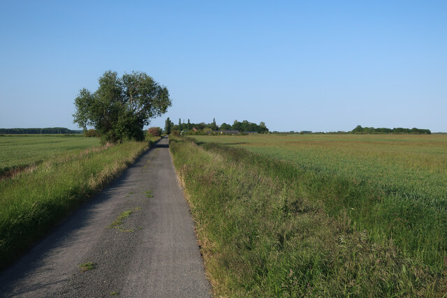
Great North Fen is a unique geographical area located in Cambridgeshire, England. Spanning over 20 square miles, it is a combination of downs and moorland, making it a diverse and fascinating landscape.

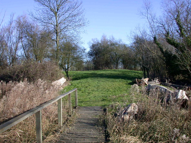
The fen is characterized by its low-lying flat terrain, with peat soils and an abundance of wetland habitats. It is home to a variety of flora and fauna, including rare species that are native to this specific area. The fen is known for its rich biodiversity, with numerous plant species such as reeds, sedges, and grasses thriving in the damp conditions.

The fen is also an important habitat for a wide range of bird species, including bitterns, marsh harriers, and bearded tits. Birdwatchers and nature enthusiasts flock to the area to observe these rare and beautiful creatures in their natural habitat.

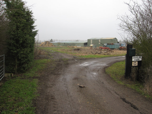
In addition to its natural beauty, Great North Fen also has historical significance. The area has been inhabited for thousands of years, with evidence of human settlement dating back to the Bronze Age. Archaeological finds, including pottery and tools, have been discovered in the fen, shedding light on the lives of its ancient inhabitants.

The fen is a popular destination for outdoor activities such as walking, cycling, and birdwatching. It offers a peaceful and tranquil escape from the bustling city life, allowing visitors to immerse themselves in the beauty of nature.

Overall, Great North Fen is a remarkable area in Cambridgeshire, offering a combination of stunning landscapes, diverse wildlife, and rich history. It is a must-visit destination for nature enthusiasts and those seeking a peaceful retreat in the heart of England.

If you have any feedback on the listing, please let us know in the comments section below.

Great North Fen Images

Images are sourced within 2km of 52.302279/0.11420969 or Grid Reference TL4469. Thanks to Geograph Open Source API. All images are credited.

Hempsals Road With recent tree planting along the verge. See <a href="https://www.geograph.org.uk/photo/2038919">TL4370 : Track across Hempsals Fen</a> for an earlier view.
Hempsals Road
With recent tree planting along the verge. See TL4370 : Track across Hempsals Fen for an earlier view.
Hempsals Fen
Hempsals Fen
Field by Iram Drove
Field by Iram Drove
Iram Drove
Iram Drove
Hempsals Road
Hempsals Road
Field by Hempsals Road
On Smithy Fen Looking towards Cottenham from the junction of Lockspit Hall Drove and Smithy Fen Engine Drove (right). Cottenham church's Jacobean tower shows on the skyline to the left.
On Smithy Fen
Looking towards Cottenham from the junction of Lockspit Hall Drove and Smithy Fen Engine Drove (right). Cottenham church's Jacobean tower shows on the skyline to the left.
Fen End Farm, Oxholme Drove A zoom view across the fields from Smithy Fen Engine Drain. The sun had not quite broken through the haze on what was later to be the hottest day to date of 2013.
Fen End Farm, Oxholme Drove
A zoom view across the fields from Smithy Fen Engine Drain. The sun had not quite broken through the haze on what was later to be the hottest day to date of 2013.
On Smithy Fen Engine Drove Looking north-west towards Lingwood Farm and, on the skyline to the left of centre, Smithy Fen Farm.
On Smithy Fen Engine Drove
Looking north-west towards Lingwood Farm and, on the skyline to the left of centre, Smithy Fen Farm.
Smithy Fen in July On the morning of what later proved to be the hottest day for seven years.
Smithy Fen in July
On the morning of what later proved to be the hottest day for seven years.
Lockspit Hall Drove Smithy Fen Farm is well signposted.
Lockspit Hall Drove
Smithy Fen Farm is well signposted.
Oxholme Drove Looking towards Fen End Farm from the corner of Lockspit Hall Drove.
Oxholme Drove
Looking towards Fen End Farm from the corner of Lockspit Hall Drove.
Along Hempsals Road
Along Hempsals Road
Smithey Fen The animals in the distance left are horses; the whole is a typical fenland view.
Smithey Fen
The animals in the distance left are horses; the whole is a typical fenland view.
Lockspit Hall Farm On Smithy Fen.
Lockspit Hall Farm
On Smithy Fen.
Lockspit Hall Farm By Lockspit Hall drove.
Lockspit Hall Farm
By Lockspit Hall drove.
Sheep by Lockspit Hall Drove Small area of grazing in the predominantly arable Smithy Fen.
Sheep by Lockspit Hall Drove
Small area of grazing in the predominantly arable Smithy Fen.
Oxholme Farm By Oxholme Drove.
Oxholme Farm
By Oxholme Drove.
Show me another place!

Great North Fen is located at Grid Ref: TL4469 (Lat: 52.302279, Lng: 0.11420969)

Administrative County: Cambridgeshire

District: South Cambridgeshire

Police Authority: Cambridgeshire

What 3 Words

///reconnect.basically.premises. Near Cottenham, Cambridgeshire

Nearby Locations

Great North Fen

Related Wikis

Rampton Castle

Rampton Castle, known locally as Giant's Hill, is the earthwork remains of a motte and bailey castle in Rampton, Cambridgeshire. It is believed that the...

Cottenham

Cottenham is a village in Cambridgeshire, England. Cottenham is one of the larger villages surrounding the city of Cambridge, located around five miles...

Rampton, Cambridgeshire

Rampton is a village in Cambridgeshire, England, situated on the edge of The Fens six miles to the north of Cambridge. == History == The edge of the Fens...

Belsar's Hill

Belsar's Hill is a hillfort near Willingham, Cambridgeshire, England. == Description == Belsar's Hill is an oval-shaped area, 265–220 metres (869–722 ft...

Cottenham Village College

Cottenham Village College is an academy school located in Cottenham, Cambridgeshire, England. The school offers secondary education to pupils from the...

Fen Edge

Fen Edge is an area and collection of villages in the South Cambridgeshire district of Cambridgeshire, England. The five villages in Fen Edge are Cottenham...

Willingham, Cambridgeshire

Willingham is a village in Cambridgeshire, England. It is located in the South Cambridgeshire district and sits just outside the border of the Fens, just...

Northstowe Secondary College

Northstowe Secondary College is a co-educational secondary school and sixth form located in Northstowe in the English county of Cambridgeshire.The school...

Nearby Amenities

Located within 500m of 52.302279,0.11420969
Ele: 1.328
Lat/Long: 52.3019418/0.1086271
Great North Fen
Created By: Potlatch 0.10b
Place: locality
Source: npe
Lat/Long: 52.3007102/0.1158823
Note: I think there should be another power pole somewhere near here, maybe at the corner of the field.
Power: pole
Source: bing
Lat/Long: 52.3039193/0.1157693
Design: h-frame
Material: wood
Power: tower
Source: survey
Source Position: bing
Lat/Long: 52.2993826/0.1131139
Note: I think there should be another power pole somewhere near here, maybe at the corner of the field.
Power: pole
Source: bing
Lat/Long: 52.3018298/0.1139454
Note: I think there should be another power pole somewhere near here, maybe at the corner of the field.
Power: pole
Source: bing
Lat/Long: 52.3049952/0.1167134
Design: h-frame
Line Attachment: anchor
Material: wood
Power: tower
Source: survey
Source Position: bing
Lat/Long: 52.3007702/0.1130173
Note: I think there should be another power pole somewhere near here, maybe at the corner of the field.
Power: pole
Source: bing
Lat/Long: 52.3028762/0.1148842
Design: h-frame
Material: wood
Power: tower
Source: survey
Source Position: bing
Lat/Long: 52.2980769/0.1120947
Note: I think there should be another power pole somewhere near here, maybe at the corner of the field.
Power: pole
Source: bing
Lat/Long: 52.3062121/0.1177434
Note: I think there should be another power pole somewhere near here, maybe at the corner of the field.
Power: pole
Source: bing
Lat/Long: 52.2983493/0.1152774
Note: I think there should be another power pole somewhere near here, maybe at the corner of the field.
Power: pole
Source: bing
Lat/Long: 52.2990521/0.1139886
The data included in this document is from www.openstreetmap.org. The data is made available under ODbL.

Have you been to Great North Fen?

Leave your review of Great North Fen below (or comments, questions and feedback).