Blunt's Green

Downs, Moorland in Sussex Lewes

England

Blunt's Green

Oast House Single round kiln oast house.

Grade II listed.
Oast House Credit: Oast House Archive

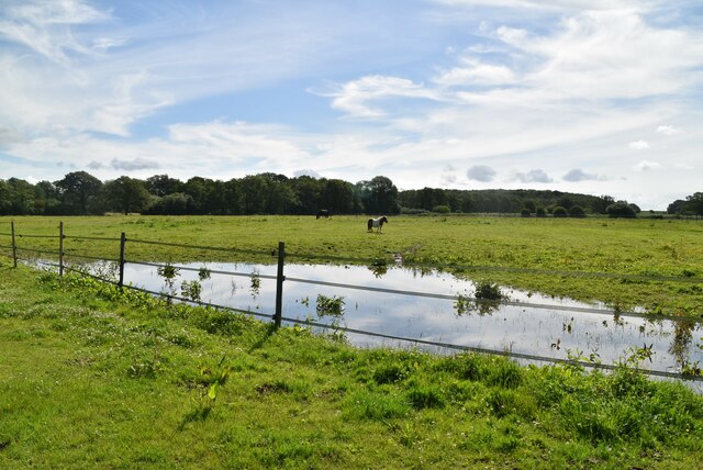
Blunt's Green is a picturesque village located in the county of Sussex in southeastern England. Nestled amidst the stunning landscape of the Sussex Downs and Moorland, the village offers a serene and tranquil environment for residents and visitors alike.

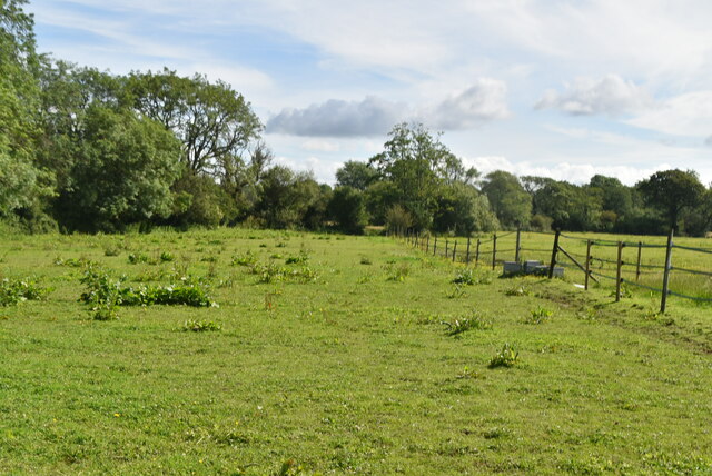
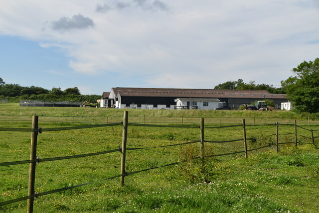
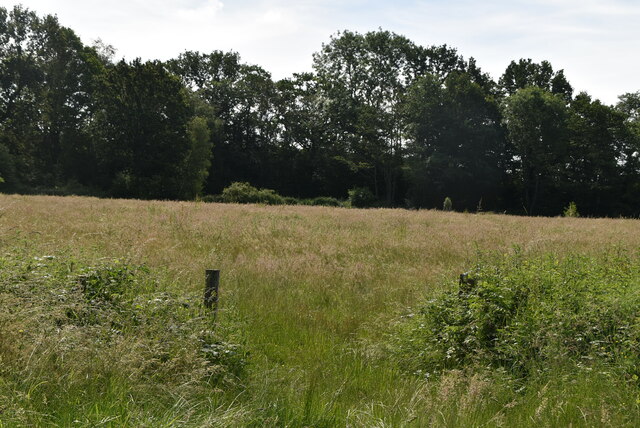
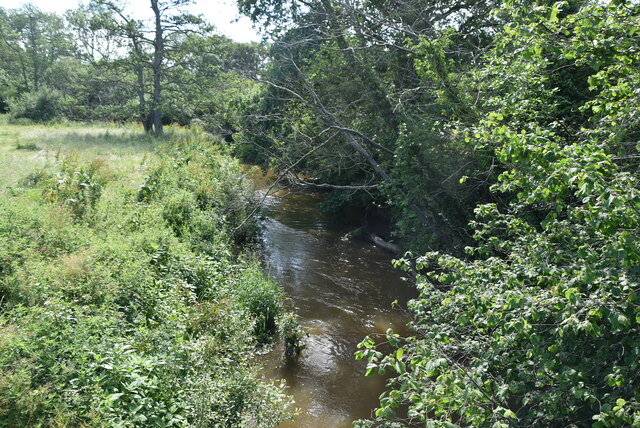
Surrounded by rolling hills and lush greenery, Blunt's Green boasts breathtaking views that capture the essence of the English countryside. The village is renowned for its scenic walks and hiking trails, attracting nature enthusiasts and outdoor lovers from far and wide. The Sussex Downs, with their expansive meadows and stunning cliffs, provide ample opportunities for exploration and adventure.

Blunt's Green is also home to a close-knit community that takes pride in preserving the village's rich history and heritage. The quaint cottages and traditional architecture add to the charm of the village, creating a nostalgic ambiance that harkens back to a bygone era.

In addition to its natural beauty, Blunt's Green offers a range of amenities and facilities to cater to residents' needs. The village boasts a local pub and a few small shops, ensuring that essential goods and services are easily accessible.

Overall, Blunt's Green, nestled amidst the stunning Sussex Downs and Moorland, offers a perfect blend of natural beauty, community spirit, and historic charm. Whether it's exploring the breathtaking countryside or immersing oneself in the village's rich heritage, Blunt's Green provides an idyllic setting for a peaceful and fulfilling lifestyle.

If you have any feedback on the listing, please let us know in the comments section below.

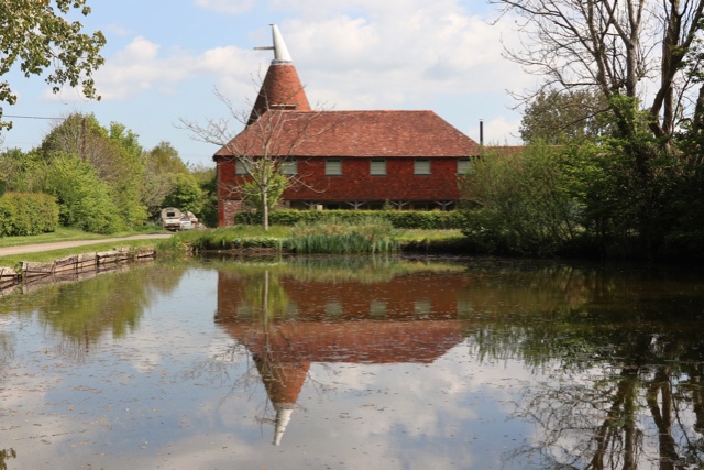
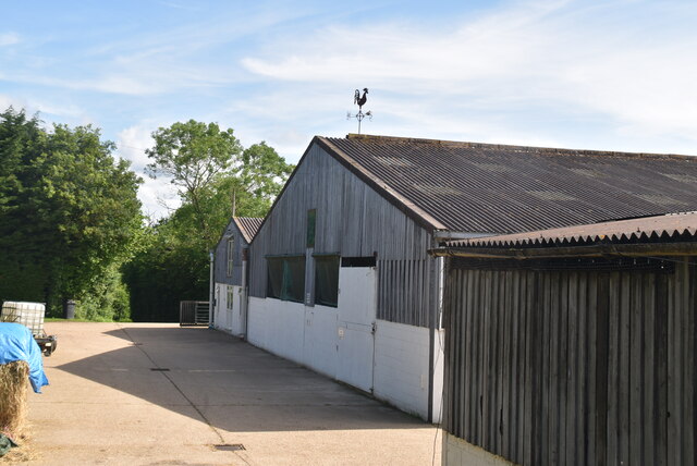
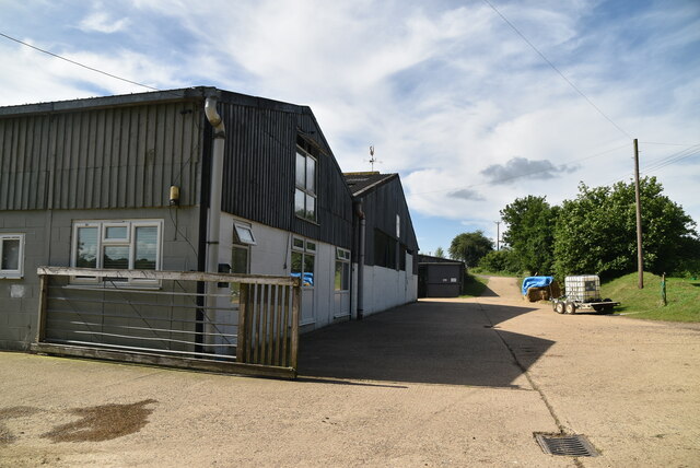
Blunt's Green Images

Images are sourced within 2km of 50.932992/0.051080229 or Grid Reference TQ4416. Thanks to Geograph Open Source API. All images are credited.

Oast House Single round kiln oast house.

Grade II listed.
Oast House
Single round kiln oast house. Grade II listed.
The Oast House Single square kiln oast house.
The Oast House
Single square kiln oast house.
Isfield Village Hall Isfield lies just off the main A26 Uckfield to Lewes main road, and is well hidden in the Ouse valley. The Romans established a staging post in the village, near a ford across the Ouse, this was on a section of Ermine Street which ran from Newhaven to London, passing through Lewes and Isfield and Maresfield. The village was recorded as Sifelle in the Domesday book.
More info at <span class="nowrap"><a title="http://www.villagenet.co.uk/ashdownforest/villages/isfield.php" rel="nofollow ugc noopener" href="http://www.villagenet.co.uk/ashdownforest/villages/isfield.php">Link</a><img style="margin-left:2px;" alt="External link" title="External link - shift click to open in new window" src="https://s1.geograph.org.uk/img/external.png" width="10" height="10"/></span>
Isfield Village Hall
Isfield lies just off the main A26 Uckfield to Lewes main road, and is well hidden in the Ouse valley. The Romans established a staging post in the village, near a ford across the Ouse, this was on a section of Ermine Street which ran from Newhaven to London, passing through Lewes and Isfield and Maresfield. The village was recorded as Sifelle in the Domesday book. More info at LinkExternal link
Station Rd Isfield lies just off the main A26 Uckfield to Lewes main road, and is well hidden in the Ouse valley. The Romans established a staging post in the village, near a ford across the Ouse, this was on a section of Ermine Street which ran from Newhaven to London, passing through Lewes and Isfield and Maresfield. The village was recorded as Sifelle in the Domesday book.
More info at <span class="nowrap"><a title="http://www.villagenet.co.uk/ashdownforest/villages/isfield.php" rel="nofollow ugc noopener" href="http://www.villagenet.co.uk/ashdownforest/villages/isfield.php">Link</a><img style="margin-left:2px;" alt="External link" title="External link - shift click to open in new window" src="https://s1.geograph.org.uk/img/external.png" width="10" height="10"/></span>
Station Rd
Isfield lies just off the main A26 Uckfield to Lewes main road, and is well hidden in the Ouse valley. The Romans established a staging post in the village, near a ford across the Ouse, this was on a section of Ermine Street which ran from Newhaven to London, passing through Lewes and Isfield and Maresfield. The village was recorded as Sifelle in the Domesday book. More info at LinkExternal link
Track in Isfield
Track in Isfield
Faulkners
Faulkners
Pasture
Pasture
Tile Barn Farmhouse
Tile Barn Farmhouse
Tile Barn Farm
Tile Barn Farm
Tile Barn Farm
Tile Barn Farm
A green lane
A green lane
Grassy footpath
Grassy footpath
A small pond
A small pond
Tile Barn Farm
Tile Barn Farm
Meadow
Meadow
Meadow
Meadow
River Uck The River Uck is a river in East Sussex, which drains a catchment starting near Crowborough in the North, Hadlow Down to the East and Laughton Common to the South.It flows through the town of Uckfield and into the river Ouse about 3 miles north of Lewes. The river Uck also has a scenic walk alongside it. The river burst its banks in 2000, flooding much of Uckfield and the surrounding countryside.
River Uck
The River Uck is a river in East Sussex, which drains a catchment starting near Crowborough in the North, Hadlow Down to the East and Laughton Common to the South.It flows through the town of Uckfield and into the river Ouse about 3 miles north of Lewes. The river Uck also has a scenic walk alongside it. The river burst its banks in 2000, flooding much of Uckfield and the surrounding countryside.
Show me another place!

Blunt's Green is located at Grid Ref: TQ4416 (Lat: 50.932992, Lng: 0.051080229)

Administrative County: East Sussex

District: Lewes

Police Authority: Sussex

What 3 Words

///pancakes.rinses.catchers. Near Ringmer, East Sussex

Related Wikis

Isfield

Isfield is a small village and civil parish in the Wealden District of East Sussex in England, located north-east of Lewes. == History == The village of...
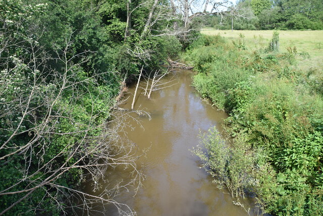
River Uck

The River Uck is a river in East Sussex, United Kingdom, which drains a catchment starting near Crowborough in the North, Hadlow Down to the East and Laughton...

Lavender Line

The Lavender Line is a heritage railway based at Isfield Station, near Uckfield in East Sussex, England. == History == The Lavender Line was originally...

Isfield railway station

Isfield is a preserved railway station on the closed section of the Wealden Line which served the East Sussex village of Isfield near Uckfield. Originally...

Barcombe Mills

Barcombe Mills is a small settlement and an area of countryside including a local nature reserve near the village of Barcombe Cross in East Sussex, England...

Plashett Park Wood

Plashett Park Wood is a 157.6-hectare (389-acre) biological Site of Special Scientific Interest between Lewes and Uckfield in East Sussex.This ancient...

Barcombe Mills railway station

Barcombe Mills is a disused railway station in the hamlet of Barcombe Mills, on the closed section of the Wealden Line. The station was opened in 1858...

Barcombe

Barcombe is an East Sussex village and civil parish in the Lewes District of East Sussex. The parish has four settlements: old Barcombe (TQ 418 143), the...

Nearby Amenities

Located within 500m of 50.932992,0.051080229
Barrier: kissing_gate
Foot: yes
Lat/Long: 50.9301453/0.0525857
Barrier: stile
Foot: yes
Lat/Long: 50.9357647/0.0544684
Barrier: stile
Lat/Long: 50.9336062/0.0498448
Type FW3/28A
Building: bunker
Bunker Type: pillbox
Military: bunker
Lat/Long: 50.9289736/0.051012
Type FW3/24
Building: bunker
Bunker Type: pillbox
Military: bunker
Lat/Long: 50.9353038/0.0508818
The data included in this document is from www.openstreetmap.org. The data is made available under ODbL.

Have you been to Blunt's Green?

Leave your review of Blunt's Green below (or comments, questions and feedback).