Crabtree Shaw

Wood, Forest in Sussex Wealden

England

Crabtree Shaw

Oast House Single round kiln oast house.

Grade II listed.
Oast House Credit: Oast House Archive

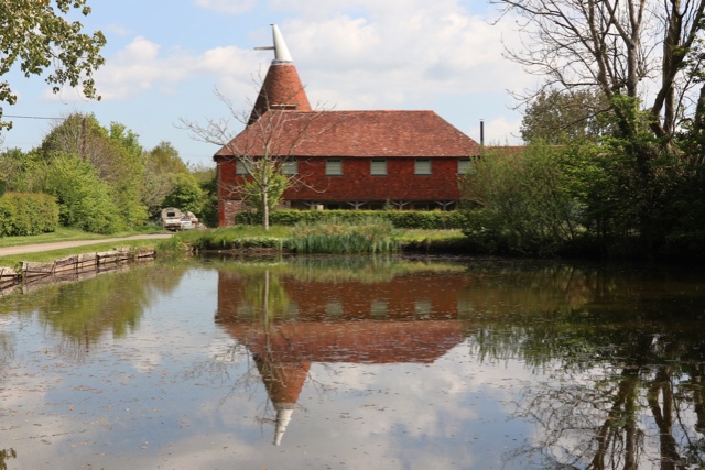
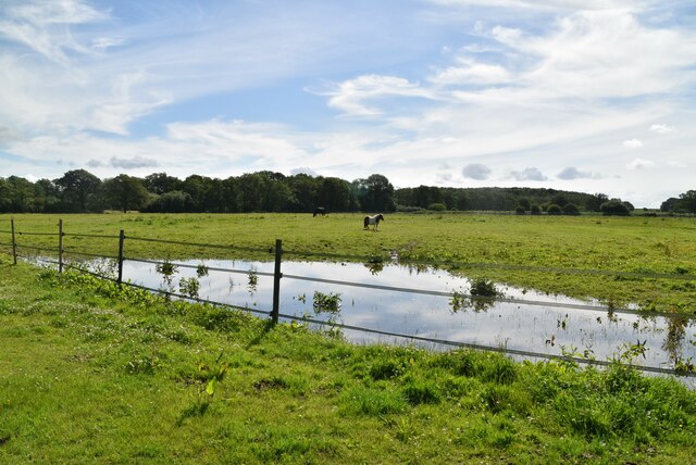
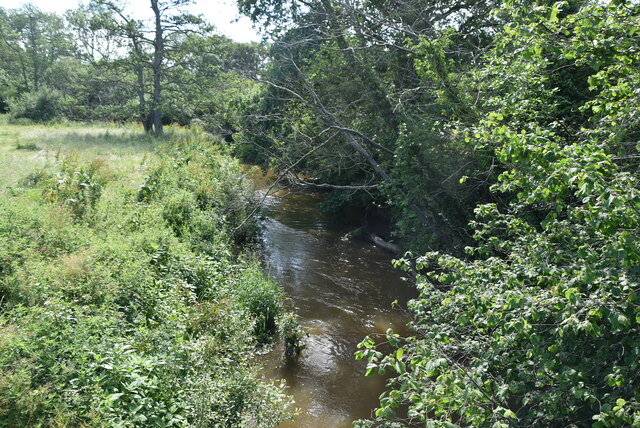
Crabtree Shaw is a picturesque woodland area located in Sussex, England. Spread across a vast expanse, it is known for its dense forest and verdant landscapes. The woodland is part of the larger Crabtree Shaw Nature Reserve, which encompasses various habitats and is managed by the Sussex Wildlife Trust.

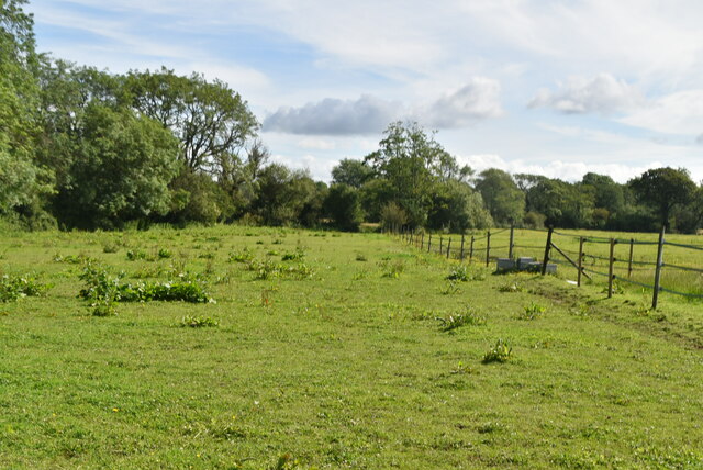
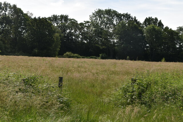
The forest is predominantly composed of native tree species like oak, beech, and birch, creating a rich and diverse ecosystem. The woodland floor is carpeted with a plethora of flowering plants and ferns, adding to the area's natural beauty. This thriving habitat provides a sanctuary for various wildlife species including deer, rabbits, badgers, and a variety of bird species.

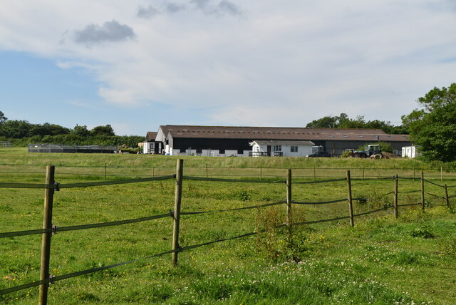
Crabtree Shaw offers numerous recreational opportunities for nature enthusiasts and visitors alike. It features a network of well-maintained trails that wind through the forest, allowing visitors to explore the area on foot or by bicycle. These trails offer breathtaking views of the surrounding countryside and provide the perfect setting for a leisurely stroll or a more adventurous hike.

The woodland also offers a tranquil setting for picnics, birdwatching, and photography. Its peaceful ambiance and untouched beauty make it a popular destination for those seeking solace in nature. Additionally, Crabtree Shaw hosts organized events and workshops throughout the year, inviting the community to learn more about the local flora and fauna and engage in conservation efforts.

Overall, Crabtree Shaw in Sussex is a haven for nature lovers, offering a chance to immerse oneself in the serene beauty of a forested landscape while enjoying a range of outdoor activities.

If you have any feedback on the listing, please let us know in the comments section below.

Crabtree Shaw Images

Images are sourced within 2km of 50.93344/0.0548003 or Grid Reference TQ4416. Thanks to Geograph Open Source API. All images are credited.

Oast House Single round kiln oast house.

Grade II listed.
Oast House
Single round kiln oast house. Grade II listed.
The Oast House Single square kiln oast house.
The Oast House
Single square kiln oast house.
Isfield Village Hall Isfield lies just off the main A26 Uckfield to Lewes main road, and is well hidden in the Ouse valley. The Romans established a staging post in the village, near a ford across the Ouse, this was on a section of Ermine Street which ran from Newhaven to London, passing through Lewes and Isfield and Maresfield. The village was recorded as Sifelle in the Domesday book.
More info at <span class="nowrap"><a title="http://www.villagenet.co.uk/ashdownforest/villages/isfield.php" rel="nofollow ugc noopener" href="http://www.villagenet.co.uk/ashdownforest/villages/isfield.php">Link</a><img style="margin-left:2px;" alt="External link" title="External link - shift click to open in new window" src="https://s1.geograph.org.uk/img/external.png" width="10" height="10"/></span>
Isfield Village Hall
Isfield lies just off the main A26 Uckfield to Lewes main road, and is well hidden in the Ouse valley. The Romans established a staging post in the village, near a ford across the Ouse, this was on a section of Ermine Street which ran from Newhaven to London, passing through Lewes and Isfield and Maresfield. The village was recorded as Sifelle in the Domesday book. More info at LinkExternal link
Station Rd Isfield lies just off the main A26 Uckfield to Lewes main road, and is well hidden in the Ouse valley. The Romans established a staging post in the village, near a ford across the Ouse, this was on a section of Ermine Street which ran from Newhaven to London, passing through Lewes and Isfield and Maresfield. The village was recorded as Sifelle in the Domesday book.
More info at <span class="nowrap"><a title="http://www.villagenet.co.uk/ashdownforest/villages/isfield.php" rel="nofollow ugc noopener" href="http://www.villagenet.co.uk/ashdownforest/villages/isfield.php">Link</a><img style="margin-left:2px;" alt="External link" title="External link - shift click to open in new window" src="https://s1.geograph.org.uk/img/external.png" width="10" height="10"/></span>
Station Rd
Isfield lies just off the main A26 Uckfield to Lewes main road, and is well hidden in the Ouse valley. The Romans established a staging post in the village, near a ford across the Ouse, this was on a section of Ermine Street which ran from Newhaven to London, passing through Lewes and Isfield and Maresfield. The village was recorded as Sifelle in the Domesday book. More info at LinkExternal link
Track in Isfield
Track in Isfield
Faulkners
Faulkners
Pasture
Pasture
Tile Barn Farmhouse
Tile Barn Farmhouse
Tile Barn Farm
Tile Barn Farm
Tile Barn Farm
Tile Barn Farm
A green lane
A green lane
Grassy footpath
Grassy footpath
A small pond
A small pond
Tile Barn Farm
Tile Barn Farm
Meadow
Meadow
Meadow
Meadow
River Uck The River Uck is a river in East Sussex, which drains a catchment starting near Crowborough in the North, Hadlow Down to the East and Laughton Common to the South.It flows through the town of Uckfield and into the river Ouse about 3 miles north of Lewes. The river Uck also has a scenic walk alongside it. The river burst its banks in 2000, flooding much of Uckfield and the surrounding countryside.
River Uck
The River Uck is a river in East Sussex, which drains a catchment starting near Crowborough in the North, Hadlow Down to the East and Laughton Common to the South.It flows through the town of Uckfield and into the river Ouse about 3 miles north of Lewes. The river Uck also has a scenic walk alongside it. The river burst its banks in 2000, flooding much of Uckfield and the surrounding countryside.
Show me another place!

Crabtree Shaw is located at Grid Ref: TQ4416 (Lat: 50.93344, Lng: 0.0548003)

Administrative County: East Sussex

District: Wealden

Police Authority: Sussex

What 3 Words

///atom.thumb.plantings. Near Ringmer, East Sussex

Related Wikis

Isfield

Isfield is a small village and civil parish in the Wealden District of East Sussex in England, located north-east of Lewes. == History == The village of...

Lavender Line

The Lavender Line is a heritage railway based at Isfield Station, near Uckfield in East Sussex, England. == History == The Lavender Line was originally...

Isfield railway station

Isfield is a preserved railway station on the closed section of the Wealden Line which served the East Sussex village of Isfield near Uckfield. Originally...
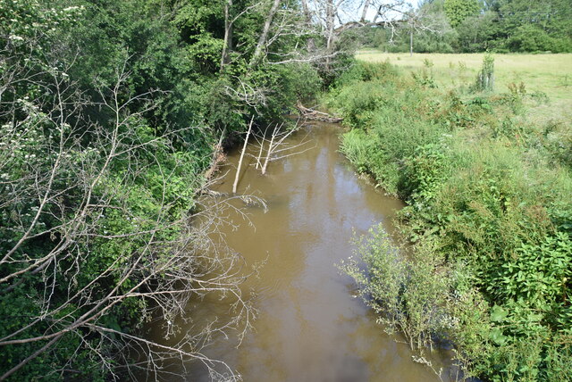
River Uck

The River Uck is a river in East Sussex, United Kingdom, which drains a catchment starting near Crowborough in the North, Hadlow Down to the East and Laughton...

Plashett Park Wood

Plashett Park Wood is a 157.6-hectare (389-acre) biological Site of Special Scientific Interest between Lewes and Uckfield in East Sussex.This ancient...

Barcombe Mills

Barcombe Mills is a small settlement and an area of countryside including a local nature reserve near the village of Barcombe Cross in East Sussex, England...

Barcombe Mills railway station

Barcombe Mills is a disused railway station in the hamlet of Barcombe Mills, on the closed section of the Wealden Line. The station was opened in 1858...

Barcombe

Barcombe is an East Sussex village and civil parish in the Lewes District of East Sussex. The parish has four settlements: old Barcombe (TQ 418 143), the...

Nearby Amenities

Located within 500m of 50.93344,0.0548003
Bridleway: designated
Lat/Long: 50.937803/0.054317
Barrier: stile
Foot: yes
Lat/Long: 50.9378171/0.0543049
Barrier: kissing_gate
Foot: yes
Lat/Long: 50.9301453/0.0525857
Barrier: stile
Foot: yes
Lat/Long: 50.9357647/0.0544684
Barrier: stile
Foot: yes
Lat/Long: 50.9370752/0.0549823
Barrier: stile
Lat/Long: 50.937854/0.0546846
Addr City: Isfield
Addr Housename: Old Mill Barn
Addr Postcode: TN22 5XJ
Building: yes
Lat/Long: 50.9376342/0.0568892
Footpath
Information: guidepost
Operator: East Sussex County Council
Tourism: information
Lat/Long: 50.9378796/0.0546659
Bridleway
Information: guidepost
Tourism: information
Lat/Long: 50.937833/0.0545427
Sussex Ouse Valley Way
Information: guidepost
Tourism: information
Lat/Long: 50.9378726/0.0542935
Barrier: stile
Lat/Long: 50.9336062/0.0498448
Type FW3/24
Building: bunker
Bunker Type: pillbox
Military: bunker
Lat/Long: 50.9353038/0.0508818
The data included in this document is from www.openstreetmap.org. The data is made available under ODbL.

Have you been to Crabtree Shaw?

Leave your review of Crabtree Shaw below (or comments, questions and feedback).