Gedney Fen

Downs, Moorland in Lincolnshire South Holland

England

Gedney Fen

Junction between Little South Holland Drain and South Holland Main Drain Sluice and pumping station emptying  the Little Holland into the South Holland Main Drain.
Junction between Little South Holland Drain and South Holland Main Drain Credit: Jonathan Bye

Gedney Fen is a small village located in the county of Lincolnshire, England. Situated within the district of South Holland, the village is surrounded by a diverse landscape consisting of downs and moorland. The area is known for its natural beauty and is a popular destination for outdoor enthusiasts and nature lovers.

The village itself is characterized by its charming rural atmosphere, with a small population of residents who enjoy a peaceful and close-knit community. The architecture in Gedney Fen reflects its agricultural heritage, with a mixture of traditional cottages and farmhouses dotting the landscape.

The downs surrounding Gedney Fen offer breathtaking panoramic views of the countryside. These rolling hills are covered in a patchwork of vibrant green fields, often grazed by livestock. The area is rich in biodiversity, with an abundance of native flora and fauna. It is a haven for birdwatchers, as numerous species can be spotted throughout the year, including skylarks, lapwings, and various waterfowl.

Moorland, characterized by its heather-covered expanses, can also be found in Gedney Fen. This unique habitat provides a home for a range of wildlife, including deer, rabbits, and various bird species. The moorland is a popular destination for hikers and nature enthusiasts, offering serene and secluded trails to explore.

In summary, Gedney Fen in Lincolnshire offers a scenic and tranquil setting, with its mix of downs and moorland creating a diverse and captivating landscape. A blend of rural charm and natural beauty make it an ideal destination for those seeking a peaceful retreat or an opportunity to connect with nature.

If you have any feedback on the listing, please let us know in the comments section below.
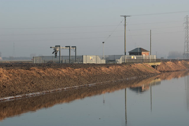
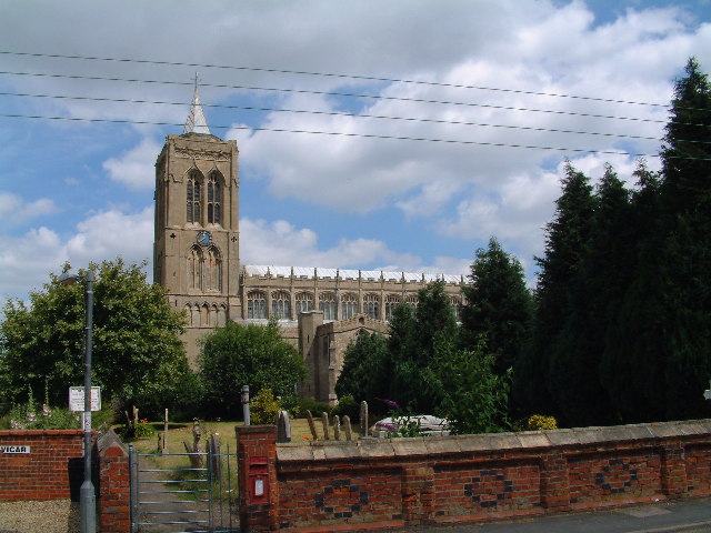
Gedney Fen Images

Images are sourced within 2km of 52.76556/0.064916783 or Grid Reference TF3920. Thanks to Geograph Open Source API. All images are credited.

Junction between Little South Holland Drain and South Holland Main Drain Sluice and pumping station emptying  the Little Holland into the South Holland Main Drain.
Junction between Little South Holland Drain and South Holland Main Drain
Sluice and pumping station emptying the Little Holland into the South Holland Main Drain.
Jarvis's Gate
Jarvis's Gate
Road junction
Road junction
Electricity transmission line
Ryefield Lane
Ryefield Lane
Drain on Gedney Fen Looking SE from Gover's Drove
Drain on Gedney Fen
Looking SE from Gover's Drove
End of surfaced section of Maisdyke Lane, Fleet
Land drain, Gedney Fen, Lincolnshire Most of the drains are full after a succession of heavy late winter rains.
Land drain, Gedney Fen, Lincolnshire
Most of the drains are full after a succession of heavy late winter rains.
Red House Bridge, near Sutton St James This is a functional and rather ugly bridge over the South Holland Main Drain in south Lincolnshire.
Red House Bridge, near Sutton St James
This is a functional and rather ugly bridge over the South Holland Main Drain in south Lincolnshire.
Fleet Drain The public footpath from Raven's Drove to Fleet and Gedney follows this drain for much of its route. Here the drain takes a turn north east and peels away from the road along Delph Bank. This section runs between a reed bank on the left and a low lying reedy area on the right. Raven's Drove is just off the picture to the right. 
Note: The 1:50,000 scale OS map is slightly inaccurate. For the start of this footpath refer to the 1:25,000 map.
Fleet Drain
The public footpath from Raven's Drove to Fleet and Gedney follows this drain for much of its route. Here the drain takes a turn north east and peels away from the road along Delph Bank. This section runs between a reed bank on the left and a low lying reedy area on the right. Raven's Drove is just off the picture to the right. Note: The 1:50,000 scale OS map is slightly inaccurate. For the start of this footpath refer to the 1:25,000 map.
Fleet Fen Looking across this flat landscape from Delph Bank to Raven's Gate. East View Farm, in the centre distance, is just in the featured square while Roselea, the white cottage to the right, is in <a href="https://www.geograph.org.uk/gridref/TF3721">TF3721</a> as are the pylons beyond. The nearest row of electricity posts follow a miner drain which takes the place of a hedge as a field boundary.
Fleet Fen
Looking across this flat landscape from Delph Bank to Raven's Gate. East View Farm, in the centre distance, is just in the featured square while Roselea, the white cottage to the right, is in TF3721 as are the pylons beyond. The nearest row of electricity posts follow a miner drain which takes the place of a hedge as a field boundary.
Fleet Drain, Fleet Fen The water in this drain was running crystal clear. The view is looking towards Auckland Farm. This is the start of the footpath to Fleet from Raven's Drove which follows the line of the Drain for much of its route.
Fleet Drain, Fleet Fen
The water in this drain was running crystal clear. The view is looking towards Auckland Farm. This is the start of the footpath to Fleet from Raven's Drove which follows the line of the Drain for much of its route.
Raven's Drove Looking WSW along the Drove from the junction with Fen Dike with Gedney Fen to the left and Fleet Fen to the right. This is typical of the Lincolnshire Fens' landscape: unending vistas of flat farmland punctuated by drains, straight roads and electricity lines.
Raven's Drove
Looking WSW along the Drove from the junction with Fen Dike with Gedney Fen to the left and Fleet Fen to the right. This is typical of the Lincolnshire Fens' landscape: unending vistas of flat farmland punctuated by drains, straight roads and electricity lines.
Ryefield Lane, Gedney Fen Looking from Fen Dike towards Ryefield House.
Ryefield Lane, Gedney Fen
Looking from Fen Dike towards Ryefield House.
Fen Dike, Gedney Fen This large farm is The Fenlands. Taken from the juncntion with Ryefield Lane.
Fen Dike, Gedney Fen
This large farm is The Fenlands. Taken from the juncntion with Ryefield Lane.
On Fen Dike This old farmhouse is available for renovation. It will be interesting to come back in a couple of years to see if it's changed.
Well, here it is 3 years and 3 days later.   <a title="https://www.geograph.org.uk/photo/2176121" href="https://www.geograph.org.uk/photo/2176121">Link</a> Well at least the grass is shorter and the front door closed!
On Fen Dike
This old farmhouse is available for renovation. It will be interesting to come back in a couple of years to see if it's changed. Well, here it is 3 years and 3 days later. Link Well at least the grass is shorter and the front door closed!
Bullock's Short Gate, Gedney Fen Raven's Drove, turns into Bullock's Short Gate as it turns away from Delph Bank. Red Lodge Farm is on the left.
Bullock's Short Gate, Gedney Fen
Raven's Drove, turns into Bullock's Short Gate as it turns away from Delph Bank. Red Lodge Farm is on the left.
Fleet Fen Fleet Drain in the foreground. Photograph taken from the footpath on the east bank looking towards Maisdike Lane.
Fleet Fen
Fleet Drain in the foreground. Photograph taken from the footpath on the east bank looking towards Maisdike Lane.
Show me another place!

Gedney Fen is located at Grid Ref: TF3920 (Lat: 52.76556, Lng: 0.064916783)

Administrative County: Lincolnshire

District: South Holland

Police Authority: Lincolnshire

What 3 Words

///crouches.ending.copiers. Near Fleet, Lincolnshire

Nearby Locations

Gedney Fen

Related Wikis

Gedney Broadgate

Gedney Broadgate is a hamlet in the civil parish of Gedney and the South Holland district of Lincolnshire, England. It is situated west from the A17 road...

Sutton St James

Sutton St James is a village and civil parish in the South Holland district of Lincolnshire, England, about four miles (6.4 km) south-west of Long Sutton...

Grange Farm Arboretum

The Grange Farm Arboretum is a small private arboretum comprising 3 hectares accommodating over 800 trees, mostly native and ornamental species or cultivars...

Fleet, Lincolnshire

Fleet is a village, civil parish and electoral ward in the South Holland district of Lincolnshire, England. It lies on Delph Bank, 3 miles (4.8 km) south...

Holbeach Fen

Holbeach Fen is a fenland settlement and area in the South Holland district of southern Lincolnshire, England. It is 3 miles (5 km) south from Holbeach...

Gedney railway station

Gedney railway station was a station in Gedney, Lincolnshire. It was a station on the Midland and Great Northern Joint Railway network. It opened on 1...

Fleet railway station (Lincolnshire)

Fleet railway station was a station in Fleet, Lincolnshire. It opened in 1862 and closed to passengers in 1959, with the goods yard closing on 3 February...

Gedney, Lincolnshire

Gedney is a village, civil parish and electoral ward in the South Holland district of Lincolnshire, England. It is just to the south of the A17 Boston...

Nearby Amenities

Located within 500m of 52.76556,0.064916783
Power: tower
Lat/Long: 52.7663059/0.062185
Power: tower
Lat/Long: 52.7653581/0.0665838
Power: pole
Lat/Long: 52.7614829/0.062323
Power: pole
Lat/Long: 52.7615346/0.0642223
Power: pole
Lat/Long: 52.7615624/0.0659179
Power: pole
Lat/Long: 52.7615908/0.0669112
Power: pole
Lat/Long: 52.7620715/0.068635
Power: pole
Lat/Long: 52.7625814/0.0699311
The data included in this document is from www.openstreetmap.org. The data is made available under ODbL.

Have you been to Gedney Fen?

Leave your review of Gedney Fen below (or comments, questions and feedback).