Upper Knarr Fen

Downs, Moorland in Cambridgeshire

England

Upper Knarr Fen

Stubble field near Toneham Farm
Stubble field near Toneham Farm Credit: Jonathan Thacker

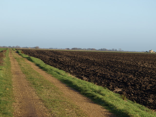
Upper Knarr Fen is a picturesque area located in Cambridgeshire, England. Known for its diverse landscape, it encompasses both downs and moorland. Spanning approximately 200 hectares, Upper Knarr Fen is a haven for nature enthusiasts and provides a unique opportunity to explore the beauty of the British countryside.

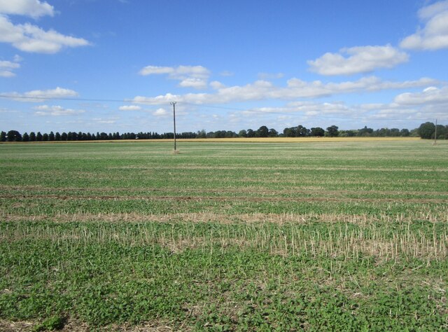
The downs of Upper Knarr Fen feature rolling hills and expansive grasslands, providing a stunning backdrop for outdoor activities such as hiking and picnicking. The area is home to a wide variety of flora and fauna, including wildflowers, birds, and small mammals. Visitors can enjoy the tranquility of the downs while taking in breathtaking views of the surrounding countryside.

Moorland, on the other hand, is characterized by its peat bogs and heather-covered landscapes. Upper Knarr Fen boasts several acres of moorland, offering a distinct and contrasting experience. The moorland is particularly fascinating for its unique ecosystem, hosting a range of plant species specially adapted to the acidic and waterlogged conditions. Rare birds, such as the curlew and snipe, can also be spotted in this area.

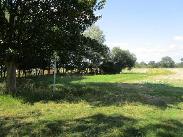
Upper Knarr Fen is a protected nature reserve, managed by local conservation organizations. The aim is to preserve the natural habitat and promote biodiversity in the region. Visitors are encouraged to follow designated paths and adhere to any regulations put in place to safeguard the delicate ecosystem.

Overall, Upper Knarr Fen in Cambridgeshire presents a captivating blend of downs and moorland, allowing visitors to immerse themselves in the beauty of the British countryside and witness the wonders of diverse ecosystems.

If you have any feedback on the listing, please let us know in the comments section below.

Upper Knarr Fen Images

Images are sourced within 2km of 52.60528/-0.091408339 or Grid Reference TF2902. Thanks to Geograph Open Source API. All images are credited.

Stubble field near Toneham Farm
The beginning of a footpath to Thorney
The Green, Thorney On the left, No. 2 <span class="nowrap"><a title="https://historicengland.org.uk/listing/the-list/list-entry/1224675" rel="nofollow ugc noopener" href="https://historicengland.org.uk/listing/the-list/list-entry/1224675">Link</a><img style="margin-left:2px;" alt="External link" title="External link - shift click to open in new window" src="https://s1.geograph.org.uk/img/external.png" width="10" height="10"/></span> Directly ahead Nos. 3 and 4 <span class="nowrap"><a title="https://historicengland.org.uk/listing/the-list/list-entry/1331268" rel="nofollow ugc noopener" href="https://historicengland.org.uk/listing/the-list/list-entry/1331268">Link</a><img style="margin-left:2px;" alt="External link" title="External link - shift click to open in new window" src="https://s1.geograph.org.uk/img/external.png" width="10" height="10"/></span>
This area was once Thorney's Market Place.
The Green, Thorney
On the left, No. 2 LinkExternal link Directly ahead Nos. 3 and 4 LinkExternal link This area was once Thorney's Market Place.
Cheriton House, Thorney Former Vicarage dating from 1728 <span class="nowrap"><a title="https://historicengland.org.uk/listing/the-list/list-entry/1127487" rel="nofollow ugc noopener" href="https://historicengland.org.uk/listing/the-list/list-entry/1127487">Link</a><img style="margin-left:2px;" alt="External link" title="External link - shift click to open in new window" src="https://s1.geograph.org.uk/img/external.png" width="10" height="10"/></span>
Cheriton House, Thorney
Former Vicarage dating from 1728 LinkExternal link
Churchyard and Abbey House, Thorney Abbey House dates from the late sixteenth century but was later refronted <span class="nowrap"><a title="https://historicengland.org.uk/listing/the-list/list-entry/1127481" rel="nofollow ugc noopener" href="https://historicengland.org.uk/listing/the-list/list-entry/1127481">Link</a><img style="margin-left:2px;" alt="External link" title="External link - shift click to open in new window" src="https://s1.geograph.org.uk/img/external.png" width="10" height="10"/></span>
Churchyard and Abbey House, Thorney
Abbey House dates from the late sixteenth century but was later refronted LinkExternal link
Chest tombs, Thorney
Church of St. Mary and St. Botolph, Thorney, east end A new east end was added to the remains of the abbey church in 1840. Designed by Edward Blore <span class="nowrap"><a title="https://en.wikipedia.org/wiki/Edward_Blore" rel="nofollow ugc noopener" href="https://en.wikipedia.org/wiki/Edward_Blore">Link</a><img style="margin-left:2px;" alt="External link" title="External link - shift click to open in new window" src="https://s1.geograph.org.uk/img/external.png" width="10" height="10"/></span>
Church of St. Mary and St. Botolph, Thorney, east end
A new east end was added to the remains of the abbey church in 1840. Designed by Edward Blore LinkExternal link
West doorway, church of St. Mary and St. Botolph, Thorney The west front of the former Thorney Abbey is Norman but the west doorway (and the window above) are later alterations. The inner doorway probably dates from 1638 when the former abbey church was adapted for parochial use. The outer doorway likely dates from just before the abbey's dissolution in 1539.
West doorway, church of St. Mary and St. Botolph, Thorney
The west front of the former Thorney Abbey is Norman but the west doorway (and the window above) are later alterations. The inner doorway probably dates from 1638 when the former abbey church was adapted for parochial use. The outer doorway likely dates from just before the abbey's dissolution in 1539.
Grounds to Park House, Thorney
Houses, Wisbech Road, Thorney Date from 1857 <span class="nowrap"><a title="https://historicengland.org.uk/listing/the-list/list-entry/1127492" rel="nofollow ugc noopener" href="https://historicengland.org.uk/listing/the-list/list-entry/1127492">Link</a><img style="margin-left:2px;" alt="External link" title="External link - shift click to open in new window" src="https://s1.geograph.org.uk/img/external.png" width="10" height="10"/></span>
Houses, Wisbech Road, Thorney
Date from 1857 LinkExternal link
Old Knarr Fen Drove looking north
Infinity at Lower Knarr Fen
Harriman's Farm Old Knarr Fen Drove
Track and field Farm track and field looking east, nothing else in this square.
Track and field
Farm track and field looking east, nothing else in this square.
Drain And Field I was walking along what I thought was this footpath but the footpath is actually on the other side of the drain and not as defined.
Drain And Field
I was walking along what I thought was this footpath but the footpath is actually on the other side of the drain and not as defined.
Farm building, Thorney, Peterborough Farm building south of Ashley Pool (Medicine pond).  Believed to be once used as a scout hut. The B1040 Thorney to Whittlesey runs in front of it.
Farm building, Thorney, Peterborough
Farm building south of Ashley Pool (Medicine pond). Believed to be once used as a scout hut. The B1040 Thorney to Whittlesey runs in front of it.
Thorney Abbey Church The Abbey Church of St Mary and St Botolph, Thorney.See: <span class="nowrap"><a title="http://www.thorney.org/about_thorney-abbey.htm" rel="nofollow ugc noopener" href="http://www.thorney.org/about_thorney-abbey.htm">Link</a><img style="margin-left:2px;" alt="External link" title="External link - shift click to open in new window" src="https://s1.geograph.org.uk/img/external.png" width="10" height="10"/></span>
Thorney Abbey Church
The Abbey Church of St Mary and St Botolph, Thorney.See: LinkExternal link
Thorney Houses around a green beside Thorney Abbey Church.
Thorney
Houses around a green beside Thorney Abbey Church.
Show me another place!

Upper Knarr Fen is located at Grid Ref: TF2902 (Lat: 52.60528, Lng: -0.091408339)

Division: Isle of Ely

Unitary Authority: Peterborough

Police Authority: Cambridgeshire

What 3 Words

///solves.reconnect.deserved. Near Thorney, Cambridgeshire

Nearby Locations

Upper Knarr Fen

Related Wikis

Thorney Abbey

Thorney Abbey, now the Church of St Mary and St Botolph, was a medieval monastic house established on the island of Thorney in The Fens of Cambridgeshire...

Thorney, Cambridgeshire

Thorney is a village in the Peterborough unitary authority in the ceremonial county of Cambridgeshire, England. Located around eight miles (13 km) east...

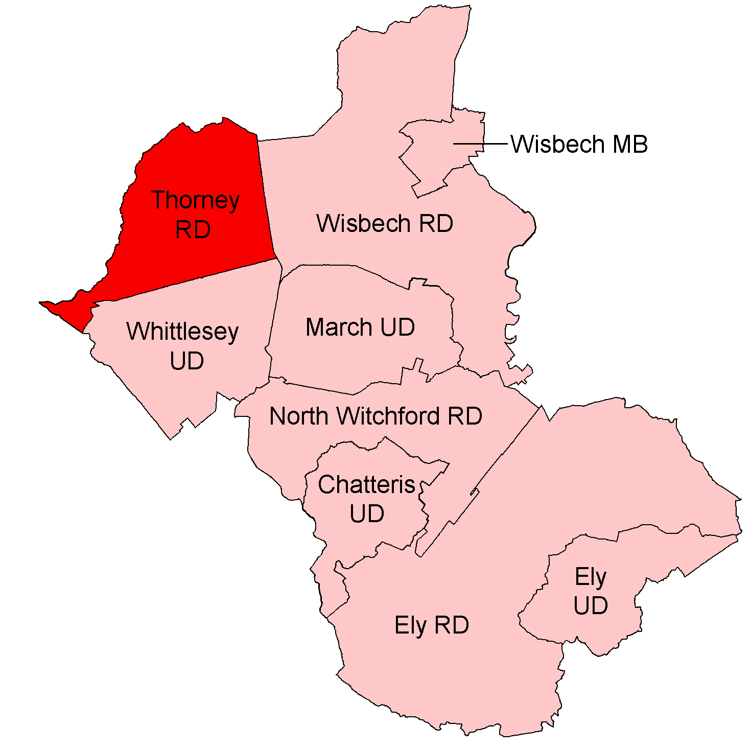
Thorney Rural District

Thorney was a rural district in England from 1894 to 1974, situated to the east of Peterborough. It was created under the Local Government Act 1894, covering...

Thorney railway station

Thorney railway station was a station in Thorney, Cambridgeshire on the Midland and Great Northern Joint Railway line between Peterborough and Wisbech...

Nene Washes

Nene Washes is a 1,522-hectare (3,760-acre) biological Site of Special Scientific Interest on the bank of the River Nene east of Peterborough in Cambridgeshire...

Wryde railway station

Wryde railway station was a station serving Wryde, Cambridgeshire on the Midland and Great Northern Joint Railway between Wisbech and Peterborough. Originally...

Bassenhally Pit

Bassenhally Pit is an 8.6-hectare (21-acre) biological Site of Special Scientific Interest north-east of Whittlesey in Cambridgeshire.This former gravel...

Thorney Toll

Thorney Toll is a hamlet in Fenland District, in the Isle of Ely, Cambridgeshire, England. The hamlet sits either side of the A47 between Guyhirn and Peterborough...

Have you been to Upper Knarr Fen?

Leave your review of Upper Knarr Fen below (or comments, questions and feedback).