Middle Moor
Downs, Moorland in Huntingdonshire Huntingdonshire
England
Middle Moor
Middle Moor is a picturesque area located in Huntingdonshire, a historic county in eastern England. Spanning across vast downs and moorland, this region showcases a diverse landscape featuring rolling hills, heathland, and scattered woodlands. Situated between the towns of St Ives and Huntingdon, Middle Moor is well-known for its natural beauty and tranquil ambiance.
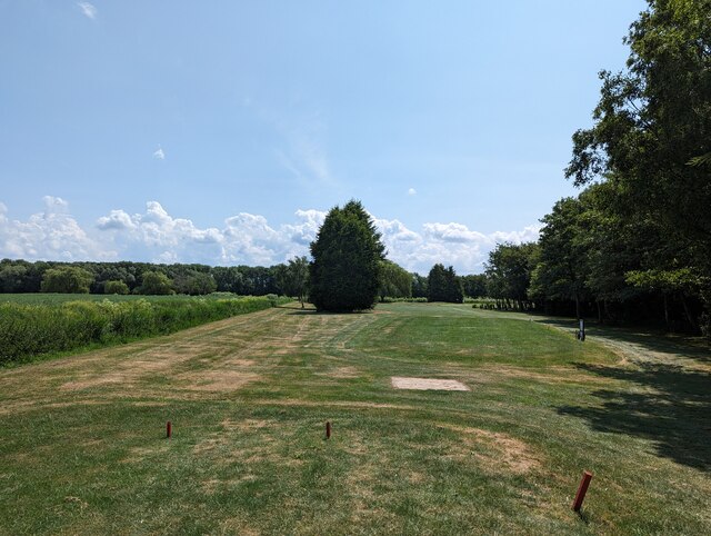
The downs of Middle Moor are characterized by gently sloping hills covered in lush green grasses, offering breathtaking panoramic views of the surrounding countryside. These open spaces provide an ideal habitat for a wide range of plant and animal species, attracting nature enthusiasts and birdwatchers alike.
In contrast, the moorland areas of Middle Moor are characterized by expanses of heather, interspersed with patches of bracken and gorse. This unique ecosystem supports a variety of wildlife, including rare bird species such as the Dartford warbler and stonechat. Visitors can explore the moorland by following well-maintained footpaths, immersing themselves in the peacefulness of this remote and untouched landscape.
Middle Moor also boasts several small woodlands, offering a stark contrast to the open downs and vast moorland. These wooded areas provide a habitat for an array of wildlife, including deer, badgers, and various bird species. Walking trails wind through these woodlands, allowing visitors to enjoy a serene and shaded environment as they meander through the trees.
Overall, Middle Moor in Huntingdonshire offers a diverse and stunning natural landscape, providing a haven for both wildlife and visitors seeking a peaceful retreat.
If you have any feedback on the listing, please let us know in the comments section below.
Middle Moor Images
Images are sourced within 2km of 52.487812/-0.1183851 or Grid Reference TL2789. Thanks to Geograph Open Source API. All images are credited.


Middle Moor is located at Grid Ref: TL2789 (Lat: 52.487812, Lng: -0.1183851)
Administrative County: Cambridgeshire
District: Huntingdonshire
Police Authority: Cambridgeshire
What 3 Words
///rationing.toddler.verb. Near Ramsey, Cambridgeshire
Nearby Locations
Related Wikis

Ramsey Mereside
Ramsey Mereside, known colloquially as "The Village", is a small village approximately 3.5 miles (5.6 km) north of the town of Ramsey, Cambridgeshire...

Ramsey St Mary's
Ramsey St Mary's is a village in Ramsey civil parish, part of the Huntingdonshire district of Cambridgeshire, England. == Church == During the 1850s, the...

Ramsey Forty Foot
Ramsey Forty Foot is a village in Ramsey civil parish, part of the Huntingdonshire district of Cambridgeshire, England. It lies on the Forty Foot Drain...
Pondersbridge
Pondersbridge is a village in Whittlesey civil parish, part of the Fenland district of Cambridgeshire, England. Pondersbridge is essentially a settlement...
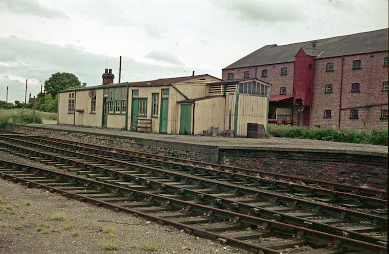
St Mary's railway station (England)
St. Mary's railway station was the intermediate railway station in Ramsey St Mary's, Cambridgeshire on the Great Northern railway line running from Holme...
Ramsey North railway station
Ramsey North railway station was a railway station in Ramsey, Cambridgeshire which is now closed. It was the terminus of a branch line from Holme on the...

Ramsey, Cambridgeshire
Ramsey is a market town and civil parish in the Huntingdonshire district of Cambridgeshire, England. The town is about 9 miles (14 km) north of Huntingdon...

Church of St Thomas à Becket, Ramsey
The Church of St Thomas à Becket, Ramsey is the Church of England parish church of Ramsey, Cambridgeshire (formerly Huntingdonshire). The parish is part...
Nearby Amenities
Located within 500m of 52.487812,-0.1183851Have you been to Middle Moor?
Leave your review of Middle Moor below (or comments, questions and feedback).