Aorangi Park
Downs, Moorland in Surrey
England
Aorangi Park

Aorangi Park is a picturesque public park located in Surrey, England. Situated on the Surrey Downs, the park spans across a vast area, encompassing both lush green meadows and rolling moorland. Offering breathtaking panoramic views of the surrounding countryside, Aorangi Park is a haven for nature lovers and outdoor enthusiasts.
The park boasts a diverse range of flora and fauna, with wildflowers, shrubs, and trees providing a vibrant and colorful landscape. The meadows are particularly renowned for their stunning displays of bluebells and daffodils during the spring season. Visitors can also spot various species of birds and small animals, adding to the park's natural charm.
Aorangi Park offers a plethora of recreational activities and amenities for visitors of all ages. The well-maintained walking trails and footpaths provide excellent opportunities for hiking, jogging, or leisurely strolls amidst the tranquil surroundings. Additionally, the park features picnic areas, perfect for enjoying a meal or a relaxing afternoon with family and friends.
For sports enthusiasts, Aorangi Park offers several sports facilities, including tennis courts, football pitches, and cricket grounds. These amenities attract both amateur and professional athletes, who can be seen honing their skills or participating in friendly matches.
Aorangi Park is easily accessible, with ample parking facilities and public transportation links nearby. The park's serene atmosphere and stunning scenery make it an ideal destination for a day out in nature, where visitors can unwind, connect with the environment, and enjoy the beauty of Surrey's Downs and Moorland.
If you have any feedback on the listing, please let us know in the comments section below.
Aorangi Park Images
Images are sourced within 2km of 51.435958/-0.21458434 or Grid Reference TQ2472. Thanks to Geograph Open Source API. All images are credited.


Aorangi Park is located at Grid Ref: TQ2472 (Lat: 51.435958, Lng: -0.21458434)
Unitary Authority: Merton
Police Authority: Metropolitan
What 3 Words
///rocky.inner.fame. Near Earlsfield, London
Nearby Locations
Related Wikis
No. 1 Court (Wimbledon)
No. 1 Court is a tennis court at the All England Lawn Tennis and Croquet Club, Wimbledon, London. Opened in 1997, it is used primarily for the Wimbledon...
Henman Hill
Aorangi Terrace, commonly known as "Henman Hill", alongside a series of other nicknames, is a mostly grassed banked area in the grounds of the All England...
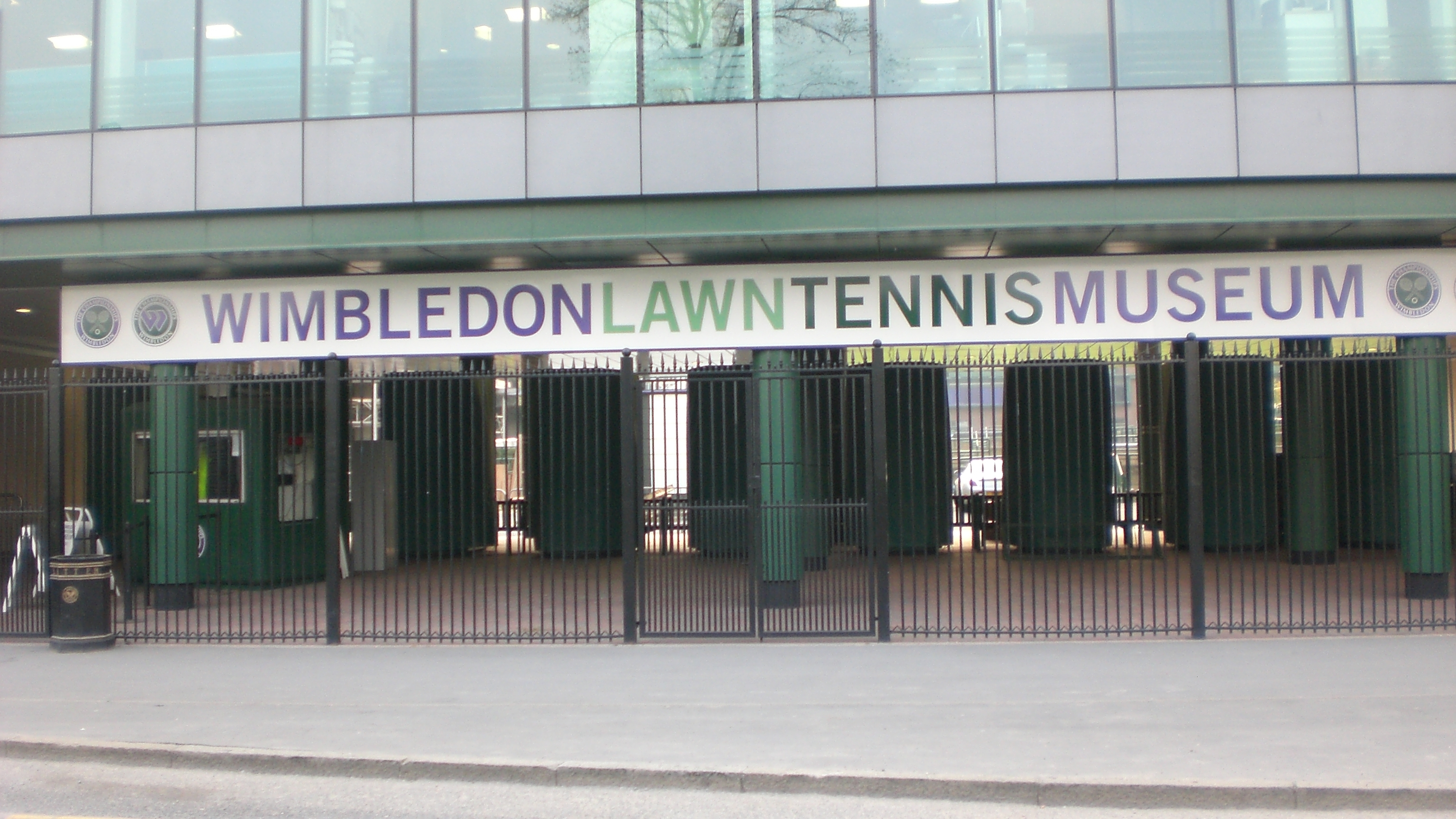
Wimbledon Lawn Tennis Museum
Wimbledon Lawn Tennis Museum (WLTM) is the largest tennis museum in the world. The museum was inaugurated at The Championships centenary event in 1977...

Radio Wimbledon
Radio Wimbledon was the official radio station to the annual Wimbledon Tennis Championships at the AELTC in Wimbledon. Their contract finished in 2011...

Centre Court
Centre Court is a tennis court at the All England Lawn Tennis and Croquet Club (also known as the All England Club) and is the main court used in The Championships...
Wimbledon Pro
The Wimbledon World Lawn Tennis Professional Championships, also known as the Wimbledon Pro, was a men's tennis tournament held in August 1967. The tournament...
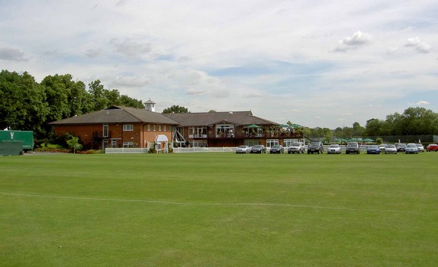
Wimbledon Cricket Club Ground
Wimbledon Cricket Club Ground is a cricket ground in Wimbledon, London. The ground is located opposite the All England Lawn Tennis and Croquet Club, famous...
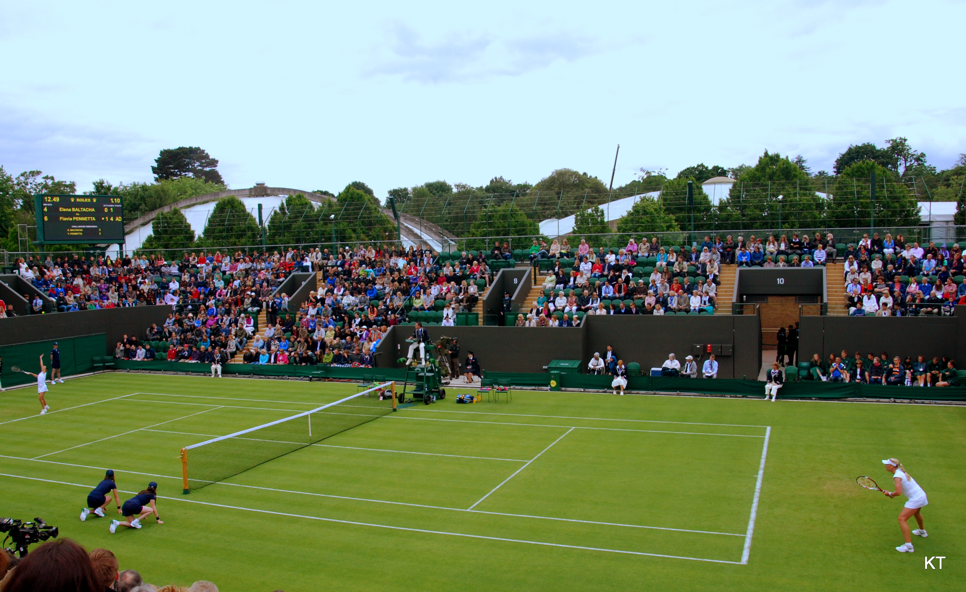
No. 3 Court (Wimbledon)
No. 3 Court is a tennis court at the All England Lawn Tennis and Croquet Club, Wimbledon, London. Unlike the other three Grand Slam events, Wimbledon does...
Nearby Amenities
Located within 500m of 51.435958,-0.21458434Have you been to Aorangi Park?
Leave your review of Aorangi Park below (or comments, questions and feedback).