Holderness

Downs, Moorland in Yorkshire

England

Holderness
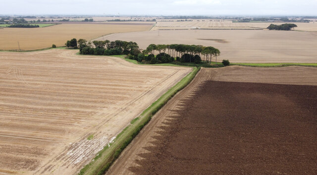
Farmland Copse This is a pretty little copse which breaks up the monotony of the flat Holderness Plain farmland.
Farmland Copse Credit: Andy Beecroft

The requested URL returned error: 429 Too Many Requests

If you have any feedback on the listing, please let us know in the comments section below.

Holderness Images

Images are sourced within 2km of 53.786557/-0.15922856 or Grid Reference TA2133. Thanks to Geograph Open Source API. All images are credited.
Farmland Copse This is a pretty little copse which breaks up the monotony of the flat Holderness Plain farmland.
Farmland Copse
This is a pretty little copse which breaks up the monotony of the flat Holderness Plain farmland.
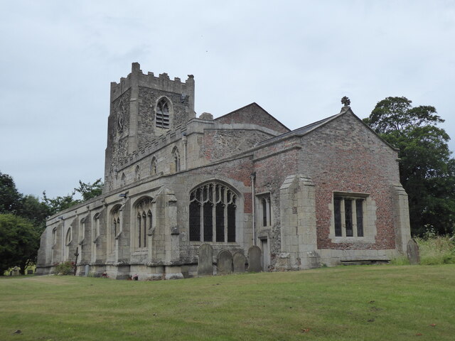
Humbleton, St Peter
Humbleton, St Peter
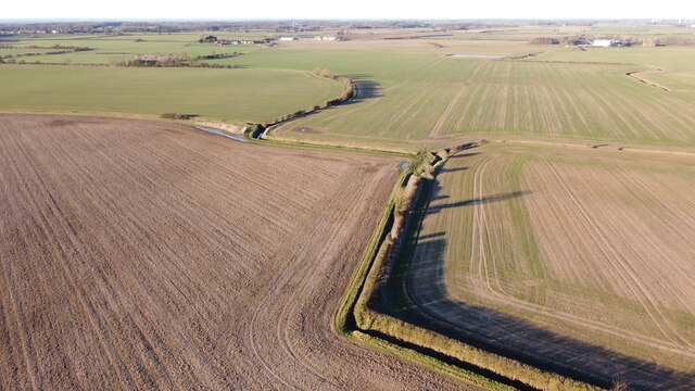
Zig Zags from the Air Farmland, in various locations in the Holderness area of East Yorkshire, has been suffering from severe flooding in places in the last couple of months.  Fortunately, this land seems to be fairly unscathed.  It's about 15 metres above sea level and even at this modest height seems to have escaped the worst consequences of the rain.
Zig Zags from the Air
Farmland, in various locations in the Holderness area of East Yorkshire, has been suffering from severe flooding in places in the last couple of months. Fortunately, this land seems to be fairly unscathed. It's about 15 metres above sea level and even at this modest height seems to have escaped the worst consequences of the rain.
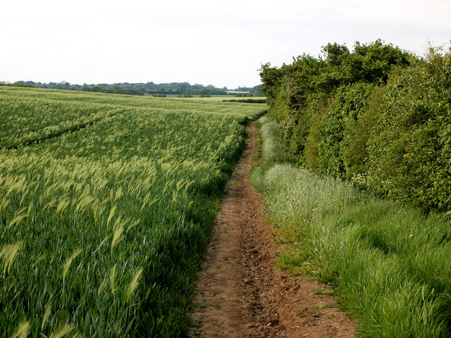
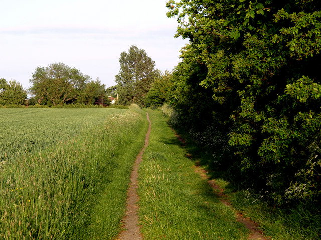
Footpath to Lelley The footpath is quite 'hilly' for this part of the very flat Holderness plain!  The field on the left is a wheatfield, but appears to be contaminated with last year's barley crop.
Footpath to Lelley
The footpath is quite 'hilly' for this part of the very flat Holderness plain! The field on the left is a wheatfield, but appears to be contaminated with last year's barley crop.
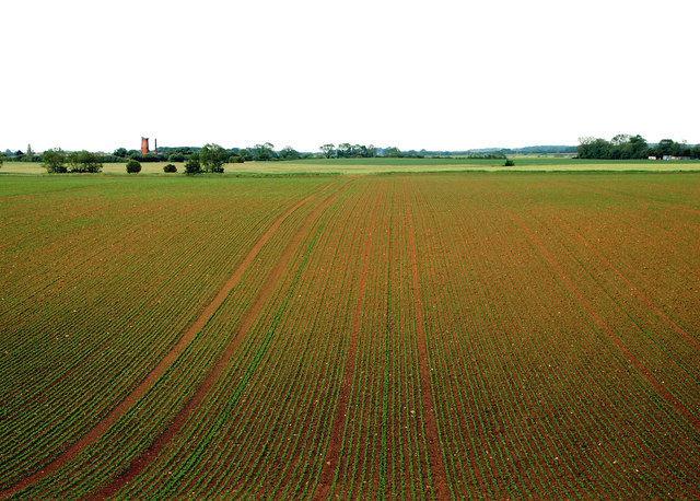
New Crop I've no idea what the new crop in the field is as it was too far away to see.  Peas perhaps?  The windmill in the background is near Elstronwick nearly a mile away.
New Crop
I've no idea what the new crop in the field is as it was too far away to see. Peas perhaps? The windmill in the background is near Elstronwick nearly a mile away.
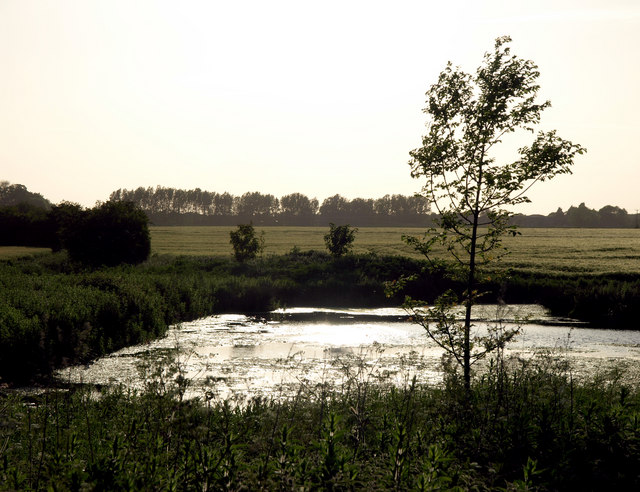
Small Pond east of Sproatley The pond is situated near to the Sproatley to Lelley path.
Small Pond east of Sproatley
The pond is situated near to the Sproatley to Lelley path.
Lelley Balk
Lelley Balk
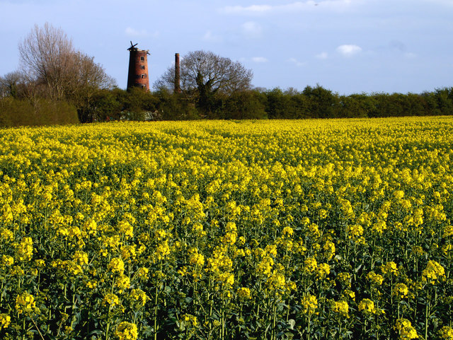
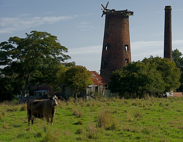
The Derelict Mill near Elstronwick The sail-less derelict windmill continues to relentlessly decay. The newly-flowered rapeseed has taken a lot longer than normal to reach this stage - presumably due to the cold weather we've had of late.
The Derelict Mill near Elstronwick
The sail-less derelict windmill continues to relentlessly decay. The newly-flowered rapeseed has taken a lot longer than normal to reach this stage - presumably due to the cold weather we've had of late.
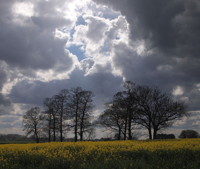
Trees near Humbleton Grange
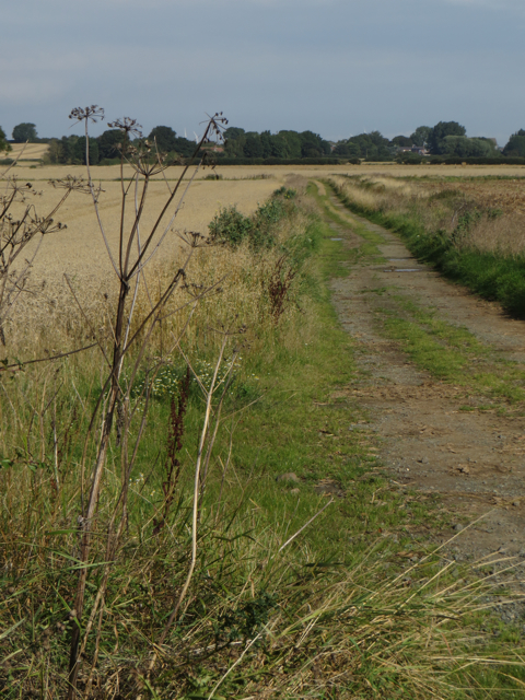
Farm track, Humbleton Track near Humbleton Manor Farm, leading to Flinton Grange from Long Lane
Farm track, Humbleton
Track near Humbleton Manor Farm, leading to Flinton Grange from Long Lane
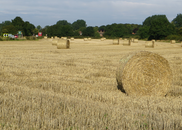
Bales near Lelley Seen from the public bridleway which leads from Newfield Lane towards Elstronwick
Bales near Lelley
Seen from the public bridleway which leads from Newfield Lane towards Elstronwick
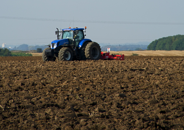
Ploughing near Humbleton Arable field cultivation close to Humbleton Road
Ploughing near Humbleton
Arable field cultivation close to Humbleton Road
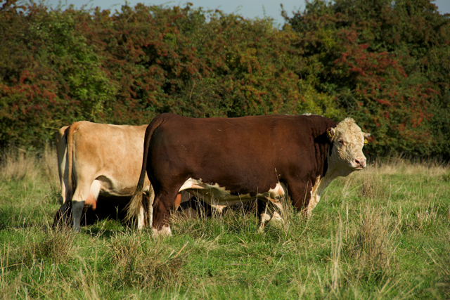
Elstronwick cattle Large bull, thankfully of apparently placid temperament (though I didn't test it) with several cows and calves in a field next to the mill
Elstronwick cattle
Large bull, thankfully of apparently placid temperament (though I didn't test it) with several cows and calves in a field next to the mill
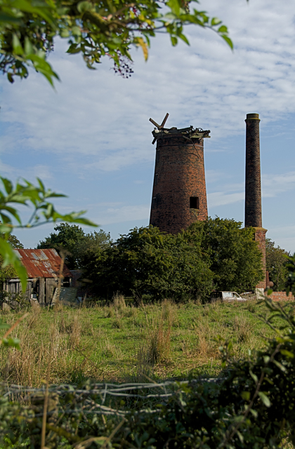
Old mill, Elstronwick In the relatively featureless and generally flat local landscape, this derelict windmill is a clearly visible landmark for miles around
Old mill, Elstronwick
In the relatively featureless and generally flat local landscape, this derelict windmill is a clearly visible landmark for miles around
Derelict mill, Elstronwick In the relatively featureless and generally flat local landscape, this derelict windmill is a clearly visible landmark for miles around. Seen from the public bridleway which crosses an adjacent field containing cows, calves and a large bull.
Derelict mill, Elstronwick
In the relatively featureless and generally flat local landscape, this derelict windmill is a clearly visible landmark for miles around. Seen from the public bridleway which crosses an adjacent field containing cows, calves and a large bull.
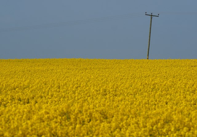
Power through the Field An 11,000V power line carries power over the fertile farmland of South Holderness.  The rapeseed crop has finally fully blossomed after weeks of colder than normal weather.
Power through the Field
An 11,000V power line carries power over the fertile farmland of South Holderness. The rapeseed crop has finally fully blossomed after weeks of colder than normal weather.
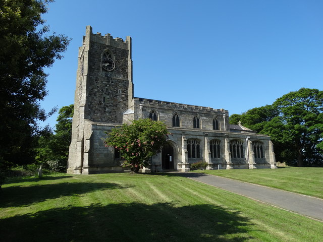
St Peter's Church, Humbleton
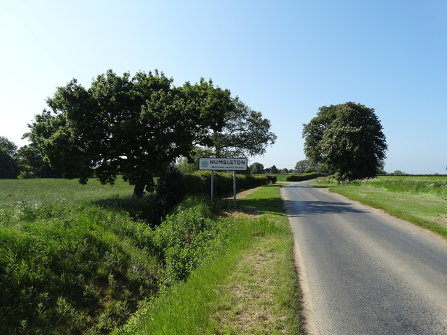
Entering Humbleton on Danthorpe Road
Show me another place!

Holderness is located at Grid Ref: TA2133 (Lat: 53.786557, Lng: -0.15922856)

Division: East Riding

Unitary Authority: East Riding of Yorkshire

Police Authority: Humberside

What 3 Words

///study.hissing.appointed. Near Humbleton, East Yorkshire

Nearby Locations

Holderness Horning Hill

Related Wikis

Holderness (borough)

Holderness was a local government district and borough in northern England, named after the Holderness peninsula. It was formed on 1 April 1974 along with...

Lelley

Lelley is a small village in the civil parish of Elstronwick, in the East Riding of Yorkshire, England, in an area known as Holderness. It is situated...

Beverley and Holderness (UK Parliament constituency)

Beverley and Holderness is a county constituency in the East Riding of Yorkshire for the House of Commons of the Parliament of the United Kingdom. It elects...

Humbleton

Humbleton is a village and civil parish in the East Riding of Yorkshire, England, in an area known as Holderness. It is situated approximately 9 miles...

Nearby Amenities

Located within 500m of 53.786557,-0.15922856
Power: pole
Lat/Long: 53.7845669/-0.153324
Power: pole
Lat/Long: 53.7849995/-0.155406
Power: pole
Lat/Long: 53.7854483/-0.15737
Power: pole
Lat/Long: 53.7855514/-0.1596432
Power: pole
Lat/Long: 53.7856856/-0.161835
Power: pole
Lat/Long: 53.7858267/-0.1640336
Power: pole
Lat/Long: 53.78599/-0.1663201
Power: pole
Lat/Long: 53.7830474/-0.1589692
Power: pole
Lat/Long: 53.7826132/-0.157612
Power: pole
Lat/Long: 53.7833295/-0.1599884
Power: pole
Lat/Long: 53.7822645/-0.1596237
Power: pole
Lat/Long: 53.7837605/-0.1615441
Power: pole
Lat/Long: 53.7841029/-0.1629281
Power: pole
Lat/Long: 53.7844483/-0.1642907
Power: pole
Lat/Long: 53.7847938/-0.1656479
The data included in this document is from www.openstreetmap.org. The data is made available under ODbL.

Have you been to Holderness?

Leave your review of Holderness below (or comments, questions and feedback).