Heathfield

Settlement in Somerset Somerset West and Taunton

England

Heathfield

Meadowside Cottages, Combe Florey See also <a href="https://www.geograph.org.uk/photo/5028206">ST1531 : Combe Florey View</a>.
Meadowside Cottages, Combe Florey Credit: Stephen Craven

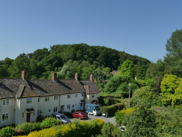
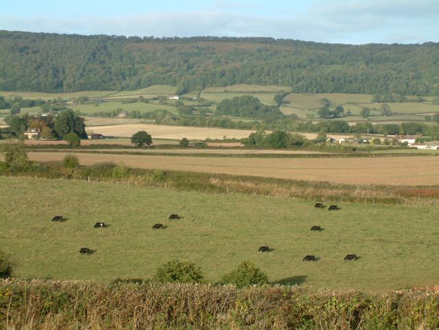
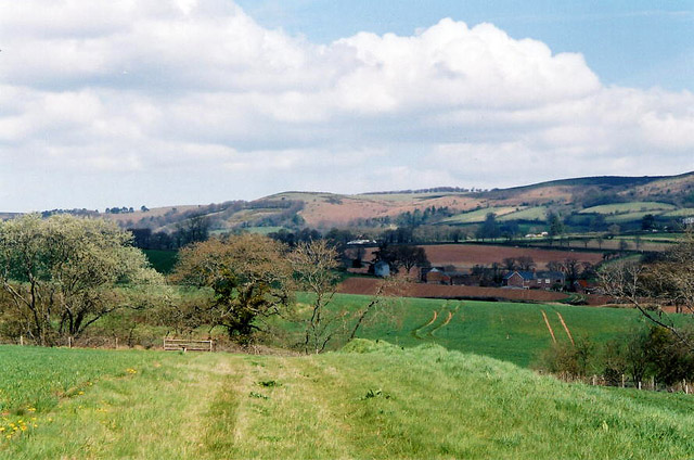
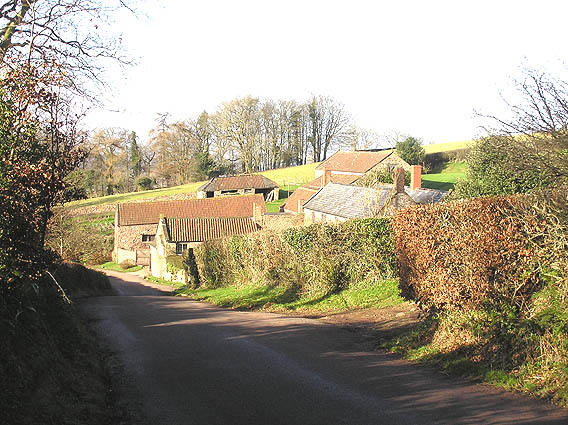
Heathfield is a small village located in the county of Somerset, England. Nestled in the picturesque countryside, it is situated approximately 3 miles northeast of Taunton, the county town. With a population of around 1,500 residents, it offers a peaceful and close-knit community atmosphere.

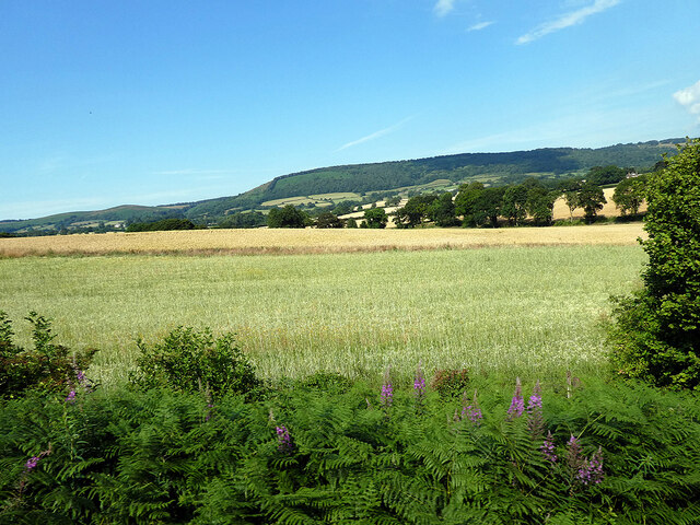
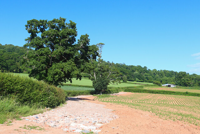
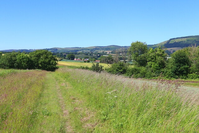
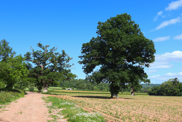
The village is known for its charming rural character, characterized by rolling hills, lush green fields, and quaint cottages. It benefits from its proximity to the stunning Quantock Hills, a designated Area of Outstanding Natural Beauty, providing residents and visitors with ample opportunities for outdoor activities such as walking, hiking, and cycling.

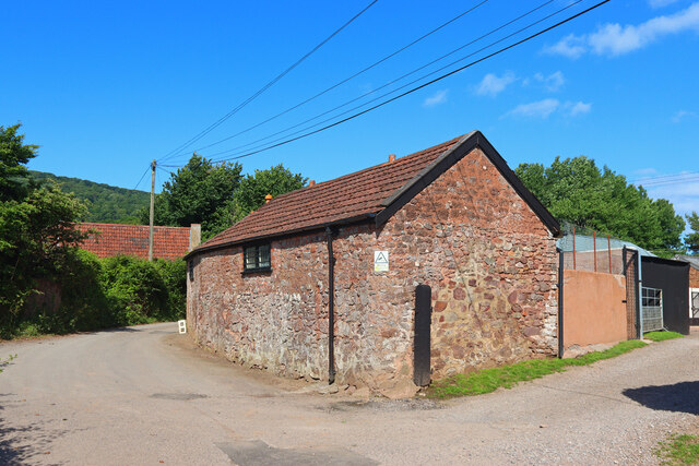
Heathfield boasts a range of amenities to cater to the needs of its residents. The village has a primary school, providing education for children aged 4-11, and there are several secondary schools in nearby towns. Additionally, there is a local convenience store, post office, and a couple of welcoming pubs offering a selection of food and drink.

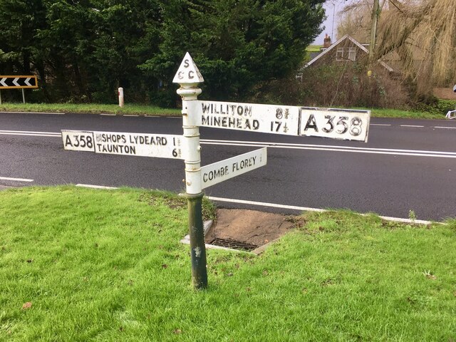
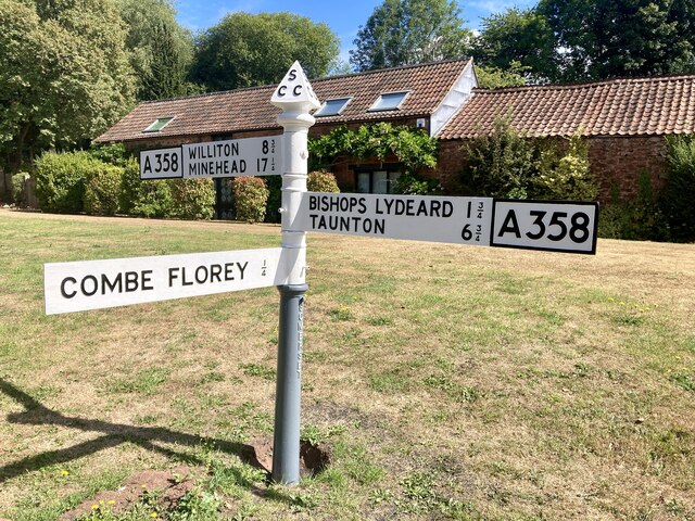
The village is well-connected, with good transport links to neighboring towns and cities. The A358 road runs through the village, connecting it to Taunton and the M5 motorway, providing easy access to Bristol and Exeter. There are also regular bus services that serve the village, making it convenient for commuting and traveling within the region.

In summary, Heathfield is a picturesque village in Somerset, offering a peaceful and friendly community, surrounded by stunning countryside and benefiting from good transport links. It is an ideal place for those seeking a rural lifestyle while still being within reach of urban amenities.

If you have any feedback on the listing, please let us know in the comments section below.
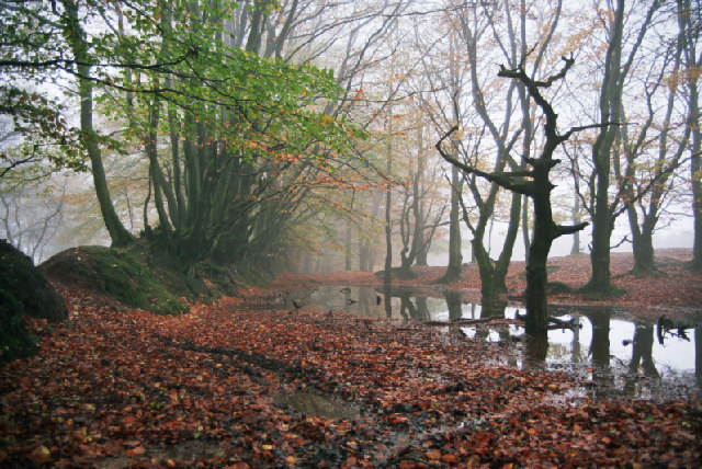
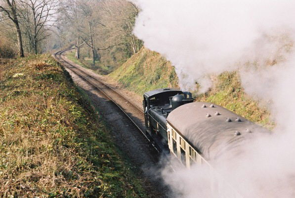
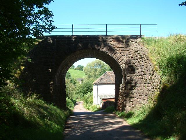
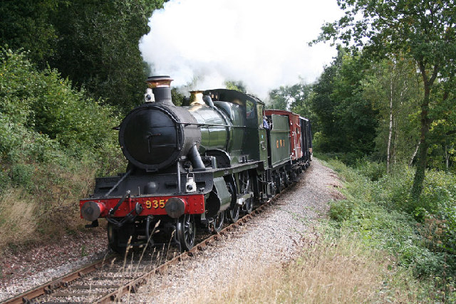
Heathfield Images

Images are sourced within 2km of 51.090138/-3.2007858 or Grid Reference ST1633. Thanks to Geograph Open Source API. All images are credited.

Meadowside Cottages, Combe Florey See also <a href="https://www.geograph.org.uk/photo/5028206">ST1531 : Combe Florey View</a>.
Meadowside Cottages, Combe Florey
Somerset County Council fingerpost - on the A358 Combe Florey SCC fingerpost condition in January 2022 prior to refurbishment, which is due to take place in the Summer of 2022. The post is on the A358 at the junction with the road leading into Combe Florey village.
Somerset County Council fingerpost - on the A358 Combe Florey
SCC fingerpost condition in January 2022 prior to refurbishment, which is due to take place in the Summer of 2022. The post is on the A358 at the junction with the road leading into Combe Florey village.
Crops beside the railway Near Crowcombe.
Crops beside the railway
Near Crowcombe.
Somerset County Council fingerpost - A358 Combe Florey Somerset County Council fingerpost - on the A358 at the Combe Florey junction which was refurbished in July 2022 as part of the Somerset County Council fingerpost restoration project. Repainting was undertaken by 2 volunteers working on behalf of Combe Florey parish council which provided the paints and materials.
Somerset County Council fingerpost - A358 Combe Florey
Somerset County Council fingerpost - on the A358 at the Combe Florey junction which was refurbished in July 2022 as part of the Somerset County Council fingerpost restoration project. Repainting was undertaken by 2 volunteers working on behalf of Combe Florey parish council which provided the paints and materials.
Near Crowcombe Field and trees near Crowcombe.
Near Crowcombe
Field and trees near Crowcombe.
Kennel Lane Entrance to the Stockham Lane kennels.
Kennel Lane
Entrance to the Stockham Lane kennels.
Nornvis Bridge Fields near the railway line.
Nornvis Bridge
Fields near the railway line.
Footpath near Crowcombe Trees by the footpath off New Road.
Footpath near Crowcombe
Trees by the footpath off New Road.
Track off the Quantock Drove Road near Wills Neck This point is on the Quantock ridge line about a half mile SE of Wills Neck.  Note the ancient wall on the left with trees growing out of it.  The practice of planting trees in walls is not uncommon in the area
Track off the Quantock Drove Road near Wills Neck
This point is on the Quantock ridge line about a half mile SE of Wills Neck. Note the ancient wall on the left with trees growing out of it. The practice of planting trees in walls is not uncommon in the area
West Somerset Railway, Churchlands Bridge, Combe Florey The steam-hauled train is heading up the grade to Crowcombe Heathfield
West Somerset Railway, Churchlands Bridge, Combe Florey
The steam-hauled train is heading up the grade to Crowcombe Heathfield
Nethercott Bridge The bridge carries the West Somerset Railway high above the quiet hamlet of Nethercott...
Nethercott Bridge
The bridge carries the West Somerset Railway high above the quiet hamlet of Nethercott...
Combe Florey: the West Somerset Railway near Nethercott Locomotive 9351 on a demonstration freight train from Bishop’s Lydeard to Williton. Note – a Photographer’s Lineside Pass has to be obtained from the WSR office at Minehead for access to railway property other than the trains and stations
Combe Florey: the West Somerset Railway near Nethercott
Locomotive 9351 on a demonstration freight train from Bishop’s Lydeard to Williton. Note – a Photographer’s Lineside Pass has to be obtained from the WSR office at Minehead for access to railway property other than the trains and stations
Railway Cutting near Trebles Holford
Combe Florey: West Somerset Railway at Nethercott 5553 heads a demonstration freight train on this heritage line. Note: a Photographer’s Lineside Pass has to be obtained from the railway’s office at Minehead for shots such as this on railway property
Combe Florey: West Somerset Railway at Nethercott
5553 heads a demonstration freight train on this heritage line. Note: a Photographer’s Lineside Pass has to be obtained from the railway’s office at Minehead for shots such as this on railway property
Farm at Nethercott Nearby was a notice about planning permission to convert the old stone barn into three dwellings...
Farm at Nethercott
Nearby was a notice about planning permission to convert the old stone barn into three dwellings...
Lydeard St Lawrence: towards Rich’s Holford Looking north-north-east from a footpath from Coursley with the Quantock Hills ahead. The West Somerset Railway runs beyond the field in the foreground
Lydeard St Lawrence: towards Rich’s Holford
Looking north-north-east from a footpath from Coursley with the Quantock Hills ahead. The West Somerset Railway runs beyond the field in the foreground
Tilbury Farm, Bagborough
The Rising Sun, Bagborough In small words below the "Rising Sun", it says Established 1573!
The Rising Sun, Bagborough
In small words below the "Rising Sun", it says Established 1573!
Show me another place!

Heathfield is located at Grid Ref: ST1633 (Lat: 51.090138, Lng: -3.2007858)

Administrative County: Somerset

District: Somerset West and Taunton

Police Authority: Avon and Somerset

What 3 Words

///plotted.drawn.corrupted. Near Bishops Lydeard, Somerset

Related Wikis

Cockercombe

Cockercombe is a hamlet within the civil parish of West Bagborough in the Somerset West and Taunton district of Somerset, England, approximately 8.3 miles...

Cockercombe tuff

Cockercombe Tuff is a greenish-grey, hard pyroclastic rock, formed by the compression of volcanic ash containing high quantities of chlorite, which gives...

Church of St Pancras, West Bagborough

The Anglican Church of St Pancras in West Bagborough, Somerset, England was built in the 15th century. It is a Grade II* listed building. == History... ==

Bagborough House

Bagborough House in West Bagborough, Somerset, England was built circa 1730. It was designated a Grade II* listed building on 4 May 1984.Bagborough House...

West Bagborough

West Bagborough is a village and civil parish in Somerset, England, about 5 miles (8.0 km) north of Taunton. In 2011, the village had a population of 358...

West Bagborough Hoard

The West Bagborough Hoard is a hoard of 670 Roman coins and 72 pieces of hacksilver found in October 2001 by metal detectorist James Hawkesworth near...

Combe Florey

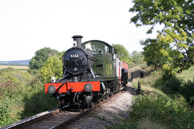
Combe Florey is a village and civil parish in Somerset, England, situated 6 miles (9.7 km) northwest of Taunton, on the West Somerset Railway. The village...

Combe Florey House

Combe Florey House in Combe Florey, Somerset, England is a country house dating from the early 18th century. It replaced an Elizabethan manor house which...

Nearby Amenities

Located within 500m of 51.090138,-3.2007858
Power: pole
Lat/Long: 51.0906772/-3.2066375
Power: pole
Lat/Long: 51.0884568/-3.2048968
Power: pole
Lat/Long: 51.0888481/-3.2052164
Brand: National Grid
Brand Wikidata: Q1465461
Design: two-level
Line Management: branch
Material: wood
Operator: National Grid Electricity Distribution Plc
Operator Old: Western Power Distribution
Operator Wikidata: Q7988183
Owner: National Grid Electricity Distribution (South West) Plc
Owner Wikidata: Q114397866
Power: pole
Lat/Long: 51.0897574/-3.2058871
Brand: National Grid
Brand Wikidata: Q1465461
Material: wood
Operator: National Grid Electricity Distribution Plc
Operator Old: Western Power Distribution
Operator Wikidata: Q7988183
Owner: National Grid Electricity Distribution (South West) Plc
Owner Wikidata: Q114397866
Power: pole
Lat/Long: 51.0906009/-3.1942243
Branch Type: split
Brand: National Grid
Brand Wikidata: Q1465461
Guyed: yes
Material: wood
Operator: National Grid Electricity Distribution Plc
Operator Old: Western Power Distribution
Operator Wikidata: Q7988183
Owner: National Grid Electricity Distribution (South West) Plc
Owner Wikidata: Q114397866
Pole: branch
Power: pole
Lat/Long: 51.0901993/-3.1962198
Brand: National Grid
Brand Wikidata: Q1465461
Guyed: yes
Material: wood
Operator: National Grid Electricity Distribution Plc
Operator Old: Western Power Distribution
Operator Wikidata: Q7988183
Owner: National Grid Electricity Distribution (South West) Plc
Owner Wikidata: Q114397866
Power: pole
Lat/Long: 51.0897613/-3.198564
Brand: National Grid
Brand Wikidata: Q1465461
Material: wood
Operator: National Grid Electricity Distribution Plc
Operator Old: Western Power Distribution
Operator Wikidata: Q7988183
Owner: National Grid Electricity Distribution (South West) Plc
Owner Wikidata: Q114397866
Power: pole
Lat/Long: 51.089394/-3.1958496
Brand: National Grid
Brand Wikidata: Q1465461
Material: wood
Operator: National Grid Electricity Distribution Plc
Operator Old: Western Power Distribution
Operator Wikidata: Q7988183
Owner: National Grid Electricity Distribution (South West) Plc
Owner Wikidata: Q114397866
Power: pole
Lat/Long: 51.088742/-3.195737
Brand: National Grid
Brand Wikidata: Q1465461
Material: wood
Operator: National Grid Electricity Distribution Plc
Operator Old: Western Power Distribution
Operator Wikidata: Q7988183
Owner: National Grid Electricity Distribution (South West) Plc
Owner Wikidata: Q114397866
Power: pole
Lat/Long: 51.0890999/-3.1995355
Power: pole
Lat/Long: 51.0901261/-3.2031487
Power: pole
Lat/Long: 51.0934193/-3.199769
Power: pole
Lat/Long: 51.089934/-3.2045059
Power: pole
Lat/Long: 51.0919941/-3.2003617
Brand: National Grid
Brand Wikidata: Q1465461
Material: wood
Operator: National Grid Electricity Distribution Plc
Operator Old: Western Power Distribution
Operator Wikidata: Q7988183
Owner: National Grid Electricity Distribution (South West) Plc
Owner Wikidata: Q114397866
Power: pole
Lat/Long: 51.0883603/-3.2006701
Power: pole
Lat/Long: 51.0911515/-3.20101
Power: pole
Lat/Long: 51.0942329/-3.1994391
Brand: National Grid
Brand Wikidata: Q1465461
Frequency: 50
Location Transition: yes
Material: wood
Operator: National Grid Electricity Distribution Plc
Operator Old: Western Power Distribution
Operator Wikidata: Q7988183
Owner: National Grid Electricity Distribution (South West) Plc
Owner Wikidata: Q114397866
Phases: 1
Power: pole
Transformer: distribution
Lat/Long: 51.0902944/-3.2016787
Brand: National Grid
Brand Wikidata: Q1465461
Material: wood
Operator: National Grid Electricity Distribution Plc
Operator Old: Western Power Distribution
Operator Wikidata: Q7988183
Owner: National Grid Electricity Distribution (South West) Plc
Owner Wikidata: Q114397866
Power: pole
Lat/Long: 51.0875836/-3.2019066
Post Box
Operator: Royal Mail
Operator Wikidata: Q638098
Post Box Type: wall
Ref: TA4 156
Royal Cypher: EVIIR
Royal Cypher Wikidata: Q33102324
Lat/Long: 51.0907085/-3.2003255
Access: private
Door: hinged
Door Type: double
Entrance: yes
Motorcar: private
Lat/Long: 51.0877418/-3.2055701
Access: private
Door: overhead
Entrance: yes
Motorcar: private
Lat/Long: 51.0867481/-3.2044317
Bbq
Covered: no
Fuel: charcoal
Lat/Long: 51.087061/-3.2052988
Access: customers
Entrance: main
Female: yes
Male: no
Lat/Long: 51.0867898/-3.2040789
Access: customers
Entrance: main
Female: no
Male: yes
Lat/Long: 51.0867818/-3.2040883
Bbq
Covered: no
Fuel: charcoal
Lat/Long: 51.0865147/-3.203609
Covered: no
Leisure: picnic_table
Lat/Long: 51.0865341/-3.2036801
Covered: no
Leisure: picnic_table
Lat/Long: 51.08666/-3.2037491
Direction: backward
Maxspeed: 50 mph
Maxspeed Type: GB:nsl_restricted
Source Maxspeed: sign
Traffic Sign: maxspeed
Lat/Long: 51.0873087/-3.2062
Give Way
Direction: forward
Lat/Long: 51.0877181/-3.2058379
Noexit: yes
Lat/Long: 51.0871979/-3.2034595
Noexit: yes
Lat/Long: 51.087224/-3.2037746
Brand: National Grid
Brand Wikidata: Q1465461
Frequency: 50
Location Transition: yes
Material: wood
Operator: National Grid Electricity Distribution Plc
Operator Old: Western Power Distribution
Operator Wikidata: Q7988183
Owner: National Grid Electricity Distribution (South West) Plc
Owner Wikidata: Q114397866
Power: pole
Transformer: distribution
Lat/Long: 51.0878112/-3.2044076
Brand: National Grid
Brand Wikidata: Q1465461
Material: wood
Operator: National Grid Electricity Distribution Plc
Operator Old: Western Power Distribution
Operator Wikidata: Q7988183
Owner: National Grid Electricity Distribution (South West) Plc
Owner Wikidata: Q114397866
Power: pole
Lat/Long: 51.087272/-3.2039597
Branch Type: split
Brand: National Grid
Brand Wikidata: Q1465461
Design: two-level
Guyed: yes
Material: wood
Operator: National Grid Electricity Distribution Plc
Operator Old: Western Power Distribution
Operator Wikidata: Q7988183
Owner: National Grid Electricity Distribution (South West) Plc
Owner Wikidata: Q114397866
Pole: branch
Power: pole
Lat/Long: 51.0866137/-3.2034346
Give Way
Direction: backward
Lat/Long: 51.0871208/-3.1961109
Give Way
Direction: forward
Lat/Long: 51.0904052/-3.2006116
The data included in this document is from www.openstreetmap.org. The data is made available under ODbL.

Have you been to Heathfield?

Leave your review of Heathfield below (or comments, questions and feedback).