West Bagborough

Settlement in Somerset Somerset West and Taunton

England

West Bagborough

Views towards Wills Neck
Views towards Wills Neck Credit: thejackrustles

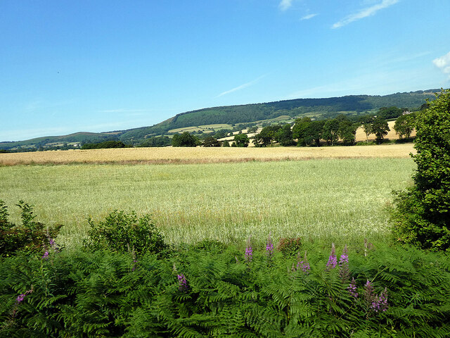
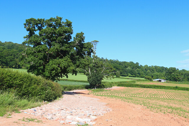
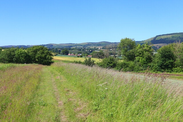
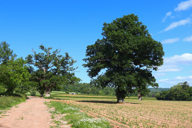
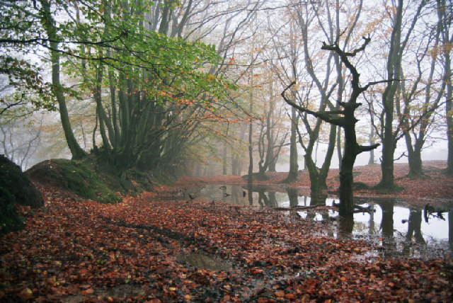
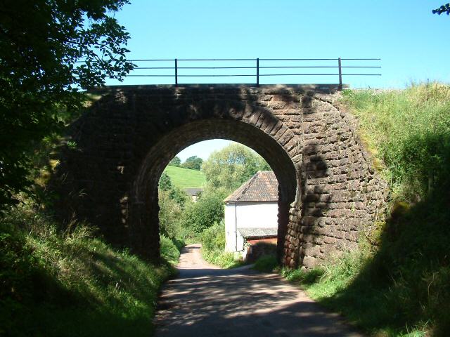
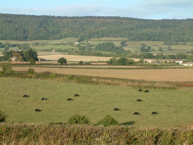
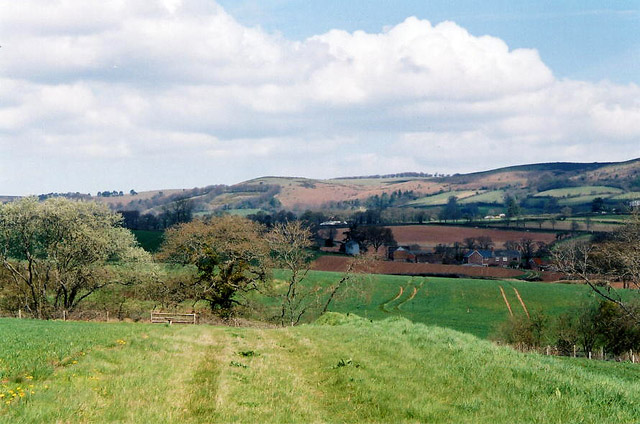
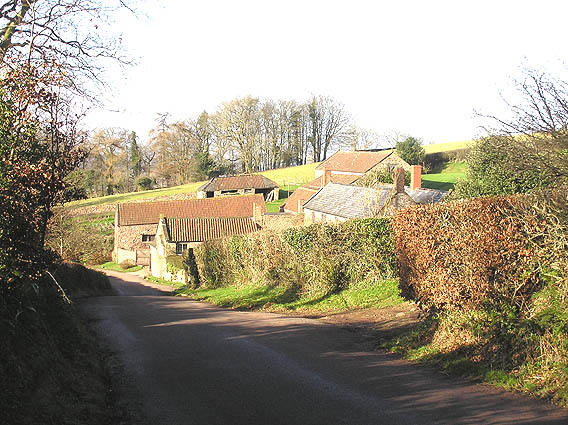
West Bagborough is a charming village located in the county of Somerset in southwest England. Situated on the southern slopes of the Quantock Hills, it offers breathtaking views of the surrounding countryside. The village is nestled amidst picturesque landscapes, with rolling hills, green pastures, and ancient woodlands.

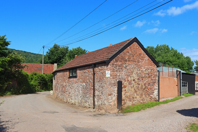
With a population of around 400 residents, West Bagborough is a close-knit community that exudes a friendly and welcoming atmosphere. Its history can be traced back to the Domesday Book, where it is mentioned as "Bageberge." The village has retained its traditional character, with many well-preserved historic buildings and cottages lining its streets.

The heart of West Bagborough is St. Pancras Church, a beautiful 12th-century building that is a testament to the village's rich heritage. The church is known for its stunning stained glass windows and intricate stone carvings. It serves as a focal point for community events and religious services.

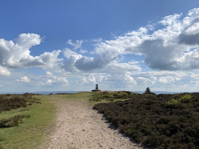
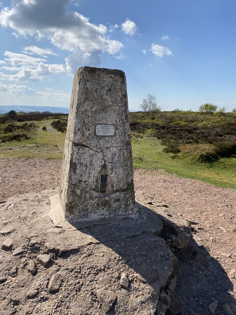
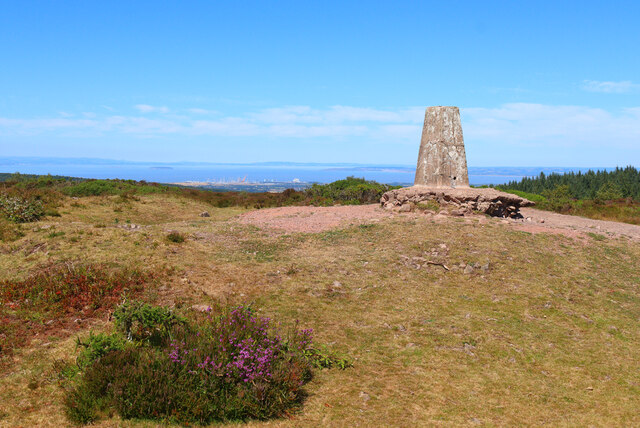
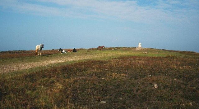
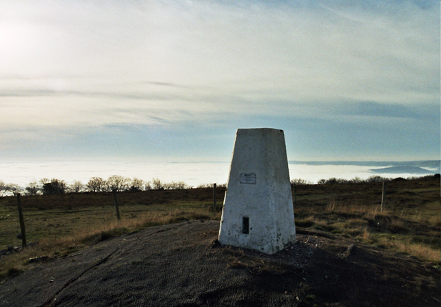
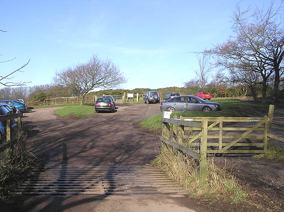
Nature enthusiasts will be delighted by the abundance of outdoor activities in the area. The Quantock Hills, designated as an Area of Outstanding Natural Beauty, provide ample opportunities for hiking, cycling, and horseback riding. The village is also close to Wills Neck, the highest point in the Quantocks, offering panoramic views of the surrounding countryside.

West Bagborough is conveniently located near the town of Taunton, which provides easy access to amenities, shopping centers, and transportation links. Overall, West Bagborough offers a peaceful and idyllic setting for those seeking a rural retreat in the heart of Somerset.

If you have any feedback on the listing, please let us know in the comments section below.

West Bagborough Images

Images are sourced within 2km of 51.094281/-3.198281 or Grid Reference ST1633. Thanks to Geograph Open Source API. All images are credited.

Views towards Wills Neck
Bagborough Trig Point Flush Bracket S1526
Crops beside the railway Near Crowcombe.
Crops beside the railway
Near Crowcombe.
Near Crowcombe Field and trees near Crowcombe.
Near Crowcombe
Field and trees near Crowcombe.
Kennel Lane Entrance to the Stockham Lane kennels.
Kennel Lane
Entrance to the Stockham Lane kennels.
Nornvis Bridge Fields near the railway line.
Nornvis Bridge
Fields near the railway line.
Footpath near Crowcombe Trees by the footpath off New Road.
Footpath near Crowcombe
Trees by the footpath off New Road.
Wills Neck Cairn at Wills Neck. The construction site of the Hinkley Point nuclear power station can be seen in the distance.
Wills Neck
Cairn at Wills Neck. The construction site of the Hinkley Point nuclear power station can be seen in the distance.
Wills Neck Summit The highest point of the Quantocks. The trig point is built on a tumulus.
Wills Neck Summit
The highest point of the Quantocks. The trig point is built on a tumulus.
The Trig Point on Wills Neck Wills Neck is the highest point on the Quantocks
The Trig Point on Wills Neck
Wills Neck is the highest point on the Quantocks
Track off the Quantock Drove Road near Wills Neck This point is on the Quantock ridge line about a half mile SE of Wills Neck.  Note the ancient wall on the left with trees growing out of it.  The practice of planting trees in walls is not uncommon in the area
Track off the Quantock Drove Road near Wills Neck
This point is on the Quantock ridge line about a half mile SE of Wills Neck. Note the ancient wall on the left with trees growing out of it. The practice of planting trees in walls is not uncommon in the area
Nethercott Bridge The bridge carries the West Somerset Railway high above the quiet hamlet of Nethercott...
Nethercott Bridge
The bridge carries the West Somerset Railway high above the quiet hamlet of Nethercott...
Railway Cutting near Trebles Holford
Combe Florey: West Somerset Railway at Nethercott 5553 heads a demonstration freight train on this heritage line. Note: a Photographer’s Lineside Pass has to be obtained from the railway’s office at Minehead for shots such as this on railway property
Combe Florey: West Somerset Railway at Nethercott
5553 heads a demonstration freight train on this heritage line. Note: a Photographer’s Lineside Pass has to be obtained from the railway’s office at Minehead for shots such as this on railway property
Farm at Nethercott Nearby was a notice about planning permission to convert the old stone barn into three dwellings...
Farm at Nethercott
Nearby was a notice about planning permission to convert the old stone barn into three dwellings...
Lydeard St Lawrence: towards Rich’s Holford Looking north-north-east from a footpath from Coursley with the Quantock Hills ahead. The West Somerset Railway runs beyond the field in the foreground
Lydeard St Lawrence: towards Rich’s Holford
Looking north-north-east from a footpath from Coursley with the Quantock Hills ahead. The West Somerset Railway runs beyond the field in the foreground
Lydeard Hill car park, Quantock Hills
Tilbury Farm, Bagborough
Show me another place!

West Bagborough is located at Grid Ref: ST1633 (Lat: 51.094281, Lng: -3.198281)

Administrative County: Somerset

District: Somerset West and Taunton

Police Authority: Avon and Somerset

What 3 Words

///escapades.farmer.composes. Near Bishops Lydeard, Somerset

Related Wikis

Cockercombe

Cockercombe is a hamlet within the civil parish of West Bagborough in the Somerset West and Taunton district of Somerset, England, approximately 8.3 miles...

Cockercombe tuff

Cockercombe Tuff is a greenish-grey, hard pyroclastic rock, formed by the compression of volcanic ash containing high quantities of chlorite, which gives...

Church of St Pancras, West Bagborough

The Anglican Church of St Pancras in West Bagborough, Somerset, England was built in the 15th century. It is a Grade II* listed building. == History... ==

Bagborough House

Bagborough House in West Bagborough, Somerset, England was built circa 1730. It was designated a Grade II* listed building on 4 May 1984.Bagborough House...

West Bagborough

West Bagborough is a village and civil parish in Somerset, England, about 5 miles (8.0 km) north of Taunton. In 2011, the village had a population of 358...

West Bagborough Hoard

The West Bagborough Hoard is a hoard of 670 Roman coins and 72 pieces of hacksilver found in October 2001 by metal detectorist James Hawkesworth near...

Wills Neck

Wills Neck is the highest summit on the Quantock Hills and one of the highest points in Somerset, England. Although only 1261 ft (384 m) high, it qualifies...

Combe Florey

Combe Florey is a village and civil parish in Somerset, England, situated 6 miles (9.7 km) northwest of Taunton, on the West Somerset Railway. The village...

Nearby Amenities

Located within 500m of 51.094281,-3.198281
West Bagborough
Is In: Somerset
Place: village
Population: 394
Wikidata: Q2583862
Wikipedia: en:West Bagborough
Lat/Long: 51.0943448/-3.1978409
Brand: National Grid
Brand Wikidata: Q1465461
Material: wood
Operator: National Grid Electricity Distribution Plc
Operator Old: Western Power Distribution
Operator Wikidata: Q7988183
Owner: National Grid Electricity Distribution (South West) Plc
Owner Wikidata: Q114397866
Power: pole
Lat/Long: 51.0906009/-3.1942243
Branch Type: split
Brand: National Grid
Brand Wikidata: Q1465461
Guyed: yes
Material: wood
Operator: National Grid Electricity Distribution Plc
Operator Old: Western Power Distribution
Operator Wikidata: Q7988183
Owner: National Grid Electricity Distribution (South West) Plc
Owner Wikidata: Q114397866
Pole: branch
Power: pole
Lat/Long: 51.0901993/-3.1962198
Power: pole
Lat/Long: 51.0934193/-3.199769
Power: pole
Lat/Long: 51.0948474/-3.1992077
Power: pole
Lat/Long: 51.0919941/-3.2003617
Power: pole
Lat/Long: 51.0911515/-3.20101
Power: pole
Lat/Long: 51.0942329/-3.1994391
West Bagborough Info Box
Booth: K6
Covered: booth
Disused Amenity: telephone
Man Made: telephone_box
Tourism: information
Lat/Long: 51.0940858/-3.1969875
Post Box
Operator: Royal Mail
Operator Wikidata: Q638098
Post Box Type: wall
Ref: TA4 150
Royal Cypher: EVIIR
Royal Cypher Wikidata: Q33102324
Lat/Long: 51.0946744/-3.1916705
Post Box
Operator: Royal Mail
Operator Wikidata: Q638098
Post Box Type: wall
Ref: TA4 156
Royal Cypher: EVIIR
Royal Cypher Wikidata: Q33102324
Lat/Long: 51.0907085/-3.2003255
Post Box
Operator: Royal Mail
Operator Wikidata: Q638098
Post Box Type: lamp
Ref: TA4 536
Royal Cypher: EIIR
Royal Cypher Wikidata: Q33102113
Lat/Long: 51.0942105/-3.1976049
Material: wood
Power: pole
Lat/Long: 51.0962543/-3.2002032
Give Way
Direction: forward
Lat/Long: 51.0904052/-3.2006116
Entrance: yes
Lat/Long: 51.0939457/-3.1968174
Defibrillator
Defibrillator Location: outside West Bagborough Village Hall
Emergency: defibrillator
Indoor: no
Lat/Long: 51.0939749/-3.1968008
The data included in this document is from www.openstreetmap.org. The data is made available under ODbL.

Have you been to West Bagborough?

Leave your review of West Bagborough below (or comments, questions and feedback).