Heathfield

Settlement in Somerset Somerset West and Taunton

England

Heathfield

Norton Fitzwarren: view north to the Quantocks Taken overlooking Dollings Farm, a little to the west of Heathfield, on the Norton Fitzwarren - Oake parish boundary
Norton Fitzwarren: view north to the Quantocks Credit: Martin Bodman

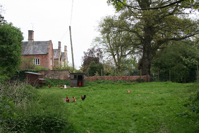
Heathfield is a small village located in the county of Somerset, England. Situated approximately 6 miles east of Taunton, it is surrounded by beautiful countryside and offers a peaceful and rural setting for its residents. The village has a population of around 500 people, making it a close-knit and friendly community.

Heathfield is known for its picturesque landscapes, with rolling hills and fields stretching as far as the eye can see. The village is surrounded by farmland, providing ample opportunities for outdoor activities such as hiking and cycling. The nearby Heathfield Park offers a tranquil retreat for nature lovers, with its well-maintained gardens and scenic walking paths.

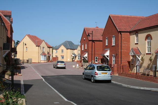
Despite its small size, Heathfield has a number of amenities to cater to its residents. The village boasts a primary school, a post office, and a pub, serving as a social hub for locals. The nearby market town of Taunton provides additional facilities, including supermarkets, shops, and leisure centers, just a short drive away.

Heathfield also benefits from excellent transport links, with easy access to major road networks such as the A38 and M5 motorway. The village is well-connected by public transport, with regular bus services to Taunton and surrounding areas.

Overall, Heathfield offers a peaceful and idyllic setting for those seeking a rural lifestyle, while still providing access to necessary amenities and transport links. Its stunning natural surroundings and friendly community make it an appealing place to reside.

If you have any feedback on the listing, please let us know in the comments section below.

Heathfield Images

Images are sourced within 2km of 51.030204/-3.199565 or Grid Reference ST1526. Thanks to Geograph Open Source API. All images are credited.

Norton Fitzwarren: view north to the Quantocks Taken overlooking Dollings Farm, a little to the west of Heathfield, on the Norton Fitzwarren - Oake parish boundary
Norton Fitzwarren: view north to the Quantocks
Taken overlooking Dollings Farm, a little to the west of Heathfield, on the Norton Fitzwarren - Oake parish boundary
Milverton: Blagrove’s Farm, Hillcommon Seen from a public footpath between Weekmoor and Oake: looking north-north-east. In the nineteenth century the farm had water power, utilising a leat from the Hillfarrance Brook
Milverton: Blagrove’s Farm, Hillcommon
Seen from a public footpath between Weekmoor and Oake: looking north-north-east. In the nineteenth century the farm had water power, utilising a leat from the Hillfarrance Brook
Pontispool cottages
Pontispool cottages
Oake church
Oake church
Hillfarance church
Hillfarance church
Oake: Hillcommon Looking east on the road from Wiveliscombe to Taunton with the Royal Oak Inn on the right, just in the next square
Oake: Hillcommon
Looking east on the road from Wiveliscombe to Taunton with the Royal Oak Inn on the right, just in the next square
Bishops Lydeard: Cotford St Luke A major housing development on and by the site of the Tone Vale Hospital. Looking north
Bishops Lydeard: Cotford St Luke
A major housing development on and by the site of the Tone Vale Hospital. Looking north
Bishops Lydeard: Cotford St Luke New housing at Burge Meadow. Looking roughly east
Bishops Lydeard: Cotford St Luke
New housing at Burge Meadow. Looking roughly east
Oake: lane by The Old Rectory Looking west-north-west
Oake: lane by The Old Rectory
Looking west-north-west
Norton Fitzwarren: Heathfield church and cross Looking west-south-west
Norton Fitzwarren: Heathfield church and cross
Looking west-south-west
Oake: orchard at Hillcommon Looking south west
Oake: orchard at Hillcommon
Looking south west
Norton Fitzwarren: stile at Heathfield Start of footpath to Cotford St Luke. Looking north east
Norton Fitzwarren: stile at Heathfield
Start of footpath to Cotford St Luke. Looking north east
Bishop's Lydeard: lane near Stallenge Farm Looking north on a no-through road with the Quantocks in the background
Bishop's Lydeard: lane near Stallenge Farm
Looking north on a no-through road with the Quantocks in the background
Oake: old orchard at Monty’s Court Looking south-south-west
Oake: old orchard at Monty’s Court
Looking south-south-west
Norton Fitzwarren: free range at Monty’s Court Looking south east
Norton Fitzwarren: free range at Monty’s Court
Looking south east
Oake telephone box This is No 10 of 42 images of BT telephone boxes in Taunton Deane which BT is trying to cull due to their claimed 'lack of use'.  If you would like to see this phone box stay in situ, please email savethispayphone@ukpayphone.com
Oake telephone box
This is No 10 of 42 images of BT telephone boxes in Taunton Deane which BT is trying to cull due to their claimed 'lack of use'. If you would like to see this phone box stay in situ, please email savethispayphone@ukpayphone.com
Hillcommon telephone box (B3227) This is No 11 of 42 images of BT telephone boxes in Taunton Deane which BT is trying to cull due to their claimed 'lack of use'.  If you would like to see this phone box stay in situ, please email savethispayphone@ukpayphone.com
Hillcommon telephone box (B3227)
This is No 11 of 42 images of BT telephone boxes in Taunton Deane which BT is trying to cull due to their claimed 'lack of use'. If you would like to see this phone box stay in situ, please email savethispayphone@ukpayphone.com
Monty's Court The front of the house from the shrubbery.
Monty's Court
The front of the house from the shrubbery.
Show me another place!

Heathfield is located at Grid Ref: ST1526 (Lat: 51.030204, Lng: -3.199565)

Administrative County: Somerset

District: Somerset West and Taunton

Police Authority: Avon and Somerset

What 3 Words

///tenders.afternoon.mopped. Near Bishops Lydeard, Somerset

Nearby Locations

Heathfield Hillcommon

Related Wikis

Church of St John the Baptist, Heathfield

The Church of St John the Baptist in Heathfield, Somerset, England was built in the 13th century, from which the tower remains. It is a Grade II listed...

Oake

Oake is a village and civil parish in Somerset, England, situated 5 miles (8.0 km) west of Taunton. The village has a population of 765.The parish includes...

Cotford St Luke

Cotford St Luke () is a village and civil parish in Somerset, England. It is located approximately 2 miles (3.2 km) northwest of Norton Fitzwarren and...

Tone Vale Hospital

Tone Vale Hospital was a psychiatric hospital located approximately 3 kilometres (1.9 mi) to the north west of Norton Fitzwarren, near Taunton, Somerset...

Merrifield Children's Unit

Merrifield Children's Unit (also known as Merryfield or colloquially as Merrifields) was a residential children's and adolescents' psychiatric institution...

Church of St Bartholomew, Oake

The Church of St Bartholomew in Oake, Somerset, England was built in the 13th century. It is a Grade II* listed building. == History == The first part...

Church of the Holy Cross, Hillfarrance

The Church of the Holy Cross in Hillfarrance, Oake, Somerset, England was built in the 14th century. It is a Grade II* listed building. == History == The...

Lang's Farm

Lang's Farm (grid reference ST170241) is a 7.5 hectare (18.5 acre) biological Site of Special Scientific Interest between Oake and Bradford on Tone in...

Nearby Amenities

Located within 500m of 51.030204,-3.199565
Halse Corner
Is In: Somerset, England, United Kingdom
Place: locality
Lat/Long: 51.032159/-3.2010082
Brand: National Grid
Brand Wikidata: Q1465461
Colour: gray
Line Attachment: suspension
Material: metal
Operator: National Grid Electricity Distribution Plc
Operator Old: Western Power Distribution
Operator Wikidata: Q7988183
Owner: National Grid Electricity Distribution (South West) Plc
Owner Wikidata: Q114397866
Power: tower
Source: bing
Structure: lattice
Lat/Long: 51.0322879/-3.1972988
Brand: National Grid
Brand Wikidata: Q1465461
Colour: gray
Line Attachment: suspension
Material: metal
Operator: National Grid Electricity Distribution Plc
Operator Old: Western Power Distribution
Operator Wikidata: Q7988183
Owner: National Grid Electricity Distribution (South West) Plc
Owner Wikidata: Q114397866
Power: tower
Source: bing
Structure: lattice
Lat/Long: 51.0299684/-3.1954692
Heathfield
Place: hamlet
Lat/Long: 51.031251/-3.1986004
Post Box
Operator: Royal Mail
Operator Wikidata: Q638098
Lat/Long: 51.0294834/-3.1967831
Direction: backward
Maxspeed: 40 mph
Source Maxspeed: sign
Traffic Sign: maxspeed
Lat/Long: 51.0287291/-3.2044723
Give Way
Direction: backward
Lat/Long: 51.0291565/-3.1967921
Barrier: stile
Bicycle: no
Foot: yes
Lat/Long: 51.0292025/-3.2008377
Barrier: stile
Bicycle: no
Foot: yes
Lat/Long: 51.0307503/-3.1979129
Barrier: stile
Lat/Long: 51.0315505/-3.1970095
Brand: National Grid
Brand Wikidata: Q1465461
Material: wood
Operator: National Grid Electricity Distribution Plc
Operator Old: Western Power Distribution
Operator Wikidata: Q7988183
Owner: National Grid Electricity Distribution (South West) Plc
Owner Wikidata: Q114397866
Power: pole
Lat/Long: 51.0277708/-3.1955831
Brand: National Grid
Brand Wikidata: Q1465461
Material: wood
Operator: National Grid Electricity Distribution Plc
Operator Old: Western Power Distribution
Operator Wikidata: Q7988183
Owner: National Grid Electricity Distribution (South West) Plc
Owner Wikidata: Q114397866
Power: pole
Lat/Long: 51.0277256/-3.1970112
Brand: National Grid
Brand Wikidata: Q1465461
Material: wood
Operator: National Grid Electricity Distribution Plc
Operator Old: Western Power Distribution
Operator Wikidata: Q7988183
Owner: National Grid Electricity Distribution (South West) Plc
Owner Wikidata: Q114397866
Power: pole
Lat/Long: 51.027672/-3.1987218
Brand: National Grid
Brand Wikidata: Q1465461
Material: wood
Operator: National Grid Electricity Distribution Plc
Operator Old: Western Power Distribution
Operator Wikidata: Q7988183
Owner: National Grid Electricity Distribution (South West) Plc
Owner Wikidata: Q114397866
Power: pole
Lat/Long: 51.0276183/-3.2004731
Give Way
Lat/Long: 51.0321686/-3.2010312
Brand: National Grid
Brand Wikidata: Q1465461
Material: wood
Operator: National Grid Electricity Distribution Plc
Operator Old: Western Power Distribution
Operator Wikidata: Q7988183
Owner: National Grid Electricity Distribution (South West) Plc
Owner Wikidata: Q114397866
Power: pole
Lat/Long: 51.0280414/-3.1941521
Brand: National Grid
Brand Wikidata: Q1465461
Material: wood
Operator: National Grid Electricity Distribution Plc
Operator Old: Western Power Distribution
Operator Wikidata: Q7988183
Owner: National Grid Electricity Distribution (South West) Plc
Owner Wikidata: Q114397866
Power: pole
Lat/Long: 51.0274802/-3.2048629
Brand: National Grid
Brand Wikidata: Q1465461
Guyed: yes
Material: wood
Operator: National Grid Electricity Distribution Plc
Operator Old: Western Power Distribution
Operator Wikidata: Q7988183
Owner: National Grid Electricity Distribution (South West) Plc
Owner Wikidata: Q114397866
Power: pole
Lat/Long: 51.0275687/-3.2022598
Brand: National Grid
Brand Wikidata: Q1465461
Devices: 1
Guyed: yes
Material: wood
Operator: National Grid Electricity Distribution Plc
Operator Old: Western Power Distribution
Operator Wikidata: Q7988183
Owner: National Grid Electricity Distribution (South West) Plc
Owner Wikidata: Q114397866
Phases: 3
Power: pole
Transformer: distribution
Lat/Long: 51.0285126/-3.2025468
The data included in this document is from www.openstreetmap.org. The data is made available under ODbL.

Have you been to Heathfield?

Leave your review of Heathfield below (or comments, questions and feedback).