George's Gorse

Downs, Moorland in Sussex Horsham

England

George's Gorse

Scene near the south bank of the River Adur This path is often difficult to follow after heavy rain and flooding. There were no such difficulties today.
Scene near the south bank of the River Adur Credit: Ian Cunliffe

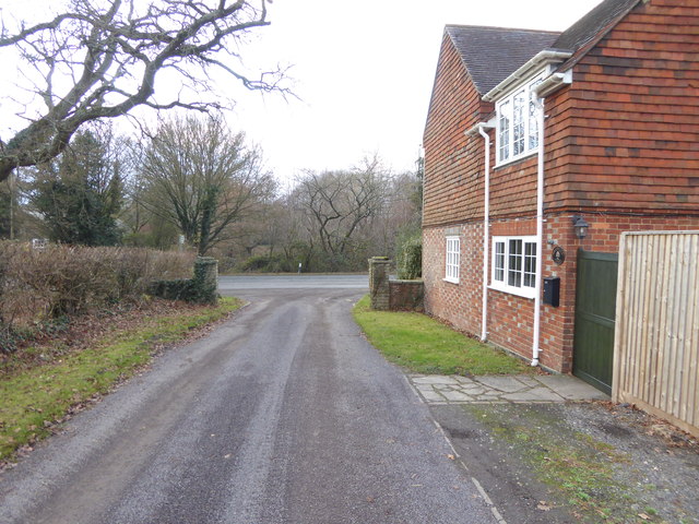
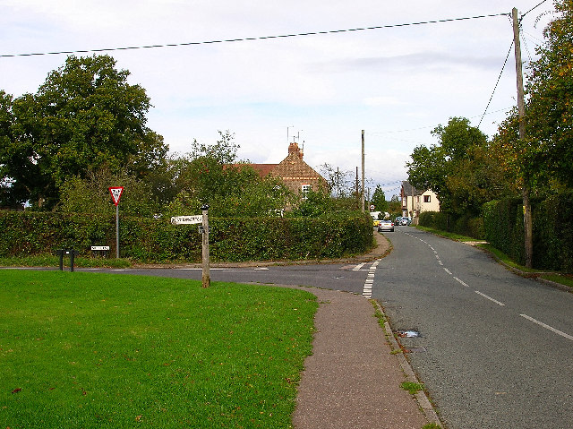
George's Gorse, located in the county of Sussex, is a picturesque area nestled within the Sussex Downs and Moorland. Spanning over acres of stunning landscape, this region offers a diverse range of natural beauty and recreational opportunities.

The area is characterized by its vast expanses of rolling hills, covered in vibrant yellow gorse bushes that bloom in the spring, creating a breathtaking sight. The gorse, a flowering shrub native to the region, adds a splash of color to the otherwise green and brown landscape. The fragrance of the gorse flowers fills the air, creating a sensory experience for visitors.

The Sussex Downs and Moorland provide a haven for wildlife enthusiasts and nature lovers. The diverse ecosystem supports a wide variety of plant and animal species. Visitors may encounter rare birds, such as the Dartford warbler and the stonechat, as well as butterflies and bees attracted to the gorse flowers. It is not uncommon to spot grazing animals, such as sheep and cows, as they roam freely across the open grasslands.

Hiking and walking trails crisscross the area, allowing visitors to explore the stunning vistas and immerse themselves in the tranquility of the landscape. The undulating terrain offers an opportunity for outdoor activities like cycling and horseback riding, providing an exhilarating experience for adventure seekers.

George's Gorse, Sussex, is a destination that offers a peaceful retreat from the hustle and bustle of everyday life. Its natural beauty, diverse wildlife, and recreational opportunities make it an ideal location for those seeking a connection with nature and a chance to unwind in a breathtaking setting.

If you have any feedback on the listing, please let us know in the comments section below.

George's Gorse Images

Images are sourced within 2km of 50.968886/-0.28713027 or Grid Reference TQ2020. Thanks to Geograph Open Source API. All images are credited.

Scene near the south bank of the River Adur This path is often difficult to follow after heavy rain and flooding. There were no such difficulties today.
Scene near the south bank of the River Adur
This path is often difficult to follow after heavy rain and flooding. There were no such difficulties today.
Tree overhanging the river Adur
St Hugh's Charterhouse monastery This place has huge footprint on the OS map, yet I understand that only about 25 monks live here. The spire is visible from miles away on the Downs, yet you could easily drive down the nearby A281 without even spotting it.
St Hugh's Charterhouse monastery
This place has huge footprint on the OS map, yet I understand that only about 25 monks live here. The spire is visible from miles away on the Downs, yet you could easily drive down the nearby A281 without even spotting it.
Looking south on the A281 past footpath crossing See also <a title="https://www.geograph.org.uk/photo/3228295" href="https://www.geograph.org.uk/photo/3228295">Link</a>.
Looking south on the A281 past footpath crossing
See also Link.
Weatherfox on Dragons Lane
Looking west on Dragons Lane Dragons Lane is a public bridleway.
Looking west on Dragons Lane
Dragons Lane is a public bridleway.
Dragons Farm on Dragons Lane See also <a title="https://www.geograph.org.uk/photo/1502257" href="https://www.geograph.org.uk/photo/1502257">Link</a> from 2009.
Dragons Farm on Dragons Lane
See also Link from 2009.
Looking east on Dragons Lane from footpath junction
Footpath passes through corner of field near Crateman's Farm
Signpost at footpath change of direction
Stile on footpath
Stile on footpath
Footbridge on Cowfold Stream A view the other way is at <a title="https://www.geograph.org.uk/photo/252771" href="https://www.geograph.org.uk/photo/252771">Link</a>.
Footbridge on Cowfold Stream
A view the other way is at Link.
Footpath leaves field by kissing gate
Kissing gate where footpath leaves driveway The kissing gate has replaced a stile since <a title="https://www.geograph.org.uk/photo/1901457" href="https://www.geograph.org.uk/photo/1901457">Link</a>.
Kissing gate where footpath leaves driveway
The kissing gate has replaced a stile since Link.
Footpath heads west by Gratwicke Lodge The A281 is ahead.  see also <a title="https://www.geograph.org.uk/photo/1275594" href="https://www.geograph.org.uk/photo/1275594">Link</a>.
Footpath heads west by Gratwicke Lodge
The A281 is ahead. see also Link.
Looking south on the A281 from bus stop
Royal Mail box at the end of a footpath on the A281
Footpath goes west from the A281
Show me another place!

George's Gorse is located at Grid Ref: TQ2020 (Lat: 50.968886, Lng: -0.28713027)

Administrative County: West Sussex

District: Horsham

Police Authority: Sussex

What 3 Words

///remembers.galleries.bluff. Near Partridge Green, West Sussex

Related Wikis

St Hugh's Charterhouse

St Hugh's Charterhouse, Parkminster, is the only post-Reformation Carthusian monastery in the United Kingdom. It is located in the parish of Cowfold, West...

Henfield (electoral division)

Henfield is an electoral division of West Sussex in the United Kingdom and returns one member to sit on West Sussex County Council. The current County...

Shermanbury

Shermanbury is a village and civil parish in the Horsham District of West Sussex, England. It lies on the A281 road approximately 2 miles (3 km) north...

Littleworth, West Sussex

Littleworth is a hamlet in the Horsham District of West Sussex, England. It lies on the Partridge Green to Maplehurst road 2.9 miles (4.7 km) north of...

Nearby Amenities

Located within 500m of 50.968886,-0.28713027
Power: pole
Lat/Long: 50.9657824/-0.2911425
Power: pole
Lat/Long: 50.965986/-0.2904186
Power: pole
Lat/Long: 50.9664353/-0.2897105
Power: pole
Lat/Long: 50.9669015/-0.2891931
Power: pole
Lat/Long: 50.9674875/-0.2886347
Power: pole
Lat/Long: 50.967786/-0.2881277
Power: pole
Lat/Long: 50.9679476/-0.2872964
Power: pole
Lat/Long: 50.9680635/-0.2862789
Power: pole
Lat/Long: 50.9682101/-0.2849054
Power: pole
Lat/Long: 50.968219/-0.2844457
The data included in this document is from www.openstreetmap.org. The data is made available under ODbL.

Have you been to George's Gorse?

Leave your review of George's Gorse below (or comments, questions and feedback).