Lord's Fen

Downs, Moorland in Huntingdonshire Huntingdonshire

England

Lord's Fen

Osier Fen, Near Farcet From Conquest Drove looking SW.
Osier Fen, Near Farcet Credit: Julian Dowse

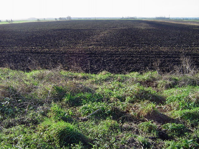
Lord's Fen is a distinctive geographical area located in Huntingdonshire, England. Spanning across Downs and Moorland, it covers an expansive area of approximately 500 acres. The fen is situated in the eastern part of the county, near the town of Huntingdon.

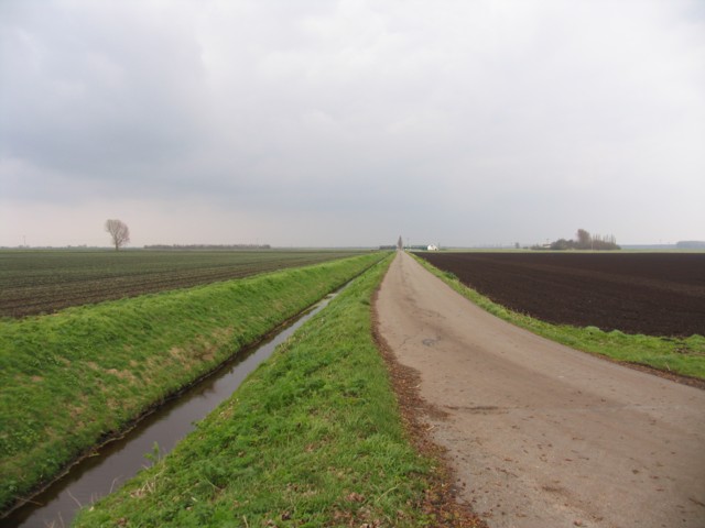
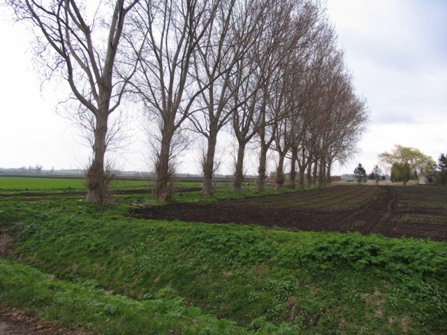
Lord's Fen is characterized by its unique landscape, combining both upland and lowland features. The Downs section of the fen is characterized by rolling hills, offering picturesque views of the surrounding countryside. The Moorland, on the other hand, consists of vast open spaces covered in heather and grasses, providing a habitat for a diverse range of flora and fauna.

The fen is home to several species of birds, including migratory waterfowl that visit the area during the winter months. The wetland areas within the fen support a variety of aquatic plants and animals, creating a rich ecosystem. The fen also houses a number of rare plant species, some of which are specific to this particular region.

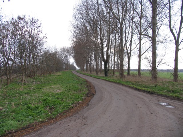
Lord's Fen is a popular destination for outdoor enthusiasts, offering opportunities for hiking, birdwatching, and nature photography. The varied topography provides a range of hiking trails suitable for different skill levels, allowing visitors to explore the fen at their own pace.

Overall, Lord's Fen in Huntingdonshire is a unique and diverse landscape, encompassing both upland and lowland features. Its natural beauty, rich biodiversity, and recreational opportunities make it an appealing destination for nature lovers and outdoor enthusiasts alike.

If you have any feedback on the listing, please let us know in the comments section below.

Lord's Fen Images

Images are sourced within 2km of 52.510986/-0.23596422 or Grid Reference TL1991. Thanks to Geograph Open Source API. All images are credited.

Osier Fen, Near Farcet From Conquest Drove looking SW.
Osier Fen, Near Farcet
From Conquest Drove looking SW.
Trundle Mere Looking north.
Trundle Mere
Looking north.
The Black  Ham Engine Used in the 1850s to drain Whittlesey Mere. Unique in that it was turf fired.
The Black Ham Engine
Used in the 1850s to drain Whittlesey Mere. Unique in that it was turf fired.
Yaxley Lode
Yaxley Lode
Black Ham Engine
Black Ham Engine
Narrow Drove Yaxley Fen
Broad Drove
Broad Drove
Fens and trees
Fens and trees
Black Ham (Drain), Yaxley Fen A typical view along this part of the drain. Lots of skylarks singing.
Black Ham (Drain), Yaxley Fen
A typical view along this part of the drain. Lots of skylarks singing.
Bank separating Yaxley Fen from Black Ham (Drain) This levee sits proud of the surrounding fenland either side. The very fertile dark soil of Yaxley Fen is at least 2+ metres below.
Bank separating Yaxley Fen from Black Ham (Drain)
This levee sits proud of the surrounding fenland either side. The very fertile dark soil of Yaxley Fen is at least 2+ metres below.
Slote Farm, Yaxley Fen Low lying flat agricultural land intersected by numerous drainage ditches.
Slote Farm, Yaxley Fen
Low lying flat agricultural land intersected by numerous drainage ditches.
Drainage ditch, Yaxley Fen The building in the distance is Lord's Farm pumping station, part of the Whittlesey Internal Drainage Board.
Drainage ditch, Yaxley Fen
The building in the distance is Lord's Farm pumping station, part of the Whittlesey Internal Drainage Board.
Lord's Farm Pumping Station, Yaxley Fen Sitting on the north bank of Yaxley Lode (Drain), this is part of the Whittlesey Internal Drainage Board.
Lord's Farm Pumping Station, Yaxley Fen
Sitting on the north bank of Yaxley Lode (Drain), this is part of the Whittlesey Internal Drainage Board.
Conquest Lode Pumping Station & drain Looking NE along Conquest Lode (Drain) towards Osier Fen. The pumping station is managed by the Whittlesey Internal Drainage Board.
Conquest Lode Pumping Station & drain
Looking NE along Conquest Lode (Drain) towards Osier Fen. The pumping station is managed by the Whittlesey Internal Drainage Board.
Black Ham (Drain) & Pumping Station
Yaxley Fen
Yaxley Fen
Yaxley Fen
Yaxley Fen
Black Ham (Drain) & bank
Show me another place!

Lord's Fen is located at Grid Ref: TL1991 (Lat: 52.510986, Lng: -0.23596422)

Administrative County: Cambridgeshire

District: Huntingdonshire

Police Authority: Cambridgeshire

What 3 Words

///gasp.systems.riverboat. Near Yaxley, Cambridgeshire

Nearby Locations

Hog Fen Lord's Fen

Related Wikis

Yaxley and Farcet railway station

Yaxley and Farcet railway station is a former station in Yaxley, Cambridgeshire, just south of Peterborough. == History == The station was opened by the...

Yaxley F.C.

Yaxley Football Club is a football club based in Yaxley, Cambridgeshire, England. They are currently members of the United Counties League Premier Division...

Yaxley, Cambridgeshire

Yaxley is a village and civil parish in the Huntingdonshire district in Cambridgeshire, England. Yaxley lies approximately 4 miles (6 km) south of Peterborough...

The Fens

The Fens or Fenlands in eastern England are a naturally marshy region supporting a rich ecology and numerous species. Most of the fens were drained centuries...

Nearby Amenities

Located within 500m of 52.510986,-0.23596422
Power: pole
Lat/Long: 52.509636/-0.2320382
Power: pole
Lat/Long: 52.5092279/-0.2346882
Power: pole
Lat/Long: 52.5082011/-0.2383414
Power: pole
Lat/Long: 52.5094368/-0.233331
Power: pole
Lat/Long: 52.5090321/-0.2359971
Power: pole
Lat/Long: 52.510867/-0.2287712
Power: pole
Lat/Long: 52.5098484/-0.2306112
Power: pole
Lat/Long: 52.5078762/-0.2394491
Power: pole
Lat/Long: 52.5103608/-0.2297046
Power: pole
Lat/Long: 52.5085928/-0.2371451
Fixme: yes
Note: pump?
Lat/Long: 52.508418/-0.240514
Power: pole
Lat/Long: 52.512026/-0.2287819
Power: pole
Lat/Long: 52.5127704/-0.2297126
Power: pole
Lat/Long: 52.513469/-0.230549
Power: pole
Lat/Long: 52.5141953/-0.2313591
The data included in this document is from www.openstreetmap.org. The data is made available under ODbL.

Have you been to Lord's Fen?

Leave your review of Lord's Fen below (or comments, questions and feedback).