Heatherside

Settlement in Surrey Surrey Heath

England

Heatherside

Path beside the B3015, Heatherside Corner
Path beside the B3015, Heatherside Corner Credit: JThomas

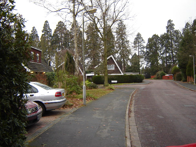
Heatherside is a residential area located in Surrey, England. It is situated approximately 30 miles southwest of central London, making it an ideal location for commuters. The neighborhood is part of the larger town of Camberley and is known for its peaceful atmosphere and attractive surroundings.

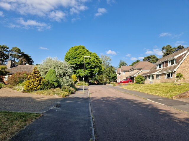
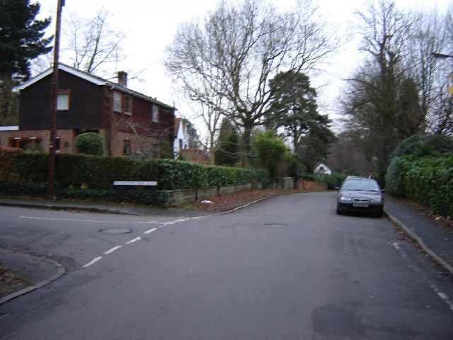
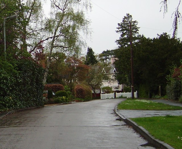
Heatherside offers a range of housing options, including detached houses, semi-detached houses, and apartments. The properties are well-maintained and often surrounded by green spaces, giving the area a suburban feel. Many of the houses have well-manicured gardens, adding to the overall charm of the neighborhood.

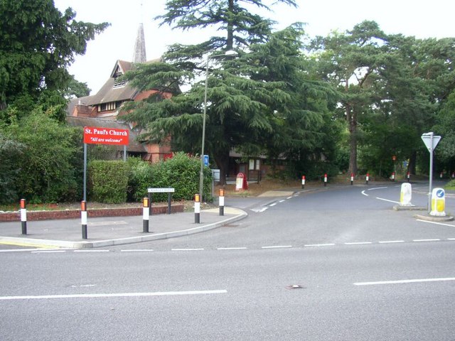
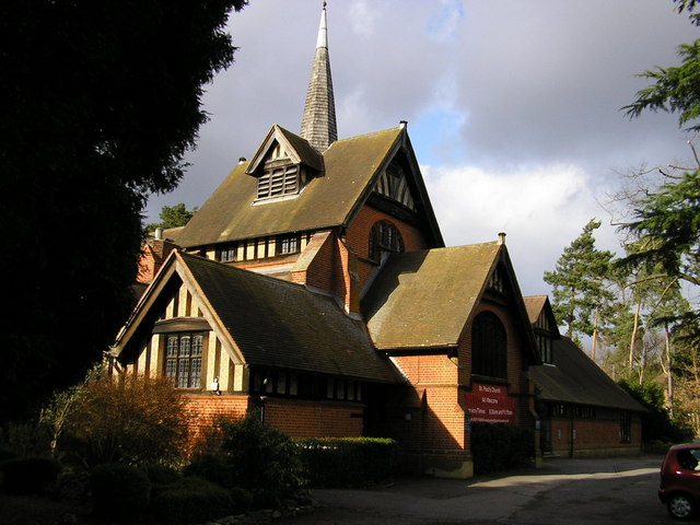
The area is well-served by amenities and facilities, with several local shops, supermarkets, and restaurants within easy reach. The nearby town of Camberley provides additional options for shopping and dining, as well as entertainment venues such as cinemas and theaters.

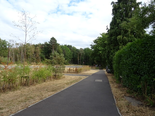
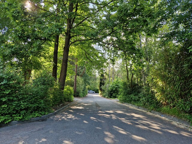
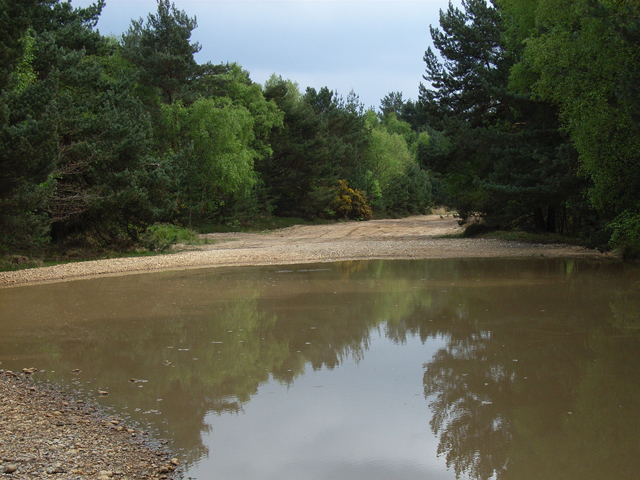
One of the highlights of Heatherside is its proximity to natural beauty spots. The neighborhood is surrounded by several parks and open spaces, including Heather Ridge, which offers ample opportunities for outdoor activities such as walking, jogging, and picnicking.

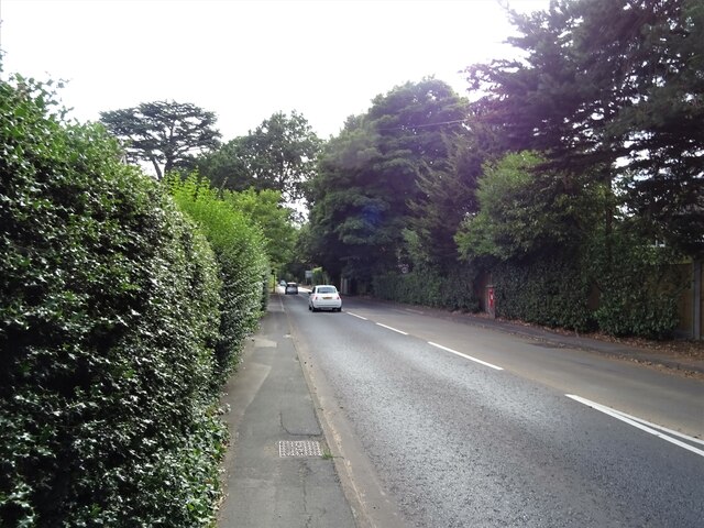
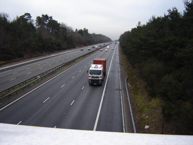
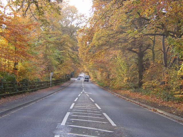
Residents of Heatherside benefit from excellent transport links. The area is well-connected by road, with the M3 motorway just a short drive away, providing easy access to London and other major cities. Additionally, there are several bus routes that serve the area, connecting it to neighboring towns and villages.

Overall, Heatherside is an attractive and peaceful residential area in Surrey, offering a high quality of life with its range of amenities, beautiful surroundings, and convenient transport links.

If you have any feedback on the listing, please let us know in the comments section below.

Heatherside Images

Images are sourced within 2km of 51.329036/-0.716516 or Grid Reference SU8959. Thanks to Geograph Open Source API. All images are credited.

Path beside the B3015, Heatherside Corner
Upper Chobham Road (B311) Towards Frimley.
Upper Chobham Road (B311)
Towards Frimley.
George V postbox on Upper Chobham Road, Camberley Postbox No. GU15 11.
George V postbox on Upper Chobham Road, Camberley
Postbox No. GU15 11.
Navigating northwards up the Basher (28) Lamppost in Roundway
Navigating northwards up the Basher (28)
Lamppost in Roundway
Navigating northwards up the Basher (27) Looking from Roundway Close into Roundway
Navigating northwards up the Basher (27)
Looking from Roundway Close into Roundway
Junction of Crawley Ridge and Branksome Park Rd A pleasant housing area a few minutes from Camberley centre
Junction of Crawley Ridge and Branksome Park Rd
A pleasant housing area a few minutes from Camberley centre
M3 between J3 and J4 This is photographed from the Ravenswood Roundabout on the A325. There is no junction here. The nearby housing is quite exclusive but the Motorway intrudes.
M3 between J3 and J4
This is photographed from the Ravenswood Roundabout on the A325. There is no junction here. The nearby housing is quite exclusive but the Motorway intrudes.
7 Pigeons, 1 Tree Not a partridge in a pear tree, but 7 pigeons feeding from the gum present on the buds on this tree.
7 Pigeons, 1 Tree
Not a partridge in a pear tree, but 7 pigeons feeding from the gum present on the buds on this tree.
Grange Road, Camberley
Junction of Crawley Ridge and Church Hill with St Paul's Church St Paul's Anglican church is located at the top of Church Hill and lies in a commanding position over this grid square, and east Camberley. The original church (now a hall) was built in 1890's and the current church building erected in the early 20th century. This present church building was designed by a Danish architect in Scandinavian style.
Junction of Crawley Ridge and Church Hill with St Paul's Church
St Paul's Anglican church is located at the top of Church Hill and lies in a commanding position over this grid square, and east Camberley. The original church (now a hall) was built in 1890's and the current church building erected in the early 20th century. This present church building was designed by a Danish architect in Scandinavian style.
Autumn leaves over A30 London Road, Camberley The colours were probably at their best 2-3 days before this photograph was taken, however, there is still plenty of autumn colour in this shot.  The A30 road runs from near Heathrow Airport (London) to a few yards short of Lands End, in Cornwall.  This spot, just east of Camberley shows the autumn colours well, and is a popular location to see the seasons change.
Autumn leaves over A30 London Road, Camberley
The colours were probably at their best 2-3 days before this photograph was taken, however, there is still plenty of autumn colour in this shot. The A30 road runs from near Heathrow Airport (London) to a few yards short of Lands End, in Cornwall. This spot, just east of Camberley shows the autumn colours well, and is a popular location to see the seasons change.
St. Paul's Church, Camberley Picturesque church at the top of Church Hill!
St. Paul's Church, Camberley
Picturesque church at the top of Church Hill!
St. Paul's Church Hall, Camberley The church hall is immediately beside St. Paul's church.
St. Paul's Church Hall, Camberley
The church hall is immediately beside St. Paul's church.
St Paul, Camberley Built in 1902.
St Paul, Camberley
Built in 1902.
Short public footpath This path is about 15 metres long and connects the Portsmouth road footpath with Lime Avenue.
Short public footpath
This path is about 15 metres long and connects the Portsmouth road footpath with Lime Avenue.
Youlden Drive The start of Youlden Drive. Notice the heavy duty fencing which shields the sound from the M3.
Youlden Drive
The start of Youlden Drive. Notice the heavy duty fencing which shields the sound from the M3.
Housing near Camberley This is the junction of Ravenstone Road and Inglewood Avenue. This is very near the ranges and so on exercise days could be noisy.
Housing near Camberley
This is the junction of Ravenstone Road and Inglewood Avenue. This is very near the ranges and so on exercise days could be noisy.
Vehicle testing track, Camberley The MOD has a complex network of tracks here. They are crossed by a couple of bridleways with copious warnings. All was peaceful on this occasion though.
Vehicle testing track, Camberley
The MOD has a complex network of tracks here. They are crossed by a couple of bridleways with copious warnings. All was peaceful on this occasion though.
Show me another place!

Heatherside is located at Grid Ref: SU8959 (Lat: 51.329036, Lng: -0.716516)

Administrative County: Surrey

District: Surrey Heath

Police Authority: Surrey

What 3 Words

///basis.vision.rejoins. Near Camberley, Surrey

Nearby Locations

Frimley Ridge Heatherside

Related Wikis

The Wheatsheaf, Camberley

The Wheatsheaf is a grade II listed public house in Heatherside, Camberley, Surrey. It was designed by John and Sylvia Reid and opened in 1970. It has...

Tomlinscote School

Tomlinscote School is a coeducational secondary school with academy status, located in Frimley, Surrey, England. The school previously held specialist...

Tekels Park

Tekels Park, Camberley, Surrey consists of about 20 hectares (50 acres) of land, grassland and houses. == History == The estate of Frimley Manor was sold...

Frimley and Camberley Urban District

Frimley and Camberley was an urban district in Surrey, England from 1894 to 1974. == Area == Frimley and Camberley consisted of the villages of Frimley...

Camberley

Camberley is a town in northwest Surrey, England, around 29 miles (47 kilometres) south-west of central London. It is in the Borough of Surrey Heath...

Camberley Obelisk

Camberley Obelisk (also known as Norris's Obelisk or Norris's Whim) is a brick tower at the top of a hill in Camberley, Surrey, England. The tower was...

Camberley railway station

Camberley railway station is in the town of Camberley in Surrey, England. It is on the Ascot to Guildford line, 35 miles 30 chains (56.9 km) from London...

Deepcut

Deepcut is a village in the borough of Surrey Heath in Surrey, England, approximately 28 mi (45 km) southwest of central London. The nearest towns are...

Nearby Amenities

Located within 500m of 51.329036,-0.716516
Crossing
Crossing: traffic_signals
Crossing Ref: pelican
Kerb: lowered
Tactile Paving: yes
Lat/Long: 51.3331233/-0.7191204
Bus Stop
Kilmore Drive
Bench: no
Bin: no
Bus: yes
Departures Board: timetable
Lit: no
Naptan AtcoCode: 40004403090A
Naptan Bearing: SE
Naptan CommonName: Kilmore Drive
Naptan Indicator: Just after
Naptan Landmark: Kilmore Drive
Naptan NaptanCode: surgajpa
Naptan PlusbusZoneRef: ALDRSHT
Naptan Street: Prior Road
Naptan Verified: no
Public Transport: platform
Shelter: no
Source: naptan_import
Tactile Paving: no
Lat/Long: 51.3305037/-0.7138274
Bus Stop
Kilmore Drive
Bench: no
Bin: no
Bus: yes
Departures Board: timetable
Lit: no
Naptan AtcoCode: 40004403090B
Naptan Bearing: NW
Naptan CommonName: Kilmore Drive
Naptan Indicator: Just Before
Naptan Landmark: Kilmore Drive
Naptan NaptanCode: surgajpd
Naptan PlusbusZoneRef: ALDRSHT
Naptan Street: Prior Road
Naptan Verified: no
Public Transport: platform
Shelter: no
Source: naptan_import
Tactile Paving: no
Lat/Long: 51.3304583/-0.7137856
Bus Stop
Springfield Road
Bench: no
Bin: no
Bus: yes
Departures Board: timetable
Lit: no
Naptan AtcoCode: 40004403091A
Naptan Bearing: SE
Naptan CommonName: Springfield Road
Naptan Indicator: Just after
Naptan Landmark: Springfield Road
Naptan NaptanCode: surgajpg
Naptan PlusbusZoneRef: ALDRSHT
Naptan Street: Prior Road
Naptan Verified: no
Public Transport: platform
Shelter: no
Source: naptan_import
Tactile Paving: no
Lat/Long: 51.332625/-0.7178448
Bus Stop
Springfield Road
Bench: no
Bin: no
Bus: yes
Departures Board: timetable
Lit: no
Naptan AtcoCode: 40004403091B
Naptan Bearing: NW
Naptan CommonName: Springfield Road
Naptan Indicator: Just Before
Naptan Landmark: Springfield Road
Naptan NaptanCode: surgajpj
Naptan PlusbusZoneRef: ALDRSHT
Naptan Street: Prior Road
Naptan Verified: no
Public Transport: platform
Shelter: no
Source: naptan_import
Tactile Paving: no
Lat/Long: 51.3325079/-0.7177114
Polling Station: 2010
Lat/Long: 51.3328383/-0.7199773
Prior Place Cross Roads
Place: locality
Lat/Long: 51.330062/-0.7123196
Crossing
Crossing Island: yes
Kerb: lowered
Sloped Curb: yes
Source: Surrey-Air_Survey
Lat/Long: 51.3312897/-0.7104202
Crossing
Crossing Island: yes
Kerb: lowered
Sloped Curb: yes
Source: Surrey-Air_Survey
Lat/Long: 51.3314314/-0.7104339
Frimley Ridge
Place: locality
Source: OS-OpenData_StreetView
Lat/Long: 51.3270615/-0.7158844
Crossing
Crossing Island: yes
Kerb: lowered
Sloped Curb: yes
Source: Surrey-Air_Survey
Lat/Long: 51.3312308/-0.7104929
Traffic Signals
Traffic Signals: pedestrian_crossing
Traffic Signals Direction: forward
Lat/Long: 51.3331432/-0.7191568
Traffic Signals
Traffic Signals: pedestrian_crossing
Traffic Signals Direction: backward
Lat/Long: 51.333104/-0.7190793
The data included in this document is from www.openstreetmap.org. The data is made available under ODbL.

Have you been to Heatherside?

Leave your review of Heatherside below (or comments, questions and feedback).