Jayes Park

Downs, Moorland in Surrey Mole Valley

England

Jayes Park

Forest Green - Etherley Farm Llamas and barns in a paddock beside the Etherley Farm Loop Walk which passes through the Leith Hill Place estate.
Forest Green - Etherley Farm Credit: Colin Smith

Jayes Park is a picturesque area located in Surrey, England. Nestled amidst the beautiful Downs and Moorland, it offers a serene and tranquil setting for visitors to enjoy. The park covers a vast expanse of land, providing ample space for recreational activities and leisurely walks.

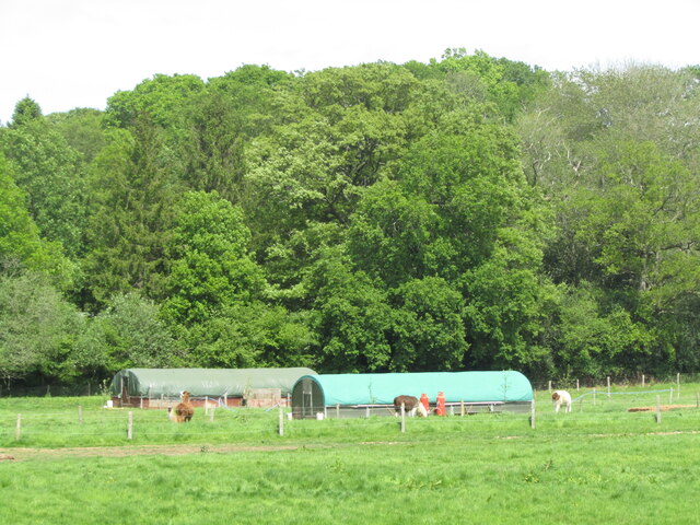
One of the standout features of Jayes Park is its stunning natural surroundings. The Downs, with their rolling hills and breathtaking vistas, offer panoramic views of the surrounding countryside. The Moorland, on the other hand, is characterized by its open landscapes, heathland, and diverse array of flora and fauna.

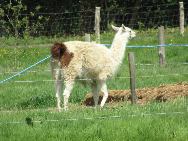
The park is home to a variety of wildlife, making it a haven for nature lovers. Visitors can spot numerous species of birds, including skylarks and kestrels, as well as rabbits, deer, and other small mammals. The park's diverse ecosystem also supports an array of plant life, including heather, gorse, and wildflowers.

In addition to its natural beauty, Jayes Park provides several amenities for visitors. There are well-maintained walking trails that wind through the park, allowing visitors to explore its various landscapes at their own pace. Picnic areas are also available, providing a perfect spot for families and friends to relax and enjoy a meal surrounded by nature.

Jayes Park is a popular destination for outdoor enthusiasts, offering a peaceful retreat away from the hustle and bustle of city life. Whether it's for a leisurely stroll, birdwatching, or simply enjoying the stunning views, visitors to Jayes Park are sure to be captivated by its natural charm.

If you have any feedback on the listing, please let us know in the comments section below.
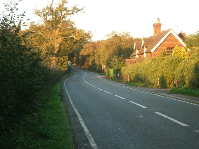
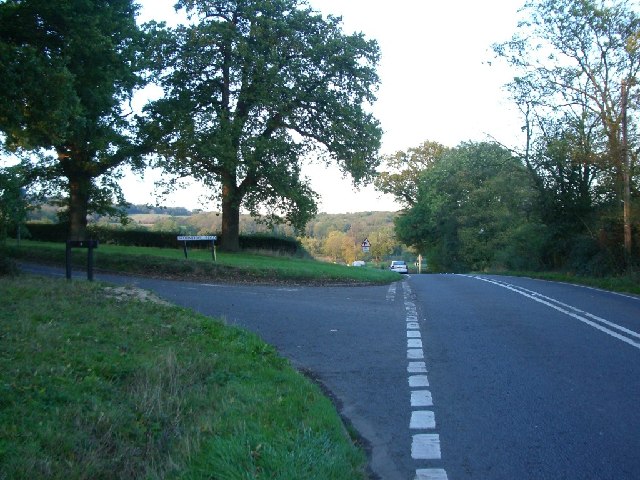
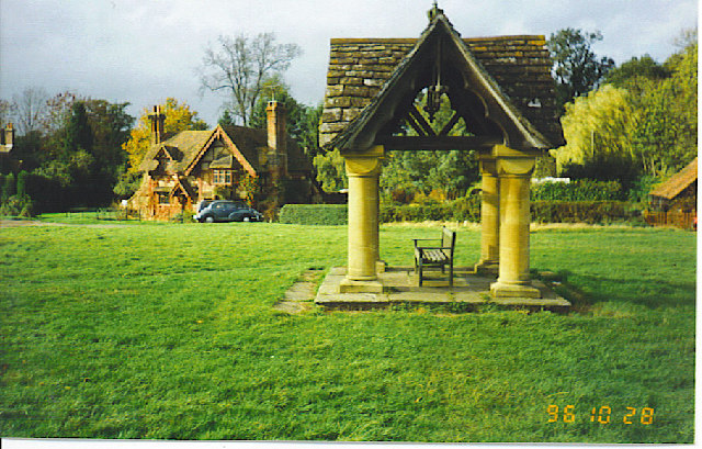
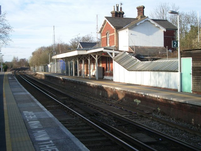
Jayes Park Images

Images are sourced within 2km of 51.153094/-0.36545582 or Grid Reference TQ1440. Thanks to Geograph Open Source API. All images are credited.

Forest Green - Etherley Farm Llamas and barns in a paddock beside the Etherley Farm Loop Walk which passes through the Leith Hill Place estate.
Forest Green - Etherley Farm
Llamas and barns in a paddock beside the Etherley Farm Loop Walk which passes through the Leith Hill Place estate.
Etherley Farm - Llama Exotic beast at Etherley Farm, seen on the loop walk from Leith Hill Place.
Etherley Farm - Llama
Exotic beast at Etherley Farm, seen on the loop walk from Leith Hill Place.
Forest Green - Etherley Farm Paddocks and barn beside the Leith Hill Place Loop path.
Forest Green - Etherley Farm
Paddocks and barn beside the Leith Hill Place Loop path.
Etherley Farm - Geese Duck eggs and other farm produce may be bought from the Etherley Farm shop, Forest Green.
Etherley Farm - Geese
Duck eggs and other farm produce may be bought from the Etherley Farm shop, Forest Green.
Forest Green - Etherley Farm Buttercups and contented cows in the Wealden sunshine.
Forest Green - Etherley Farm
Buttercups and contented cows in the Wealden sunshine.
View from Leith Hill Place This photo shows the view looking south from Leith Hill Place towards the South Downs in the distance.
View from Leith Hill Place
This photo shows the view looking south from Leith Hill Place towards the South Downs in the distance.
The A29 turns away from the Roman line The Roman Stane Street continues at first as a private drive and public footpath. Only fragments of the onwards route over hilly terrain are now public rights-of-way until rejoined by the A29 which takes a longer but easier way round.
The A29 turns away from the Roman line
The Roman Stane Street continues at first as a private drive and public footpath. Only fragments of the onwards route over hilly terrain are now public rights-of-way until rejoined by the A29 which takes a longer but easier way round.
Ockley Village Hall On Stone Street (now the A29), the old Roman road, at Ockley. The village hall is just up the road from the cricket ground.
Ockley Village Hall
On Stone Street (now the A29), the old Roman road, at Ockley. The village hall is just up the road from the cricket ground.
Junction of Abinger Road (left) with Etherley Hill (Ockley Road) looking south-east
Junction of Abinger Road (left) with Etherley Hill (Ockley Road)
looking south-east
Field south of Ockley Road looking south
Field south of Ockley Road
looking south
The bend in Ockley Road where it turns into Forest Green Road looking east
The bend in Ockley Road where it turns into Forest Green Road
looking east
Stane Street, just north of Ockley Looking NNE
Stane Street, just north of Ockley
Looking NNE
Junction of Broomehall Road (left) with Burywood Hill (Stane Street) looking NNE
Junction of Broomehall Road (left) with Burywood Hill (Stane Street)
looking NNE
The Well at Ockley. On the green beside the busy A29.
The Well at Ockley.
On the green beside the busy A29.
Ockley station looking north
Ockley station
looking north
View from Gosterwood Manor Farm With the North Downs in the distance
View from Gosterwood Manor Farm
With the North Downs in the distance
Gosterwood Manor Farm
Bridge Out Bridge works on the B2126
Bridge Out
Bridge works on the B2126
Show me another place!

Jayes Park is located at Grid Ref: TQ1440 (Lat: 51.153094, Lng: -0.36545582)

Administrative County: Surrey

District: Mole Valley

Police Authority: Surrey

What 3 Words

///worms.prefer.pacemaker. Near Capel, Surrey

Related Wikis

Ockley

Ockley is a rural village in Surrey. It lies astride the A29, the modern road using the alignment of Stane Street (Chichester). The A29 diverges from the...

Greensand Ridge

The Greensand Ridge, also known as the Wealden Greensand, is an extensive, prominent, often wooded, mixed greensand/sandstone escarpment in south-east...

Vann Lake and Ockley Woods

Vann Lake and Ockley Woods is a 57.8-hectare (143-acre) biological Site of Special Scientific Interest south of Ockley in Surrey. Vann Lake is part of...

Broome Hall

Broome Hall is a Grade II-listed country house with grounds including cottages and outhouses on the wooded, upper southern slopes of the Greensand Ridge...

Ockley railway station

Ockley railway station serves the villages of Ockley and Capel in Surrey, England and is 1.4 miles (2.3 km) from Ockley village and 0.5 miles (0.80 km...

Leith Hill

Leith Hill in southern England is the highest summit of the Greensand Ridge, approximately 6.7 km (4 mi) southwest of Dorking, Surrey and 40.5 km (30 mi...

Leith Hill multiple aircraft accident

On 26 November 1944, four C-47 transport aircraft of the 442nd Operations Group departed from Advanced Landing Ground "A-4 in Pays de la Loire, northern...

Wallis Wood

Wallis Wood is a 14-hectare (35-acre) nature reserve south-east of Ewhurst in Surrey. It is managed by the Surrey Wildlife Trust.A stream runs through...

Nearby Amenities

Located within 500m of 51.153094,-0.36545582
Jayes Park
Place: isolated_dwelling
Source: npe
Sport: equestrian
Wikidata: Q26279819
Lat/Long: 51.1550141/-0.3672383
Scott's Well
Man Made: water_well
Pump: manual
Lat/Long: 51.1496443/-0.3608845
Recycling
Created By: Merkaartor 0.12
Lat/Long: 51.1516913/-0.3587063
Bus Stop
Kings Arms Court
Bus: yes
Naptan AtcoCode: 40004408087A
Naptan Bearing: SE
Naptan BusStopType: CUS
Naptan CommonName: Kings Arms
Naptan Indicator: Just Before
Naptan Landmark: Kings Arms
Naptan NaptanCode: surgmwda
Naptan Street: Forest Green Road
Naptan Verified: no
Physically Present: no
Public Transport: platform
Source: naptan_import
Lat/Long: 51.1519429/-0.3594523
Bus Stop
Kings Arms Court
Bus: yes
Naptan AtcoCode: 40004408087B
Naptan Bearing: NW
Naptan BusStopType: CUS
Naptan CommonName: Kings Arms
Naptan Indicator: Just after
Naptan Landmark: Kings Arms
Naptan NaptanCode: surgmwdg
Naptan Street: Forest Green Road
Naptan Verified: no
Physically Present: no
Public Transport: platform
Source: naptan_import
Lat/Long: 51.1518756/-0.359522
Post Box
Ref: RH4 52
Royal Cypher: EIIR
Royal Cypher Wikidata: Q33102113
Source: Photo P143-0627
Lat/Long: 51.1568639/-0.3652507
Barrier: stile
Lat/Long: 51.1514842/-0.3614282
Grit Bin
Source: survey
Lat/Long: 51.15168/-0.359064
Bus Stop
Kings Arms Court
Bus: yes
Naptan AtcoCode: 40004408329A
Naptan NaptanCode: surgptda
Physically Present: no
Public Transport: platform
Lat/Long: 51.15268/-0.3583508
Home Farm
Place: farm
Lat/Long: 51.1556512/-0.3691928
Bus Stop
Inn On The Green
Bus: yes
Naptan AtcoCode: 40004408213B
Naptan Bearing: N
Naptan BusStopType: CUS
Naptan CommonName: Inn On The Green
Naptan Indicator: opp
Naptan Landmark: Inn On The Green
Naptan NaptanCode: surgpjpd
Naptan Street: Stane Street
Naptan Verified: no
Physically Present: no
Public Transport: platform
Source: naptan_import
Lat/Long: 51.1500994/-0.3601838
Bus Stop
Lake Road
Bus: yes
Naptan AtcoCode: 40004408802D
Naptan NaptanCode: surdawdt
Physically Present: no
Public Transport: platform
Lat/Long: 51.1546016/-0.3629498
Bus Stop
Lake Road
Bus: yes
Naptan AtcoCode: 40004408802E
Naptan NaptanCode: surdawdw
Physically Present: no
Public Transport: platform
Lat/Long: 51.154538/-0.3631112
The data included in this document is from www.openstreetmap.org. The data is made available under ODbL.

Have you been to Jayes Park?

Leave your review of Jayes Park below (or comments, questions and feedback).