St Nicholas Garden

Downs, Moorland in Sussex Arun

England

St Nicholas Garden

St Margaret's Graveyard
St Margaret's Graveyard Credit: Natasha Lee

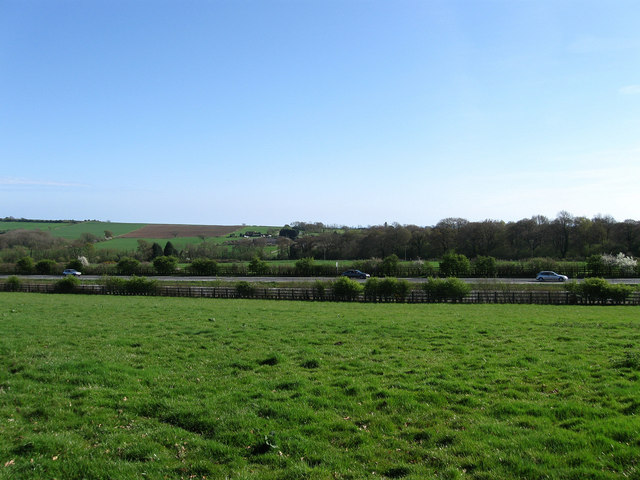
St Nicholas Garden is a picturesque nature reserve located in the heart of Sussex, England. Situated within the beautiful Sussex Downs, this 200-acre garden offers a diverse range of habitats, including moorland, woodlands, and meadows, making it a haven for wildlife enthusiasts and nature lovers alike.

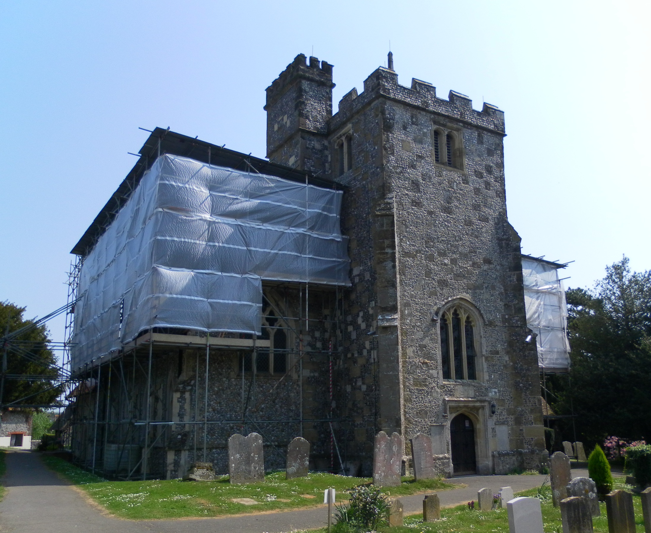
The garden is named after St Nicholas Church, which dates back to the 12th century and stands majestically at the entrance of the reserve. Its historic charm adds to the overall appeal of the site, attracting visitors from far and wide.

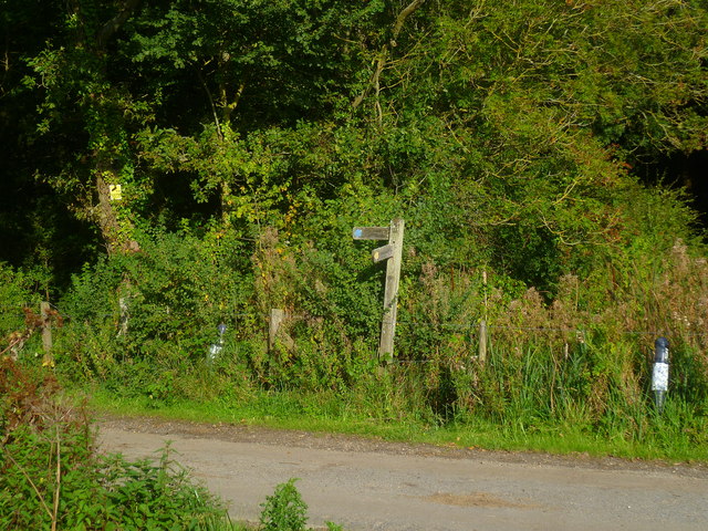
The moorland section of St Nicholas Garden boasts breathtaking views of the surrounding countryside, with its rolling hills and heather-covered slopes. This area is home to a rich variety of plant and animal species, including the elusive Dartford warbler and the endangered silver-studded blue butterfly.

The woodlands within the garden provide a tranquil setting for leisurely walks, with ancient oak and beech trees creating a serene atmosphere. Visitors can spot native birds such as woodpeckers and red kites, while the forest floor is adorned with carpets of bluebells in the spring.

Throughout the meadows, vibrant wildflowers blanket the landscape, attracting an array of insects and butterflies. Rabbits can be seen hopping between the tall grasses, while buzzards soar overhead, creating a harmonious balance between nature and wildlife.

St Nicholas Garden is not only a haven for flora and fauna but also offers educational opportunities for visitors. Guided tours and nature trails are available, allowing visitors to learn about the importance of conservation and the delicate balance of ecosystems.

Overall, St Nicholas Garden in Sussex is a true gem, offering a unique and enriching experience for anyone seeking solace in the beauty of nature.

If you have any feedback on the listing, please let us know in the comments section below.

St Nicholas Garden Images

Images are sourced within 2km of 50.829483/-0.48484525 or Grid Reference TQ0604. Thanks to Geograph Open Source API. All images are credited.

St Margaret's Graveyard
The Spotted Cow, Angmering
Footpath from Swillage Lane approaches end of woodland
Norfolk House seen from footpath across field See the first geograph for this square from 2005 at <a title="https://www.geograph.org.uk/photo/25559" href="https://www.geograph.org.uk/photo/25559">Link</a>.
Norfolk House seen from footpath across field
See the first geograph for this square from 2005 at Link.
Footpath junction on estate road
Looking west on the A27 from footpath junction
Looking eastwards across the A27 from footpath junction See also <a title="https://www.geograph.org.uk/photo/3683450" href="https://www.geograph.org.uk/photo/3683450">Link</a>.
Looking eastwards across the A27 from footpath junction
See also Link.
The back entrance to "The Woodman Arms" PH See <a title="https://www.geograph.org.uk/photo/926189" href="https://www.geograph.org.uk/photo/926189">Link</a> for the front of the building.
The back entrance to "The Woodman Arms" PH
See Link for the front of the building.
Field footpath going eastwards to Swillage Lane
Footpath approaches Swillage Lane Swillage Barn is the house on the left of the picture.  It is in the next grid square to the north.
Footpath approaches Swillage Lane
Swillage Barn is the house on the left of the picture. It is in the next grid square to the north.
Footpath arrives at Swillage Lane
Pond on Swillage Lane If you look closely you may be able to see the ducks.  A better picture is at <a title="https://www.geograph.org.uk/photo/1886691" href="https://www.geograph.org.uk/photo/1886691">Link</a>.
Pond on Swillage Lane
If you look closely you may be able to see the ducks. A better picture is at Link.
Looking south on Swillage Lane
Footpath beside sewage works goes north to Water Lane See also <a title="https://www.geograph.org.uk/photo/1329137" href="https://www.geograph.org.uk/photo/1329137">Link</a>.
Footpath beside sewage works goes north to Water Lane
See also Link.
Hazy view of windmill across fields See <span class="nowrap"><a title="http://www.angmeringvillage.co.uk/history/windmills.htm" rel="nofollow ugc noopener" href="http://www.angmeringvillage.co.uk/history/windmills.htm">Link</a><img style="margin-left:2px;" alt="External link" title="External link - shift click to open in new window" src="https://s1.geograph.org.uk/img/external.png" width="10" height="10"/></span> for more information about Ecclesden Windmill.
See <a title="https://www.geograph.org.uk/photo/797622" href="https://www.geograph.org.uk/photo/797622">Link</a> for a 2007 view.
Hazy view of windmill across fields
See LinkExternal link for more information about Ecclesden Windmill. See Link for a 2007 view.
Farmland & houses in Somerset Road
Water Lane - A280 Entering Angmering.
Water Lane - A280
Entering Angmering.
Show me another place!

St Nicholas Garden is located at Grid Ref: TQ0604 (Lat: 50.829483, Lng: -0.48484525)

Administrative County: West Sussex

District: Arun

Police Authority: Sussex

What 3 Words

///sports.website.gems. Near Rustington, West Sussex

Related Wikis

Angmering

Angmering is a village and civil parish between Littlehampton and Worthing in West Sussex on the southern edge of the South Downs National Park, England...

St Margaret's Church, Angmering

St Margaret's Church is a Church of England parish church in Angmering, West Sussex. The church is a grade II* listed building. == History == St Margaret...

Angmering School

The Angmering School is a coeducational community secondary school and sixth form located in Angmering, West Sussex that opened in 1975. The school has...

Ecclesden Manor

Ecclesden Manor is a Grade II* listed country house in Angmering, West Sussex, England. It was built for John Forster in 1634. == History == Ecclesden...

Oval Raceway

The Oval Raceway, also known as the Angmering Motor Sports Centre or Angmering Raceway is a motor racing circuit on the outskirts of Angmering, near Worthing...

Highdown New Mill, Angmering

Highdown New Mill or Ecclesden Mill is a tower mill at Angmering, Sussex, England which has been converted to residential accommodation. == History... ==

Angmering railway station

Angmering is a railway station on the West Coastway Line, on the border of Angmering and East Preston in the district of Arun. It was opened in 1846. The...

Phun City

Phun City was a rock festival held at Ecclesden Common near Worthing, England, from 24 July to 26 July 1970. Excluding the one-day free concerts in London...

Nearby Amenities

Located within 500m of 50.829483,-0.48484525
Angmering
Is In: West Sussex, England, UK
Place: village
Source: npe
Wikidata: Q1958893
Lat/Long: 50.8283499/-0.4840139
Post Office
Angmering Post Office
Addr City: Angmering, Littlehampton
Addr Country: GB
Addr Postcode: BN16 4EA
Addr Street: The Square
Addr Village: Angmering
Brand: Post Office
Brand Wikidata: Q1783168
Opening Hours: Mo-Su 07:00-22:00
Operator: Co-op Food
Ref Pol Id: 104
Source: receipt from visit
Website: https://www.postoffice.co.uk/branch-finder/0529087/angmering
Lat/Long: 50.8288141/-0.4839647
Toilets
Created By: Potlatch 0.10f
Lat/Long: 50.8290421/-0.4864099
Bus Stop
Dell Drive
Naptan AtcoCode: 4400LH0172
Naptan Bearing: N
Naptan CommonName: Dell Drive
Naptan Indicator: opp. Dell Drive
Naptan Landmark: Dell Drive
Naptan NaptanCode: wsxdajag
Naptan Street: Station Road
Naptan Verified: no
Source: naptan_import
Lat/Long: 50.8254374/-0.4866184
Bus Stop
Dell Drive
Naptan AtcoCode: 4400LH0173
Naptan Bearing: S
Naptan CommonName: Dell Drive
Naptan Indicator: adj Mill Road
Naptan Landmark: Dell Drive
Naptan NaptanCode: wsxdajaj
Naptan Street: Station Road
Naptan Verified: no
Source: naptan_import
Lat/Long: 50.825722/-0.4863678
Bus Stop
Village Green
Naptan AtcoCode: 4400LH0174
Naptan Bearing: SW
Naptan CommonName: Village Green
Naptan Indicator: opp. Arundel Road
Naptan Landmark: Arundel Road
Naptan NaptanCode: wsxdajam
Naptan Street: Station Road
Shelter: no
Source: naptan_import
Lat/Long: 50.8282891/-0.4848567
Bus Stop
Village Green
Naptan AtcoCode: 4400LH0175
Naptan Bearing: N
Naptan CommonName: Village Green
Naptan Indicator: adj Station
Naptan Landmark: Station Road
Naptan NaptanCode: wsxdajap
Naptan Street: Arundel Road
Shelter: no
Source: naptan_import
Lat/Long: 50.8287173/-0.4848229
Bus Stop
Bewley Road
Naptan AtcoCode: 4400LH0176
Naptan Bearing: S
Naptan CommonName: Bewley Road
Naptan Indicator: adj Lansdowne Way
Naptan Landmark: Lansdowne Way
Naptan NaptanCode: wsxdajat
Naptan Street: Arundel Road
Naptan Verified: no
Source: naptan_import
Lat/Long: 50.8323937/-0.4855697
Bus Stop
Bewley Road
Naptan AtcoCode: 4400LH0177
Naptan Bearing: N
Naptan CommonName: Bewley Road
Naptan Indicator: adj Bewley Road
Naptan Landmark: Bewley Road
Naptan NaptanCode: wsxdajaw
Naptan Street: Arundel Road
Naptan Verified: no
Source: naptan_import
Lat/Long: 50.8326207/-0.4857328
Bus Stop
Water Lane
Naptan AtcoCode: 4400LH0185
Naptan Bearing: NE
Naptan CommonName: Water Lane
Naptan Indicator: opp. Chandlers Garage
Naptan Landmark: High Street
Naptan NaptanCode: wsxdajga
Naptan Street: Water Lane
Naptan Verified: no
Source: naptan_import
Lat/Long: 50.8297407/-0.4834972
Bus Stop
Water Lane
Naptan AtcoCode: 4400LH0187
Naptan Bearing: W
Naptan CommonName: Water Lane
Naptan Indicator: adj Weavers Hill
Naptan Landmark: Weavers Hill
Naptan NaptanCode: wsxdajgj
Naptan Street: Water Lane
Naptan Verified: no
Source: naptan_import
Lat/Long: 50.8308162/-0.479756
Bus Stop
Water Lane
Naptan AtcoCode: 4400LH0188
Naptan Bearing: E
Naptan CommonName: Water Lane
Naptan Indicator: opp. Weavers Hill
Naptan Landmark: Weavers Hill
Naptan NaptanCode: wsxdajgm
Naptan Street: Water Lane
Naptan Verified: no
Source: naptan_import
Lat/Long: 50.8309228/-0.4796531
Bus Stop
Weavers Hill
Naptan AtcoCode: 4400LH0838
Naptan Bearing: N
Naptan CommonName: Weavers Hill
Naptan Indicator: opp Cumberland Road
Naptan Landmark: Cumberland Road
Naptan NaptanCode: wsxdpwdj
Naptan Street: Weavers Hill
Naptan Verified: no
Source: naptan_import
Lat/Long: 50.8298825/-0.4791899
Bus Stop
Weavers Hill
Naptan AtcoCode: 4400LH0839
Naptan Bearing: S
Naptan CommonName: Weavers Hill
Naptan Indicator: adj Cumberland Road
Naptan Landmark: Cumberland Road
Naptan NaptanCode: wsxdpwdm
Naptan Street: Weavers Hill
Naptan Verified: no
Source: naptan_import
Lat/Long: 50.8296945/-0.4792528
Bicycle Parking
Capacity: 4
Lat/Long: 50.8286818/-0.4847971
War Memorial
Historic: monument
Wikidata: Q26642855
Lat/Long: 50.8287782/-0.4845293
Pharmacy
Lloyds Pharmacy
Addr City: Angmering
Addr Housename: Angmering Medical Centre
Addr Postcode: BN16 4HL
Addr Street: Station Road
Brand: Lloyds Pharmacy
Brand Wikidata: Q6662870
Brand Wikipedia: en:LloydsPharmacy
Fhrs Authority: Arun
Fhrs Id: 1020401
Fhrs Local Authority Id: 25898
Healthcare: pharmacy
Lat/Long: 50.8276391/-0.4861614
Addr Housename: Chalks Flat
Addr Street: Station Road
Lat/Long: 50.8289601/-0.4838382
Addr Housename: Fairlawn
Addr Street: Station Road
Lat/Long: 50.8262968/-0.4860808
Addr Housename: Winterfold
Addr Street: Station Road
Lat/Long: 50.8268225/-0.4859504
Addr Housename: Woodside
Addr Street: Station Road
Lat/Long: 50.8269614/-0.4859389
Addr Housename: The Old Baptist Chapel
Addr Street: Station Road
Lat/Long: 50.8271585/-0.485985
Addr Housename: Amber
Addr Street: Station Road
Lat/Long: 50.8284324/-0.4849222
Bench
Lat/Long: 50.8286691/-0.4847885
Waste Basket
Lat/Long: 50.8286929/-0.4848059
Barrier: cycle_barrier
Lat/Long: 50.8295797/-0.4837855
Addr Housenumber: 3
Addr Street: Angmering Villas
Survey Date: 2019-01-03
Lat/Long: 50.8289913/-0.4828259
Addr Housenumber: 2
Addr Street: Angmering Villas
Survey Date: 2019-01-03
Lat/Long: 50.8290138/-0.4828791
Addr Housenumber: 1
Addr Street: Angmering Villas
Survey Date: 2019-01-03
Lat/Long: 50.8290389/-0.4829382
Addr Housename: Merriemede
Addr Housenumber: 3
Addr Street: Cottrell Close
Survey Date: 2019-01-03
Lat/Long: 50.8284954/-0.4831912
Addr Housename: Rooftops
Addr Street: Cottrell Close
Survey Date: 2019-01-03
Lat/Long: 50.8284464/-0.4833707
Addr Housename: Church View
Addr Housenumber: 1
Addr Street: Cottrell Close
Survey Date: 2019-01-03
Lat/Long: 50.8283312/-0.4834672
Addr Housenumber: 24
Addr Street: The Cottrells
Survey Date: 2019-01-03
Lat/Long: 50.8282105/-0.4827809
Addr Housenumber: 23
Addr Street: The Cottrells
Survey Date: 2019-01-03
Lat/Long: 50.8281232/-0.4827771
Addr Housename: Cottrells End
Addr Housenumber: 6c
Addr Street: The Cottrells
Survey Date: 2019-01-03
Lat/Long: 50.8280924/-0.4817891
Addr Housename: Orchid House
Addr Housenumber: 6b
Addr Street: The Cottrells
Survey Date: 2019-01-03
Lat/Long: 50.8281368/-0.4819017
Addr Housename: Highbury
Addr Housenumber: 6a
Addr Street: The Cottrells
Survey Date: 2019-01-03
Lat/Long: 50.8281055/-0.4820493
Addr Housenumber: 1
Addr Street: The Cottrells
Survey Date: 2019-01-03
Lat/Long: 50.8280906/-0.482576
Addr Housenumber: 6
Addr Street: The Cottrells
Survey Date: 2019-01-03
Lat/Long: 50.8280603/-0.482219
Addr Housenumber: 5
Addr Street: The Cottrells
Survey Date: 2019-01-03
Lat/Long: 50.8280628/-0.4823095
Addr Housenumber: 4
Addr Street: The Cottrells
Note: House number assumed, none displayed
Survey Date: 2019-01-03
Lat/Long: 50.828065/-0.4823907
Addr Housenumber: 3
Addr Street: The Cottrells
Survey Date: 2019-01-03
Lat/Long: 50.8280673/-0.482459
Addr Housenumber: 2
Addr Street: The Cottrells
Note: House number assumed, none displayed
Survey Date: 2019-01-03
Lat/Long: 50.8280678/-0.482518
Addr Housenumber: 22
Addr Street: The Cottrells
Survey Date: 2019-01-03
Lat/Long: 50.8279606/-0.4828955
Addr Housenumber: 21
Addr Street: The Cottrells
Survey Date: 2019-01-03
Lat/Long: 50.8279596/-0.4828379
Addr Housenumber: 20
Addr Street: The Cottrells
Survey Date: 2019-01-03
Lat/Long: 50.8279585/-0.4827782
Addr Housenumber: 19
Addr Street: The Cottrells
Note: House number assumed, none displayed
Survey Date: 2019-01-03
Lat/Long: 50.8279575/-0.4827205
Addr Housenumber: 18
Addr Street: The Cottrells
Survey Date: 2019-01-03
Lat/Long: 50.8279561/-0.4826434
Addr Housenumber: 17
Addr Street: The Cottrells
Survey Date: 2019-01-03
Lat/Long: 50.8279548/-0.4825696
Addr Housename: Grove Cottage
Addr Housenumber: 16
Addr Street: The Cottrells
Survey Date: 2019-01-03
Lat/Long: 50.8279537/-0.4825079
Addr Housenumber: 15
Addr Street: The Cottrells
Survey Date: 2019-01-03
Lat/Long: 50.8279524/-0.4824362
Addr Housenumber: 14
Addr Street: The Cottrells
Survey Date: 2019-01-03
Lat/Long: 50.8279399/-0.4823035
Addr Housenumber: 13
Addr Street: The Cottrells
Survey Date: 2019-01-03
Lat/Long: 50.8279385/-0.4822498
Addr Housenumber: 12
Addr Street: The Cottrells
Survey Date: 2019-01-03
Lat/Long: 50.8279367/-0.4821861
Addr Housenumber: 11
Addr Street: The Cottrells
Note: House number assumed, none displayed
Survey Date: 2019-01-03
Lat/Long: 50.8279343/-0.4821164
Addr Housenumber: 10
Addr Street: The Cottrells
Survey Date: 2019-01-03
Lat/Long: 50.8279327/-0.4820439
Addr Housenumber: 9
Addr Street: The Cottrells
Survey Date: 2019-01-03
Lat/Long: 50.827931/-0.4819843
Addr Housenumber: 8
Addr Street: The Cottrells
Survey Date: 2019-01-03
Lat/Long: 50.8279289/-0.4819199
Addr Housenumber: 7
Addr Street: The Cottrells
Survey Date: 2019-01-03
Lat/Long: 50.8279278/-0.4818535
The Barbers Lounge
Shop: hairdresser
Lat/Long: 50.8290169/-0.4832309
Addr Housename: Red Lion House
Addr Street: High Street
Lat/Long: 50.8290817/-0.4832592
Board Type: notice
Information: board
Tourism: information
Lat/Long: 50.8291516/-0.4834607
Defibrillator
Emergency: defibrillator
Ref GB The Circuit: 55BE9C4A-F417-4A2D-A2DF-ADEC00B65167
Lat/Long: 50.8291437/-0.4834505
Waste Basket
Lat/Long: 50.8288049/-0.4840596
Addr Housename: Hazel Cottage
Addr Street: Station Road
Lat/Long: 50.8287079/-0.4841603
Addr Housename: Byfleet House
Addr Street: Station Road
Lat/Long: 50.8286324/-0.4842277
Addr Housename: Dormouse Cottage
Addr Street: Station Road
Lat/Long: 50.8285947/-0.4843181
Addr Housename: Elmgrove Cottage
Addr Street: Station Road
Lat/Long: 50.8285385/-0.4843983
Addr Housename: Dolphin Cottage
Addr Street: Station Road
Lat/Long: 50.8284828/-0.4844779
Addr Housename: Copse Corner
Addr Street: Station Road
Lat/Long: 50.8283026/-0.4847003
Addr Housename: Fairford
Addr Street: Station Road
Lat/Long: 50.8282723/-0.4847528
Addr Housename: Leap Cottage
Addr Street: Station Road
Lat/Long: 50.828237/-0.4848139
Addr Housename: Ross Cottage
Addr Street: Station Road
Lat/Long: 50.8282091/-0.4848623
Addr Housename: Lantern Cottage
Addr Street: Station Road
Lat/Long: 50.8281707/-0.4849287
Addr Housename: Talgarth
Addr Street: Station Road
Lat/Long: 50.8281372/-0.4849868
Bench
Lat/Long: 50.8281003/-0.4854088
Bench
Lat/Long: 50.8280453/-0.4854785
Addr Housename: Denbridge
Addr Housenumber: 38a
Addr Street: Mill Road Avenue
Survey Date: 2019-01-03
Lat/Long: 50.8279055/-0.4849593
Addr Housenumber: 40
Addr Street: Mill Road Avenue
Survey Date: 2019-01-03
Lat/Long: 50.8278102/-0.4852206
Addr Housenumber: 42
Addr Street: Mill Road Avenue
Survey Date: 2019-01-03
Lat/Long: 50.8277581/-0.485307
Addr Housename: Jasmine Cottage
Addr Housenumber: 44
Addr Street: Mill Road Avenue
Survey Date: 2019-01-03
Lat/Long: 50.8276696/-0.485446
Addr Housename: La Colette
Addr Housenumber: 46
Addr Street: Mill Road Avenue
Survey Date: 2019-01-03
Lat/Long: 50.8276126/-0.48553
Addr Housenumber: 48a
Addr Street: Mill Road Avenue
Survey Date: 2019-01-03
Lat/Long: 50.8276353/-0.4849724
Addr Housenumber: 48
Addr Street: Mill Road Avenue
Survey Date: 2019-01-03
Lat/Long: 50.8274731/-0.4849777
Addr Housename: Hacketts
Addr Housenumber: 50
Addr Street: Mill Road Avenue
Survey Date: 2019-01-03
Lat/Long: 50.827342/-0.4849783
Addr Housename: Russetts
Addr Housenumber: 3
Addr Street: Chapel Walk
Survey Date: 2019-01-03
Lat/Long: 50.8274746/-0.4855285
Addr Housename: Petra
Addr Housenumber: 2
Addr Street: Chapel Walk
Survey Date: 2019-01-03
Lat/Long: 50.8273814/-0.4856141
Addr Housename: Scrogg's Folly
Addr Housenumber: 1
Addr Street: Chapel Walk
Survey Date: 2019-01-03
Lat/Long: 50.8272818/-0.4856663
Addr Housenumber: 29
Addr Street: Mill Road Avenue
Survey Date: 2019-01-03
Lat/Long: 50.8272799/-0.4845275
Addr Housenumber: 31
Addr Street: Mill Road Avenue
Note: House number assumed, none displayed
Survey Date: 2019-01-03
Lat/Long: 50.8271349/-0.4845079
Addr Housenumber: 52
Addr Street: Mill Road Avenue
Survey Date: 2019-01-03
Lat/Long: 50.8271636/-0.4850473
Addr Housename: Rowan House
Addr Housenumber: 54
Addr Street: Mill Road Avenue
Survey Date: 2019-01-03
Lat/Long: 50.8270304/-0.4849944
Addr Housename: Gilydd
Addr Street: Mill Road Avenue
Survey Date: 2019-01-03
Lat/Long: 50.8269902/-0.4844775
Addr Housename: Cobweb Cottage
Addr Housenumber: 56
Addr Street: Mill Road Avenue
Survey Date: 2019-01-03
Lat/Long: 50.8268769/-0.4850517
Addr Housenumber: 35
Addr Street: Mill Road Avenue
Survey Date: 2019-01-03
Lat/Long: 50.8268451/-0.4844922
Addr Housenumber: 37
Addr Street: Mill Road Avenue
Survey Date: 2019-01-03
Lat/Long: 50.8267478/-0.4845103
Addr Housenumber: 58
Addr Street: Mill Road Avenue
Survey Date: 2019-01-03
Lat/Long: 50.8267269/-0.4850362
Addr Housenumber: 39
Addr Street: Mill Road Avenue
Survey Date: 2019-01-03
Lat/Long: 50.8266708/-0.4845044
Addr Housename: Pebble Cottage
Addr Housenumber: 60
Addr Street: Mill Road Avenue
Survey Date: 2019-01-03
Lat/Long: 50.8266003/-0.4850938
Addr Housenumber: 41
Addr Street: Mill Road Avenue
Note: House number assumed, none displayed
Survey Date: 2019-01-03
Lat/Long: 50.8265364/-0.4845843
Addr Housename: The Firs
Addr Street: Mill Road Avenue
Survey Date: 2019-01-03
Lat/Long: 50.8264283/-0.4850886
Addr Housenumber: 43
Addr Street: Mill Road Avenue
Survey Date: 2019-01-03
Lat/Long: 50.8263682/-0.4845845
Addr Housenumber: 45
Addr Street: Mill Road Avenue
Survey Date: 2019-01-03
Lat/Long: 50.826238/-0.4845863
Addr Housename: Cosy Corner
Addr Housenumber: 64
Addr Street: Mill Road Avenue
Survey Date: 2019-01-03
Lat/Long: 50.8260807/-0.4850654
Addr Housenumber: 47
Addr Street: Mill Road Avenue
Survey Date: 2019-01-03
Lat/Long: 50.8261197/-0.484533
Addr Housenumber: Amberley
Addr Street: Mill Road Avenue
Survey Date: 2019-01-03
Lat/Long: 50.8253559/-0.4851204
Addr Housenumber: 70
Addr Street: Mill Road Avenue
Survey Date: 2019-01-03
Lat/Long: 50.8252084/-0.4852246
Addr Housenumber: 72
Addr Street: Mill Road Avenue
Survey Date: 2019-01-03
Lat/Long: 50.8250712/-0.4851513
Addr Housenumber: 71
Addr Street: Mill Road Avenue
Survey Date: 2019-01-03
Lat/Long: 50.8252684/-0.4830971
Addr Housenumber: 69
Addr Street: Mill Road Avenue
Survey Date: 2019-01-03
Lat/Long: 50.8253125/-0.4833181
Addr Housenumber: 67
Addr Street: Mill Road Avenue
Survey Date: 2019-01-03
Lat/Long: 50.8253019/-0.48357
Addr Housenumber: 65
Addr Street: Mill Road Avenue
Survey Date: 2019-01-03
Lat/Long: 50.8252934/-0.4837744
Addr Housenumber: 63
Addr Street: Mill Road Avenue
Survey Date: 2019-01-03
Lat/Long: 50.8252898/-0.4838933
Addr Housename: Broadmead
Addr Housenumber: 61
Addr Street: Mill Road Avenue
Survey Date: 2019-01-03
Lat/Long: 50.8252885/-0.4840992
Addr Housenumber: 59
Addr Street: Mill Road Avenue
Survey Date: 2019-01-03
Lat/Long: 50.8252845/-0.484265
Addr Housename: Brynglas
Addr Housenumber: 57
Addr Street: Mill Road Avenue
Survey Date: 2019-01-03
Lat/Long: 50.8252874/-0.4844751
Addr Housename: Chapelfield
Addr Housenumber: 55
Addr Street: Mill Road Avenue
Survey Date: 2019-01-03
Lat/Long: 50.8253308/-0.4846776
Addr Housename: Wren Cottage
Addr Housenumber: 53
Addr Street: Mill Road Avenue
Survey Date: 2019-01-03
Lat/Long: 50.8254816/-0.4846746
Addr Housename: Homelea
Addr Housenumber: 66
Addr Street: Mill Road Avenue
Survey Date: 2019-01-03
Lat/Long: 50.825494/-0.4851408
Addr Housenumber: 51
Addr Street: Mill Road Avenue
Survey Date: 2019-01-03
Lat/Long: 50.8256455/-0.4846074
Addr Housenumber: 6
Addr Street: Mill Road
Survey Date: 2019-01-03
Lat/Long: 50.8257605/-0.4851123
Addr Housenumber: 5
Addr Street: Mill Road
Survey Date: 2019-01-03
Lat/Long: 50.8260814/-0.4853001
Addr Housename: Wynchare
Addr Housenumber: 4
Addr Street: Mill Road
Survey Date: 2019-01-03
Lat/Long: 50.8257531/-0.4853393
Addr Housenumber: 3
Addr Street: Mill Road
Survey Date: 2019-01-03
Lat/Long: 50.8261128/-0.4855598
Addr Housenumber: 2
Addr Street: Mill Road
Survey Date: 2019-01-03
Lat/Long: 50.8257726/-0.4856194
Addr Housenumber: 1
Addr Street: Mill Road
Note: House number assumed, none displayed
Survey Date: 2019-01-03
Lat/Long: 50.8260614/-0.4858089
Mini Roundabout
Lat/Long: 50.8303345/-0.489723
St Nicholas Church
Historic: memorial
Inscription: This arrangement of stones from St Nicholas Church which stood on this site between the 12th & 16th centuries was donated in 1980 by Mrs Dianna Reynolds in memory of her parents Pat and Roy Bryson and of Stella Marcus. The Angmering Society 2004
Material: stone;concrete
Memorial: memorial
Lat/Long: 50.8293598/-0.4848823
Bench
Backrest: yes
Inscription: In loving memory of Les & Grace Baker
Material: wood
Lat/Long: 50.829441/-0.4851687
Bench
Backrest: yes
Material: wood; metal
Lat/Long: 50.8293621/-0.4847769
Post Box
Collection Plate: CP1
Collection Times: Mo-Fr 16:15; Sa 12:15
Last Checked: 2020-09-19
Operator: Royal Mail
Operator Wikidata: Q638098
Post Box Type: wall
Ref: BN16 1451
Royal Cypher: GR
Royal Cypher Wikidata: Q33102273
Source: survey
Lat/Long: 50.8321171/-0.4857324
Waste Basket
Ashtray: yes
Colour: black
Covered: yes
Operator: Arun District Council
Source: survey
Lat/Long: 50.8321517/-0.4857343
Grit Bin
Colour: green/turquoise
Note: This grit bin has padlocks.
Source: survey
Lat/Long: 50.8298087/-0.4859713
Bench
Backrest: yes
Colour: brown
Material: wood
Source: survey
Lat/Long: 50.8321073/-0.4857795
Post Box
Collection Plate: CP7D
Collection Times: Mo-Fr 09:00; Sa 07:00
Last Checked: 2020-09-19
Operator: Royal Mail
Operator Wikidata: Q638098
Post Box Type: lamp
Ref: BN16 1450D
Royal Cypher: EIIR
Royal Cypher Wikidata: Q33102113
Source: survey
Lat/Long: 50.8298479/-0.486037
Post Box
Collection Plate: CP1
Collection Times: Mo-Fr 17:15; Sa 12:15
Last Checked: 2020-09-19
Operator: Royal Mail
Operator Wikidata: Q638098
Post Box Type: pillar
Ref: BN16 1453
Royal Cypher: EIIR
Royal Cypher Wikidata: Q33102113
Source: survey
Lat/Long: 50.8287706/-0.4841856
The data included in this document is from www.openstreetmap.org. The data is made available under ODbL.

Have you been to St Nicholas Garden?

Leave your review of St Nicholas Garden below (or comments, questions and feedback).