Balfron

Settlement in Stirlingshire

Scotland

Balfron

Old Milestone by the A875, Kepculloch Road, Balfron parish Glasgow curved by the A875, in parish of Balfron (Stirling District), Kepculloch Road, North of Tombrake Farm, on grass verge, East side of road.

Inscription reads:-
GLASGOW
ROYAL EXCHANGE
20
{hand->}
BALFRON
1

Grade C(S) listed.
Reference: LB49016 <span class="nowrap"><a title="http://portal.historicenvironment.scot/designation/LB49016" rel="nofollow ugc noopener" href="http://portal.historicenvironment.scot/designation/LB49016">Link</a><img style="margin-left:2px;" alt="External link" title="External link - shift click to open in new window" src="https://s1.geograph.org.uk/img/external.png" width="10" height="10"/></span>

Surveyed

Milestone Society National ID: ST_GWBF20
Old Milestone by the A875, Kepculloch Road, Balfron parish Credit: Milestone Society

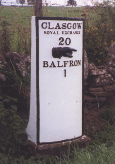
Balfron is a small village located in the Stirlingshire region of Scotland. Situated about 18 miles northwest of Stirling, it lies at the foot of the Campsie Fells and offers picturesque views of the surrounding countryside. With a population of around 1,700 residents, Balfron maintains a close-knit community atmosphere.

The village features a range of amenities and services to cater to its residents' needs. It boasts a primary school, a medical practice, a post office, and a variety of local shops and businesses. The Balfron Community Council actively engages with the local community, organizing events and initiatives to enhance village life.

Balfron is steeped in history, and remnants of its past can still be seen today. The striking Balfron Tower, a Category B listed building, dominates the village skyline. Built in 1862 as a water tower, it now serves as a unique residential property. The village also boasts several historical landmarks, including the Old Kirk of Balfron, which dates back to the 17th century.

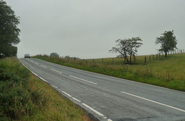
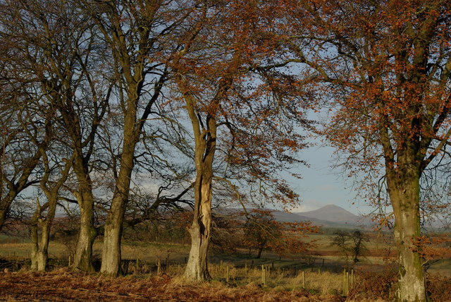
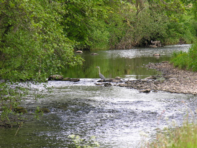
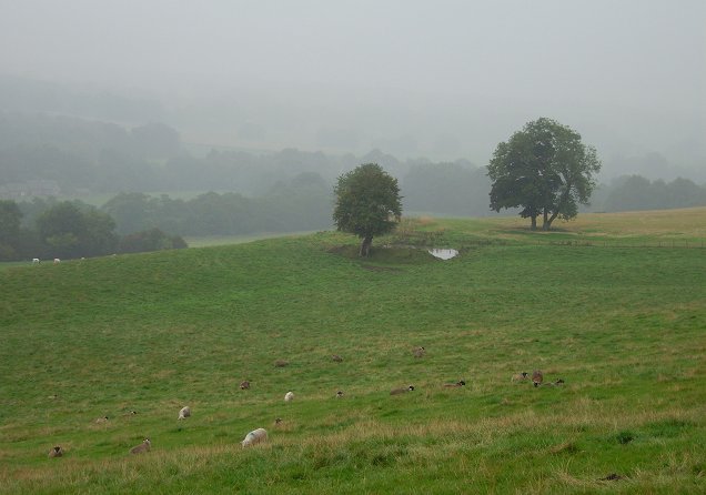
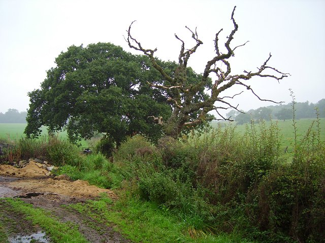
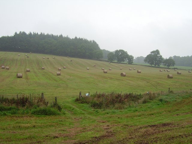
The natural beauty surrounding Balfron provides ample opportunities for outdoor activities. The Campsie Fells offer numerous walking and hiking trails, attracting outdoor enthusiasts from near and far. Additionally, the nearby Endrick River and Loch Lomond and The Trossachs National Park provide opportunities for fishing, boating, and wildlife spotting.

Balfron's convenient location offers easy access to larger towns and cities. Stirling and Glasgow are both within a short driving distance, providing additional amenities and cultural attractions. Overall, Balfron offers a peaceful and scenic setting, making it an ideal place to reside for those seeking a tranquil village lifestyle with easy access to urban centers.

If you have any feedback on the listing, please let us know in the comments section below.
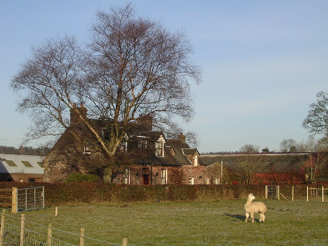
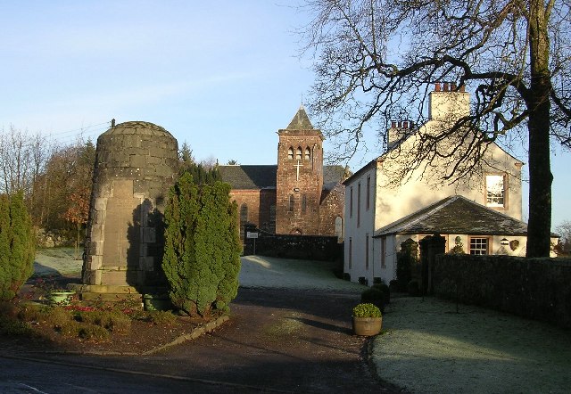
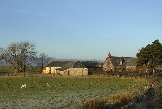
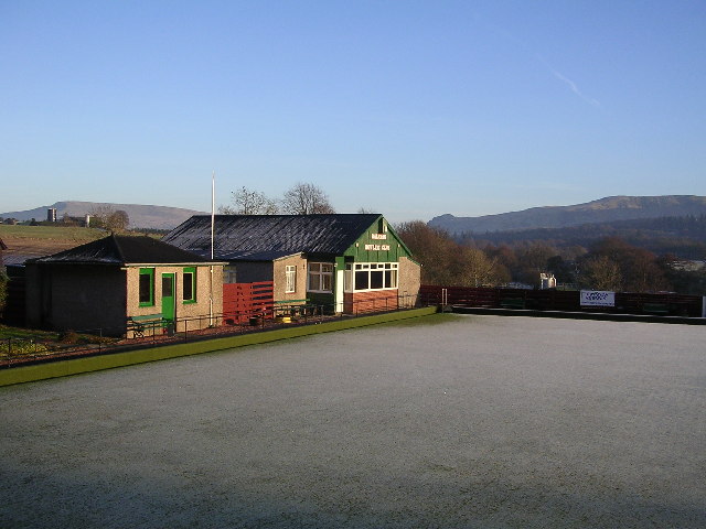
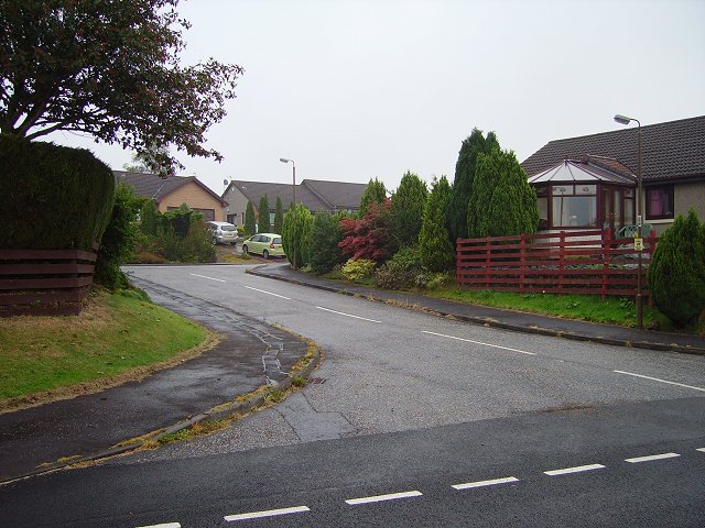
Balfron Images

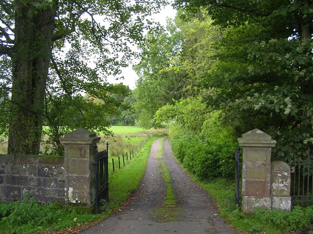
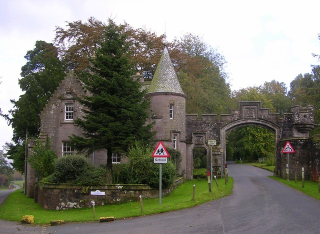
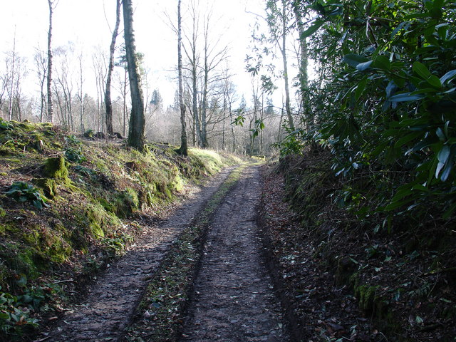
Images are sourced within 2km of 56.068948/-4.335935 or Grid Reference NS5488. Thanks to Geograph Open Source API. All images are credited.

Old Milestone by the A875, Kepculloch Road, Balfron parish Glasgow curved by the A875, in parish of Balfron (Stirling District), Kepculloch Road, North of Tombrake Farm, on grass verge, East side of road.

Inscription reads:-
GLASGOW
ROYAL EXCHANGE
20
{hand->}
BALFRON
1

Grade C(S) listed.
Reference: LB49016 <span class="nowrap"><a title="http://portal.historicenvironment.scot/designation/LB49016" rel="nofollow ugc noopener" href="http://portal.historicenvironment.scot/designation/LB49016">Link</a><img style="margin-left:2px;" alt="External link" title="External link - shift click to open in new window" src="https://s1.geograph.org.uk/img/external.png" width="10" height="10"/></span>

Surveyed

Milestone Society National ID: ST_GWBF20
Old Milestone by the A875, Kepculloch Road, Balfron parish
Glasgow curved by the A875, in parish of Balfron (Stirling District), Kepculloch Road, North of Tombrake Farm, on grass verge, East side of road. Inscription reads:- GLASGOW ROYAL EXCHANGE 20 {hand->} BALFRON 1 Grade C(S) listed. Reference: LB49016 LinkExternal link Surveyed Milestone Society National ID: ST_GWBF20
A875 near Tombrake
A875 near Tombrake
Field & trees north of Tombrake View towards distant Ben Lomond
Field & trees north of Tombrake
View towards distant Ben Lomond
River Endrick A walk along the Endrick on a Sunday Afternoon
River Endrick
A walk along the Endrick on a Sunday Afternoon
Ballochruin Farm plus Llama
Balfron Church and War Memorial
Tombrake Farm, near Balfron
Balfron Bowling Club
Sheep grazing, Kiltrochan Just outside Balfron, and overlooking the Endrick Water, a sheep field with a hanging pond.
Sheep grazing, Kiltrochan
Just outside Balfron, and overlooking the Endrick Water, a sheep field with a hanging pond.
Balfron Bungaloid close on the eastern side of Balfron.
Balfron
Bungaloid close on the eastern side of Balfron.
Dead oak, Balfron Dead tree by a cut off road loop between Balfron and Balfron Station, Stirlingshire.
Dead oak, Balfron
Dead tree by a cut off road loop between Balfron and Balfron Station, Stirlingshire.
Camoquill Round bales left out for a while, near Camoquill Douglas, Balfron.
Camoquill
Round bales left out for a while, near Camoquill Douglas, Balfron.
Beech-lined lane, Balfron
Driveway to Boquhan Old House
Entrance to Ballikinrain Castle School
Balfron Church and war memorial
Rennie's Campsite - Ballikinrain Now just a rutted track, within the grounds of Ballikinrain Castle School, between 1950-1974 this land was used as a tourist caravan and camping site, complete with site shop and outside swimming pool. Evidence of the pool - which was fed by Campsie spring water - can still be seen, however scrub has reclaimed the land and after 50-odd years, nobody will remember what was once there.
Rennie's Campsite - Ballikinrain
Now just a rutted track, within the grounds of Ballikinrain Castle School, between 1950-1974 this land was used as a tourist caravan and camping site, complete with site shop and outside swimming pool. Evidence of the pool - which was fed by Campsie spring water - can still be seen, however scrub has reclaimed the land and after 50-odd years, nobody will remember what was once there.
Gorse on Cremannan Muir
Show me another place!

Balfron is located at Grid Ref: NS5488 (Lat: 56.068948, Lng: -4.335935)

Unitary Authority: Stirling

Police Authority: Forth Valley

What 3 Words

///exonerate.stormy.grazes. Near Balfron, Stirling

Nearby Locations

Birch Wood Balfron

Related Wikis

Balfron

Balfron (Scottish Gaelic: Both Fron) is a village in the Stirling council area of Scotland. It is situated near Endrick Water on the A875 road, 18 miles...

Balfron High School

Balfron High School is a secondary school situated in the village of Balfron, approximately 18 miles (29 km) west of Stirling and 16 miles (26 km) north...

Boquhan

Boquhan (pronounced Bowhan) is a hamlet in Stirling, Scotland, sometimes known as Wester Boquhan to distinguish it from the other nearby Boquhan, near...

Ballikinrain

Ballikinrain is an independent residential school in Stirling, central Scotland. It is run by CrossReach, a social care outreach arm of the Church of Scotland...

Nearby Amenities

Located within 500m of 56.068948,-4.335935
Turning Circle
Lat/Long: 56.0665421/-4.3393157
Post Office
Balfron Post Office
Addr Country: GB
Addr Postcode: G63 0TE
Brand: Post Office
Brand Wikidata: Q1783168
Contact Website: https://www.postoffice.co.uk/branch-finder/230855x/balfron
Ref Pol Id: 24622
Lat/Long: 56.0713687/-4.3373285
Balfron
Name En: Balfron
Name Gd: Both Fron
Place: village
Population: 2200
Wikidata: Q1010220
Wikipedia: en:Balfron
Lat/Long: 56.0680711/-4.3356705
Addr City: Balfron
Addr Housenumber: 136
Addr Postcode: G63 0TG
Addr Street: Buchanan Street
Lat/Long: 56.0715834/-4.3369134
Bus: yes
Public Transport: stop_position
Lat/Long: 56.0681254/-4.3357181
Bus Stop
Clinic
Bench: yes
Bin: yes
Naptan AtcoCode: 66005000005
Naptan NaptanCode: 78423453
Operator: First Scotland East
Public Transport: platform
Ref: 78423453
Shelter: yes
Tactile Paving: no
Lat/Long: 56.0681717/-4.3358358
Bus Stop
Clinic
Naptan AtcoCode: 66005000006
Naptan NaptanCode: 78423454
Operator: First Scotland East
Public Transport: platform
Ref: 78423454
Shelter: yes
Lat/Long: 56.0680968/-4.3356105
Wonderland
Shop: gift
Lat/Long: 56.0711178/-4.3371776
Cafe
Doyles
Outdoor Seating: yes
Lat/Long: 56.0699328/-4.3361181
Balfron Butchers
Shop: butcher
Lat/Long: 56.0678824/-4.3358633
The Bakes and more
Shop: bakery
Lat/Long: 56.0677686/-4.3358499
Police
Lat/Long: 56.06942/-4.3364185
Fuel
ESSO
Brand: Esso
Brand Wikidata: Q867662
Brand Wikipedia: en:Esso
Lat/Long: 56.0667049/-4.3360193
Pharmacy
Balfron Pharmacy
Check Date: 2023-01-17
Lat/Long: 56.0689304/-4.3361691
Doctors
Lat/Long: 56.0680905/-4.335992
Bus Stop
Lomond Terrace
Bus: yes
Departures Board: timetable
Naptan AtcoCode: 66005110009
Naptan NaptanCode: 78423462
Operator: First
Public Transport: platform
Ref: 78423462
Shelter: yes
Lat/Long: 56.0717933/-4.3348072
Bus Stop
Lomond Terrace
Bus: yes
Departures Board: timetable
Naptan AtcoCode: 66005110010
Naptan NaptanCode: 78423464
Operator: First
Public Transport: platform
Ref: 78423464
Shelter: yes
Lat/Long: 56.0720475/-4.3339152
Bus Stop
Co-op
Bus: yes
Departures Board: timetable
Naptan AtcoCode: 66005110004
Naptan NaptanCode: 78423459
Operator: First Scotland East
Public Transport: platform
Ref: 78423459
Shelter: yes
Lat/Long: 56.0707863/-4.3367112
Bus Stop
Coach House Inn
Bus: yes
Departures Board: timetable
Naptan AtcoCode: 66005110003
Naptan NaptanCode: 78423463
Operator: First Scotland East
Public Transport: platform
Ref: 78423463
Shelter: yes
Lat/Long: 56.0707783/-4.3369084
Generator Method: photovoltaic
Generator Output Electricity: yes
Generator Source: solar
Generator Type: solar_photovoltaic_panel
Power: generator
Lat/Long: 56.0704924/-4.3364666
Generator Method: photovoltaic
Generator Output Electricity: yes
Generator Source: solar
Generator Type: solar_photovoltaic_panel
Power: generator
Lat/Long: 56.070519/-4.3363357
Generator Method: photovoltaic
Generator Output Electricity: yes
Generator Source: solar
Generator Type: solar_photovoltaic_panel
Power: generator
Lat/Long: 56.0705388/-4.3361853
Generator Method: photovoltaic
Generator Output Electricity: yes
Generator Source: solar
Generator Type: solar_photovoltaic_panel
Power: generator
Lat/Long: 56.0705536/-4.3359853
Generator Method: photovoltaic
Generator Output Electricity: yes
Generator Source: solar
Generator Type: solar_photovoltaic_panel
Power: generator
Lat/Long: 56.0703679/-4.3354739
Generator Method: photovoltaic
Generator Output Electricity: yes
Generator Source: solar
Generator Type: solar_photovoltaic_panel
Power: generator
Lat/Long: 56.071026/-4.3337366
Generator Method: photovoltaic
Generator Output Electricity: yes
Generator Source: solar
Generator Type: solar_photovoltaic_panel
Power: generator
Lat/Long: 56.0723875/-4.3354691
Generator Method: photovoltaic
Generator Output Electricity: yes
Generator Source: solar
Generator Type: solar_photovoltaic_panel
Power: generator
Lat/Long: 56.0723944/-4.3354001
Generator Method: photovoltaic
Generator Output Electricity: yes
Generator Source: solar
Generator Type: solar_photovoltaic_panel
Power: generator
Lat/Long: 56.0725593/-4.3353629
Generator Method: photovoltaic
Generator Output Electricity: yes
Generator Source: solar
Generator Type: solar_photovoltaic_panel
Power: generator
Lat/Long: 56.0712056/-4.3363517
Generator Method: photovoltaic
Generator Output Electricity: yes
Generator Source: solar
Generator Type: solar_photovoltaic_panel
Power: generator
Lat/Long: 56.0726275/-4.3349966
Generator Method: photovoltaic
Generator Output Electricity: yes
Generator Source: solar
Generator Type: solar_photovoltaic_panel
Power: generator
Lat/Long: 56.0727282/-4.3346816
Generator Method: photovoltaic
Generator Output Electricity: yes
Generator Source: solar
Generator Type: solar_photovoltaic_panel
Power: generator
Lat/Long: 56.0727835/-4.3345666
Generator Method: photovoltaic
Generator Output Electricity: yes
Generator Source: solar
Generator Type: solar_photovoltaic_panel
Power: generator
Lat/Long: 56.072746/-4.3343436
Generator Method: photovoltaic
Generator Output Electricity: yes
Generator Source: solar
Generator Type: solar_photovoltaic_panel
Power: generator
Lat/Long: 56.0726334/-4.3340977
Generator Method: photovoltaic
Generator Output Electricity: yes
Generator Source: solar
Generator Type: solar_photovoltaic_panel
Power: generator
Lat/Long: 56.07251/-4.3338322
Generator Method: photovoltaic
Generator Output Electricity: yes
Generator Source: solar
Generator Type: solar_photovoltaic_panel
Power: generator
Lat/Long: 56.0723588/-4.3342605
Generator Method: photovoltaic
Generator Output Electricity: yes
Generator Source: solar
Generator Type: solar_photovoltaic_panel
Power: generator
Lat/Long: 56.0700008/-4.3378755
Generator Method: photovoltaic
Generator Output Electricity: yes
Generator Source: solar
Generator Type: solar_photovoltaic_panel
Power: generator
Lat/Long: 56.0698077/-4.3377092
Generator Method: photovoltaic
Generator Output Electricity: yes
Generator Source: solar
Generator Type: solar_photovoltaic_panel
Power: generator
Lat/Long: 56.0700772/-4.3350565
Generator Method: photovoltaic
Generator Output Electricity: yes
Generator Source: solar
Generator Type: solar_photovoltaic_panel
Power: generator
Lat/Long: 56.0700008/-4.3348902
Generator Method: photovoltaic
Generator Output Electricity: yes
Generator Source: solar
Generator Type: solar_photovoltaic_panel
Power: generator
Lat/Long: 56.0698182/-4.3347025
Generator Method: photovoltaic
Generator Output Electricity: yes
Generator Source: solar
Generator Type: solar_photovoltaic_panel
Power: generator
Lat/Long: 56.0697658/-4.3342304
Generator Method: photovoltaic
Generator Output Electricity: yes
Generator Source: solar
Generator Type: solar_photovoltaic_panel
Power: generator
Lat/Long: 56.070164/-4.3352336
Fast Food
Friar Tuck
Check Date: 2023-01-17
Cuisine: fish_and_chips
Lat/Long: 56.0704448/-4.3371188
Charging Station
Chargeplace Scotland Charging Station
Lat/Long: 56.070555/-4.3370981
Recycling
Recycling Type: centre
Lat/Long: 56.0703455/-4.3378664
Flour Girl
Shop: bakery
Lat/Long: 56.0707282/-4.3380279
Balfron Bowling Club
Leisure: pitch
Sport: bowls
Lat/Long: 56.0663165/-4.336223
Bus Stop
Bench: no
Bus: yes
Public Transport: platform
Shelter: no
Lat/Long: 56.0651682/-4.3388841
Crossing
Crossing: zebra
Crossing Island: no
Tactile Paving: yes
Lat/Long: 56.0711488/-4.3370341
Power: pole
Lat/Long: 56.0647727/-4.3338868
Power: pole
Lat/Long: 56.06522/-4.3327551
Power: pole
Lat/Long: 56.064949/-4.338543
Power: pole
Lat/Long: 56.0646233/-4.3368466
Power: pole
Lat/Long: 56.0653087/-4.3314499
Power: pole
Lat/Long: 56.0689891/-4.3431783
Power: pole
Lat/Long: 56.0692612/-4.3423395
Power: pole
Lat/Long: 56.0694585/-4.3417726
Social Facility
Village Phone Box
Addr City: Balfron
Booth: K6
Covered: booth
Description: old red phone box now used as food bank
Disused Amenity: telephone
Man Made: telephone_box
Operator: Balfron Community Council
Social Facility: food_bank
Website: https://balfroncc.org.uk/projects/balfron-phone-box/
Lat/Long: 56.067905/-4.3346312
Balfron Depot
Depot: bus
Industrial: depot
Operator: First
Lat/Long: 56.0680507/-4.3340662
Post Box
Brand: Royal Mail
Brand Wikidata: Q638098
Collection Times: Mo-Fr 16:45; Sa 12:00
Operator: Royal Mail
Operator Wikidata: Q638098
Lat/Long: 56.0714417/-4.3371935
Defibrillator
Emergency: defibrillator
Indoor: no
Lat/Long: 56.0705138/-4.3368223
Grit Bin
Colour: yellow
Material: plastic
Lat/Long: 56.0701741/-4.3365769
Check Date: 2023-01-17
Shop: funeral_directors
Lat/Long: 56.0695538/-4.3358354
Post Box
Brand: Royal Mail
Brand Wikidata: Q638098
Collection Times: Mo-Fr 15:30; Sa 07:30
Operator: Royal Mail
Operator Wikidata: Q638098
Ref: G63 820
Lat/Long: 56.0687042/-4.3360128
Grit Bin
Colour: yellow
Material: plastic
Lat/Long: 56.0670383/-4.3354222
Bench
Backrest: yes
Colour: cyan
Direction: 270
Material: metal
Lat/Long: 56.0680599/-4.3355999
Bench
Backrest: yes
Colour: cyan
Direction: 70
Material: metal
Lat/Long: 56.070751/-4.3368952
Bench
Backrest: yes
Colour: cyan
Direction: 260
Material: metal
Lat/Long: 56.0690166/-4.3357878
Erhan's Barbers
Check Date: 2023-01-17
Shop: hairdresser
Lat/Long: 56.0694741/-4.335788
The data included in this document is from www.openstreetmap.org. The data is made available under ODbL.

Have you been to Balfron?

Leave your review of Balfron below (or comments, questions and feedback).