Grimsthorpe Park

Downs, Moorland in Lincolnshire South Kesteven

England

Grimsthorpe Park

Grimsthorpe Castle Looking down North Avenue
Grimsthorpe Castle Credit: Tim Heaton

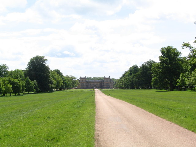
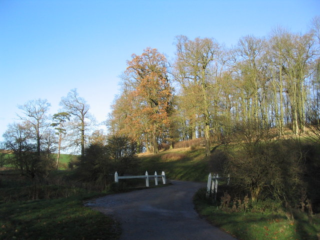
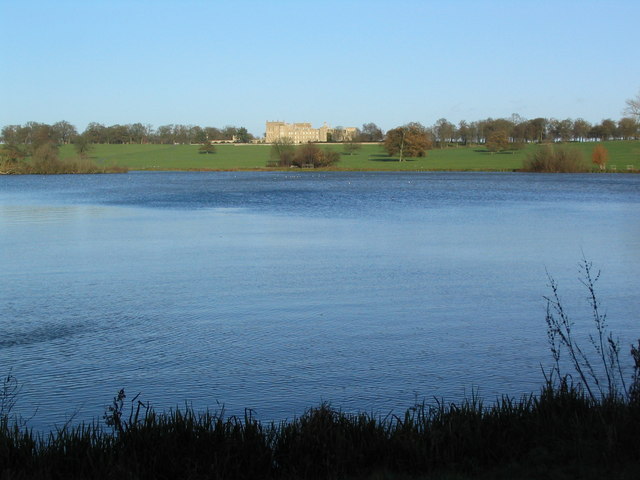
Grimsthorpe Park is an expansive estate located in the county of Lincolnshire, England. Covering an area of over 3,000 acres, it is renowned for its picturesque landscape, featuring a combination of downs and moorland. The park is situated within the grounds of Grimsthorpe Castle, a historic stately home that dates back to the 16th century.

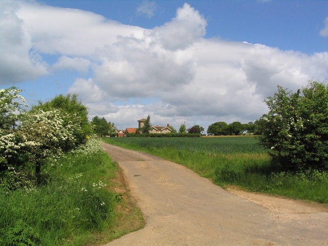
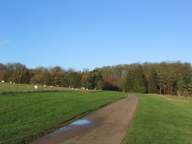
The downs within Grimsthorpe Park are characterized by their gently rolling hills and open grasslands. These areas offer breathtaking views of the surrounding countryside, making them ideal for leisurely walks and picnics. The downs are dotted with a variety of flowering plants and provide a haven for numerous bird species, making it a popular spot for birdwatching enthusiasts.

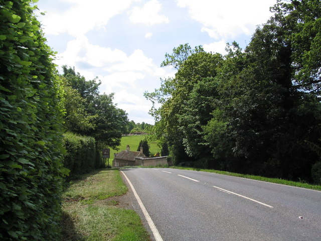
On the other hand, the moorland sections of the park boast a rugged and wild beauty. Covered in heather and bracken, these areas are home to a diverse range of wildlife including deer, rabbits, and various bird species. The moors provide an opportunity for visitors to immerse themselves in nature and experience the tranquility of the surroundings.

Grimsthorpe Park offers visitors the chance to explore its vast landscape through a network of well-maintained walking trails. Along these paths, visitors can discover hidden gems such as ancient woodlands, serene lakes, and even a medieval deer park. Additionally, the park features a variety of recreational activities including cycling, fishing, and horse riding.

Overall, Grimsthorpe Park is a natural haven that offers visitors a chance to escape the hustle and bustle of everyday life. With its diverse landscapes and abundant wildlife, it is a perfect destination for nature lovers and those seeking a peaceful retreat in the heart of Lincolnshire.

If you have any feedback on the listing, please let us know in the comments section below.

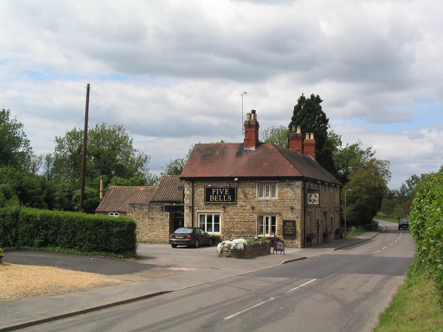
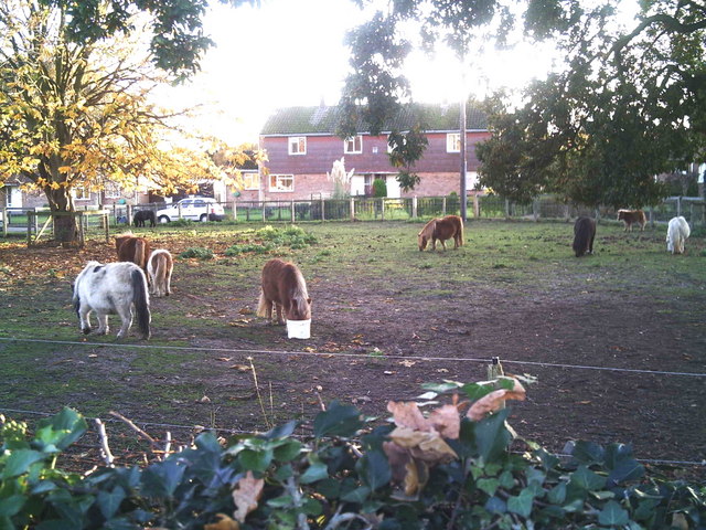
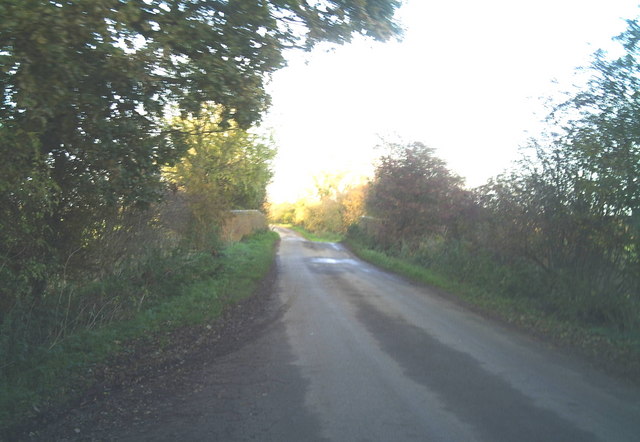
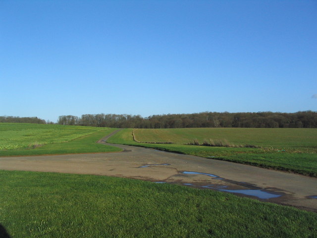
Grimsthorpe Park Images

Images are sourced within 2km of 52.784356/-0.45894781 or Grid Reference TF0421. Thanks to Geograph Open Source API. All images are credited.

Grimsthorpe Castle Looking down North Avenue
Grimsthorpe Castle
Looking down North Avenue
Track to Tower Farm
Track to Tower Farm
The Black Horse, Grimsthorpe Now open for business again
The Black Horse, Grimsthorpe
Now open for business again
Entering Grimsthorpe
The Five Bells at Edenham
Estate cottages, Scottlethorpe road
Tumble Row Farm, Scottlethorpe
View north from near Scottlethorpe Grange The road to Scottlethorpe runs across a valley in the middle distance and (invisibly) through the woods on the horizon
View north from near Scottlethorpe Grange
The road to Scottlethorpe runs across a valley in the middle distance and (invisibly) through the woods on the horizon
Shetland ponies in a paddock Shetland ponies.
Shetland ponies in a paddock
Shetland ponies.
Brick road bridge over the River Glen near Elsthorpe Hump-back brick-built bridge over the River Glen, near Elsthorpe.
Brick road bridge over the River Glen near Elsthorpe
Hump-back brick-built bridge over the River Glen, near Elsthorpe.
View north towards Park House, Grimsthorpe Park
Farm buildings, Grimsthorpe Park The track runs north-west towards Swinstead.
Farm buildings, Grimsthorpe Park
The track runs north-west towards Swinstead.
Road running east into Grimsthorpe Park Much of the central part of this large Park estate is farmed, but the remainder is attractive woodland.
Road running east into Grimsthorpe Park
Much of the central part of this large Park estate is farmed, but the remainder is attractive woodland.
Road junction, Grimsthorpe Park The main road through the Park. Running from Chestnut Avenue to the south (bottom right), towards the castle at the north end of the Park (top).
Road junction, Grimsthorpe Park
The main road through the Park. Running from Chestnut Avenue to the south (bottom right), towards the castle at the north end of the Park (top).
'Pots and Pans', Grimsthorpe Park Bumpy ground marking former quarry. Extraction of good quality limestone remains an important activity in the area.
'Pots and Pans', Grimsthorpe Park
Bumpy ground marking former quarry. Extraction of good quality limestone remains an important activity in the area.
Bridge leading to 'The Vaudey', Grimsthorpe Park The stream leaving from the lake south of Grimsthorpe Castle runs through a valley named 'Vallis Dei' (Valley of God, now 'Vaudey') by Cistercian monks who founded an abbey here in the 12th century.
Bridge leading to 'The Vaudey', Grimsthorpe Park
The stream leaving from the lake south of Grimsthorpe Castle runs through a valley named 'Vallis Dei' (Valley of God, now 'Vaudey') by Cistercian monks who founded an abbey here in the 12th century.
Grimsthorpe Park
Grimsthorpe Park
Grimsthorpe Lake The southern end of the lake, with Grimsthorpe Castle in the distance
Grimsthorpe Lake
The southern end of the lake, with Grimsthorpe Castle in the distance
Show me another place!

Grimsthorpe Park is located at Grid Ref: TF0421 (Lat: 52.784356, Lng: -0.45894781)

Administrative County: Lincolnshire

District: South Kesteven

Police Authority: Lincolnshire

What 3 Words

///proposals.valid.spots. Near Corby Glen, Lincolnshire

Related Wikis

Vaudey Abbey

Vaudey Abbey , also known as Vandy Abbey or Vandey Abbey, was an English Cistercian abbey. It was founded in 1147 by William, Count of Aumale, Earl of...

South Kesteven Rural District

South Kesteven was a rural district in Lincolnshire, Parts of Kesteven in England from 1931 to 1974. It was formed under a County Review Order in 1931...
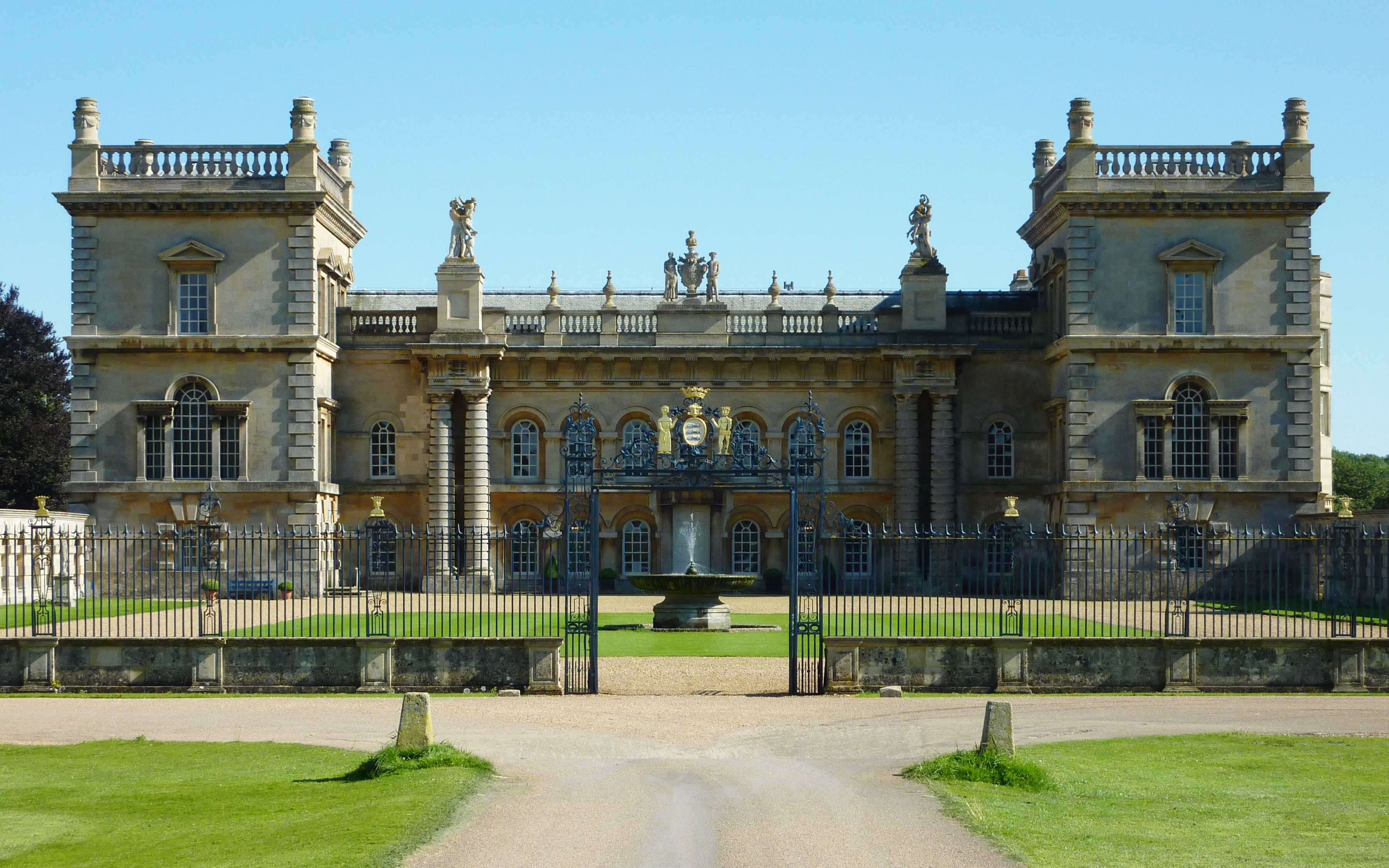
Grimsthorpe Castle

Grimsthorpe Castle is a country house in Lincolnshire, England 4 miles (6.4 km) north-west of Bourne on the A151. It lies within a 3,000 acre (12 km2)...

Grimsthorpe

Grimsthorpe is a hamlet in the South Kesteven district of Lincolnshire, England. It is situated on the A151 road, and 3 miles (5 km) north-west from Bourne...

Edenham railway station

Edenham railway station was a station in Edenham, Lincolnshire. It was the terminus of a four-mile branch line from the Great Northern Railway at Little...

Edenham

Edenham ( EDD-ən-əm) is a village and civil parish in the South Kesteven district of Lincolnshire, England. It is approximately 3 miles (5 km) north-west...

Scottlethorpe

Scottlethorpe is a village in the South Kesteven district of Lincolnshire, England. It is situated approximately 3 miles (4.8 km) north-west from Bourne...

Swinstead

Swinstead is a village and civil parish in the South Kesteven district of Lincolnshire, England. It is situated 5 miles (8.0 km) west from Bourne, 9 miles...

Nearby Amenities

Located within 500m of 52.784356,-0.45894781
Ele: 40.0000000
Lat/Long: 52.7845275/-0.4601818
Ele: 63.0000000
Lat/Long: 52.7847627/-0.4516998
Ele: 49.0000000
Lat/Long: 52.7846982/-0.4541355
Barrier: stile
Ele: 43.0000000
Steps: 2
Stile: stepover
Lat/Long: 52.784541/-0.4563372
Ele: 43.0000000
Lat/Long: 52.7845205/-0.4570738
Ele: 64.0000000
Lat/Long: 52.7848283/-0.4517081
Ele: 40.0000000
Lat/Long: 52.7855424/-0.4609117
Ele: 40.0000000
Lat/Long: 52.7856452/-0.4609913
Ele: 41.0000000
Lat/Long: 52.7857361/-0.4611614
Ele: 41.0000000
Lat/Long: 52.7857833/-0.4613296
Ford: yes
Lat/Long: 52.7855615/-0.4610475
Ele: 44.0000000
Lat/Long: 52.7844844/-0.4590895
Ele: 40.0000000
Lat/Long: 52.7857077/-0.4610925
Bench
Ele: 40.0000000
Lat/Long: 52.7849548/-0.4604923
Ele: 41.0000000
Lat/Long: 52.7850943/-0.4605325
Ele: 43.0000000
Lat/Long: 52.7858535/-0.4620399
Ele: 46.0000000
Lat/Long: 52.7865841/-0.464966
Maize Hill
Place: locality
Source: Bing
Lat/Long: 52.7822581/-0.4562591
Daudney Abbey
Historic: archaeological_site
Source: Bing
Lat/Long: 52.7811545/-0.4636765
The data included in this document is from www.openstreetmap.org. The data is made available under ODbL.

Have you been to Grimsthorpe Park?

Leave your review of Grimsthorpe Park below (or comments, questions and feedback).