Barkston Heath

Downs, Moorland in Lincolnshire South Kesteven

England

Barkston Heath

Bridleway towards Ermine Street Running along the district boundary between North and South Kesteven
Bridleway towards Ermine Street Credit: Tim Heaton

Barkston Heath is a rural area located in Lincolnshire, England. It is situated approximately 6 miles south of the town of Grantham. The region is characterized by its diverse landscape, consisting of downs and moorland.

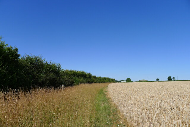
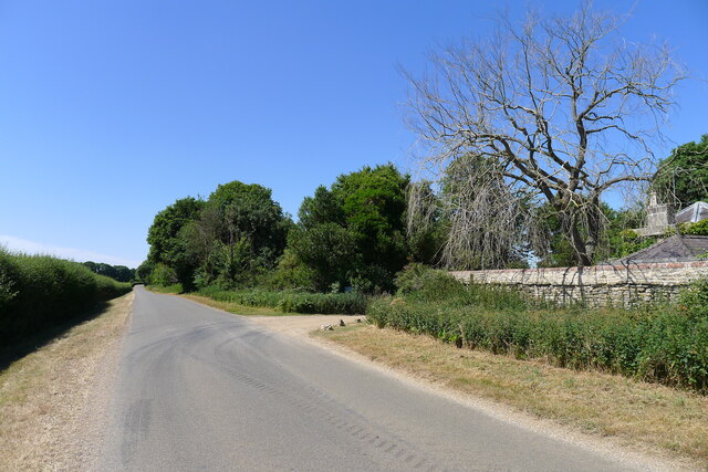
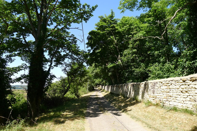
The downs in Barkston Heath are rolling hills that offer picturesque views of the surrounding countryside. They are covered in lush grass and are often used for grazing livestock. The downs provide a tranquil and peaceful atmosphere, attracting hikers and nature enthusiasts.

In contrast, the moorland of Barkston Heath is a more rugged and wild terrain. It is characterized by its open expanses of heather and gorse, interspersed with areas of wetland. The moorland is home to a variety of wildlife, including birds of prey, such as kestrels and buzzards, as well as smaller mammals like hares and rabbits.

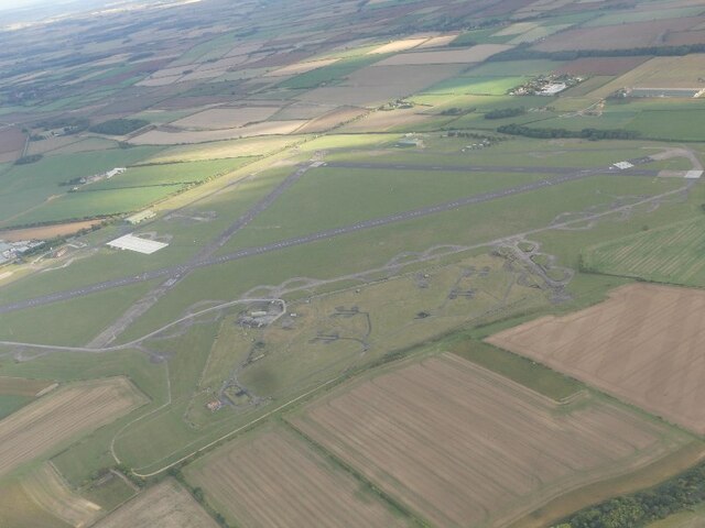
Barkston Heath is also notable for its military significance. It is home to the Barkston Heath Training Area, which is used by the Royal Air Force for training purposes. The training area consists of a large airfield and surrounding land, which is utilized for exercises and maneuvers by both British and international forces.

Overall, Barkston Heath in Lincolnshire offers a unique blend of natural beauty and military importance. Its downs and moorland provide a stunning backdrop for outdoor activities and exploration, while the nearby training area adds an element of excitement and history to the region.

If you have any feedback on the listing, please let us know in the comments section below.

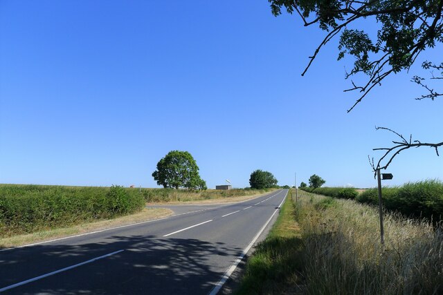
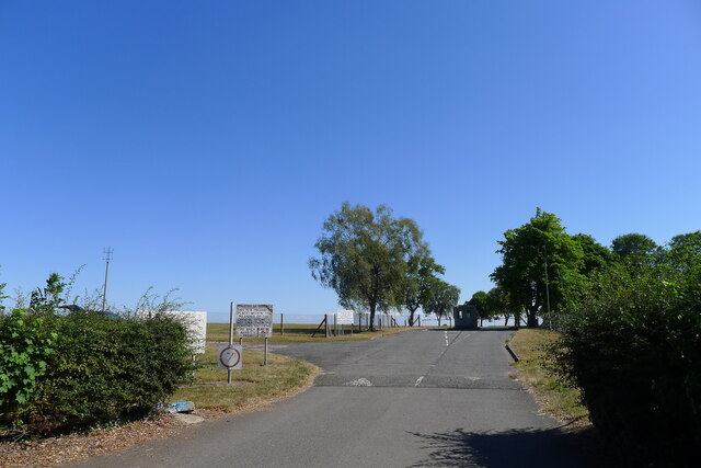
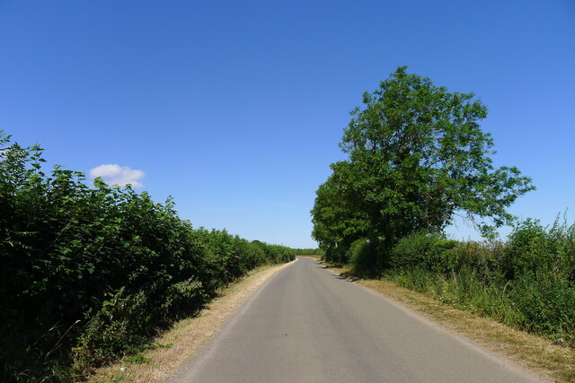
Barkston Heath Images

Images are sourced within 2km of 52.961442/-0.573151 or Grid Reference SK9541. Thanks to Geograph Open Source API. All images are credited.

Bridleway towards Ermine Street Running along the district boundary between North and South Kesteven
Bridleway towards Ermine Street
Running along the district boundary between North and South Kesteven
Ermine Street (High Dike) at the junction with Heath Lane The fingerpost on the right indicates a bridleway to another Roman road, King Street, to the east.
Ermine Street (High Dike) at the junction with Heath Lane
The fingerpost on the right indicates a bridleway to another Roman road, King Street, to the east.
Entrance to RAF Barkston Heath A training school for MOD pilots, with dire warnings against unauthorised entry.
Entrance to RAF Barkston Heath
A training school for MOD pilots, with dire warnings against unauthorised entry.
Heath Lane passing RAF Barkston Heath airfield
Entrance to Heath Lane track At the edge of RAF Barkston Heath. The track leads down to Barkston in the Witham valley
Entrance to Heath Lane track
At the edge of RAF Barkston Heath. The track leads down to Barkston in the Witham valley
Heath Lane The belt of trees on the horizon, Minnets Wood, sits on the top of the escarpment overlooking the Witham valley
Heath Lane
The belt of trees on the horizon, Minnets Wood, sits on the top of the escarpment overlooking the Witham valley
Heath Lane approaching Minnet's Wood Running towards the edge of the escarpment of Jurassic Lincolnshire Limestone
Heath Lane approaching Minnet's Wood
Running towards the edge of the escarpment of Jurassic Lincolnshire Limestone
North Lodge at the top of Minnett's Hill Once part of the former Syston Park estate. The hill drops down the Jurassic limestone escarpment towards the River Witham.
North Lodge at the top of Minnett's Hill
Once part of the former Syston Park estate. The hill drops down the Jurassic limestone escarpment towards the River Witham.
Restricted byway along the boundary of RAF Barkston Heath
Junction of bridleway and restricted byway at the edge of RAF Barkston Heath The bridleway runs between the two hedges, and the junction is shifted slightly from the position shown on the OS map.
Junction of bridleway and restricted byway at the edge of RAF Barkston Heath
The bridleway runs between the two hedges, and the junction is shifted slightly from the position shown on the OS map.
Bridleway by a field of oats The bridleway leads towards Honington
Bridleway by a field of oats
The bridleway leads towards Honington
Honington Camp hill fort Part of the defensive earth banks of an Iron Age hill fort or settlement <span class="nowrap"><a title="https://heritage-explorer.lincolnshire.gov.uk/Monument/MLI30366" rel="nofollow ugc noopener" href="https://heritage-explorer.lincolnshire.gov.uk/Monument/MLI30366">Link</a><img style="margin-left:2px;" alt="External link" title="External link - shift click to open in new window" src="https://s1.geograph.org.uk/img/external.png" width="10" height="10"/></span> <span class="nowrap"><a title="http://www.stone-circles.org.uk/stone/honington.htm" rel="nofollow ugc noopener" href="http://www.stone-circles.org.uk/stone/honington.htm">Link</a><img style="margin-left:2px;" alt="External link" title="External link - shift click to open in new window" src="https://s1.geograph.org.uk/img/external.png" width="10" height="10"/></span> . It sits close to the top of the Jurassic limestone escarpment overlooking the Witham valley and Vale of Belvoir.
Honington Camp hill fort
Part of the defensive earth banks of an Iron Age hill fort or settlement LinkExternal link LinkExternal link . It sits close to the top of the Jurassic limestone escarpment overlooking the Witham valley and Vale of Belvoir.
Heath Lane passing East Lodge The lodge was once part of the former Syston Park estate
Heath Lane passing East Lodge
The lodge was once part of the former Syston Park estate
Green Lane, Syston, Grantham Running by the estate wall of the former Syston Park, on the edge of the Jurassic limestone scarpment overlooking Grantham
Green Lane, Syston, Grantham
Running by the estate wall of the former Syston Park, on the edge of the Jurassic limestone scarpment overlooking Grantham
RAF Barkston Heath: aerial 2022
Main Street, Honington, joining the A607 Across the road a Restricted Byway, Heath Lane, climbs up the escarpment of  Lincolnshire limestone known as the 'Lincoln Cliff'
Main Street, Honington, joining the A607
Across the road a Restricted Byway, Heath Lane, climbs up the escarpment of Lincolnshire limestone known as the 'Lincoln Cliff'
Heath Lane running down to Honington View west from the limestone escarpment of the 'Lincoln Cliff'
Heath Lane running down to Honington
View west from the limestone escarpment of the 'Lincoln Cliff'
View north-east from Heath Lane Looking along the shallow limestone escarpment known as the 'Lincoln Cliff'
View north-east from Heath Lane
Looking along the shallow limestone escarpment known as the 'Lincoln Cliff'
Show me another place!

Barkston Heath is located at Grid Ref: SK9541 (Lat: 52.961442, Lng: -0.573151)

Administrative County: Lincolnshire

District: South Kesteven

Police Authority: Lincolnshire

What 3 Words

///bounding.flame.sour. Near Ancaster, Lincolnshire

Nearby Locations

Barkston Heath

Related Wikis

RAF Barkston Heath

Royal Air Force Barkston Heath or RAF Barkston Heath (ICAO: EGYE) is a Royal Air Force Relief Landing Ground under the command of RAF Cranwell near Grantham...

Honington, Lincolnshire

Honington is an English village and civil parish in the South Kesteven district of Lincolnshire. It lies just north of the junction between the A153 and...

Ancaster, Lincolnshire

Ancaster is a village and civil parish in the South Kesteven district of Lincolnshire, England, on the site of a Roman town. The population of the civil...

Barkston

Barkston is an English village and civil parish in the South Kesteven district of Lincolnshire. The parish population was 497 at the 2001 census and 493...

Honington railway station

Honington railway station was a station in the village of Honington, Lincolnshire. It was located on junction with the line Grantham and Lincoln railway...

Syston, Lincolnshire

Syston is a village and civil parish in the South Kesteven district of Lincolnshire, England. The population of the civil parish was 162 at the 2011 census...

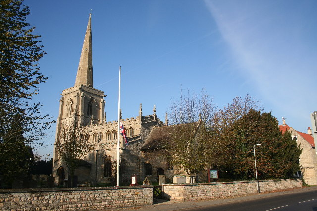
St Martin's Church, Ancaster

St Martin's Church is a Grade I listed Anglican church, dedicated to Martin of Tours, in Ancaster, Lincolnshire, England. The church is 6 miles (10 km...

Welby, Lincolnshire

Welby is a village and civil parish in the South Kesteven district of Lincolnshire, England. The population of the civil parish was 169 in 82 households...

Nearby Amenities

Located within 500m of 52.961442,-0.573151
Access: no
Barrier: lift_gate
Lat/Long: 52.9582312/-0.5742102
Turning Circle
Lat/Long: 52.9592919/-0.5713355
Turning Circle
Lat/Long: 52.9610754/-0.569031
Barkston Heath Farm
Historic Place: farm
Source: Bing
Lat/Long: 52.96507/-0.5732939
Barkston Heath
Place: locality
Source: Bing
Lat/Long: 52.9618188/-0.5662469
S2
Aeroway: holding_position
Holding Position Type: runway
Ref: S2
Lat/Long: 52.9581811/-0.5701156
Turning Circle
Lat/Long: 52.9605268/-0.5710723
S4
Aeroway: holding_position
Holding Position Type: runway
Ref: S4
Lat/Long: 52.9592003/-0.572023
S3
Aeroway: holding_position
Holding Position Type: runway
Ref: S3
Lat/Long: 52.9593327/-0.5720597
Aeroway: windsock
Lit: no
Lat/Long: 52.9626805/-0.5701863
24/10
Aeroway: holding_position
Holding Position Type: runway
Ref: 24/10
Lat/Long: 52.9603301/-0.5671988
The data included in this document is from www.openstreetmap.org. The data is made available under ODbL.

Have you been to Barkston Heath?

Leave your review of Barkston Heath below (or comments, questions and feedback).