Brow Moor

Downs, Moorland in Yorkshire Scarborough

England

Brow Moor

Robin Hood's Bay Bucking the trend for the month, Christmas Day 2021 dawned bright and clear on the Yorkshire coast. Even so, a brisk breeze ensured plenty of waves. Robin Hood's Bay village can be seen straight ahead. Ness Point is at the end of the headland.
Robin Hood's Bay Credit: Stephen McKay

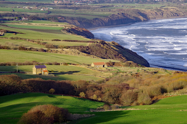
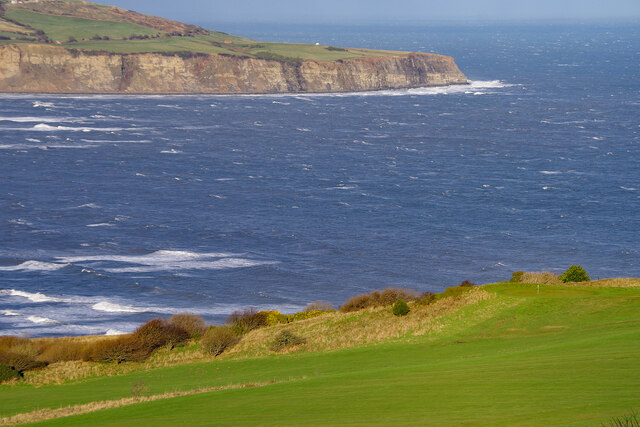
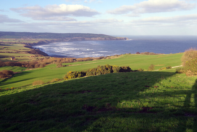
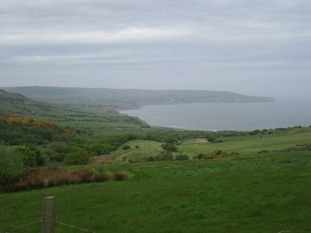
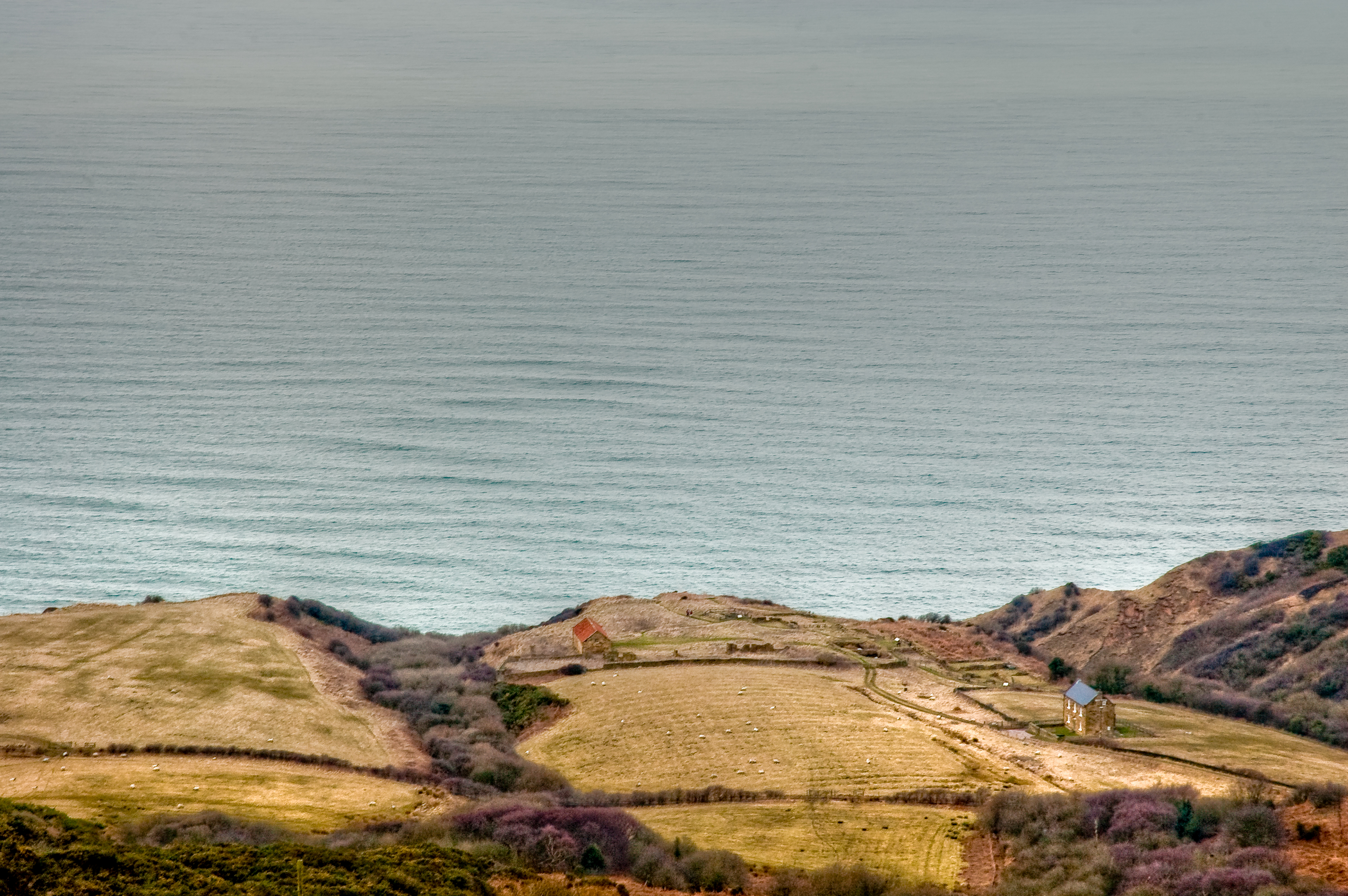
Brow Moor is a picturesque region located in Yorkshire, England. Situated on the edge of the North York Moors National Park, it encompasses a diverse landscape of downs and moorland. Spanning an area of approximately 200 square kilometers, Brow Moor is renowned for its natural beauty, attracting visitors from near and far.

The moorland of Brow Moor is characterized by its rolling hills, heather-covered expanses, and scattered patches of woodland. This unique environment supports a rich biodiversity and provides a habitat for several species of birds, mammals, and plants. It is not uncommon to spot red grouse, curlews, and golden plovers, among other wildlife, while exploring the area.

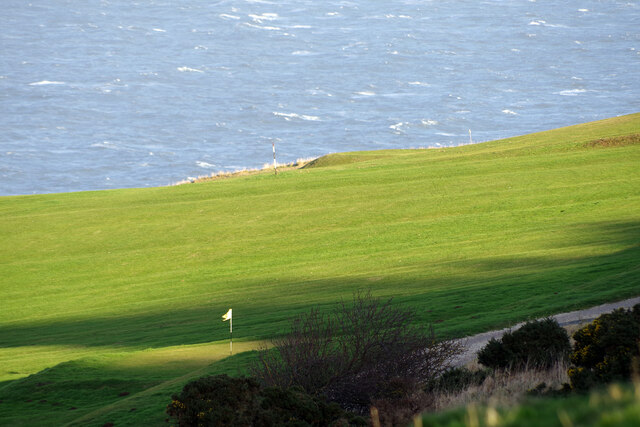
The downs of Brow Moor offer breathtaking views of the surrounding countryside. With their gentle slopes and open grasslands, they provide an ideal setting for leisurely walks and picnics. The landscape is adorned with vibrant wildflowers during the summer months, creating a colorful tapestry that is a delight to behold.

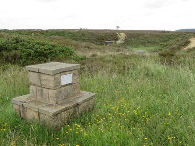
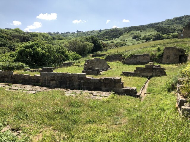
In addition to its natural splendor, Brow Moor boasts a fascinating history. Ancient burial mounds and stone circles can be found scattered throughout the area, bearing testament to its prehistoric past. The moorland has also played a significant role in the region's agricultural heritage, with evidence of farming practices dating back centuries.

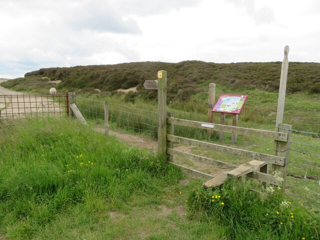
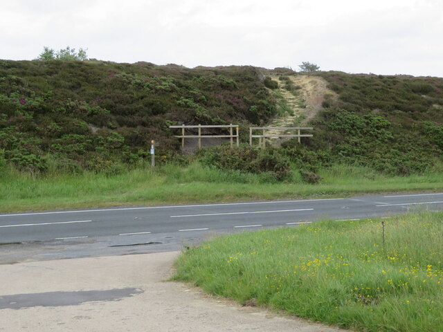
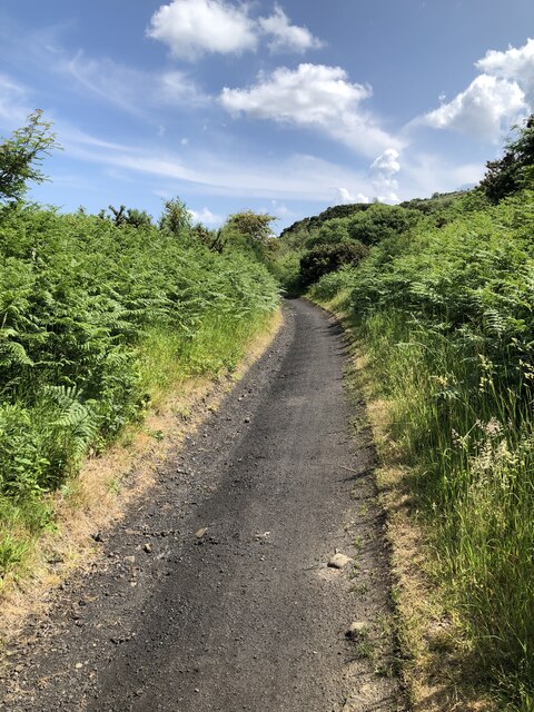
Visitors to Brow Moor can engage in a range of outdoor activities, including hiking, birdwatching, and even horseback riding. The area is crisscrossed by a network of footpaths and bridleways, allowing visitors to explore its various nooks and crannies at their own pace.

All in all, Brow Moor is a haven for nature enthusiasts and history buffs alike, offering a captivating blend of natural beauty and cultural heritage.

If you have any feedback on the listing, please let us know in the comments section below.

Brow Moor Images

Images are sourced within 2km of 54.400981/-0.5246809 or Grid Reference NZ9501. Thanks to Geograph Open Source API. All images are credited.

Robin Hood's Bay Bucking the trend for the month, Christmas Day 2021 dawned bright and clear on the Yorkshire coast. Even so, a brisk breeze ensured plenty of waves. Robin Hood's Bay village can be seen straight ahead. Ness Point is at the end of the headland.
Robin Hood's Bay
Bucking the trend for the month, Christmas Day 2021 dawned bright and clear on the Yorkshire coast. Even so, a brisk breeze ensured plenty of waves. Robin Hood's Bay village can be seen straight ahead. Ness Point is at the end of the headland.
Low Peak Looking down from High Peak. There was once an alum works here; alum was extracted from quarried shales and used for textile dyes. The process was slow and complex and synthetic alum became available in the second half of the 19th century, leading to the end of the industry in this area.
Low Peak
Looking down from High Peak. There was once an alum works here; alum was extracted from quarried shales and used for textile dyes. The process was slow and complex and synthetic alum became available in the second half of the 19th century, leading to the end of the industry in this area.
Robin Hood's Bay Looking across the choppy sea from Peakside Farm to Ness Point. In the foreground is part of the golf course belonging to Raven Hall Hotel.
Robin Hood's Bay
Looking across the choppy sea from Peakside Farm to Ness Point. In the foreground is part of the golf course belonging to Raven Hall Hotel.
Fairview House, Ravenscar Looking up from Peakside Farm to Fairview House at the end of Robin Hood's Road; the house is used as holiday accommodation. Behind that is a 45 metre transmitting mast operated by Arqiva.
Fairview House, Ravenscar
Looking up from Peakside Farm to Fairview House at the end of Robin Hood's Road; the house is used as holiday accommodation. Behind that is a 45 metre transmitting mast operated by Arqiva.
Raven Hall Hotel Golf Course Raven Hall Hotel boasts its own 9-hole par 64 golf course. Nobody would claim it is up to championship standards but at least it has a superb sea view. Sea conditions were decidedly choppy in this Christmas Day view.
Raven Hall Hotel Golf Course
Raven Hall Hotel boasts its own 9-hole par 64 golf course. Nobody would claim it is up to championship standards but at least it has a superb sea view. Sea conditions were decidedly choppy in this Christmas Day view.
View from Peakside Farm Looking towards Robin Hood's Bay and Ness Point. This is said to be one of the best views in Yorkshire.
View from Peakside Farm
Looking towards Robin Hood's Bay and Ness Point. This is said to be one of the best views in Yorkshire.
Ravenscar view Looking towards the alum works.
Ravenscar view
Looking towards the alum works.
Stoupe Brow Looking up at Stoupe Brow.
Stoupe Brow
Looking up at Stoupe Brow.
Browside Farm view The view from the old railway line at Browside Farm.
Browside Farm view
The view from the old railway line at Browside Farm.
Lyke Wake Walk stile near Jugger Howe Moor This stile is off the A171 on the old by-passed road. The route is part of the Lyke Wake Walk from Osmotherley to Ravenscar.
Lyke Wake Walk stile near Jugger Howe Moor
This stile is off the A171 on the old by-passed road. The route is part of the Lyke Wake Walk from Osmotherley to Ravenscar.
Memorial to Pete Gough by the A171 and Lyke Wake Walk Pete Gough (1921-1994) was a founder member and team leader of the Scarborough and District Search and Rescue Team.
Memorial to Pete Gough by the A171 and Lyke Wake Walk
Pete Gough (1921-1994) was a founder member and team leader of the Scarborough and District Search and Rescue Team.
The A171 and the Lyke Wake Walk up on to Stony Marl Moor For the Wikipedia article on the Lyke Wake Walk see <span class="nowrap"><a title="http://en.wikipedia.org/wiki/Lyke_Wake_Walk" rel="nofollow ugc noopener" href="http://en.wikipedia.org/wiki/Lyke_Wake_Walk">Link</a><img style="margin-left:2px;" alt="External link" title="External link - shift click to open in new window" src="https://s1.geograph.org.uk/img/external.png" width="10" height="10"/></span>

The Lyke Wake Race is held in conjunction with the Osmotherley Summer Games and run in an East to West direction finishing in the village. On 11 July 1981 the author won the race in a time of 4 hours 51 minutes thereby setting a new record which lasted for several years.
The A171 and the Lyke Wake Walk up on to Stony Marl Moor
For the Wikipedia article on the Lyke Wake Walk see LinkExternal link The Lyke Wake Race is held in conjunction with the Osmotherley Summer Games and run in an East to West direction finishing in the village. On 11 July 1981 the author won the race in a time of 4 hours 51 minutes thereby setting a new record which lasted for several years.
Stroupe Beck
Stroupe Beck
The Cleveland Way above High Scar
Sunken Pillbox on Peter White Cliff
Remains of Peak Alum Works Alum, a salt of aluminium, was extracted from shale for use as a fixing agent in the dying industry. Pre-dating the industrialisation associated with the industrial revolution, alum production began in the 17th century and continued until the late 19th century when synthetic fixing agents were produced. The coastal area around Ravenscar was the location of a large quarrying and alum production centre until 1871.
Remains of Peak Alum Works
Alum, a salt of aluminium, was extracted from shale for use as a fixing agent in the dying industry. Pre-dating the industrialisation associated with the industrial revolution, alum production began in the 17th century and continued until the late 19th century when synthetic fixing agents were produced. The coastal area around Ravenscar was the location of a large quarrying and alum production centre until 1871.
The Cinder Track The Cinder Track is a walking / cycling route utilising the trackbed of the former railway that ran between Scarborough and Whitby.
The Cinder Track
The Cinder Track is a walking / cycling route utilising the trackbed of the former railway that ran between Scarborough and Whitby.
The Cinder Track below Stoupe Brow
Show me another place!

Brow Moor is located at Grid Ref: NZ9501 (Lat: 54.400981, Lng: -0.5246809)

Division: North Riding

Administrative County: North Yorkshire

District: Scarborough

Police Authority: North Yorkshire

What 3 Words

///triangles.pepper.even. Near Burniston, North Yorkshire

Nearby Locations

Howdale Moor Brow Moor

Related Wikis

Fylingdales

Fylingdales is a civil parish in North Yorkshire, England situated south of Whitby, within the North York Moors National Park. It contains the villages...

Fyling Hall railway station

Fyling Hall railway station was a railway station on the Scarborough & Whitby Railway. It opened on 16 July 1885, and was named after Fyling Hall, near...

Ravenscar, North Yorkshire

Ravenscar is a coastal village in the Scarborough district of North Yorkshire, England. It is within the civil parish of Staintondale and the North York...

Ramsdale Beck

Ramsdale Beck is a small river that feeds directly into the North Sea between Robin Hood's Bay and Ravenscar on the North Yorkshire coast in England. The...

Ravenscar railway station

Ravenscar was a railway station on the Scarborough & Whitby Railway and served the village of Ravenscar, North Yorkshire, England. == History == The station...

Robin Hood's Bay Marine Laboratory

The Robin Hood's Bay Marine Laboratory was a marine scientific research and education unit in North Yorkshire, England, from 1912 to 1982. Purchased in...

The Pigsty

The Pigsty is a folly located next to Fyling Hall School, near Robin Hood's Bay, North Yorkshire, England. It is a Grade II* listed wooden building that...

The Old Chapel, Robin Hood's Bay

The former Wesleyan Chapel on Chapel Street, Robin Hood's Bay, North Yorkshire, England, was built in 1779. John Wesley is recorded as preaching there...

Nearby Amenities

Located within 500m of 54.400981,-0.5246809
Ford: yes
Lat/Long: 54.40218/-0.5284262
The data included in this document is from www.openstreetmap.org. The data is made available under ODbL.

Have you been to Brow Moor?

Leave your review of Brow Moor below (or comments, questions and feedback).