Westbrook Green

Downs, Moorland in Surrey Waverley

England

Westbrook Green

Moat Pond Car Park near Elstead, Surrey A public car park in woodland near the village of Elstead in Surrey.
Moat Pond Car Park near Elstead, Surrey Credit: Malc McDonald

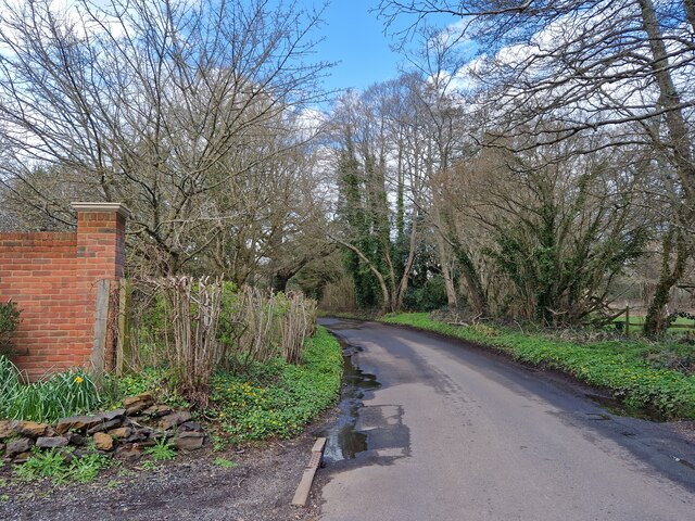
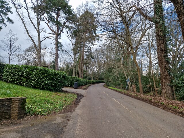
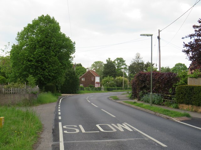
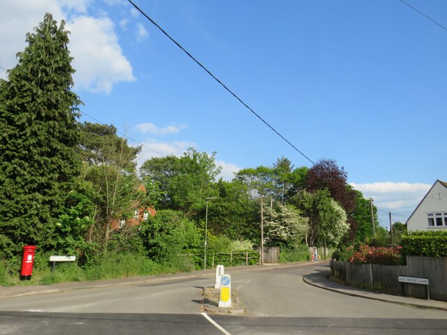
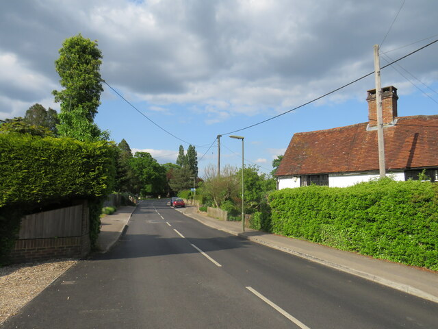
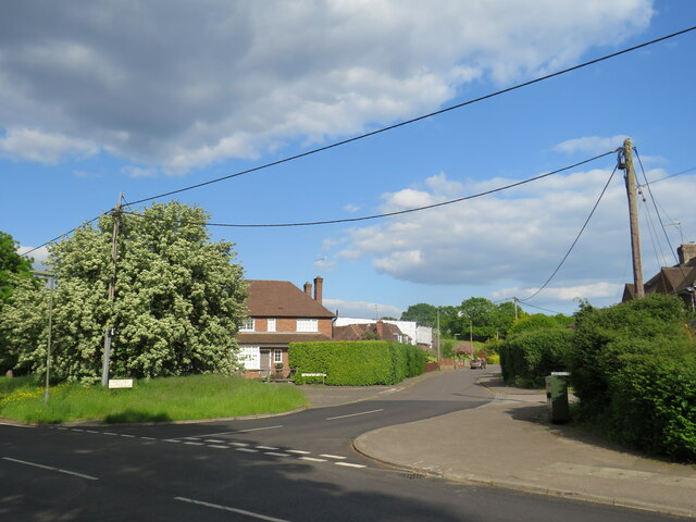
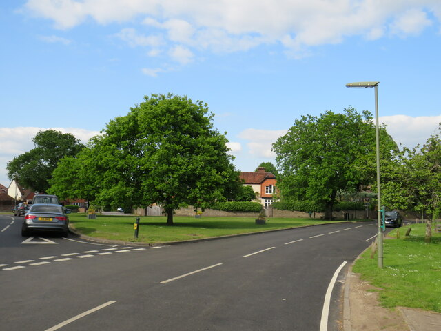
Westbrook Green is a picturesque village located in the county of Surrey, England. It is situated in the southern part of the county, surrounded by stunning landscapes and sprawling countryside. The village is known for its idyllic setting and offers a peaceful retreat for residents and visitors alike.

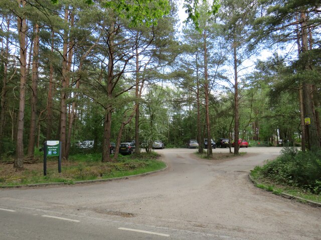
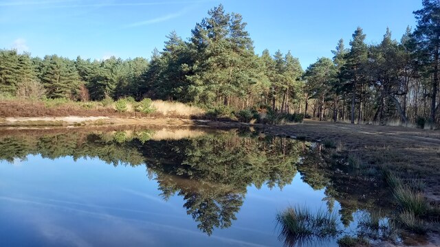
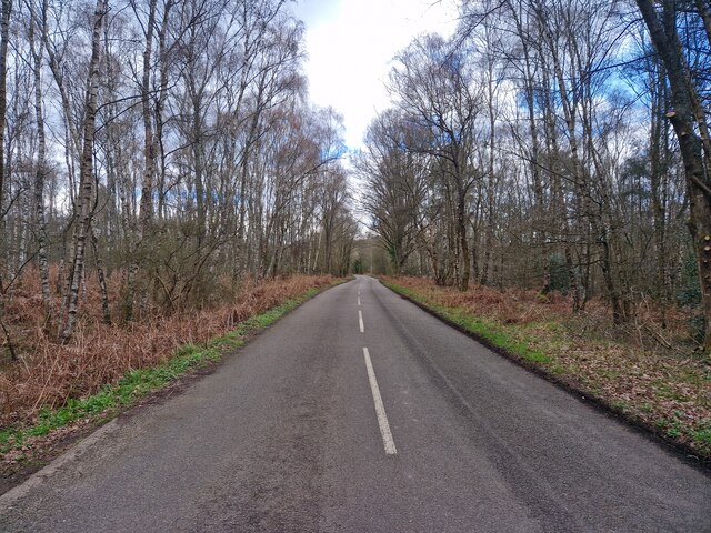
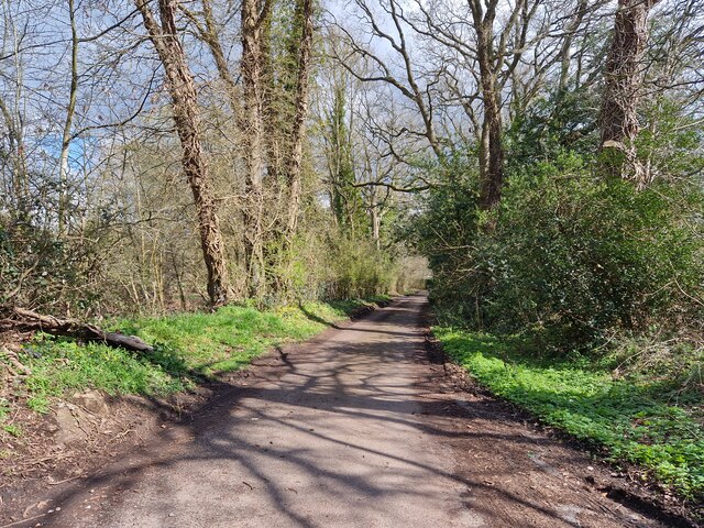
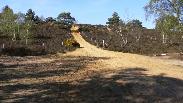
One of the main features of Westbrook Green is its close proximity to the Surrey Downs, an area of outstanding natural beauty. The Downs provide ample opportunities for outdoor activities such as hiking, cycling, and horse riding. The rolling hills and lush greenery make it a popular destination for nature enthusiasts and those seeking a tranquil escape from the hustle and bustle of city life.

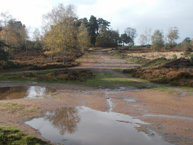
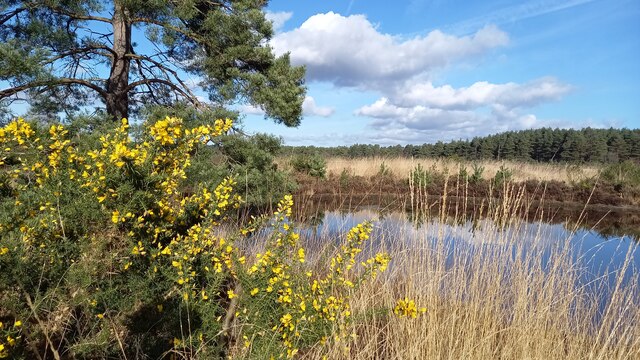
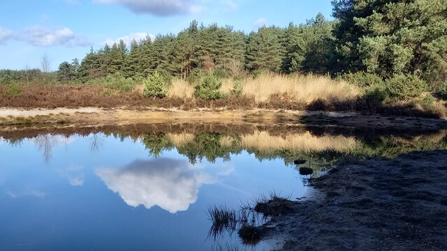
Additionally, Westbrook Green is home to a thriving moorland, which further enhances its natural beauty. The moorland is characterized by its vast open spaces, heather-covered hills, and diverse wildlife. It provides a habitat for various species of birds, mammals, and reptiles, making it a haven for nature lovers and birdwatchers.

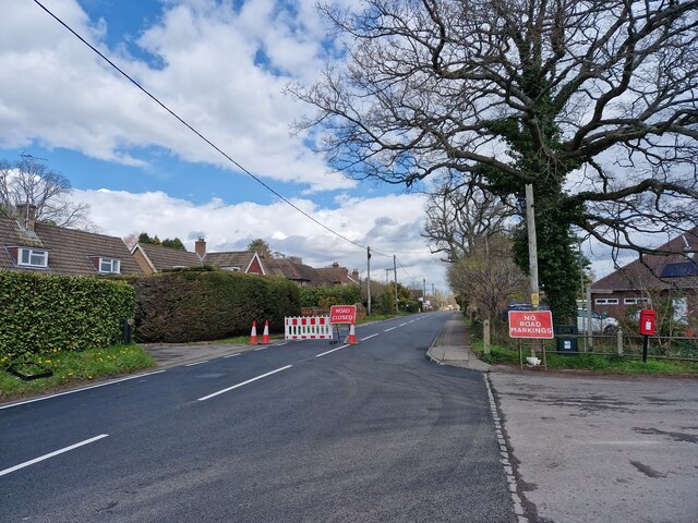
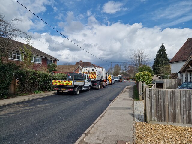
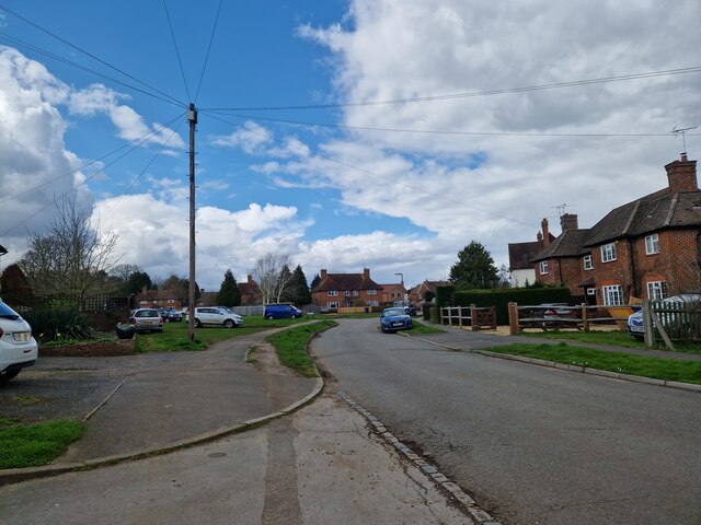
The village itself is small but charming, with a tight-knit community that takes great pride in preserving its rural character. It boasts a few local amenities, including a village hall, a quaint pub, and a small convenience store. The traditional architecture of the village, consisting of stone cottages and farmhouses, adds to its charm and historical appeal.

In conclusion, Westbrook Green offers a unique blend of natural beauty, rural charm, and community spirit. With its proximity to the Surrey Downs and its stunning moorland, it is a haven for outdoor enthusiasts and nature lovers. The village provides a peaceful and idyllic setting for those seeking a slower pace of life amidst the serenity of the countryside.

If you have any feedback on the listing, please let us know in the comments section below.

Westbrook Green Images

Images are sourced within 2km of 51.184252/-0.71318104 or Grid Reference SU9043. Thanks to Geograph Open Source API. All images are credited.

Moat Pond Car Park near Elstead, Surrey A public car park in woodland near the village of Elstead in Surrey.
Moat Pond Car Park near Elstead, Surrey
A public car park in woodland near the village of Elstead in Surrey.
Yagden Hill on Hankley Common Plenty of pools of water around indicating recent rainfall.
Yagden Hill on Hankley Common
Plenty of pools of water around indicating recent rainfall.
Elstead Common Nature reserve with blooming gorse beside a heathland pond.
Elstead Common
Nature reserve with blooming gorse beside a heathland pond.
Elstead Common - Pond Nature reserve and heathland - reflective scene on the edge of coniferous woodland.
Elstead Common - Pond
Nature reserve and heathland - reflective scene on the edge of coniferous woodland.
Elstead Common Small pond on heathland in a nature reserve.
Elstead Common
Small pond on heathland in a nature reserve.
Navigating northwards along the Bashir (9 ) Road ahead closed at Elstead
Navigating northwards along the Bashir (9 )
Road ahead closed at Elstead
Navigating northwards up the Bashir (10) Road works at Elstead
Navigating northwards up the Bashir (10)
Road works at Elstead
Springfield: early April 2023 (taken from the junction with Bankside Close)
Springfield: early April 2023
(taken from the junction with Bankside Close)
Navigating northwards up the Basher (11) Taken in Fulbrook Lane, just past Thundry Farm
Navigating northwards up the Basher (11)
Taken in Fulbrook Lane, just past Thundry Farm
Fulbrook  Lane in early April
Fulbrook Lane in early April
Navigating northwards up the Basher (12) Top end of Fulbrook Lane
Navigating northwards up the Basher (12)
Top end of Fulbrook Lane
Looking eastwards in Ham Lane
Thursley Road, Pot Common, near Elstead Thursley Road is a minor road in Surrey,  Here it passes through the hamlet of Pot Common as it approaches the village of Elstead.
Thursley Road, Pot Common, near Elstead
Thursley Road is a minor road in Surrey, Here it passes through the hamlet of Pot Common as it approaches the village of Elstead.
Thursley Road, Elstead, near Farnham Thursley Road entering the village of Elstead in Surrey.
Thursley Road, Elstead, near Farnham
Thursley Road entering the village of Elstead in Surrey.
Red House Lane, Elstead, near Farnham Red House Lane is a minor road in the village of Elstead in Surrey.
Red House Lane, Elstead, near Farnham
Red House Lane is a minor road in the village of Elstead in Surrey.
Thursley Road, Elstead, near Farnham Thursley Road is a minor road leading into the village of Elstead in Surrey.
Thursley Road, Elstead, near Farnham
Thursley Road is a minor road leading into the village of Elstead in Surrey.
West Hill, Elstead, near Farnham West Hill is a residential road in Elstead, a village in Surrey.
West Hill, Elstead, near Farnham
West Hill is a residential road in Elstead, a village in Surrey.
The Green, Elstead, near Farnham The Green in the village of Elstead in Surrey.
The Green, Elstead, near Farnham
The Green in the village of Elstead in Surrey.
Show me another place!

Westbrook Green is located at Grid Ref: SU9043 (Lat: 51.184252, Lng: -0.71318104)

Administrative County: Surrey

District: Waverley

Police Authority: Surrey

What 3 Words

///resist.toothpick.bars. Near Elstead, Surrey

Nearby Locations

Elstead Westbrook Green

Related Wikis

Charleshill SSSI

Charleshill SSSI is a 10.1-hectare (25-acre) biological Site of Special Scientific Interest west of Elstead in Surrey. It is part of Thundry Meadows nature...

Thundry Meadows

Thundry Meadows is a 16-hectare (40-acre) nature reserve in Elstead in Surrey. It is managed by the Surrey Wildlife Trust. Part of it is Charleshill Site...

Hankley Farm

Hankley Farm is a 2.4-hectare (5.9-acre) biological Site of Special Scientific Interest (SSSI) west of Elstead in Surrey.This sandy arable field has been...

Elstead

Elstead is a civil parish in Surrey, England with shops, houses and cottages spanning the north and south sides of the River Wey; development is concentrated...

Tilford

Tilford is a village and civil parish centred at the point where the two branches of the River Wey merge in Surrey, England, 3 miles (4.8 km) south-east...

Thursley Common

Thursley Common is a national nature reserve in Surrey, England, and has also been designated as a Ramsar wetland. It is also part of a Site of Special...
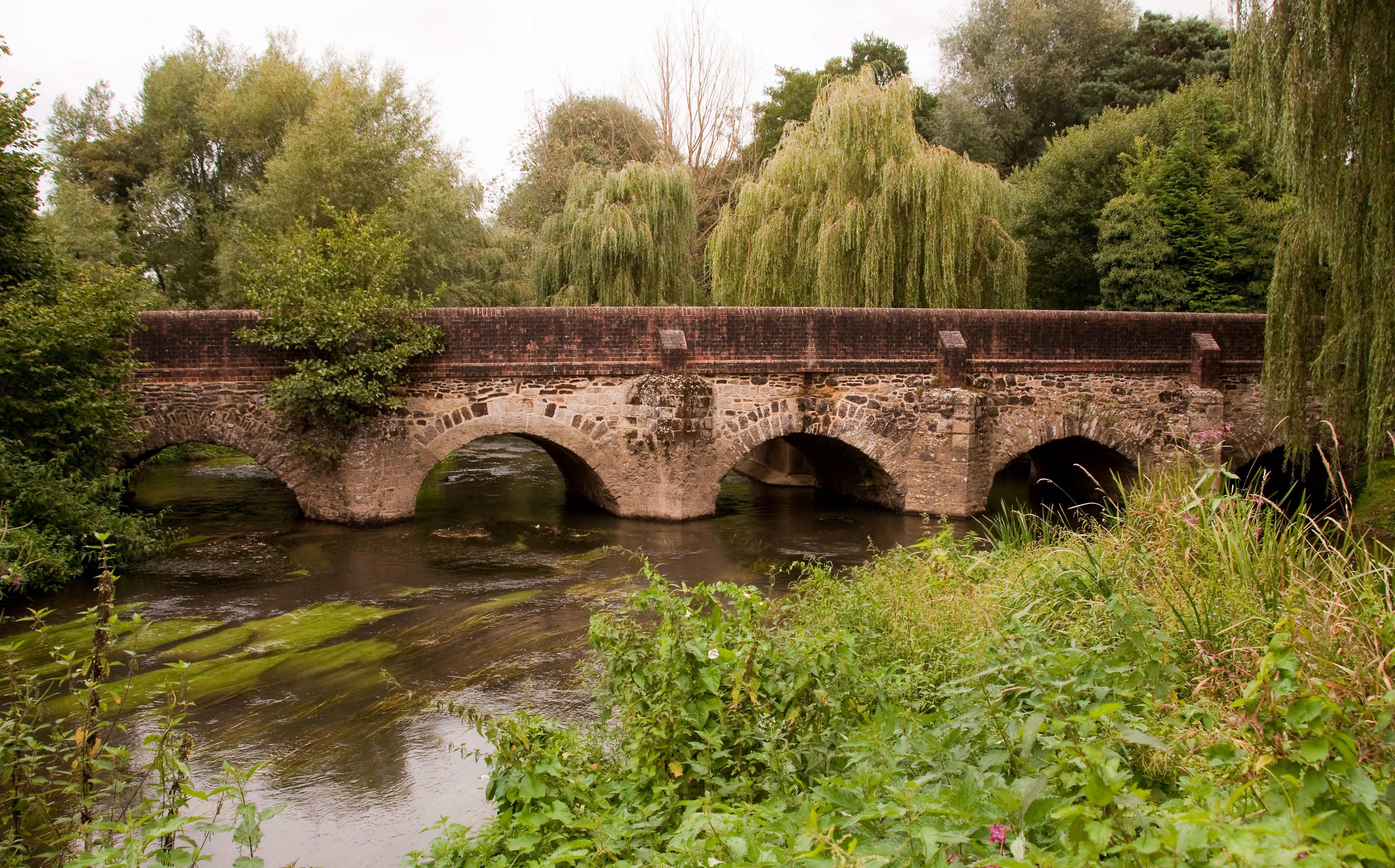
River Wey

The River Wey is a main tributary of the River Thames in south east England. Its two branches, one of which rises near Alton in Hampshire and the other...

Hankley Common

Hankley Common is a 560-hectare (1,400-acre) nature reserve and filming location in the south-west of Elstead in Surrey. It is owned by the Ministry of...

Nearby Amenities

Located within 500m of 51.184252,-0.71318104
Bus Stop
Church
Bench: no
Bin: no
Lit: yes
Naptan AtcoCode: 40004411201A
Naptan Bearing: S
Naptan CommonName: Church
Naptan Indicator: Opp
Naptan Landmark: Church Green
Naptan NaptanCode: surdwagm
Naptan Street: Thursley Road
Naptan Verified: no
Shelter: no
Source: naptan_import
Tactile Paving: no
Lat/Long: 51.1823433/-0.7082403
Bus Stop
Church
Bench: yes
Bin: yes
Departures Board: no
Lit: yes
Naptan AtcoCode: 40004411201B
Naptan Bearing: N
Naptan CommonName: Church
Naptan Indicator: adj
Naptan Landmark: Church Green
Naptan NaptanCode: surdwagp
Naptan Street: Thursley Road
Naptan Verified: no
Shelter: no
Source: naptan_import
Tactile Paving: no
Lat/Long: 51.182781/-0.7079705
Waterway: weir
Lat/Long: 51.1866332/-0.7095008
Historic: memorial
Inscription: LEST WE FORGET THE FOLLOWING ELSTEAD MEN FELL IN THE GREAT WAR 1914-1919 ... FOR GOD FOR KING FOR COUNTRY.
Material: stone
Memorial: war_memorial
Lat/Long: 51.1835597/-0.706696
Post Box
Collection Times: Mo-Fr 09:00; Sa 07:00
Operator: Royal Mail
Post Box Type: lamp
Ref: GU8 105D
Royal Cypher: EIIR
Royal Cypher Wikidata: Q33102113
Lat/Long: 51.1877753/-0.7117408
Thundry Farm
Landuse: farm
Note Retag: CS #48756035
Source: OS_OpenData_StreetView
Lat/Long: 51.1882036/-0.711392
Bench
Lat/Long: 51.1840599/-0.7124492
Barrier: stile
Lat/Long: 51.1869032/-0.7084522
Barrier: stile
Lat/Long: 51.1871161/-0.7091145
Entrance: yes
Lat/Long: 51.1834466/-0.7069604
Defibrillator
Defibrillator Location: On the wall in coded box to the right of entrance of Elstead Village Hall
Emergency: defibrillator
Indoor: no
Lat/Long: 51.1834478/-0.7069184
Door: hinged
Entrance: yes
Lat/Long: 51.1834461/-0.7071302
Bench
Backrest: yes
Material: stone
Lat/Long: 51.1828425/-0.7079397
Historic: memorial
Inscription: IT WAS ON THIS GREEN THAT H.M KING GEORGE V. LEFT HIS CAR AND MOUNTED HIS HORSE WHEN HE CAME TO REVIEW THE TROOPS IN HANKLEY COMMON 31st MAY 1915
Memorial: plaque
Lat/Long: 51.1828924/-0.7078586
Your Clean Oven
Craft: cleaning
Lat/Long: 51.1828685/-0.707727
Post Box
Collection Times: Mo-Fr 09:00; Sa 07:00
Post Box Type: wall
Ref: GU8 31D
Royal Cypher: GVIR
Royal Cypher Wikidata: Q33102169
Lat/Long: 51.1832325/-0.7066901
Direction: 200
Generator Method: photovoltaic
Generator Output Electricity: yes
Generator Solar Modules: 16
Generator Source: solar
Generator Type: solar_photovoltaic_panel
Location: roof
Power: generator
Lat/Long: 51.1815733/-0.7088485
Drinking Water: yes
Man Made: water_tap
Lat/Long: 51.183764/-0.7071231
Direction: 290
Historic: memorial
Inscription: This infants school room was erected in the year 1898 to commemorate the diamond jubilee of her most gracious majesty Queen Victoria
Material: stone
Memorial: plaque
Lat/Long: 51.1823876/-0.7081666
Waste Basket
Colour: black
Material: plastic;metal
Lat/Long: 51.1836314/-0.7066627
Bench
Backrest: yes
Colour: brown
Direction: 139
Inscription: THIS BENCH HAS BEEN DONATED BY THE FAMILY AND FRIENDS OF PHIL NETLEY WHO SADLY DIED ON 28TH JANUARY 1995 AGED 60 SO THAT HE WILL BE REMEMBERED FOR HIS YEARS OF HARD WORK AND COMMITMENT TO THE PEOPLE OF ELSTEAD
Material: wood
Seats: 4
Lat/Long: 51.183418/-0.7069927
Rainbows Nursery School
Addr Street: Thursley Road
Disused Amenity: childcare
Note: seems to be closed. establishment closed according to ofsted
Phone: +447743 299611
Website: https://rainbowsnurseryschool.co.uk/
Lat/Long: 51.183646/-0.7072078
Clock
Display: sundial
Inscription: ...But Always Love...
Support: pedestal
Lat/Long: 51.1828771/-0.7090688
Entrance: main
Lat/Long: 51.1828022/-0.7090442
Camera Mount: pole
Camera Type: panning
Man Made: surveillance
Surveillance: outdoor
Surveillance Type: camera
Surveillance Zone: entrance
Lat/Long: 51.1829964/-0.70862
Door: hinged
Entrance: yes
Lat/Long: 51.1833616/-0.7072086
Drinking Water: yes
Man Made: water_tap
Operator: Elstead Village Hall
Lat/Long: 51.1837231/-0.7071268
Addr Housenumber: 9,10
Addr Street: Church View Close
Lat/Long: 51.1823932/-0.7076871
Addr Housenumber: 13
Addr Street: Church View Close
Lat/Long: 51.1822283/-0.7078773
Addr Housenumber: 12
Addr Street: Church View Close
Lat/Long: 51.1822912/-0.7077575
Addr Housenumber: 14
Addr Street: Church View Close
Lat/Long: 51.1822541/-0.7079729
Addr Housenumber: 11
Addr Street: Church View Close
Lat/Long: 51.1823371/-0.7077159
Addr Housenumber: 5
Addr Street: Copse Edge
Lat/Long: 51.1811337/-0.709672
Addr Housenumber: 8
Addr Street: Copse Edge
Lat/Long: 51.1811256/-0.7100638
Addr Housenumber: 3
Addr Street: Copse Edge
Lat/Long: 51.1810843/-0.7095058
Addr Housenumber: 4
Addr Street: Copse Edge
Lat/Long: 51.1811052/-0.7096128
Addr Housenumber: 7
Addr Street: Copse Edge
Lat/Long: 51.1811763/-0.7099939
Addr Housenumber: 6
Addr Street: Copse Edge
Lat/Long: 51.1811599/-0.7097765
Addr Housenumber: 2
Addr Street: Copse Edge
Lat/Long: 51.1810401/-0.7093877
Addr Housename: Thundry Cottage
Addr Street: Farnham Road
Lat/Long: 51.1877937/-0.711584
The data included in this document is from www.openstreetmap.org. The data is made available under ODbL.

Have you been to Westbrook Green?

Leave your review of Westbrook Green below (or comments, questions and feedback).