Elstead

Settlement in Surrey Waverley

England

Elstead

Moat Pond Car Park near Elstead, Surrey A public car park in woodland near the village of Elstead in Surrey.
Moat Pond Car Park near Elstead, Surrey Credit: Malc McDonald

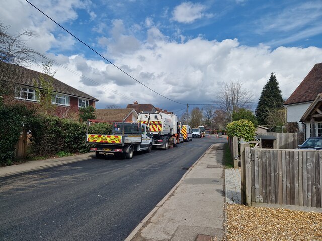
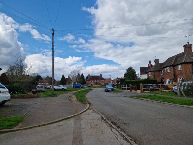
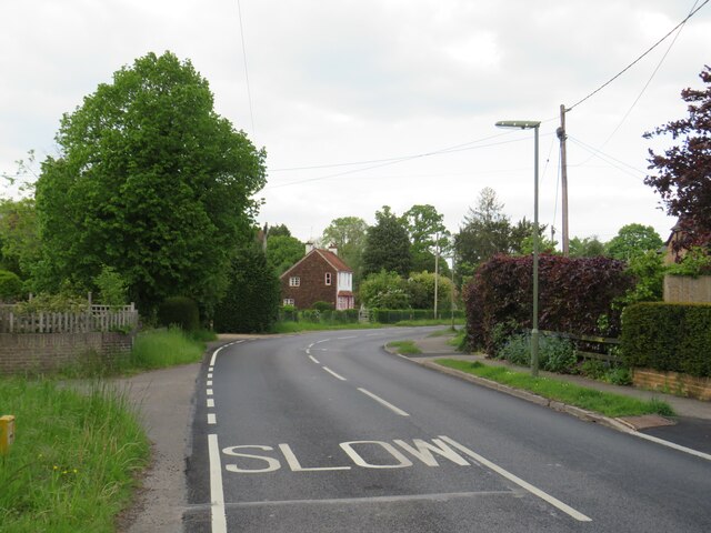
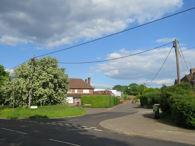
Elstead is a picturesque village located in the county of Surrey, England. Situated on the River Wey, it lies approximately 6 miles southwest of the town of Farnham and 10 miles southeast of the town of Guildford. With a population of around 2,400 people, Elstead offers a peaceful and rural setting with easy access to larger towns and cities.

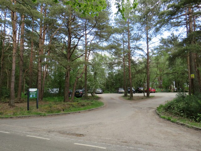
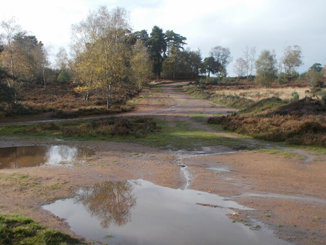
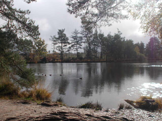
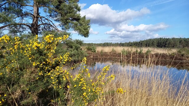
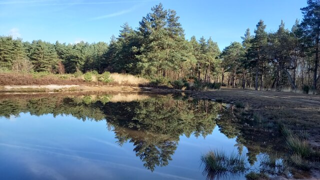
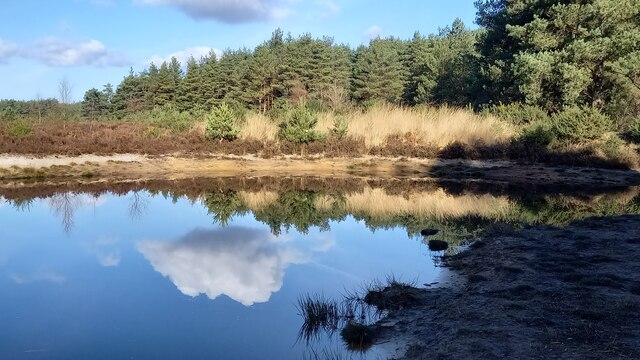
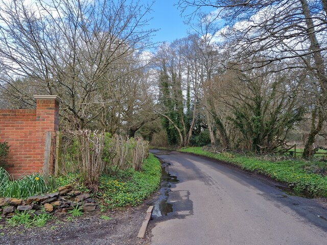
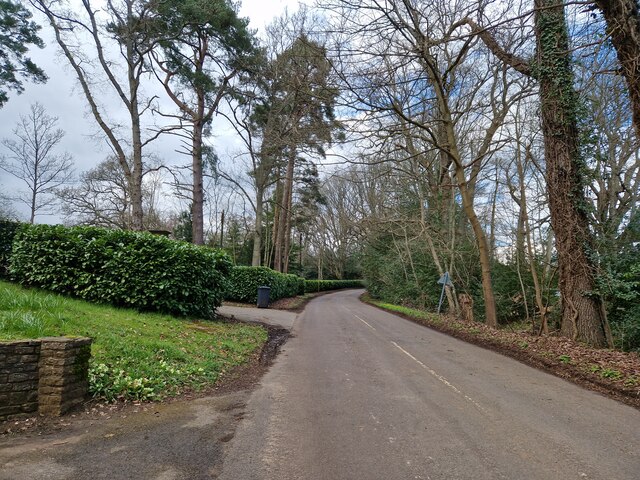
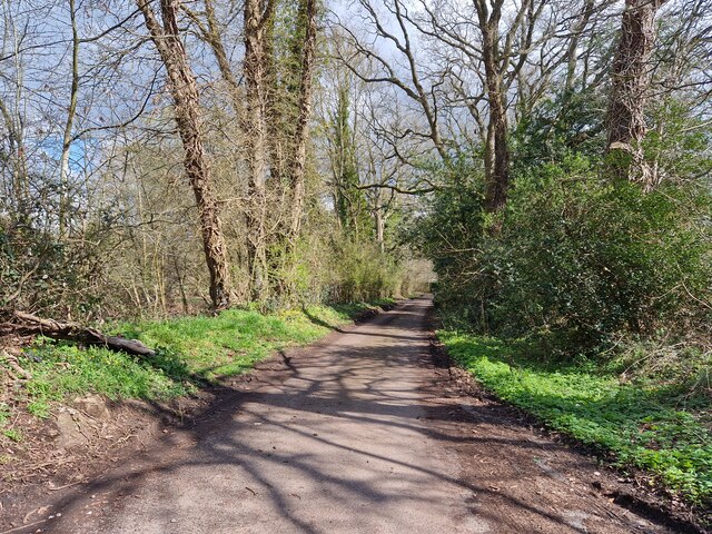
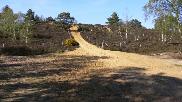
The village is known for its stunning natural beauty, with the River Wey meandering through the heart of Elstead. The surrounding countryside is characterized by rolling hills, woodlands, and meadows, making it an ideal location for outdoor enthusiasts and nature lovers. There are numerous walking and cycling trails that allow visitors to explore the area's scenic landscapes.

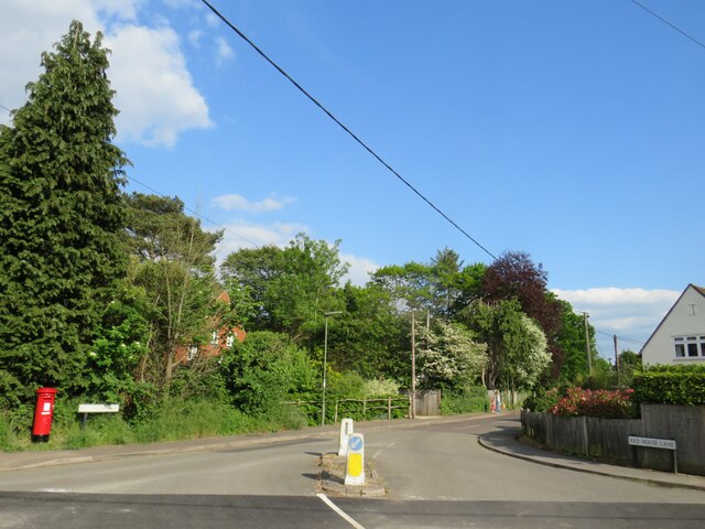
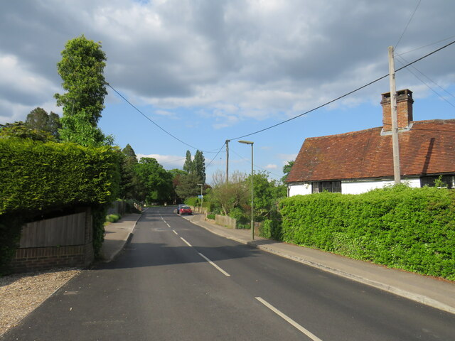
Elstead is also home to several historic buildings, including the beautiful St. James' Church, which dates back to the 12th century. The village has a strong sense of community, with a range of local amenities and services, including a primary school, village hall, and a selection of shops, pubs, and restaurants.

The village enjoys good transport links, with the A3 road passing nearby, providing easy access to London and the South Coast. Elstead also has a railway station in the neighboring village of Milford, offering regular services to London Waterloo and other major cities.

Overall, Elstead offers a charming blend of natural beauty, historic architecture, and a close-knit community, making it an attractive place to live or visit for those seeking a peaceful and idyllic setting.

If you have any feedback on the listing, please let us know in the comments section below.
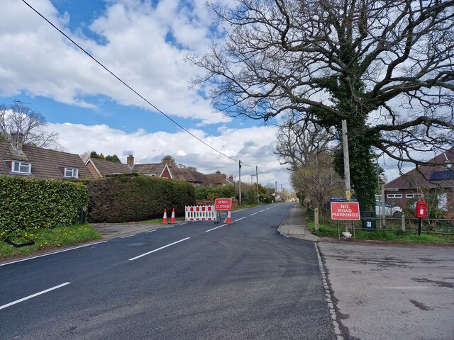
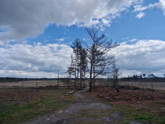
Elstead Images

Images are sourced within 2km of 51.179652/-0.709152 or Grid Reference SU9043. Thanks to Geograph Open Source API. All images are credited.

Moat Pond Car Park near Elstead, Surrey A public car park in woodland near the village of Elstead in Surrey.
Moat Pond Car Park near Elstead, Surrey
A public car park in woodland near the village of Elstead in Surrey.
Yagden Hill on Hankley Common Plenty of pools of water around indicating recent rainfall.
Yagden Hill on Hankley Common
Plenty of pools of water around indicating recent rainfall.
Moat Pond, Thursley Common
Elstead Common Nature reserve with blooming gorse beside a heathland pond.
Elstead Common
Nature reserve with blooming gorse beside a heathland pond.
Elstead Common - Pond Nature reserve and heathland - reflective scene on the edge of coniferous woodland.
Elstead Common - Pond
Nature reserve and heathland - reflective scene on the edge of coniferous woodland.
Elstead Common Small pond on heathland in a nature reserve.
Elstead Common
Small pond on heathland in a nature reserve.
Navigating northwards along the Bashir (9 ) Road ahead closed at Elstead
Navigating northwards along the Bashir (9 )
Road ahead closed at Elstead
Navigating northwards up the Bashir (8) Path east of Moat Pond
Navigating northwards up the Bashir (8)
Path east of Moat Pond
Navigating northwards up the Bashir (10) Road works at Elstead
Navigating northwards up the Bashir (10)
Road works at Elstead
Springfield: early April 2023 (taken from the junction with Bankside Close)
Springfield: early April 2023
(taken from the junction with Bankside Close)
Navigating northwards up the Basher (11) Taken in Fulbrook Lane, just past Thundry Farm
Navigating northwards up the Basher (11)
Taken in Fulbrook Lane, just past Thundry Farm
Fulbrook  Lane in early April
Fulbrook Lane in early April
Looking eastwards in Ham Lane
Thursley Road, Pot Common, near Elstead Thursley Road is a minor road in Surrey,  Here it passes through the hamlet of Pot Common as it approaches the village of Elstead.
Thursley Road, Pot Common, near Elstead
Thursley Road is a minor road in Surrey, Here it passes through the hamlet of Pot Common as it approaches the village of Elstead.
Thursley Road, Elstead, near Farnham Thursley Road entering the village of Elstead in Surrey.
Thursley Road, Elstead, near Farnham
Thursley Road entering the village of Elstead in Surrey.
Red House Lane, Elstead, near Farnham Red House Lane is a minor road in the village of Elstead in Surrey.
Red House Lane, Elstead, near Farnham
Red House Lane is a minor road in the village of Elstead in Surrey.
Thursley Road, Elstead, near Farnham Thursley Road is a minor road leading into the village of Elstead in Surrey.
Thursley Road, Elstead, near Farnham
Thursley Road is a minor road leading into the village of Elstead in Surrey.
West Hill, Elstead, near Farnham West Hill is a residential road in Elstead, a village in Surrey.
West Hill, Elstead, near Farnham
West Hill is a residential road in Elstead, a village in Surrey.
Show me another place!

Elstead is located at Grid Ref: SU9043 (Lat: 51.179652, Lng: -0.709152)

Administrative County: Surrey

District: Waverley

Police Authority: Surrey

What 3 Words

///stressed.superbly.emerald. Near Elstead, Surrey

Nearby Locations

Westbrook Green Elstead

Related Wikis

Elstead

Elstead is a civil parish in Surrey, England with shops, houses and cottages spanning the north and south sides of the River Wey; development is concentrated...

Charleshill SSSI

Charleshill SSSI is a 10.1-hectare (25-acre) biological Site of Special Scientific Interest west of Elstead in Surrey. It is part of Thundry Meadows nature...

Thundry Meadows

Thundry Meadows is a 16-hectare (40-acre) nature reserve in Elstead in Surrey. It is managed by the Surrey Wildlife Trust. Part of it is Charleshill Site...

Hankley Farm

Hankley Farm is a 2.4-hectare (5.9-acre) biological Site of Special Scientific Interest (SSSI) west of Elstead in Surrey.This sandy arable field has been...

Thursley Common

Thursley Common is a national nature reserve in Surrey, England, and has also been designated as a Ramsar wetland. It is also part of a Site of Special...

Elstead Group of Commons

Elstead Group of Commons is a 180-hectare (440-acre) nature reserve east of Elstead in Surrey. It is composed of Royal, Elstead and Ockley Commons, which...

Hankley Common

Hankley Common is a 560-hectare (1,400-acre) nature reserve and filming location in the south-west of Elstead in Surrey. It is owned by the Ministry of...

Thursley, Hankley and Frensham Commons

Thursley, Hankley and Frensham Commons is a 1,878.5-hectare (4,642-acre) biological Site of Special Scientific Interest west of Godalming in Surrey. Thursley...

Related Videos

Fire at Hankley Common

To give you some context, I was walking my dog at Hankley Common with my friend Exaflip, when we saw this massive fire.

WE VISIT MOD HANKLEY NATURE RESERVE area

Today we set off to Hankley Nature reserve which is owned by the MOD We visit the area where graham played as a youngster.

Our first Van Life adventure Skyfall and Atlantic Wall 2 0!

We have finally finished her and off we went on our first van life adventure. We found ourselves strolling through the set of Skyfall, ...

Nearby Amenities

Located within 500m of 51.179652,-0.709152
Post Box
Collection Times: Mo-Fr 09:00; Sa 07:00
Post Box Type: lamp
Ref: GU8 9D
Royal Cypher: EIIR
Royal Cypher Wikidata: Q33102113
Lat/Long: 51.1776284/-0.7107575
Pot Common
Leisure: common
Source: npe
Lat/Long: 51.1791357/-0.7030576
Beacon View Road
Naptan AtcoCode: 40004411199A
Naptan Bearing: SW
Naptan BusStopType: CUS
Naptan CommonName: Beacon View Road
Naptan Indicator: Just after
Naptan Landmark: Beacon View Road
Naptan NaptanCode: surgpdtw
Naptan Street: Thursley Road
Naptan Verified: no
Source: naptan_import
Lat/Long: 51.1773651/-0.7110262
Bus Stop
Beacon View Road
Naptan AtcoCode: 40004411199B
Naptan Bearing: N
Naptan CommonName: Beacon View Road
Naptan Indicator: Just Before
Naptan Landmark: Beacon View Road
Naptan NaptanCode: surdwagd
Naptan Street: Thursley Road
Naptan Verified: no
Source: naptan_import
Lat/Long: 51.1774739/-0.711109
Bus Stop
Post Office
Naptan AtcoCode: 40004411200B
Naptan Bearing: NE
Naptan CommonName: Post Office
Naptan Indicator: O/s
Naptan Landmark: Post Office
Naptan NaptanCode: surdwagj
Naptan Street: Thursley Road
Naptan Verified: no
Source: naptan_import
Lat/Long: 51.1793191/-0.7096268
Bus Stop
Church
Bench: no
Bin: no
Lit: yes
Naptan AtcoCode: 40004411201A
Naptan Bearing: S
Naptan CommonName: Church
Naptan Indicator: Opp
Naptan Landmark: Church Green
Naptan NaptanCode: surdwagm
Naptan Street: Thursley Road
Naptan Verified: no
Shelter: no
Source: naptan_import
Tactile Paving: no
Lat/Long: 51.1823433/-0.7082403
Bus Stop
Church
Bench: yes
Bin: yes
Departures Board: no
Lit: yes
Naptan AtcoCode: 40004411201B
Naptan Bearing: N
Naptan CommonName: Church
Naptan Indicator: adj
Naptan Landmark: Church Green
Naptan NaptanCode: surdwagp
Naptan Street: Thursley Road
Naptan Verified: no
Shelter: no
Source: naptan_import
Tactile Paving: no
Lat/Long: 51.182781/-0.7079705
Historic: memorial
Inscription: LEST WE FORGET THE FOLLOWING ELSTEAD MEN FELL IN THE GREAT WAR 1914-1919 ... FOR GOD FOR KING FOR COUNTRY.
Material: stone
Memorial: war_memorial
Lat/Long: 51.1835597/-0.706696
Barrier: kissing_gate
Lat/Long: 51.1817076/-0.7030461
Entrance: yes
Lat/Long: 51.1834466/-0.7069604
Defibrillator
Defibrillator Location: On the wall in coded box to the right of entrance of Elstead Village Hall
Emergency: defibrillator
Indoor: no
Lat/Long: 51.1834478/-0.7069184
Door: hinged
Entrance: yes
Lat/Long: 51.1834461/-0.7071302
Bench
Backrest: yes
Material: stone
Lat/Long: 51.1828425/-0.7079397
Historic: memorial
Inscription: IT WAS ON THIS GREEN THAT H.M KING GEORGE V. LEFT HIS CAR AND MOUNTED HIS HORSE WHEN HE CAME TO REVIEW THE TROOPS IN HANKLEY COMMON 31st MAY 1915
Memorial: plaque
Lat/Long: 51.1828924/-0.7078586
Your Clean Oven
Craft: cleaning
Lat/Long: 51.1828685/-0.707727
Driving School
Automatic Driving Tuition
Lat/Long: 51.1782759/-0.7105047
Post Box
Collection Times: Mo-Fr 09:00; Sa 07:00
Post Box Type: wall
Ref: GU8 31D
Royal Cypher: GVIR
Royal Cypher Wikidata: Q33102169
Lat/Long: 51.1832325/-0.7066901
Defibrillator
Defibrillator Location: Outside on south east corner of pavilion in coded green and yellow box to the far left of main pavilion entrance and facing the recreation grounds.
Emergency: defibrillator
Indoor: no
Ref: AHA537
Lat/Long: 51.1777149/-0.7101678
Bench
Backrest: yes
Inscription: In Memory of John and Mary Shrubb Trevor Williams
Seats: 4
Lat/Long: 51.1774563/-0.7099635
Addr Housename: Thornbury
Lat/Long: 51.1765599/-0.707134
Addr Housename: St. Judes
Lat/Long: 51.1767472/-0.7080537
Bench
Backrest: yes
Inscription: Dr William F. Lascelles 1900-1973 This seat, presented by his friends, commemorates 26 year of service to Elstead.
Material: wood
Seats: 4
Lat/Long: 51.1773808/-0.7096491
Addr Housename: Hazeldene
Lat/Long: 51.1766672/-0.7078428
Addr Housename: Whispers
Lat/Long: 51.1765083/-0.7068964
Drinking Water: yes
Man Made: water_tap
Lat/Long: 51.1778711/-0.7104414
Addr Housename: Broad Oak
Lat/Long: 51.1765268/-0.7069688
Addr Housename: Woodpeckers Rest
Lat/Long: 51.1765481/-0.7070474
Elstead Cricket Club
Addr City: Elstead
Addr Postcode: GU8 6DU
Addr Street: Thursley Road
Club: sport
Sport: cricket
Lat/Long: 51.177826/-0.7103349
Elstead FC
Club: sport
Contact Website: https://elsteadfc.co.uk/
Sport: soccer
Lat/Long: 51.177779/-0.7102964
ELSTEAD TELEPHONE EXCHANGE
Operator: SSE
Operator Wikidata: Q493854
Power: substation
Lat/Long: 51.1808346/-0.7084116
Post Box
Brand: Royal Mail
Brand Wikidata: Q638098
Brand Wikipedia: en:Royal Mail
Collection Times: Mo-Fr 16:00; Sa 09:30
Drive Through: no
Operator: Royal Mail
Operator Wikidata: Q638098
Post Box Type: pillar
Ref: GU8 74
Royal Cypher: GVIR
Royal Cypher Wikidata: Q33102169
Lat/Long: 51.180137/-0.7086483
Direction: 200
Generator Method: photovoltaic
Generator Output Electricity: yes
Generator Solar Modules: 16
Generator Source: solar
Generator Type: solar_photovoltaic_panel
Location: roof
Power: generator
Lat/Long: 51.1815733/-0.7088485
Drinking Water: yes
Man Made: water_tap
Lat/Long: 51.183764/-0.7071231
Elstead Parish Council
Note: council notice board
Tourism: information
Lat/Long: 51.1779875/-0.7105394
Bench
Backrest: yes
Colour: pinkish
Inscription: Donated by Elstead WI (Afternoon) Group 2009
Material: plastic;metal
Seats: 4
Lat/Long: 51.17856/-0.7093014
Waste Basket
Colour: green
Material: metal
Lat/Long: 51.1776516/-0.7107481
Bicycle Parking
Bicycle Parking: stands
Capacity: 12
Covered: no
Lat/Long: 51.1778812/-0.7101373
Leisure: pitch
Sport: table_tennis
Lat/Long: 51.1781921/-0.7101012
Bench
Backrest: no
Material: wood
Seats: 8
Lat/Long: 51.1783612/-0.7100154
Access: yes
Hoops: 1
Leisure: pitch
Lit: no
Sport: basketball
Surface: asphalt
Lat/Long: 51.1784802/-0.7098708
Direction: 290
Historic: memorial
Inscription: This infants school room was erected in the year 1898 to commemorate the diamond jubilee of her most gracious majesty Queen Victoria
Material: stone
Memorial: plaque
Lat/Long: 51.1823876/-0.7081666
Waste Basket
Colour: black
Material: plastic;metal
Lat/Long: 51.1836314/-0.7066627
Bench
Backrest: yes
Colour: brown
Direction: 139
Inscription: THIS BENCH HAS BEEN DONATED BY THE FAMILY AND FRIENDS OF PHIL NETLEY WHO SADLY DIED ON 28TH JANUARY 1995 AGED 60 SO THAT HE WILL BE REMEMBERED FOR HIS YEARS OF HARD WORK AND COMMITMENT TO THE PEOPLE OF ELSTEAD
Material: wood
Seats: 4
Lat/Long: 51.183418/-0.7069927
Rainbows Nursery School
Addr Street: Thursley Road
Disused Amenity: childcare
Note: seems to be closed. establishment closed according to ofsted
Phone: +447743 299611
Website: https://rainbowsnurseryschool.co.uk/
Lat/Long: 51.183646/-0.7072078
Clock
Display: sundial
Inscription: ...But Always Love...
Support: pedestal
Lat/Long: 51.1828771/-0.7090688
Entrance: main
Lat/Long: 51.1828022/-0.7090442
Camera Mount: pole
Camera Type: panning
Man Made: surveillance
Surveillance: outdoor
Surveillance Type: camera
Surveillance Zone: entrance
Lat/Long: 51.1829964/-0.70862
Door: hinged
Entrance: yes
Lat/Long: 51.1833616/-0.7072086
Drinking Water: yes
Man Made: water_tap
Operator: Elstead Village Hall
Lat/Long: 51.1837231/-0.7071268
Childcare
Tenderlinks Day Nursery
Addr City: Godalming
Addr Housename: The Pavilion
Addr Postcode: GU8 6DU
Addr Street: Beacon View Road
Opening Hours: +441252 703 593
Source Addr: survey/sign on pavilion
Website: https://www.tenderlinksdaynursery.co.uk/locations/elstead/
Lat/Long: 51.1777145/-0.7102734
Addr Housenumber: 9,10
Addr Street: Church View Close
Lat/Long: 51.1823932/-0.7076871
Addr Housenumber: 13
Addr Street: Church View Close
Lat/Long: 51.1822283/-0.7078773
Addr Housenumber: 12
Addr Street: Church View Close
Lat/Long: 51.1822912/-0.7077575
Addr Housenumber: 14
Addr Street: Church View Close
Lat/Long: 51.1822541/-0.7079729
Addr Housenumber: 11
Addr Street: Church View Close
Lat/Long: 51.1823371/-0.7077159
Addr Housenumber: 5
Addr Street: Copse Edge
Lat/Long: 51.1811337/-0.709672
Addr Housenumber: 8
Addr Street: Copse Edge
Lat/Long: 51.1811256/-0.7100638
Addr Housenumber: 3
Addr Street: Copse Edge
Lat/Long: 51.1810843/-0.7095058
Addr Housenumber: 4
Addr Street: Copse Edge
Lat/Long: 51.1811052/-0.7096128
Addr Housenumber: 7
Addr Street: Copse Edge
Lat/Long: 51.1811763/-0.7099939
Addr Housenumber: 6
Addr Street: Copse Edge
Lat/Long: 51.1811599/-0.7097765
Addr Housenumber: 2
Addr Street: Copse Edge
Lat/Long: 51.1810401/-0.7093877
Bench
Backrest: yes
Colour: brown
Direction: 120
Inscription: DEDICATED TO ELSTEAD VILLAGE BY THE KINGSMEAD GROUP
Material: wood
Seats: 6
Lat/Long: 51.177482/-0.7110922
The data included in this document is from www.openstreetmap.org. The data is made available under ODbL.

Have you been to Elstead?

Leave your review of Elstead below (or comments, questions and feedback).