Little Boys Heath

Downs, Moorland in Buckinghamshire

England

Little Boys Heath

Pasture, Great Missenden With a footpath crossing a dry valley to the north of Sedges Farm.
Pasture, Great Missenden Credit: Andrew Smith

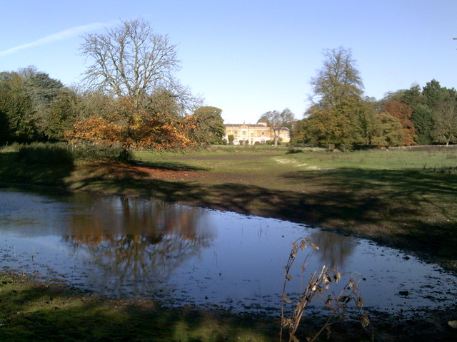
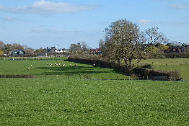
Little Boys Heath is a charming village located in the county of Buckinghamshire, England. Situated amidst the picturesque Downs and Moorland, this village offers breathtaking natural beauty and a peaceful escape from the hustle and bustle of city life.

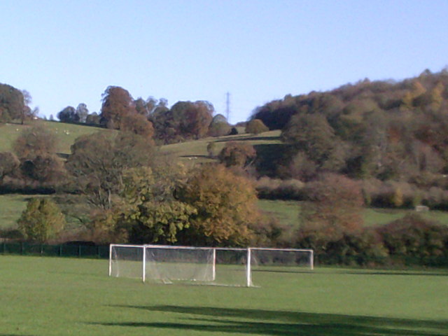
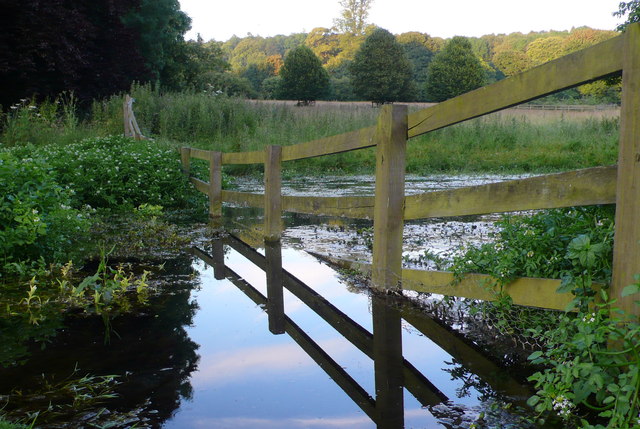
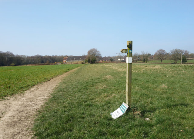
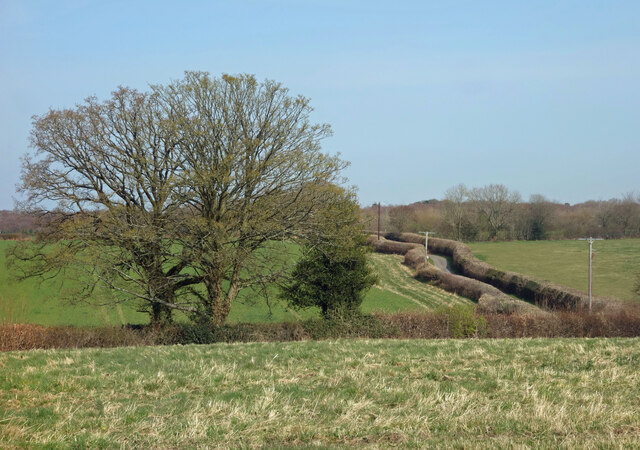
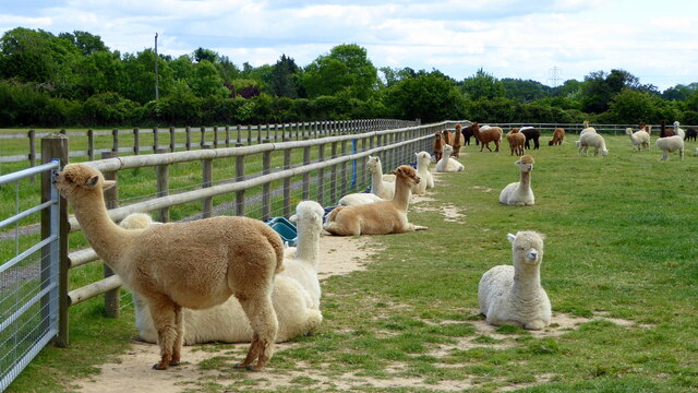
The village is known for its idyllic surroundings, with rolling hills, lush green meadows, and a tranquil atmosphere. It is a haven for nature lovers and outdoor enthusiasts, offering ample opportunities for hiking, cycling, and leisurely walks. The Downs offer stunning panoramic views of the surrounding countryside, making it a popular spot for photographers and artists.

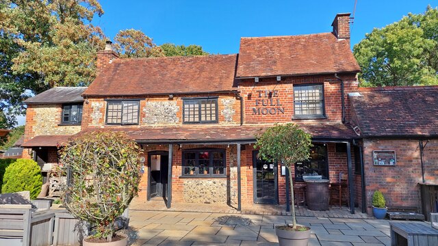
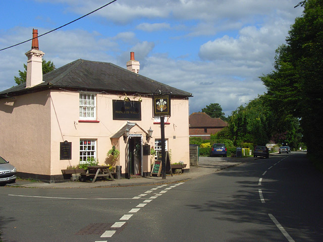
Little Boys Heath is also home to a close-knit community that takes pride in its heritage and traditions. The village has a rich history, and visitors can explore its historic buildings and landmarks, such as the charming village church and the old manor house. The local pub is a popular gathering spot for residents and visitors alike, offering a warm and friendly atmosphere.

Despite its rural setting, Little Boys Heath is conveniently located near several amenities and services. The nearby town of Buckingham provides a range of shops, restaurants, and entertainment options. Additionally, the village is well-connected to larger cities like Oxford and Milton Keynes, ensuring easy access to further amenities and cultural experiences.

Overall, Little Boys Heath is a hidden gem in Buckinghamshire, offering a unique blend of natural beauty, history, and community spirit. Whether you are seeking a peaceful retreat or a place to immerse yourself in rural charm, this village is sure to captivate you with its timeless appeal.

If you have any feedback on the listing, please let us know in the comments section below.

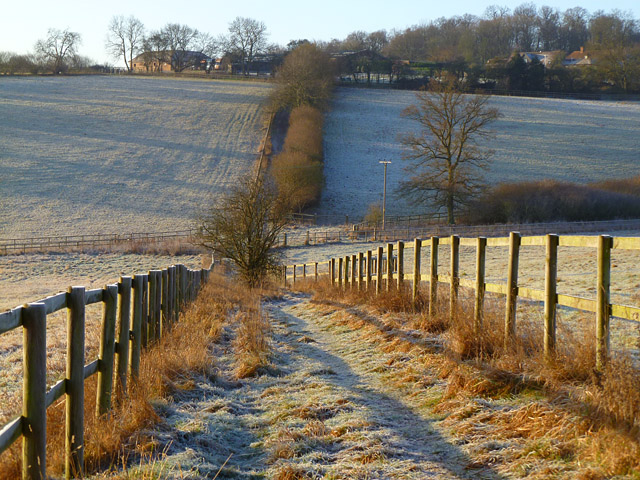
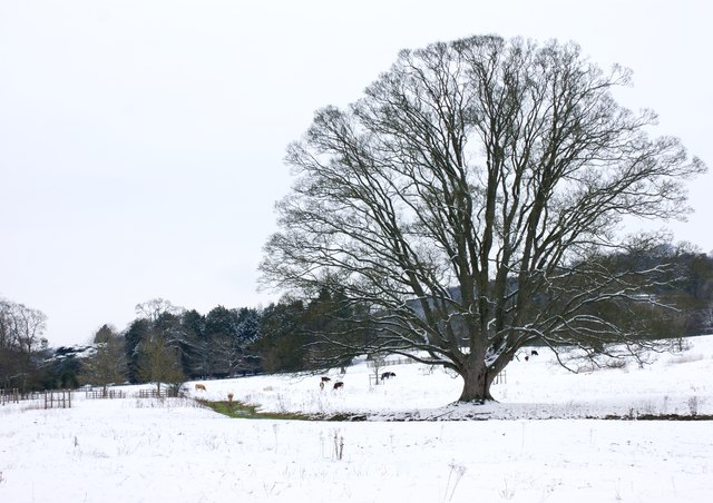
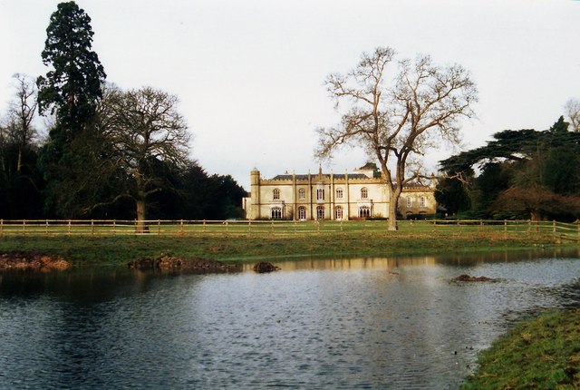
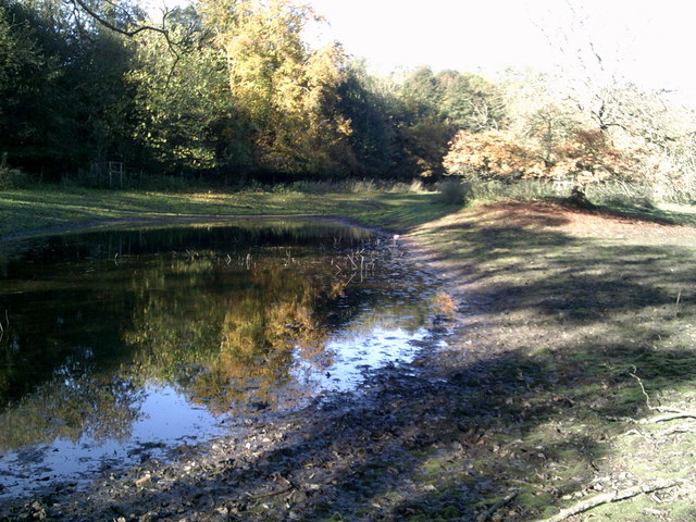
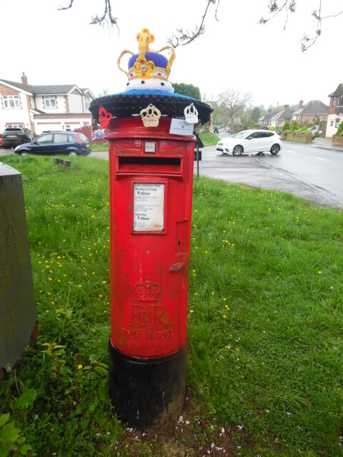
Little Boys Heath Images

Images are sourced within 2km of 51.681488/-0.70022094 or Grid Reference SU8998. Thanks to Geograph Open Source API. All images are credited.

Pasture, Great Missenden With a footpath crossing a dry valley to the north of Sedges Farm.
Pasture, Great Missenden
With a footpath crossing a dry valley to the north of Sedges Farm.
Abbey Park in the snow Looking north along the River Misbourne towards the trees of the grounds of Missenden Abbey.
Abbey Park in the snow
Looking north along the River Misbourne towards the trees of the grounds of Missenden Abbey.
Missenden Abbey Missenden Abbey was an Augustinian monastery founded in 1133 in Great Missenden, Buckinghamshire, United Kingdom. It was ruined in the Dissolution of the Monasteries and the ruins later incorporated into a Georgian mansion. 
This view is from a good few years ago, taken across Warren Water, the ornamental lake created on the River Misbourne.
From a print. Date approximate.
Missenden Abbey
Missenden Abbey was an Augustinian monastery founded in 1133 in Great Missenden, Buckinghamshire, United Kingdom. It was ruined in the Dissolution of the Monasteries and the ruins later incorporated into a Georgian mansion. This view is from a good few years ago, taken across Warren Water, the ornamental lake created on the River Misbourne. From a print. Date approximate.
Warren Water off the South Bucks Way
Autumn colours at Warren Water
Goal nets - towards Abbey Park Point where the South Bucks Way approaches, and passes underneath, the railway line.
Goal nets - towards Abbey Park
Point where the South Bucks Way approaches, and passes underneath, the railway line.
Warren Water, Missenden Abbey This wooden fence runs across the artificial lake in the grounds of Missenden Abbey which is now the Conference Centre of Bucks New University.
Warren Water, Missenden Abbey
This wooden fence runs across the artificial lake in the grounds of Missenden Abbey which is now the Conference Centre of Bucks New University.
Footpath Sign near Nairdwood Farm At a junction of two footpaths in an open location.
The notice on the ground is about environmental stewardship and keeping to the path. 
Not fixed to the post well enough.
Footpath Sign near Nairdwood Farm
At a junction of two footpaths in an open location. The notice on the ground is about environmental stewardship and keeping to the path. Not fixed to the post well enough.
Countryside along Nags Head Lane The road between the hedges goes to a farm and then turns into a track off into  the woods.
Countryside along Nags Head Lane
The road between the hedges goes to a farm and then turns into a track off into the woods.
Latton Alpaca Farm
Latton Alpaca Farm
Information Board at Little Kingshill This information board is by the recreation ground in Windsor Lane HP16 0DZ and 
 has the heading "Little Missenden and its footpaths. The map in the middle 
 shows the area that the parish of Little Missenden covers including Holmer 
 Green, Hyde Heath, Little Kingshill and Little Missenden.
 The wording on the left of the map is as follows:
 
 The Parish Church of St John the Baptist
 Over a thousand years old, Little Missenden Parish Church is famous for its 
 wall paintings dating from the 13th century. The church itself dates from Saxon
 times (950-1050AD) and was originally built with Roman bricks. However it has
 been enlarged many times over the centuries. There is also an early map of the
 Parish on the wall of Lady Chapel.

 The River Misbourne
 The river flow is somewhat erratic, occasionally drying up completely. 
 Excellent views over the valley may be seen from the South Bucks Way between 
 Little Missenden and Little Kingshill.
 There were once watercress beds near Suffolk Bridge and water mills at Deep 
 Mill and Little Missenden. Of the 13th century Deep Mill only the mill pond
 remains. The mill itself finally disappeared about the time the railway was 
 built (early 1890s). Little Missenden water mill is first mentioned in 1352, 
 the present building is mainly 17th century and ceased using water in about 
 1920. Latterly, it was augmented by a steam engine, its chimney still survives 
 and is now a private house.

 The wording on the right of the map is as follows:
 
 Since prehistoric times
 In about the 12th century there was a Motte and Bailey castle in Hyde Heath, 
 although all that can now be seen are the remains of the earthworks a few feet
 high, visible from Church Lane. It once probably had a tower on top of the 
 motte.

 There is a leaflet available showing all the parish footpaths. Please call at
 Little Missenden Parish Office, Rossetti Hall, 38 New Pond Road, Holmer Green, 
 HP15 6SU.

 1) Full Moon Public House, Little Kingshill
 2) The Plough Public House, Hyde Heath
 3) St Andrews Church, Hyde Heath
 4) St John the Baptist Church, Little Missenden
 5) Red Lion Public House, Little Missenden
 6) The Crown Public House, Little Missenden
 7) Christ Church, Holmer Green
 8) Bat and Ball Public House, Holmer Green
 9) Old Oak Public House, Holmer Green
 10) Earl Howe Public House, Holmer Green

 public footpaths
 public bridleways
 south bucks way
 picnic areas
 parking
 recreation areas
 woodland

 Wording below the map:
 
 This map is reproduced from Ordnance Survey material with the permission of
 Ordnance Survey on behalf of the Controller of Her Majesty's Stationery Office
 c Crown Copyright. Unauthorised reproduction infringes Crown copyright and may
 lead to prosecution or civil proceedings.
 
 enjoy our parish and please follow the country code...take only photographs and 
 leave only footprints
Information Board at Little Kingshill
This information board is by the recreation ground in Windsor Lane HP16 0DZ and has the heading "Little Missenden and its footpaths. The map in the middle shows the area that the parish of Little Missenden covers including Holmer Green, Hyde Heath, Little Kingshill and Little Missenden. The wording on the left of the map is as follows: The Parish Church of St John the Baptist Over a thousand years old, Little Missenden Parish Church is famous for its wall paintings dating from the 13th century. The church itself dates from Saxon times (950-1050AD) and was originally built with Roman bricks. However it has been enlarged many times over the centuries. There is also an early map of the Parish on the wall of Lady Chapel. The River Misbourne The river flow is somewhat erratic, occasionally drying up completely. Excellent views over the valley may be seen from the South Bucks Way between Little Missenden and Little Kingshill. There were once watercress beds near Suffolk Bridge and water mills at Deep Mill and Little Missenden. Of the 13th century Deep Mill only the mill pond remains. The mill itself finally disappeared about the time the railway was built (early 1890s). Little Missenden water mill is first mentioned in 1352, the present building is mainly 17th century and ceased using water in about 1920. Latterly, it was augmented by a steam engine, its chimney still survives and is now a private house. The wording on the right of the map is as follows: Since prehistoric times In about the 12th century there was a Motte and Bailey castle in Hyde Heath, although all that can now be seen are the remains of the earthworks a few feet high, visible from Church Lane. It once probably had a tower on top of the motte. There is a leaflet available showing all the parish footpaths. Please call at Little Missenden Parish Office, Rossetti Hall, 38 New Pond Road, Holmer Green, HP15 6SU. 1) Full Moon Public House, Little Kingshill 2) The Plough Public House, Hyde Heath 3) St Andrews Church, Hyde Heath 4) St John the Baptist Church, Little Missenden 5) Red Lion Public House, Little Missenden 6) The Crown Public House, Little Missenden 7) Christ Church, Holmer Green 8) Bat and Ball Public House, Holmer Green 9) Old Oak Public House, Holmer Green 10) Earl Howe Public House, Holmer Green public footpaths public bridleways south bucks way picnic areas parking recreation areas woodland Wording below the map: This map is reproduced from Ordnance Survey material with the permission of Ordnance Survey on behalf of the Controller of Her Majesty's Stationery Office c Crown Copyright. Unauthorised reproduction infringes Crown copyright and may lead to prosecution or civil proceedings. enjoy our parish and please follow the country code...take only photographs and leave only footprints
The Full Moon pub, Little Kingshill
Pasture, Little Missenden Fields to the north of Spurlands End.
Pasture, Little Missenden
Fields to the north of Spurlands End.
Label on top of decorated postbox, Heath End This label is attached to the knitted crown on top of the post box in Heath End Road near St Margaret's Grove. It has the following wording:

                                       Made with love
                                        for our village
                                                ♥
                               GK Postbox Topper Ladies

   Incidentally, GK stands for Great Kingshill which is adjacent to Heath End.
Label on top of decorated postbox, Heath End
This label is attached to the knitted crown on top of the post box in Heath End Road near St Margaret's Grove. It has the following wording: Made with love for our village ♥ GK Postbox Topper Ladies Incidentally, GK stands for Great Kingshill which is adjacent to Heath End.
Decorated Post Box in Heath End This Elizabeth II postbox is located in Heath End Road HP15 6HL and has a knitted crown on its top to commemorate the coronation of King Charles III on Saturday 6th May 2023. The wording on the label below the top is at <a title="https://www.geograph.org.uk/photo/7479279" href="https://www.geograph.org.uk/photo/7479279">Link</a>. St Margaret's Road can just be seen to the left of the postbox.
Decorated Post Box in Heath End
This Elizabeth II postbox is located in Heath End Road HP15 6HL and has a knitted crown on its top to commemorate the coronation of King Charles III on Saturday 6th May 2023. The wording on the label below the top is at Link. St Margaret's Road can just be seen to the left of the postbox.
Television Transmitting Station, Great Missenden (1) Situated in Wendover Woods, south east of Great Missenden, this station, began transmitting television programmes to the Misbourne valley including Great Missenden in 1974. It is about 45 metres (147ft) high and is fixed with aerials and microwave dishes. At the top of the mast are the white aerials which were converted to digital operation in April 2012, when the parent transmitter at Crystal Palace (TQ3371 refers) was changed at the same time.
Television Transmitting Station, Great Missenden (1)
Situated in Wendover Woods, south east of Great Missenden, this station, began transmitting television programmes to the Misbourne valley including Great Missenden in 1974. It is about 45 metres (147ft) high and is fixed with aerials and microwave dishes. At the top of the mast are the white aerials which were converted to digital operation in April 2012, when the parent transmitter at Crystal Palace (TQ3371 refers) was changed at the same time.
Television Transmitting Station, Great Missenden (2) This photo shows the back of the television transmitting station in Wendover Woods taken from behind Rookwood Cottage. Overhead power cables can be seen in the foreground.
Television Transmitting Station, Great Missenden (2)
This photo shows the back of the television transmitting station in Wendover Woods taken from behind Rookwood Cottage. Overhead power cables can be seen in the foreground.
Noticeboard at Television Transmitting Station, Great Missenden Taken in Wendover Woods, this photo shows the notice board in front of the television transmitter. It mentions that Arqiva has taken over from Crown Castle International regarding the maintenance of this transmitter.
Noticeboard at Television Transmitting Station, Great Missenden
Taken in Wendover Woods, this photo shows the notice board in front of the television transmitter. It mentions that Arqiva has taken over from Crown Castle International regarding the maintenance of this transmitter.
Show me another place!

Little Boys Heath is located at Grid Ref: SU8998 (Lat: 51.681488, Lng: -0.70022094)

Unitary Authority: Buckinghamshire

Police Authority: Thames Valley

What 3 Words

///yoga.youthful.soaps. Near Great Missenden, Buckinghamshire

Related Wikis

Little Kingshill

Little Kingshill is a small Chilterns village in the parish of Little Missenden in Buckinghamshire, England, with the closest amenities being in its post...

Spurlands End

Spurlands End is a hamlet in the parish of Little Missenden, in Buckinghamshire, England.For most of its history, it consisted of just five neighbouring...

Holmer Green F.C.

Holmer Green Football Club are an F.A. Charter Standard football club based at Holmer Green near High Wycombe in Buckinghamshire, England. The club is...

Holmer Green Senior School

Holmer Green Senior School is a co-educational secondary school and sixth form with academy status, located in Holmer Green, Buckinghamshire, England....

Holmer Green

Holmer Green is a village in the civil parish of Little Missenden, in Buckinghamshire, England. It is next to Hazlemere, about 3 miles (5 km) south of...

Misbourne School

The Misbourne School is a coeducational secondary school and sixth form located in Great Missenden, Buckinghamshire, England. The school has approximately...

Heath End, Buckinghamshire

Heath End is a hamlet in the parish of Great Missenden in Buckinghamshire, England. At the 2011 Census the population of the hamlet was included in the...

Gipsy House

Gipsy House (formerly Little Whitefield) is a house in the village of Great Missenden in the English county of Buckinghamshire. It was the home of the...

Nearby Amenities

Located within 500m of 51.681488,-0.70022094
Little Kingshill
Place: village
Website: http://www.lkvs.org.uk
Wikidata: Q15054194
Wikipedia: en:Little Kingshill
Lat/Long: 51.6849563/-0.7040584
Post Box
Collection Times: Mo-Fr 09:00; Sa 07:00
Operator: Royal Mail
Post Box Mounting: pier
Post Box Type: lamp
Ref: HP16 76D
Royal Cypher: EIIR
Royal Cypher Wikidata: Q33102113
Source: survey
Survey Date: 2017-10-14
Lat/Long: 51.682903/-0.698832
Waste Basket
Waste: trash
Lat/Long: 51.6824055/-0.7044473
Waste Basket
Waste: trash
Lat/Long: 51.6823947/-0.7035702
Information: board
Tourism: information
Lat/Long: 51.6829416/-0.6986852
Power: pole
Lat/Long: 51.680723/-0.6950377
Power: pole
Lat/Long: 51.6825303/-0.6951759
Direction: 170
Generator Method: photovoltaic
Generator Output Electricity: yes
Generator Solar Modules: 15
Generator Source: solar
Generator Type: solar_photovoltaic_panel
Location: roof
Power: generator
Lat/Long: 51.6831692/-0.695749
Direction: 180
Generator Method: photovoltaic
Generator Output Electricity: yes
Generator Solar Modules: 16
Generator Source: solar
Generator Type: solar_photovoltaic_panel
Location: roof
Power: generator
Lat/Long: 51.6790639/-0.6987664
Direction: 170
Generator Method: photovoltaic
Generator Output Electricity: yes
Generator Solar Modules: 32
Generator Source: solar
Generator Type: solar_photovoltaic_panel
Location: roof
Power: generator
Lat/Long: 51.6790922/-0.6949423
Direction: 150
Generator Method: photovoltaic
Generator Output Electricity: yes
Generator Solar Modules: 40
Generator Source: solar
Generator Type: solar_photovoltaic_panel
Location: roof
Power: generator
Lat/Long: 51.679716/-0.694317
Direction: 170
Generator Method: photovoltaic
Generator Output Electricity: yes
Generator Solar Modules: 10
Generator Source: solar
Generator Type: solar_photovoltaic_panel
Location: roof
Power: generator
Lat/Long: 51.6836495/-0.6953586
Direction: 80
Generator Method: photovoltaic
Generator Output Electricity: yes
Generator Solar Modules: 10
Generator Source: solar
Generator Type: solar_photovoltaic_panel
Location: roof
Power: generator
Lat/Long: 51.6835714/-0.6964549
Direction: 260
Generator Method: photovoltaic
Generator Output Electricity: yes
Generator Solar Modules: 6
Generator Source: solar
Generator Type: solar_photovoltaic_panel
Location: roof
Power: generator
Lat/Long: 51.683597/-0.6965255
Direction: 165
Generator Method: photovoltaic
Generator Output Electricity: yes
Generator Solar Modules: 15
Generator Source: solar
Generator Type: solar_photovoltaic_panel
Location: roof
Power: generator
Lat/Long: 51.6834859/-0.69695
Direction: 170
Generator Method: photovoltaic
Generator Output Electricity: yes
Generator Solar Modules: 16
Generator Source: solar
Generator Type: solar_photovoltaic_panel
Location: roof
Power: generator
Lat/Long: 51.683372/-0.698929
Direction: 260
Generator Method: photovoltaic
Generator Output Electricity: yes
Generator Solar Modules: 16
Generator Source: solar
Generator Type: solar_photovoltaic_panel
Location: roof
Power: generator
Lat/Long: 51.6829965/-0.6994576
Direction: 160
Fixme: survey for module count
Generator Method: photovoltaic
Generator Output Electricity: yes
Generator Solar Modules: 16
Generator Source: solar
Generator Type: solar_photovoltaic_panel
Location: roof
Power: generator
Lat/Long: 51.6832854/-0.7002447
Direction: 160
Generator Method: photovoltaic
Generator Output Electricity: yes
Generator Solar Modules: 16
Generator Source: solar
Generator Type: solar_photovoltaic_panel
Location: roof
Power: generator
Lat/Long: 51.6832177/-0.7004312
Direction: 200
Generator Method: photovoltaic
Generator Output Electricity: yes
Generator Solar Modules: 20
Generator Source: solar
Generator Type: solar_photovoltaic_panel
Location: roof
Power: generator
Lat/Long: 51.682636/-0.7034717
Direction: 180
Generator Method: photovoltaic
Generator Output Electricity: yes
Generator Solar Modules: 32
Generator Source: solar
Generator Type: solar_photovoltaic_panel
Location: roof
Power: generator
Lat/Long: 51.6820899/-0.7043137
The data included in this document is from www.openstreetmap.org. The data is made available under ODbL.

Have you been to Little Boys Heath?

Leave your review of Little Boys Heath below (or comments, questions and feedback).