Grubbins Plantation

Wood, Forest in Buckinghamshire

England

Grubbins Plantation

Pasture, Great Missenden With a footpath crossing a dry valley to the north of Sedges Farm.
Pasture, Great Missenden Credit: Andrew Smith

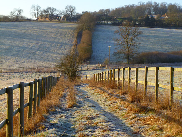
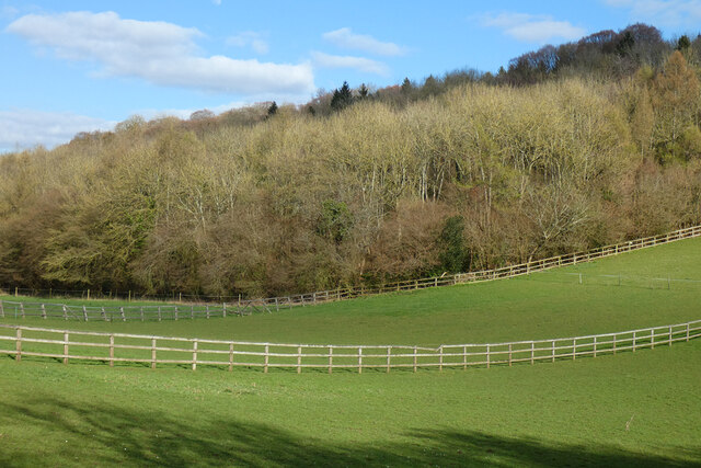
Grubbins Plantation is a picturesque woodland located in Buckinghamshire, England. Situated in the heart of the county, this enchanting forest is renowned for its natural beauty and serene atmosphere. With its dense vegetation and towering trees, Grubbins Plantation offers a haven for nature enthusiasts and outdoor explorers.

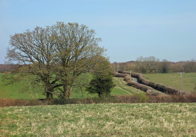
Covering an extensive area of land, the plantation is home to a diverse range of flora and fauna. Ancient oak, beech, and birch trees dominate the landscape, providing a rich habitat for various species of birds, mammals, and insects. The forest floor is adorned with a vibrant carpet of wildflowers, ferns, and mosses, adding to the charm of this woodland paradise.

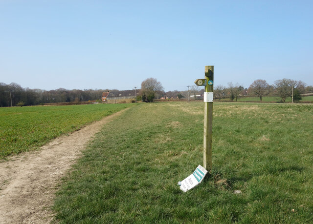
Grubbins Plantation is also known for its tranquil walking trails, which wind their way through the forest. These well-maintained paths offer visitors the opportunity to immerse themselves in the beauty of nature while enjoying a leisurely stroll. The peaceful ambiance and fresh air make it a popular destination for hikers, joggers, and families seeking a relaxing day out.

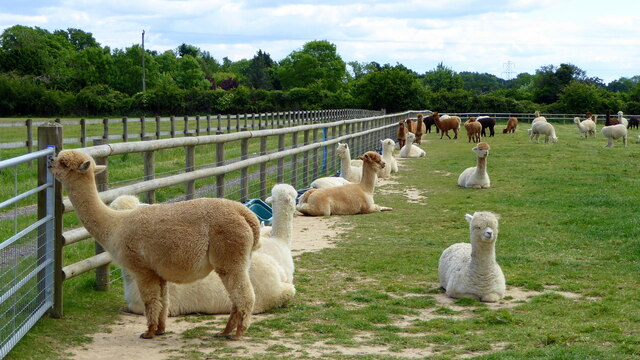
Nature lovers will find an abundance of wildlife to observe in Grubbins Plantation. Squirrels scurrying up trees, deer gracefully grazing, and a chorus of birdsong are common sights and sounds throughout the forest. The plantation's diverse ecosystem provides a sanctuary for numerous species, making it a haven for wildlife enthusiasts and photographers alike.

Whether one seeks solace in nature or simply wishes to explore the great outdoors, Grubbins Plantation offers a captivating experience. With its stunning scenery, diverse wildlife, and tranquil atmosphere, this woodland gem in Buckinghamshire is a must-visit destination for anyone seeking a peaceful escape into nature.

If you have any feedback on the listing, please let us know in the comments section below.

Grubbins Plantation Images

Images are sourced within 2km of 51.676683/-0.70485647 or Grid Reference SU8998. Thanks to Geograph Open Source API. All images are credited.

Pasture, Great Missenden With a footpath crossing a dry valley to the north of Sedges Farm.
Pasture, Great Missenden
With a footpath crossing a dry valley to the north of Sedges Farm.
Graffiti on the Pump House The back wall of Thames Water's Peterley sewage pumping station has been visited by graffiti artists.
Graffiti on the Pump House
The back wall of Thames Water's Peterley sewage pumping station has been visited by graffiti artists.
Peterley Sewage Pumping Station A humble pumping station out in the woods, but dating from a time when even utility buildings had a bit of attention paid to their design.
This little pump house is out of the same stable as many a cinema or train station of the time.
Even the railings look more garden gate than sewage works.
Peterley Sewage Pumping Station
A humble pumping station out in the woods, but dating from a time when even utility buildings had a bit of attention paid to their design. This little pump house is out of the same stable as many a cinema or train station of the time. Even the railings look more garden gate than sewage works.
Footpath Sign near Nairdwood Farm At a junction of two footpaths in an open location.
The notice on the ground is about environmental stewardship and keeping to the path. 
Not fixed to the post well enough.
Footpath Sign near Nairdwood Farm
At a junction of two footpaths in an open location. The notice on the ground is about environmental stewardship and keeping to the path. Not fixed to the post well enough.
Countryside along Nags Head Lane The road between the hedges goes to a farm and then turns into a track off into  the woods.
Countryside along Nags Head Lane
The road between the hedges goes to a farm and then turns into a track off into the woods.
Latton Alpaca Farm
Latton Alpaca Farm
Information Board at Little Kingshill This information board is by the recreation ground in Windsor Lane HP16 0DZ and 
 has the heading "Little Missenden and its footpaths. The map in the middle 
 shows the area that the parish of Little Missenden covers including Holmer 
 Green, Hyde Heath, Little Kingshill and Little Missenden.
 The wording on the left of the map is as follows:
 
 The Parish Church of St John the Baptist
 Over a thousand years old, Little Missenden Parish Church is famous for its 
 wall paintings dating from the 13th century. The church itself dates from Saxon
 times (950-1050AD) and was originally built with Roman bricks. However it has
 been enlarged many times over the centuries. There is also an early map of the
 Parish on the wall of Lady Chapel.

 The River Misbourne
 The river flow is somewhat erratic, occasionally drying up completely. 
 Excellent views over the valley may be seen from the South Bucks Way between 
 Little Missenden and Little Kingshill.
 There were once watercress beds near Suffolk Bridge and water mills at Deep 
 Mill and Little Missenden. Of the 13th century Deep Mill only the mill pond
 remains. The mill itself finally disappeared about the time the railway was 
 built (early 1890s). Little Missenden water mill is first mentioned in 1352, 
 the present building is mainly 17th century and ceased using water in about 
 1920. Latterly, it was augmented by a steam engine, its chimney still survives 
 and is now a private house.

 The wording on the right of the map is as follows:
 
 Since prehistoric times
 In about the 12th century there was a Motte and Bailey castle in Hyde Heath, 
 although all that can now be seen are the remains of the earthworks a few feet
 high, visible from Church Lane. It once probably had a tower on top of the 
 motte.

 There is a leaflet available showing all the parish footpaths. Please call at
 Little Missenden Parish Office, Rossetti Hall, 38 New Pond Road, Holmer Green, 
 HP15 6SU.

 1) Full Moon Public House, Little Kingshill
 2) The Plough Public House, Hyde Heath
 3) St Andrews Church, Hyde Heath
 4) St John the Baptist Church, Little Missenden
 5) Red Lion Public House, Little Missenden
 6) The Crown Public House, Little Missenden
 7) Christ Church, Holmer Green
 8) Bat and Ball Public House, Holmer Green
 9) Old Oak Public House, Holmer Green
 10) Earl Howe Public House, Holmer Green

 public footpaths
 public bridleways
 south bucks way
 picnic areas
 parking
 recreation areas
 woodland

 Wording below the map:
 
 This map is reproduced from Ordnance Survey material with the permission of
 Ordnance Survey on behalf of the Controller of Her Majesty's Stationery Office
 c Crown Copyright. Unauthorised reproduction infringes Crown copyright and may
 lead to prosecution or civil proceedings.
 
 enjoy our parish and please follow the country code...take only photographs and 
 leave only footprints
Information Board at Little Kingshill
This information board is by the recreation ground in Windsor Lane HP16 0DZ and has the heading "Little Missenden and its footpaths. The map in the middle shows the area that the parish of Little Missenden covers including Holmer Green, Hyde Heath, Little Kingshill and Little Missenden. The wording on the left of the map is as follows: The Parish Church of St John the Baptist Over a thousand years old, Little Missenden Parish Church is famous for its wall paintings dating from the 13th century. The church itself dates from Saxon times (950-1050AD) and was originally built with Roman bricks. However it has been enlarged many times over the centuries. There is also an early map of the Parish on the wall of Lady Chapel. The River Misbourne The river flow is somewhat erratic, occasionally drying up completely. Excellent views over the valley may be seen from the South Bucks Way between Little Missenden and Little Kingshill. There were once watercress beds near Suffolk Bridge and water mills at Deep Mill and Little Missenden. Of the 13th century Deep Mill only the mill pond remains. The mill itself finally disappeared about the time the railway was built (early 1890s). Little Missenden water mill is first mentioned in 1352, the present building is mainly 17th century and ceased using water in about 1920. Latterly, it was augmented by a steam engine, its chimney still survives and is now a private house. The wording on the right of the map is as follows: Since prehistoric times In about the 12th century there was a Motte and Bailey castle in Hyde Heath, although all that can now be seen are the remains of the earthworks a few feet high, visible from Church Lane. It once probably had a tower on top of the motte. There is a leaflet available showing all the parish footpaths. Please call at Little Missenden Parish Office, Rossetti Hall, 38 New Pond Road, Holmer Green, HP15 6SU. 1) Full Moon Public House, Little Kingshill 2) The Plough Public House, Hyde Heath 3) St Andrews Church, Hyde Heath 4) St John the Baptist Church, Little Missenden 5) Red Lion Public House, Little Missenden 6) The Crown Public House, Little Missenden 7) Christ Church, Holmer Green 8) Bat and Ball Public House, Holmer Green 9) Old Oak Public House, Holmer Green 10) Earl Howe Public House, Holmer Green public footpaths public bridleways south bucks way picnic areas parking recreation areas woodland Wording below the map: This map is reproduced from Ordnance Survey material with the permission of Ordnance Survey on behalf of the Controller of Her Majesty's Stationery Office c Crown Copyright. Unauthorised reproduction infringes Crown copyright and may lead to prosecution or civil proceedings. enjoy our parish and please follow the country code...take only photographs and leave only footprints
The Full Moon pub, Little Kingshill
Pasture, Hughenden Fields between Great Kingshill and Widmer End are seen from one of the area's many footpaths.
Pasture, Hughenden
Fields between Great Kingshill and Widmer End are seen from one of the area's many footpaths.
Pasture, Little Missenden Fields to the north of Spurlands End.
Pasture, Little Missenden
Fields to the north of Spurlands End.
Label on top of decorated postbox, Heath End This label is attached to the knitted crown on top of the post box in Heath End Road near St Margaret's Grove. It has the following wording:

                                       Made with love
                                        for our village
                                                ♥
                               GK Postbox Topper Ladies

   Incidentally, GK stands for Great Kingshill which is adjacent to Heath End.
Label on top of decorated postbox, Heath End
This label is attached to the knitted crown on top of the post box in Heath End Road near St Margaret's Grove. It has the following wording: Made with love for our village ♥ GK Postbox Topper Ladies Incidentally, GK stands for Great Kingshill which is adjacent to Heath End.
Decorated Post Box in Heath End This Elizabeth II postbox is located in Heath End Road HP15 6HL and has a knitted crown on its top to commemorate the coronation of King Charles III on Saturday 6th May 2023. The wording on the label below the top is at <a title="https://www.geograph.org.uk/photo/7479279" href="https://www.geograph.org.uk/photo/7479279">Link</a>. St Margaret's Road can just be seen to the left of the postbox.
Decorated Post Box in Heath End
This Elizabeth II postbox is located in Heath End Road HP15 6HL and has a knitted crown on its top to commemorate the coronation of King Charles III on Saturday 6th May 2023. The wording on the label below the top is at Link. St Margaret's Road can just be seen to the left of the postbox.
London Road, Great Missenden
London Road London Road passing the Nags Head
London Road
London Road passing the Nags Head
Pasture and woodland, Little Missenden Paddocks next to the western end of Haleacre Wood.
Pasture and woodland, Little Missenden
Paddocks next to the western end of Haleacre Wood.
Jubilee Sensory Garden, Holmer Green Situated in Earl Howe Road HP15 6QT, this sensory garden is managed by the Holmer Green Village Society and mentioned on its website at <span class="nowrap"><a title="https://www.holmergreenvillagesociety.co.uk/jubileesensorygarden" rel="nofollow ugc noopener" href="https://www.holmergreenvillagesociety.co.uk/jubileesensorygarden">Link</a><img style="margin-left:2px;" alt="External link" title="External link - shift click to open in new window" src="https://s1.geograph.org.uk/img/external.png" width="10" height="10"/></span>. Work on this garden commenced in March 2021 and now comprises different sensory elements for the public to see, smell, hear and touch.
Jubilee Sensory Garden, Holmer Green
Situated in Earl Howe Road HP15 6QT, this sensory garden is managed by the Holmer Green Village Society and mentioned on its website at LinkExternal link. Work on this garden commenced in March 2021 and now comprises different sensory elements for the public to see, smell, hear and touch.
Entrance Board at Jubilee Sensory Garden, Holmer Green This board is at the entrance to the Jubilee Sensory Garden in Earl Howe Road. These gardens are managed by the Holmer Green Village Society and further information can be obtained from its website "<span class="nowrap"><a title="www.holmergreenvillagesociety.co.uk/jubileesensorygarden"" rel="nofollow ugc noopener" href="http://www.holmergreenvillagesociety.co.uk/jubileesensorygarden"">Link</a><img style="margin-left:2px;" alt="External link" title="External link - shift click to open in new window" src="https://s1.geograph.org.uk/img/external.png" width="10" height="10"/></span>. At the foot of the board, it mentions that these gates access the Jubilee Sensory Garden and allotments only.
Entrance Board at Jubilee Sensory Garden, Holmer Green
This board is at the entrance to the Jubilee Sensory Garden in Earl Howe Road. These gardens are managed by the Holmer Green Village Society and further information can be obtained from its website "LinkExternal link. At the foot of the board, it mentions that these gates access the Jubilee Sensory Garden and allotments only.
London Road at the junction of the A413
Show me another place!

Grubbins Plantation is located at Grid Ref: SU8998 (Lat: 51.676683, Lng: -0.70485647)

Unitary Authority: Buckinghamshire

Police Authority: Thames Valley

What 3 Words

///affords.throat.dictation. Near Great Missenden, Buckinghamshire

Related Wikis

Little Kingshill

Little Kingshill is a small Chilterns village in the parish of Little Missenden in Buckinghamshire, England, with the closest amenities being in its post...

Spurlands End

Spurlands End is a hamlet in the parish of Little Missenden, in Buckinghamshire, England.For most of its history, it consisted of just five neighbouring...

Holmer Green F.C.

Holmer Green Football Club are an F.A. Charter Standard football club based at Holmer Green near High Wycombe in Buckinghamshire, England. The club is...

Holmer Green Senior School

Holmer Green Senior School is a co-educational secondary school and sixth form with academy status, located in Holmer Green, Buckinghamshire, England....

Holmer Green

Holmer Green is a village in the civil parish of Little Missenden, in Buckinghamshire, England. It is next to Hazlemere, about 3 miles (5 km) south of...

Heath End, Buckinghamshire

Heath End is a hamlet in the parish of Great Missenden in Buckinghamshire, England. At the 2011 Census the population of the hamlet was included in the...

Great Kingshill

Great Kingshill is a small village in the parish of Hughenden in Buckinghamshire, England. It is located in the Chiltern Hills, about five miles west...

Widmer End

Widmer End is a hamlet in the parish of Hughenden, in Buckinghamshire, England. The Village of Widmer End is situated about three miles north of High Wycombe...

Nearby Amenities

Located within 500m of 51.676683,-0.70485647
Power: tower
Lat/Long: 51.6754857/-0.7017393
Power: tower
Lat/Long: 51.6762923/-0.7051757
Power: tower
Lat/Long: 51.677111/-0.7088451
Direction: 180
Generator Method: photovoltaic
Generator Output Electricity: yes
Generator Solar Modules: 16
Generator Source: solar
Generator Type: solar_photovoltaic_panel
Location: roof
Power: generator
Lat/Long: 51.6790639/-0.6987664
The data included in this document is from www.openstreetmap.org. The data is made available under ODbL.

Have you been to Grubbins Plantation?

Leave your review of Grubbins Plantation below (or comments, questions and feedback).