Hazelton Walls

Settlement in Fife

Scotland

Hazelton Walls

Road by Creich Inexplicably part of the Fife Coast Path.
Road by Creich Credit: Richard Webb

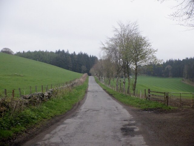
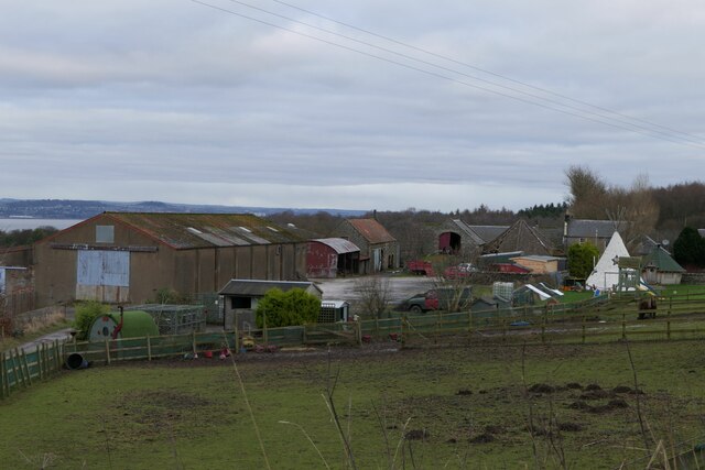
Hazelton Walls is a small village located in the county of Fife, Scotland. Situated approximately 15 miles north of the town of Cupar, it is nestled between the rural landscapes of Fife's rolling hills and farmland. The village is characterized by its tranquil and picturesque setting, offering residents and visitors a peaceful retreat from the bustling city life.

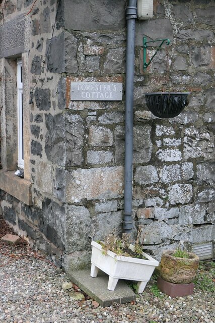
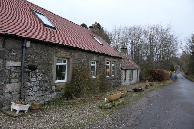
Hazelton Walls is known for its charming architecture, with traditional stone cottages and buildings lining its quaint streets. The village has a close-knit community, and its residents take pride in maintaining the village's unique character and beauty.

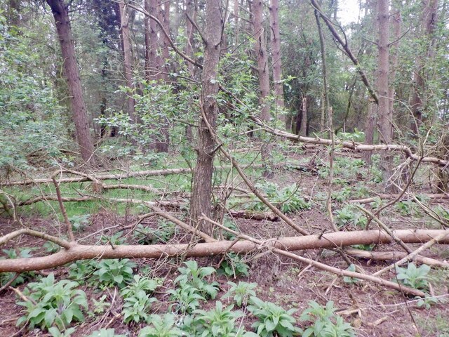
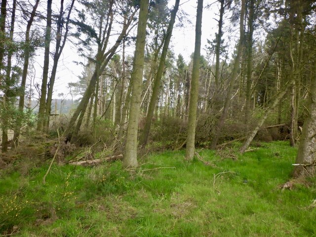
Nature enthusiasts are drawn to Hazelton Walls for its proximity to stunning natural surroundings. The village is surrounded by lush greenery and offers easy access to scenic walking trails and countryside views. Additionally, the nearby Hazelton Loch provides opportunities for fishing and bird-watching, attracting wildlife enthusiasts from far and wide.

Despite its rural setting, Hazelton Walls is conveniently located close to various amenities. The neighboring town of Cupar offers a range of shops, supermarkets, and services, ensuring that residents have easy access to everyday essentials.

Overall, Hazelton Walls offers a tranquil and idyllic lifestyle for those seeking a peaceful retreat in the heart of Fife's beautiful countryside. With its charming architecture, stunning natural surroundings, and close-knit community, it is a place that captures the essence of rural Scottish living.

If you have any feedback on the listing, please let us know in the comments section below.

Hazelton Walls Images

Images are sourced within 2km of 56.386177/-3.073986 or Grid Reference NO3322. Thanks to Geograph Open Source API. All images are credited.

Road by Creich Inexplicably part of the Fife Coast Path.
Road by Creich
Inexplicably part of the Fife Coast Path.
Summit area, Starr Law
Windthrow A strip wood on the slopes of Starr Law.
Windthrow
A strip wood on the slopes of Starr Law.
Benchmark location, East Flisk This benchmark took quite a bit of finding.  We covered it back up as best we could once we had photographed it.  The original stone has been dislodged and the benchmark is lying on its side.
Benchmark location, East Flisk
This benchmark took quite a bit of finding. We covered it back up as best we could once we had photographed it. The original stone has been dislodged and the benchmark is lying on its side.
Forester's Cottage sign There is an Ordnance Survey benchmark just visible on photo on large stone between house sign and plant pot.
Forester's Cottage sign
There is an Ordnance Survey benchmark just visible on photo on large stone between house sign and plant pot.
East Flisk Farm On south side of River Tay.
East Flisk Farm
On south side of River Tay.
Benchmark on Forester's Cottage, Hazelton Walls Ordnance Survey benchmark, described on database at <span class="nowrap"><a title="https://www.bench-marks.org.uk/bm37777" rel="nofollow ugc noopener" href="https://www.bench-marks.org.uk/bm37777">Link</a><img style="margin-left:2px;" alt="External link" title="External link - shift click to open in new window" src="https://s1.geograph.org.uk/img/external.png" width="10" height="10"/></span>.
Benchmark on Forester's Cottage, Hazelton Walls
Ordnance Survey benchmark, described on database at LinkExternal link.
Ordnance Survey benchmark on fallen stone, East Flisk Described on database at <span class="nowrap"><a title="https://www.bench-marks.org.uk/bm211340" rel="nofollow ugc noopener" href="https://www.bench-marks.org.uk/bm211340">Link</a><img style="margin-left:2px;" alt="External link" title="External link - shift click to open in new window" src="https://s1.geograph.org.uk/img/external.png" width="10" height="10"/></span>.  See also <a href="https://www.geograph.org.uk/photo/7687235">NO3222 : Benchmark location, East Flisk</a>.
Ordnance Survey benchmark on fallen stone, East Flisk
Described on database at LinkExternal link. See also NO3222 : Benchmark location, East Flisk.
Forester's Cottage, Hazelton Walls There is an Ordnance Survey benchmark on this cottage. See <a href="https://www.geograph.org.uk/photo/7687257">NO3321 : Benchmark on Forester's Cottage, Hazelton Walls</a>.
Forester's Cottage, Hazelton Walls
There is an Ordnance Survey benchmark on this cottage. See NO3321 : Benchmark on Forester's Cottage, Hazelton Walls.
Village street In the village of Brunton.
Village street
In the village of Brunton.
Road north out of Brunton
Village of Brunton Seen from the road to Newburgh.
Village of Brunton
Seen from the road to Newburgh.
Flisk Wood and the River Tay Flisk wood adjacent to a tidal section of the River Tay. The small burn that flows through Corbie Den enters the Tay to the right of the image.
Flisk Wood and the River Tay
Flisk wood adjacent to a tidal section of the River Tay. The small burn that flows through Corbie Den enters the Tay to the right of the image.
Green Craig A line of fence posts on the summit of Green Craig, with Norman's Law and the River Tay visible in the distance. The remains of a Pictish hill fort are situated on Green Craig - although the traces of this are hard to distinguish.
Green Craig
A line of fence posts on the summit of Green Craig, with Norman's Law and the River Tay visible in the distance. The remains of a Pictish hill fort are situated on Green Craig - although the traces of this are hard to distinguish.
Flisk Wood Trees and leaf canopy in Flisk Wood, which is the largest area of mixed deciduous woodland in Fife. The wood supports the growth of several species of rare plants, and is designated as a SSSI.
Flisk Wood
Trees and leaf canopy in Flisk Wood, which is the largest area of mixed deciduous woodland in Fife. The wood supports the growth of several species of rare plants, and is designated as a SSSI.
Track in Flisk Wood
Track in Flisk Wood
Corbie Den Fallen trees obscuring the Corbie Den, a small ravine eroded by an unnamed burn flowing into the River Tay from the southern flank of Corbie Hill.
Corbie Den
Fallen trees obscuring the Corbie Den, a small ravine eroded by an unnamed burn flowing into the River Tay from the southern flank of Corbie Hill.
Green Craig The north facing escarpment of Green Craig, situated near Criech in northern Fife.
Green Craig
The north facing escarpment of Green Craig, situated near Criech in northern Fife.
Show me another place!

Hazelton Walls is located at Grid Ref: NO3322 (Lat: 56.386177, Lng: -3.073986)

Unitary Authority: Fife

Police Authority: Fife

What 3 Words

///punctured.brotherly.repaying. Near Longforgan, Perth & Kinross

Related Wikis

Creich, Fife

Creich (Scottish Gaelic: Craoich, pronounced [kʰɾɯːç]; OS: Criech), is a hamlet in Fife, Scotland.The local parish is named after Creich. The ruins of...

Birkhill Castle

Birkhill Castle is a stately home, the residence of the Earl of Dundee, located on the banks of the River Tay, a short drive from St. Andrews. The castle...

Flisk

Flisk (Scottish Gaelic: Fleasg meaning "Stalk" or "Rod") was a parish in Fife, Scotland. According to the 1853 Gazetteer, in part: "Flisk parish is bounded...

Luthrie

Luthrie is a village in the parish of Creich in Fife, Scotland. A small stream shown on maps as Windygates Burn (but known locally as Luthrie Burn) flows...

Nearby Amenities

Located within 500m of 56.386177,-3.073986
Corbiehill
Ele: 156
Natural: peak
Lat/Long: 56.3885366/-3.0726017
Power: pole
Lat/Long: 56.3824464/-3.0783585
Power: pole
Lat/Long: 56.3828838/-3.0776408
Power: pole
Lat/Long: 56.383469/-3.0766562
Power: pole
Lat/Long: 56.3841652/-3.0761495
Power: pole
Lat/Long: 56.3846335/-3.0758206
Power: pole
Lat/Long: 56.3852129/-3.0748299
Power: pole
Lat/Long: 56.3856023/-3.0741784
Power: pole
Lat/Long: 56.3859/-3.0736696
Power: pole
Lat/Long: 56.3864301/-3.0727905
Power: pole
Lat/Long: 56.3867026/-3.0723272
Power: pole
Lat/Long: 56.3870026/-3.071866
Power: pole
Lat/Long: 56.3874572/-3.0719901
Power: pole
Lat/Long: 56.3877938/-3.0720976
Power: pole
Lat/Long: 56.3878064/-3.0714626
Power: pole
Lat/Long: 56.3880113/-3.0708194
Power: pole
Lat/Long: 56.3884716/-3.0697087
Power: pole
Lat/Long: 56.3890521/-3.0683022
The data included in this document is from www.openstreetmap.org. The data is made available under ODbL.

Have you been to Hazelton Walls?

Leave your review of Hazelton Walls below (or comments, questions and feedback).