Hockerton Moor
Downs, Moorland in Nottinghamshire Newark and Sherwood
England
Hockerton Moor
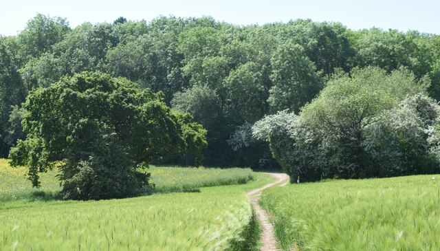
Hockerton Moor is a picturesque area located in Nottinghamshire, England. Situated just south of the village of Hockerton, it is a part of the wider Hockerton Downs and Moorland region. The moorland covers an approximate area of 400 acres and is known for its diverse ecosystem and natural beauty.
The landscape of Hockerton Moor is characterized by rolling hills, open fields, and patches of dense woodland. The moorland itself is covered in heather, grasses, and other low-lying vegetation, creating a vibrant and colorful display throughout the year. The area is also home to various species of wildlife, including birds, mammals, and insects.
Hockerton Moor is a popular destination for nature enthusiasts and outdoor activities such as hiking, birdwatching, and photography. The moorland provides stunning panoramic views, especially from its highest points, where visitors can enjoy uninterrupted vistas of the surrounding countryside.
In addition to its natural beauty, Hockerton Moor also has historical significance. The area has evidence of human activity dating back thousands of years, including ancient burial mounds and remnants of settlements. Archaeological excavations have unearthed artifacts and structures from different time periods, providing insight into the area's rich history.
Overall, Hockerton Moor offers visitors a chance to immerse themselves in the tranquility of nature and explore a landscape that is both visually captivating and historically significant. It is a place where people can reconnect with the natural world and appreciate the beauty and diversity of the Nottinghamshire countryside.
If you have any feedback on the listing, please let us know in the comments section below.
Hockerton Moor Images
Images are sourced within 2km of 53.115173/-0.95348872 or Grid Reference SK7058. Thanks to Geograph Open Source API. All images are credited.


Hockerton Moor is located at Grid Ref: SK7058 (Lat: 53.115173, Lng: -0.95348872)
Administrative County: Nottinghamshire
District: Newark and Sherwood
Police Authority: Nottinghamshire
What 3 Words
///joys.eagles.sloping. Near Southwell, Nottinghamshire
Nearby Locations
Related Wikis

Winkburn
Winkburn is a small village and civil parish in the Newark and Sherwood district, in Nottinghamshire, England. It is located north-west of Southwell and...
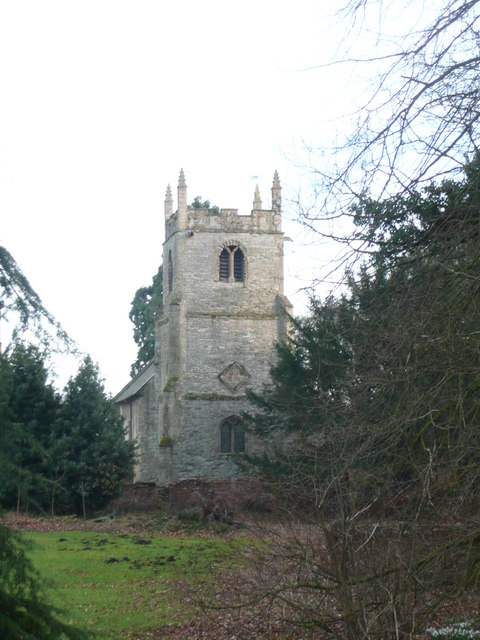
St John of Jerusalem's Church, Winkburn
St John of Jerusalem's Church, Winkburn is a Grade I listed parish church in the Church of England in Winkburn. == History == The church was built in the...

Winkburn Hall
Winkburn Hall is a Grade I listed country house which stands at the corner of an estate a few miles north-east of Southwell, Nottinghamshire, off the Hockerton...
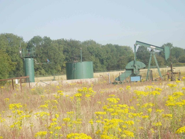
Kirklington Hall Research Station
Kirklington Hall Research Station was a geophysical research institute of BP in Kirklington, Nottinghamshire. During the 1950s it was the main research...
Nearby Amenities
Located within 500m of 53.115173,-0.95348872Have you been to Hockerton Moor?
Leave your review of Hockerton Moor below (or comments, questions and feedback).