Baldovie

Settlement in Angus

Scotland

Baldovie

East Balgillo Road East Balgillo Road heading north towards the roundabout on the A92.
East Balgillo Road Credit: Scott Cormie

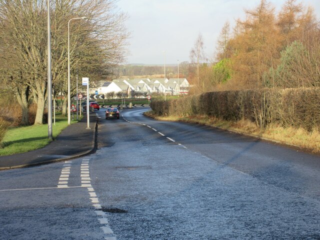
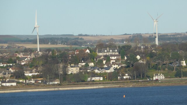
Baldovie is a small village located in the Angus region of Scotland. Situated just a few miles northeast of the city of Dundee, Baldovie is a rural community surrounded by picturesque countryside. The village is known for its tranquil atmosphere and stunning natural beauty.

Baldovie is characterized by its rolling hills, lush green fields, and charming farmhouses. The area is predominantly agricultural, with farming being the primary occupation for many residents. Cattle and sheep farming are particularly prevalent, and the village is often dotted with grazing livestock.

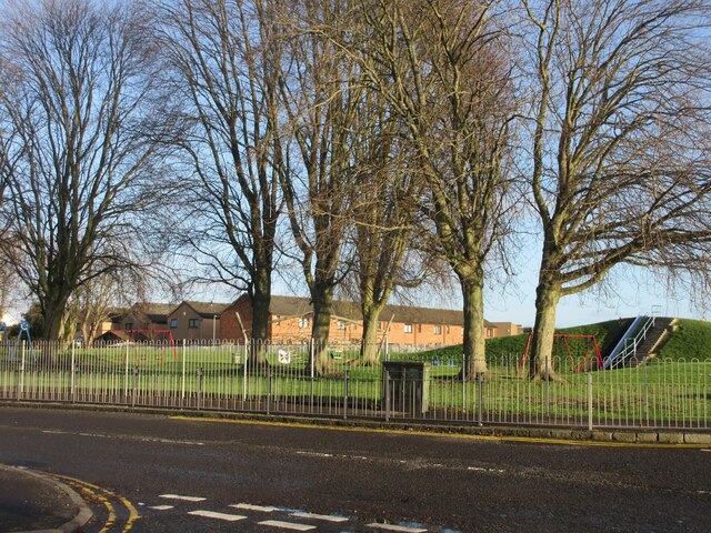
Despite its small size, Baldovie offers a range of amenities to its residents. The village has a local primary school, providing education for the younger population. Additionally, there is a village hall that serves as a community center, hosting various events and gatherings throughout the year.

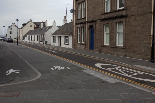
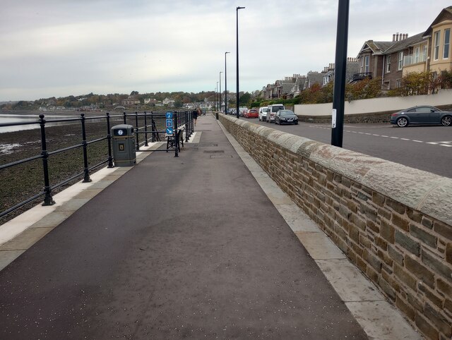
For those seeking outdoor activities, Baldovie boasts numerous walking and cycling routes, allowing visitors to explore the surrounding countryside. The nearby Angus Glens provide opportunities for hiking and nature walks, offering breathtaking views and abundant wildlife.

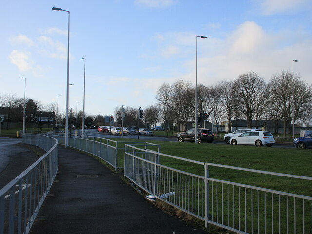
Baldovie's proximity to Dundee provides residents with easy access to urban amenities, including shopping centers, restaurants, and cultural attractions. The city is renowned for its vibrant arts scene, with galleries, museums, and theaters aplenty.

In conclusion, Baldovie is a charming village nestled in the Angus region of Scotland. With its rural charm, stunning natural landscapes, and close proximity to Dundee, it offers residents and visitors a peaceful yet convenient place to live or explore.

If you have any feedback on the listing, please let us know in the comments section below.

Baldovie Images

Images are sourced within 2km of 56.47689/-2.8944808 or Grid Reference NO4532. Thanks to Geograph Open Source API. All images are credited.

East Balgillo Road East Balgillo Road heading north towards the roundabout on the A92.
East Balgillo Road
East Balgillo Road heading north towards the roundabout on the A92.
Claypotts Junction The busy Claypotts Junction at the intersection of the A92 with the B978.
Claypotts Junction
The busy Claypotts Junction at the intersection of the A92 with the B978.
Woodland on the play park Trees on the play park on Forthill Road, looking from Fintry Place.
Woodland on the play park
Trees on the play park on Forthill Road, looking from Fintry Place.
Claypotts Castle Claypotts Castle viewed from the south-east on Claypotts Road.
Claypotts Castle
Claypotts Castle viewed from the south-east on Claypotts Road.
Former Queen Street Church Church and steeple of the former Queen Street United Presbyterian Church in Broughty Ferry, now a restaurant.
Former Queen Street Church
Church and steeple of the former Queen Street United Presbyterian Church in Broughty Ferry, now a restaurant.
Broughty Ferry Library The public library in Broughty Ferry viewed across Queen Street.
Broughty Ferry Library
The public library in Broughty Ferry viewed across Queen Street.
Pair of wind turbines
1E11 Aberdeen to London Kings Cross passing through Broughty Ferry Station Unit 800102
1E11 Aberdeen to London Kings Cross passing through Broughty Ferry Station
Unit 800102
Construction of flood defences, Broughty Ferry
Promenade at James Place, Broughty Ferry
Firth of Tay Seen from the promenade at James Place, Broughty Ferry. The Tay Road Bridge can be seen on the horizon.
Firth of Tay
Seen from the promenade at James Place, Broughty Ferry. The Tay Road Bridge can be seen on the horizon.
Lifeboat sculpture Depicts lifeboat davits and bears names of Broughty Ferry lifeboats since 1850
Lifeboat sculpture
Depicts lifeboat davits and bears names of Broughty Ferry lifeboats since 1850
The Royal Arch Pub and restaurant on corner of Brook Street and Gray Street
The Royal Arch
Pub and restaurant on corner of Brook Street and Gray Street
Lodge Broughty Castle No 486 Building dates from 1912
Lodge Broughty Castle No 486
Building dates from 1912
Fisher Street Clearly marked routes for pedestrians, cyclists & cars
Fisher Street
Clearly marked routes for pedestrians, cyclists & cars
Footpath/cycle path: Broughty Ferry Recent addition as shown by Streetview (June 2018)
Footpath/cycle path: Broughty Ferry
Recent addition as shown by Streetview (June 2018)
Pebble covered beach Heron on water's edge
Pebble covered beach
Heron on water's edge
Show me another place!

Baldovie is located at Grid Ref: NO4532 (Lat: 56.47689, Lng: -2.8944808)

Unitary Authority: City of Dundee

Police Authority: Tayside

What 3 Words

///bring.behave.punchy. Near Tayport, Fife

Nearby Locations

Baldovie

Related Wikis

Broughty Athletic F.C.

Broughty Athletic Junior Football Club is a Scottish football club based in Broughty Ferry, a suburb of the city of Dundee. Members of the Scottish Junior...
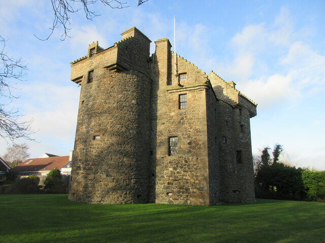
Claypotts Castle

Claypotts Castle is a late medieval castle in the suburban West Ferry area of Dundee, Scotland. It is one of the best-preserved examples of a 16th-century...

Douglas, Dundee

Douglas and Angus (commonly referred to as Douglas) is an area of Eastern Dundee, Scotland. It is located between Whitfield to the North and Broughty Ferry...

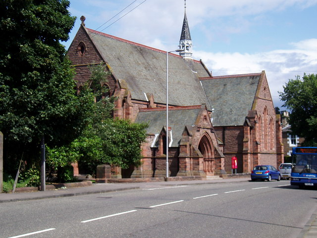
St Luke's Church, Broughty Ferry

St Luke's & Queen Street Church is a congregation of the Church of Scotland in Broughty Ferry, on the edge of Dundee, Scotland. The church building was...

Nearby Amenities

Located within 500m of 56.47689,-2.8944808
Traffic Signals
Traffic Signals: signal
Lat/Long: 56.4772176/-2.8899465
Traffic Signals
Lat/Long: 56.4779897/-2.8889912
Turning Circle
Lat/Long: 56.4762515/-2.891903
Mini Roundabout
Lat/Long: 56.4787486/-2.889411
Crossing
Crossing: traffic_signals
Lat/Long: 56.4773962/-2.8886411
Parking
Created By: Potlatch 0.10b
Lat/Long: 56.4732082/-2.8950342
Traffic Signals
Lat/Long: 56.4779711/-2.888733
Crossing
Crossing: traffic_signals
Crossing Island: yes
Tactile Paving: yes
Lat/Long: 56.4754277/-2.9009818
Traffic Signals
Lat/Long: 56.4782265/-2.8888499
Mini Roundabout
Lat/Long: 56.4783634/-2.8972605
Mini Roundabout
Lat/Long: 56.4781743/-2.9006481
Crossing
Crossing: traffic_signals
Lat/Long: 56.4780718/-2.8884715
Bus Stop
Balgillo Road near Arbroath Road
Naptan AtcoCode: 6400PT1054
Naptan CommonName: Arbroath Road
Naptan Indicator: near
Naptan NaptanCode: 36323476
Operator: Stagecoach
Public Transport: platform
Route Ref: 39
Shelter: no
Towards: Montrose
Lat/Long: 56.4770775/-2.8878625
Bus Stop
Arbroath Road
Naptan AtcoCode: 6400PT1756
Naptan CommonName: Arbroath Road
Naptan Indicator: at
Naptan NaptanCode: 36323485
Operator: Strathtay
Public Transport: platform
Route Ref: 39
Shelter: no
Towards: Dundee City Centre
Lat/Long: 56.4767599/-2.8878192
Bus Stop
Strathern Road at Ellieslea Road
Naptan AtcoCode: 6400PT1465
Naptan CommonName: Ellieslea Road
Naptan Indicator: at
Naptan NaptanCode: 36325396
Operator: Strathtay
Public Transport: platform
Route Ref: 73
Shelter: yes
Towards: Ninewells Hospital
Lat/Long: 56.4727051/-2.8953947
Bus Stop
Strathern Road opp. Ellieslea Road
Naptan AtcoCode: 6400PT1471
Naptan CommonName: Ellieslea Road
Naptan Indicator: opp
Naptan NaptanCode: 36325429
Operator: Stagecoach
Public Transport: platform
Route Ref: 73
Shelter: yes
Towards: Arbroath
Lat/Long: 56.4728993/-2.8945068
Bus Stop
Strathern Road at Grove Road
Naptan AtcoCode: 6400PT1467
Naptan CommonName: Grove Road
Naptan Indicator: at
Naptan NaptanCode: 36325423
Operator: Stagecoach
Public Transport: platform
Route Ref: 73
Shelter: yes
Towards: Arbroath
Lat/Long: 56.4730543/-2.8912704
Traffic Signals
Lat/Long: 56.4780106/-2.8886413
Traffic Signals
Traffic Signals: signal
Lat/Long: 56.4769247/-2.889356
Traffic Signals
Traffic Signals: signal
Lat/Long: 56.4773461/-2.889484
Crossing
Button Operated: yes
Crossing: traffic_signals
Crossing Ref: pelican
Tactile Paving: yes
Lat/Long: 56.4797958/-2.8896585
Crossing
Button Operated: yes
Crossing: traffic_signals
Crossing Ref: pelican
Tactile Paving: yes
Lat/Long: 56.4798309/-2.8897617
Crossing
Crossing: uncontrolled
Crossing Ref: zebra
Lat/Long: 56.4785042/-2.8887953
Crossing
Crossing: uncontrolled
Crossing Ref: zebra
Lat/Long: 56.478561/-2.8887737
Crossing
Crossing: uncontrolled
Crossing Ref: zebra
Lat/Long: 56.4786836/-2.888946
Generator Method: photovoltaic
Generator Output Electricity: yes
Generator Source: solar
Generator Type: solar_photovoltaic_panel
Power: generator
Lat/Long: 56.4775174/-2.899184
Generator Method: photovoltaic
Generator Output Electricity: yes
Generator Source: solar
Generator Type: solar_photovoltaic_panel
Power: generator
Lat/Long: 56.4774705/-2.8991875
Generator Method: photovoltaic
Generator Output Electricity: yes
Generator Source: solar
Generator Type: solar_photovoltaic_panel
Power: generator
Lat/Long: 56.4774617/-2.9002103
Generator Method: photovoltaic
Generator Output Electricity: yes
Generator Source: solar
Generator Type: solar_photovoltaic_panel
Power: generator
Lat/Long: 56.47438/-2.8916441
Bus Stop
Baldovie Road near Sainsburys
Naptan AtcoCode: 6400PT1884
Naptan CommonName: Sainsburys
Naptan Indicator: near
Naptan NaptanCode: 36323457
Naptan Verified: yes
Public Transport: platform
Shelter: no
Lat/Long: 56.4794749/-2.8894767
Bus Stop
Baldovie Road near Sainsburys
Naptan AtcoCode: 6400PT1970
Naptan CommonName: Sainsburys
Naptan Indicator: opp
Naptan NaptanCode: 36325745
Naptan Verified: yes
Public Transport: platform
Shelter: no
Lat/Long: 56.4796786/-2.8898804
Bus Stop
Balunie Drive
Naptan AtcoCode: 6400PT1886
Naptan CommonName: Balunie Drive
Naptan Indicator: at
Naptan NaptanCode: 36323452
Naptan Verified: no
Public Transport: platform
Lat/Long: 56.4804854/-2.8900293
Bus Stop
Broughty Ferry Walk
Naptan AtcoCode: 6400S217
Naptan CommonName: Broughty Ferry Walk
Naptan Indicator: opp
Naptan NaptanCode: 36323567
Naptan Verified: no
Public Transport: platform
Lat/Long: 56.480214/-2.8920892
Bus Stop
Harry Lawson
Naptan AtcoCode: 6400PT1075
Naptan CommonName: Harry Lawson
Naptan Indicator: opp
Naptan NaptanCode: 36323564
Naptan Verified: no
Public Transport: platform
Shelter: yes
Lat/Long: 56.480531/-2.8945005
Bus Stop
Baluniefield Road
Naptan AtcoCode: 6400PT1787
Naptan CommonName: Baluniefield Road
Naptan Indicator: at
Naptan NaptanCode: 36323563
Naptan Verified: no
Public Transport: platform
Shelter: yes
Lat/Long: 56.4782033/-2.901835
Bus Stop
Balunie Place
Naptan AtcoCode: 6400PT1073
Naptan CommonName: Balunie Place
Naptan Indicator: near
Naptan NaptanCode: 36323543
Naptan Verified: no
Public Transport: platform
Lat/Long: 56.4782521/-2.8987464
Bus Stop
Balunie Gardens
Naptan AtcoCode: 6400S215
Naptan CommonName: Balunie Gardens
Naptan Indicator: opp
Naptan NaptanCode: 36323549
Naptan Verified: no
Public Transport: platform
Shelter: yes
Lat/Long: 56.4782344/-2.8979807
Bus Stop
Balunie Terrace
Naptan AtcoCode: 6400PT1071
Naptan CommonName: Balunie Terrace
Naptan Indicator: near
Naptan NaptanCode: 36323545
Naptan Verified: no
Public Transport: platform
Shelter: yes
Lat/Long: 56.4785721/-2.895623
Bus Stop
Baldovie Road
Naptan AtcoCode: 6400PT1823
Naptan CommonName: Baldovie Road
Naptan Indicator: near
Naptan NaptanCode: 36323562
Naptan Verified: no
Public Transport: platform
Lat/Long: 56.4789365/-2.8912309
Bus Stop
Baldovie Road
Naptan AtcoCode: 6400PT1656
Naptan CommonName: Baldovie Road
Naptan Indicator: at
Naptan NaptanCode: 36323546
Naptan Verified: no
Public Transport: platform
Lat/Long: 56.4790505/-2.8907333
Traffic Signals
Traffic Signals: signal
Lat/Long: 56.4780896/-2.8884061
Crossing
Crossing: traffic_signals
Lat/Long: 56.4781245/-2.888523
Crossing
Crossing: traffic_signals
Lat/Long: 56.4782192/-2.8890699
Crossing
Crossing: traffic_signals
Lat/Long: 56.4781978/-2.888827
Crossing
Crossing: traffic_signals
Lat/Long: 56.4782554/-2.8887006
Traffic Signals
Traffic Signals: signal
Lat/Long: 56.4781399/-2.8884621
Traffic Signals
Traffic Signals: signal
Lat/Long: 56.4782733/-2.8887376
Traffic Signals
Traffic Signals: signal
Lat/Long: 56.4771884/-2.8892118
Crossing
Crossing: uncontrolled
Crossing Markings: zebra
Lat/Long: 56.4792433/-2.8882289
Crossing
Crossing: uncontrolled
Crossing Markings: zebra
Lat/Long: 56.4795575/-2.8883138
Baluniefield
Place: suburb
Lat/Long: 56.4803591/-2.8944401
The data included in this document is from www.openstreetmap.org. The data is made available under ODbL.

Have you been to Baldovie?

Leave your review of Baldovie below (or comments, questions and feedback).