Beningbrough Park

Downs, Moorland in Yorkshire Hambleton

England

Beningbrough Park

Moor Lane, Newton-on-Ouse Looking across the green in Newton on Ouse.
Moor Lane, Newton-on-Ouse Credit: DS Pugh

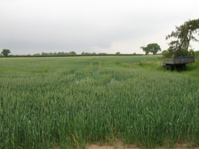
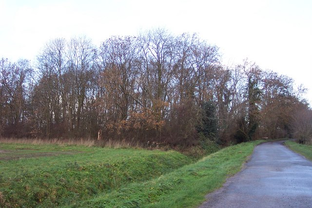
Beningbrough Park is a picturesque estate located in the heart of Yorkshire, England. Set amidst rolling hills, lush meadows, and expansive moorland, it offers visitors a tranquil escape in the midst of nature. Covering an area of approximately 300 acres, the park boasts diverse landscapes, making it a haven for wildlife and a popular destination for nature enthusiasts.

The park is known for its stunning vistas, with breathtaking views of the surrounding Yorkshire Downs and the serene River Ouse meandering through the estate. Visitors can explore the numerous walking trails that wind their way through the park, providing opportunities to discover its hidden gems, such as ancient woodlands, sparkling lakes, and charming meadows filled with wildflowers.

Beningbrough Park is also home to an impressive collection of wildlife, including deer, foxes, and a wide variety of bird species. Birdwatchers can spot kingfishers, herons, and even the elusive barn owl, among others. The park's diverse habitats, including heathland and wetlands, provide a rich and diverse ecosystem that supports a wide range of flora and fauna.

In addition to its natural beauty, Beningbrough Park is also renowned for its historic features. The centerpiece of the estate is Beningbrough Hall, an elegant Georgian mansion that dates back to the 18th century. The hall is open to the public and offers a glimpse into the lives of its former inhabitants through its opulent interiors and extensive art collection.

Overall, Beningbrough Park is a captivating destination that seamlessly combines natural beauty with rich history. Whether one seeks a peaceful stroll amidst stunning landscapes or an exploration of architectural wonders, this park offers a delightful experience for all.

If you have any feedback on the listing, please let us know in the comments section below.

Beningbrough Park Images

Images are sourced within 2km of 54.018582/-1.2135525 or Grid Reference SE5158. Thanks to Geograph Open Source API. All images are credited.

Moor Lane, Newton-on-Ouse Looking across the green in Newton on Ouse.
Moor Lane, Newton-on-Ouse
Looking across the green in Newton on Ouse.
The Dawnay Arms, Newton-on-Ouse
Entering Newton-on-Ouse
Farmland near Newton-on-Ouse
Moor Lane towards Shipton
The Dawnay Arms, Newton-on-Ouse
Parish Hall
Parish Hall
Village green With resting cyclists.
Village green
With resting cyclists.
Former infant school and schoolhouse Viewed across the village green.
Former infant school and schoolhouse
Viewed across the village green.
Former chapel Now in use as a dwelling.
Former chapel
Now in use as a dwelling.
Dawnay Arms pub sign
River Ouse View from the riverbank behind the Dawnay Arms.
River Ouse
View from the riverbank behind the Dawnay Arms.
Moor Lane, Newton-on-Ouse The furthest building on the right-hand side of the road was formerly a Methodist chapel
Moor Lane, Newton-on-Ouse
The furthest building on the right-hand side of the road was formerly a Methodist chapel
Boundary wall, Newton Park, Newton-on-Ouse The wall shows two style and two kinds of brick; the road is a modern estate
Boundary wall, Newton Park, Newton-on-Ouse
The wall shows two style and two kinds of brick; the road is a modern estate
Dawnay Arms at Newton - on- Ouse
Newton upon Ouse - Dawnay Arms From the village green.
Newton upon Ouse - Dawnay Arms
From the village green.
Newton upon Ouse On the road going east out of the village.
Newton upon Ouse
On the road going east out of the village.
A copse named 'America' Unusual name for woodland near Grange Farm, Nun Monkton.
A copse named 'America'
Unusual name for woodland near Grange Farm, Nun Monkton.
Show me another place!

Beningbrough Park is located at Grid Ref: SE5158 (Lat: 54.018582, Lng: -1.2135525)

Division: North Riding

Administrative County: North Yorkshire

District: Hambleton

Police Authority: North Yorkshire

What 3 Words

///apartment.marbles.reviews. Near Linton upon Ouse, North Yorkshire

Related Wikis

River Nidd

The River Nidd is a tributary of the River Ouse in the English county of North Yorkshire. In its first few miles it is dammed three times to create Angram...

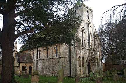
St Mary's Church, Nun Monkton

St Mary's Church is the parish church of Nun Monkton, in North Yorkshire, in England. == History == Nun Monkton Priory was founded in 1172 by Ivetta of...

Nun Monkton

Nun Monkton is a village and civil parish in the Harrogate district of North Yorkshire, England. It is situated 8 miles (13 km) northwest of York at the...
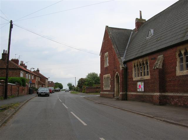
Beningbrough

Beningbrough is a village and civil parish in the Hambleton district of North Yorkshire, England. The population as taken at the 2011 Census was less than...

Nearby Amenities

Located within 500m of 54.018582,-1.2135525
Barrier: cattle_grid
Lat/Long: 54.0208134/-1.212231
Beningbrough Hall & Gardens
Addr City: York
Addr Postcode: YO30 1DD
Operator: National Trust
Toilets Wheelchair: yes
Tourism: attraction
Website: https://www.nationaltrust.org.uk/beningbrough-hall/
Wheelchair: yes
Wikidata: Q4888052
Wikipedia: en:Beningbrough Hall
Lat/Long: 54.0221006/-1.2112642
Restaurant
Beningbrough Hall Restaurant
Addr City: York
Addr Housename: Beningbrough Hall
Addr Postcode: YO30 1DD
Diet Vegetarian: yes
Opening Hours: Mo-Su 10:00-17:00
Wheelchair: yes
Lat/Long: 54.0207278/-1.2115181
Recycling
Location: overground
Recycling Cans: yes
Recycling Glass Bottles: yes
Recycling Paper: yes
Recycling Plastic: no
Recycling Plastic Packaging: yes
Recycling Type: container
Lat/Long: 54.0206974/-1.2119103
Cafe
Home Farm Café
Addr City: York
Addr Housename: Beningbrough Hall
Addr Postcode: YO30 1DD
Cuisine: coffee_shop
Name En: Home Farm Café
Lat/Long: 54.0217639/-1.2090356
Toilets
Fee: no
Wheelchair: yes
Lat/Long: 54.0207191/-1.2106077
Name Signed: no
Opening Hours: Mo-Su 10:30-15:30
Operator: National Trust
Shop: gift
Lat/Long: 54.0207726/-1.2109301
Barrier: kissing_gate
Lat/Long: 54.0169328/-1.206702
Barrier: kissing_gate
Lat/Long: 54.0165509/-1.2086068
Waste Basket
Lat/Long: 54.0214023/-1.2104756
Bicycle Parking
Bicycle Parking: stands
Capacity: 40
Covered: no
Lat/Long: 54.0208262/-1.2109425
Barrier: chain
Lat/Long: 54.0205677/-1.2104998
Wilderness Playground
Access: customers
Leisure: playground
Surface: woodchips
Lat/Long: 54.0209555/-1.2153255
Beningbrough Hall
Power: substation
Lat/Long: 54.0206844/-1.2121336
Toilets
Changing Table: yes
Fee: no
Wheelchair: yes
Lat/Long: 54.0206325/-1.21473
Victorian Laundry
Internet Access: wlan
Internet Access Fee: no
Level: 2
Name En: Victorian Laundry
Operator: National Trust
Rooms: 2
Smoking: no
Tourism: apartment
Website: https://www.nationaltrust.org.uk/holidays/the-victorian-laundry-yorkshire
Wheelchair: no
Lat/Long: 54.0207676/-1.2144689
Bench
Lat/Long: 54.0170299/-1.2065423
The data included in this document is from www.openstreetmap.org. The data is made available under ODbL.

Have you been to Beningbrough Park?

Leave your review of Beningbrough Park below (or comments, questions and feedback).