Hawford

Settlement in Worcestershire Wychavon

England

Hawford

Droitwich Canal at Porter's Mill The remains of a lock on the Droitwich canal.  To see the same scene almost seven years later see: <a href="https://www.geograph.org.uk/photo/2958161">SO8660 : Lock at Porter's Mill</a>
Droitwich Canal at Porter's Mill Credit: Philip Halling

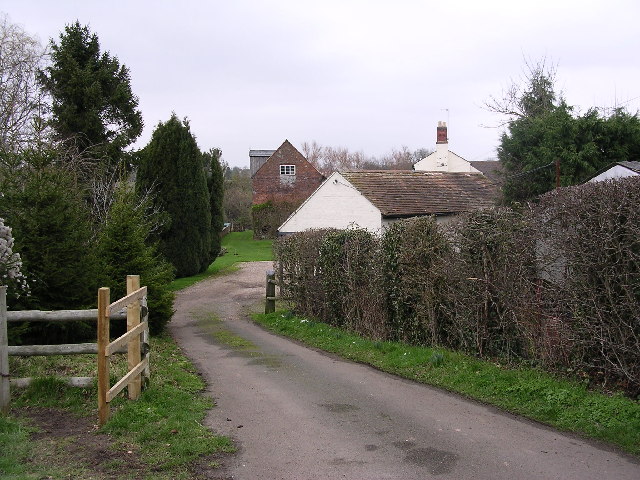
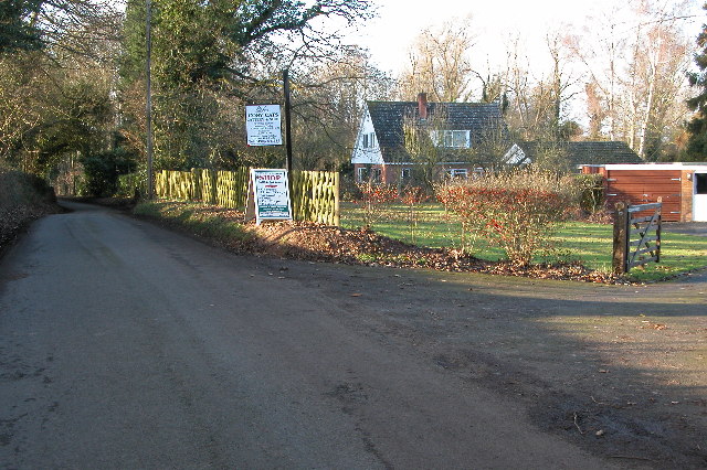
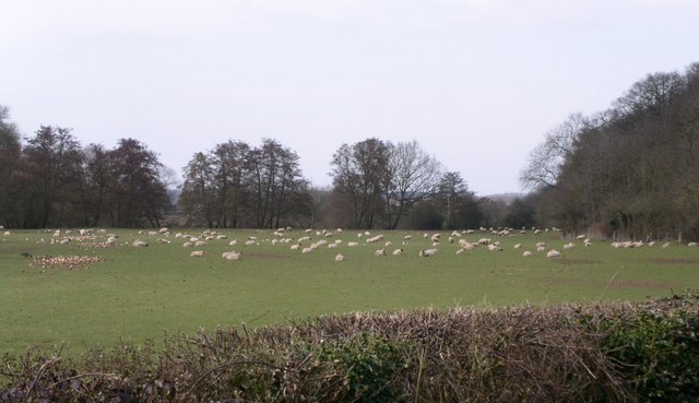
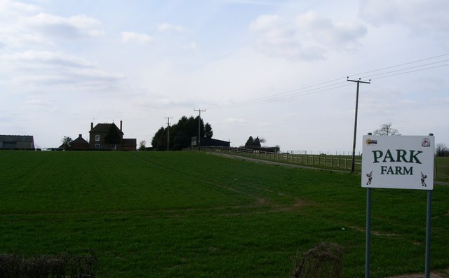
Hawford is a small village located in the county of Worcestershire, England. Situated about 5 miles north of Worcester, Hawford is nestled in a picturesque countryside setting, characterized by rolling hills, meandering streams, and lush green landscapes. The village falls within the administrative district of Wychavon and is part of the wider civil parish of Ombersley.

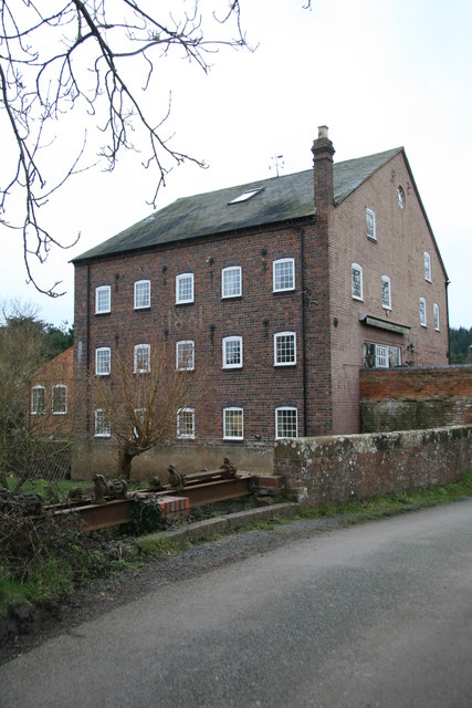
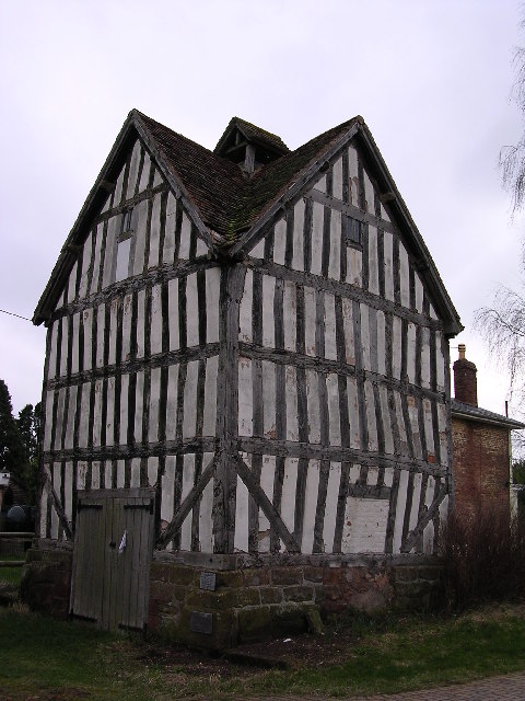
With a population of around 500 residents, Hawford is a tight-knit community known for its peaceful and tranquil atmosphere. The village is predominantly residential, consisting of a mix of traditional cottages, farmhouses, and modern homes. The architecture reflects the village's rich history, with some buildings dating back several centuries.

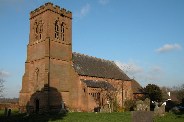
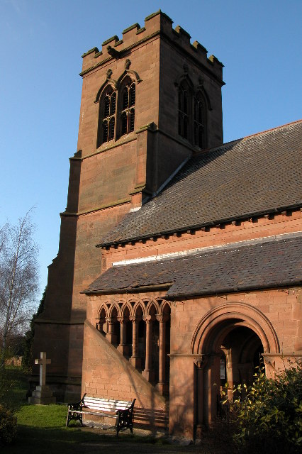
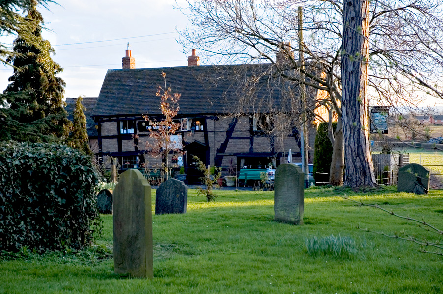
Although small in size, Hawford benefits from a range of amenities. The village boasts a charming 18th-century pub, the Hawford Dovecote Inn, which serves as a social hub for locals and visitors alike. The beautiful St. Mary's Church, also from the 18th century, stands as a prominent landmark in the village.

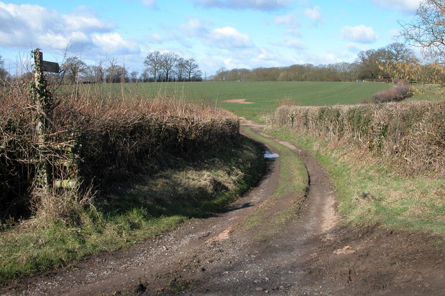
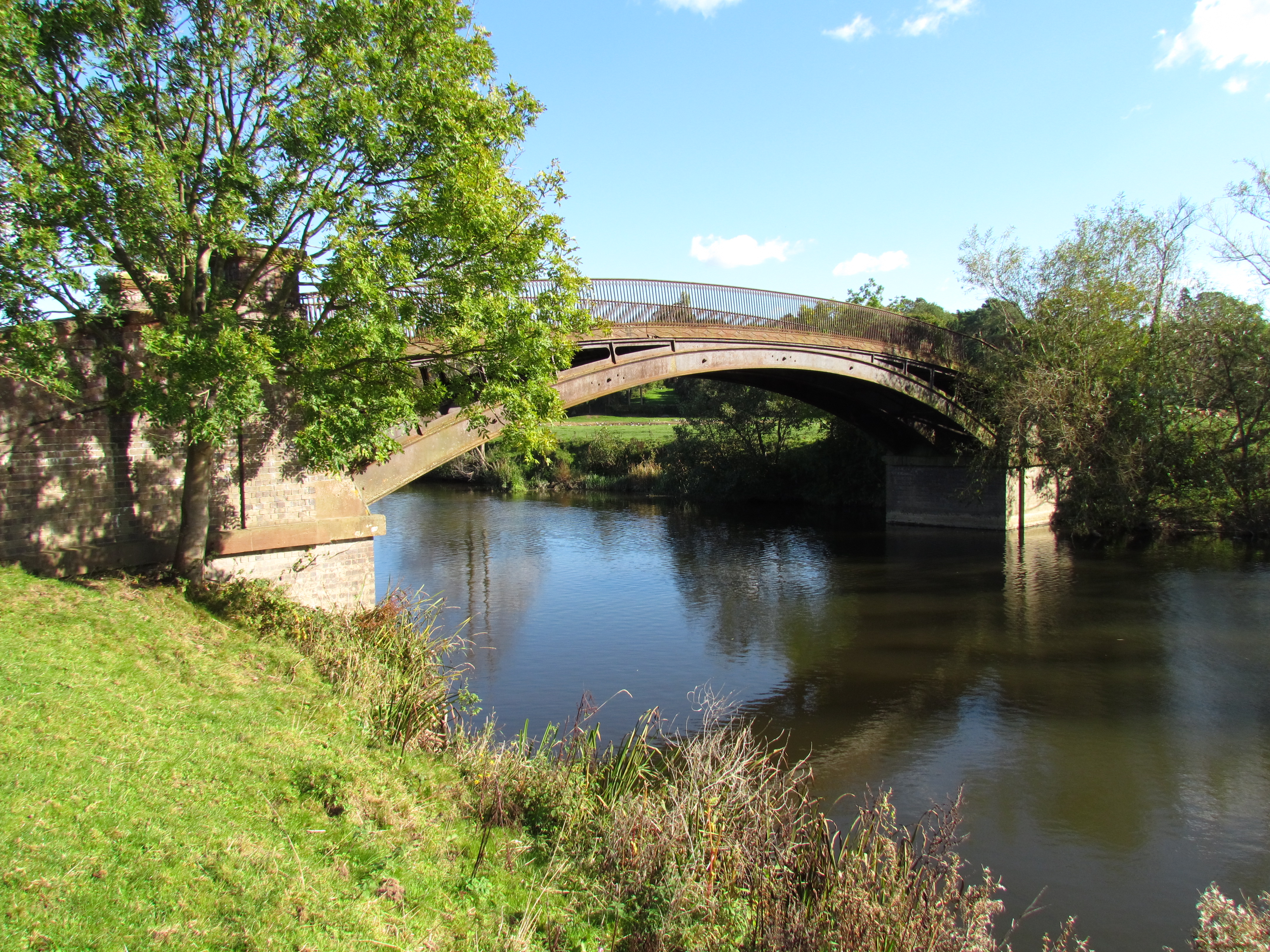
Nature lovers will enjoy the scenic walks and cycling routes that surround Hawford. The nearby Hawford Wood is a popular destination for outdoor enthusiasts, offering opportunities for woodland walks and wildlife spotting. Additionally, the village's proximity to the River Severn provides opportunities for boating, fishing, and other water activities.

Hawford's location offers easy access to larger towns and cities. The city of Worcester is a short drive away, providing residents with a wide range of shopping, dining, and entertainment options. The village is also well-connected by public transport, with regular bus services linking Hawford to Worcester and other neighboring areas.

In summary, Hawford is a charming village in Worcestershire, known for its idyllic countryside, friendly community, and convenient location.

If you have any feedback on the listing, please let us know in the comments section below.

Hawford Images

Images are sourced within 2km of 52.24018/-2.229893 or Grid Reference SO8460. Thanks to Geograph Open Source API. All images are credited.

Droitwich Canal at Porter's Mill The remains of a lock on the Droitwich canal.  To see the same scene almost seven years later see: <a href="https://www.geograph.org.uk/photo/2958161">SO8660 : Lock at Porter's Mill</a>
Droitwich Canal at Porter's Mill
The remains of a lock on the Droitwich canal. To see the same scene almost seven years later see: SO8660 : Lock at Porter's Mill
Droitwich Canal at Porter's Mill Droitwich canal was built by James Brindley and opened in 1771, it was abandoned in 1939.
Droitwich Canal at Porter's Mill
Droitwich canal was built by James Brindley and opened in 1771, it was abandoned in 1939.
Hawford dovecot Hawford dovecote, a National Trust property, close to the A 449 trunk road, north of Worcester
Hawford dovecot
Hawford dovecote, a National Trust property, close to the A 449 trunk road, north of Worcester
Mildenham mill Mildenham mill on the Droitwich canal/River Salwarpe
Mildenham mill
Mildenham mill on the Droitwich canal/River Salwarpe
Cosy Cats Cattery The cattery is on Dark Lane to Sinton Green.
Cosy Cats Cattery
The cattery is on Dark Lane to Sinton Green.
St Bartholomew's Church, Grimley
St Bartholomew 's Church, Grimley
Footpath to Knight's Grove Short track providing access to a field
Footpath to Knight's Grove
Short track providing access to a field
Severn flood plain beneath Hawford Wood The trees on the left mark the riverbank , no doubt this is good grazing for this number of sheep.
Severn flood plain beneath Hawford Wood
The trees on the left mark the riverbank , no doubt this is good grazing for this number of sheep.
Park farm a landmark on the left of the A449 heading for Kidderminster A very tidy farm very much on view from the busy dual carriage way north out of Worcester.
Park farm a landmark on the left of the A449 heading for Kidderminster
A very tidy farm very much on view from the busy dual carriage way north out of Worcester.
Church Farm quarry Still extracting gravel in the area this south east of the Top Barn complex of boating and fishing lakes
Church Farm quarry
Still extracting gravel in the area this south east of the Top Barn complex of boating and fishing lakes
Lock 4, Droitwich Canal This section is decidedly disused. There's a nasty bloom on the water. The mild winter has left the canal largely covered by green algae.
Lock 4, Droitwich Canal
This section is decidedly disused. There's a nasty bloom on the water. The mild winter has left the canal largely covered by green algae.
Lock Cottage by lock 5, Droitwich Canal The lock here is pretty derelict.
Lock Cottage by lock 5, Droitwich Canal
The lock here is pretty derelict.
Porter's Mill Now a dwelling. A large water mill with 1861 in the brickwork on the upstream side. Fed from the River Salwarpe.
Porter's Mill
Now a dwelling. A large water mill with 1861 in the brickwork on the upstream side. Fed from the River Salwarpe.
Porter's Mill The upstream side.
Porter's Mill
The upstream side.
Lane near Porter's Mill Looking southwards on another wet summer afternoon.
Lane near Porter's Mill
Looking southwards on another wet summer afternoon.
Lock keepers cottage near Porter's Mill From the canal bridge looking across the disused lock.
Lock keepers cottage near Porter's Mill
From the canal bridge looking across the disused lock.
Droitwich Barge Canal From the bridge near Porter's Mill. In summer, the canal is totally green with duckweed.
Droitwich Barge Canal
From the bridge near Porter's Mill. In summer, the canal is totally green with duckweed.
Show me another place!

Hawford is located at Grid Ref: SO8460 (Lat: 52.24018, Lng: -2.229893)

Administrative County: Worcestershire

District: Wychavon

Police Authority: West Mercia

What 3 Words

///rare.boom.wire. Near Hallow, Worcestershire

Nearby Locations

Hawford Hawford Dovecote

Related Wikis

A449 road

The A449 is a major road in the United Kingdom. It runs north from junction 24 of the A48 road at Newport in South Wales to Stafford in Staffordshire....

River Salwarpe

The River Salwarpe is a 20.4 miles (32.8 km) long river in Worcestershire, England. It is a left bank tributary of the River Severn, which it joins near...

Hawford

Hawford is a hamlet in Worcestershire, England. It falls within two parishes; North Claines and Ombersley and Doverdale in the outer suburbs of Worcester...

Grimley, Worcestershire

Grimley is a village and civil parish (grid reference SO8360) in the Malvern Hills District in the county of Worcestershire, England about 3 miles (4...

North Claines

North Claines is a civil parish in Wychavon district, Worcestershire, England, immediately north of the city of Worcester. It includes the settlements...

The Mug House

The Mug House is a traditional public house located in the village of Claines, Worcestershire, England, which dates back to the 15th century. == Overview... ==

Claines

Claines is a small village just to the north of Worcester, in the Worcester district, in the county of Worcestershire, England, on the east bank of the...

Worcester City F.C.

Worcester City Football Club is an English football club based in Worcester, Worcestershire. The club play in the Hellenic Football League Premier Division...

Nearby Amenities

Located within 500m of 52.24018,-2.229893
Hawford
Is In: Worcester
Place: village
Wikidata: Q5684752
Lat/Long: 52.2417321/-2.2264297
Seamark Type: gate
Waterway: lock_gate
Lat/Long: 52.2388193/-2.2301848
Seamark Type: gate
Waterway: lock_gate
Lat/Long: 52.2375488/-2.2321315
Hawford Junction
Place: junction
Lat/Long: 52.2371371/-2.2326582
Seamark Type: gate
Waterway: lock_gate
Lat/Long: 52.2378212/-2.2320387
Seamark Type: gate
Waterway: lock_gate
Lat/Long: 52.2388157/-2.230566
Barrier: kissing_gate
Foot: yes
Lat/Long: 52.2371261/-2.2311023
Bench
Lat/Long: 52.2389149/-2.2303536
Information: board
Tourism: information
Lat/Long: 52.2389181/-2.2306246
Direction: both
Traffic Calming: hump
Lat/Long: 52.2426631/-2.2264164
Marker: post
Operator: CLH
Operator Old: GPSS
Utility: oil
Lat/Long: 52.2387157/-2.2306511
Marker: aerial
Operator: CLH
Operator Old: GPSS
Ref GPSS: 19727
Utility: oil
Lat/Long: 52.2393304/-2.2306712
Marker: pedestal
Operator: CLH
Operator Old: GPSS
Ref: CP 1477
Utility: oil
Lat/Long: 52.2372107/-2.2305042
Marker: aerial
Operator: CLH
Operator Old: GPSS
Ref GPSS: 17268
Utility: oil
Lat/Long: 52.2371368/-2.2304914
Marker: pedestal
Operator: CLH
Operator Old: GPSS
Ref: CP 1744
Utility: oil
Lat/Long: 52.2371281/-2.2304899
Marker: post
Operator: CLH
Operator Old: GPSS
Ref GPSS: 17267
Utility: oil
Lat/Long: 52.2370678/-2.2304794
Marker: pedestal
Operator: CLH
Operator Old: GPSS
Utility: oil
Lat/Long: 52.2370765/-2.2304809
Marker: aerial
Operator: CLH
Operator Old: GPSS
Ref: MP 2885
Ref GPSS: 19727
Utility: oil
Lat/Long: 52.241986/-2.231034
Marker: aerial
Note: ref:GPSS:post=17271
Operator: CLH
Operator Old: GPSS
Ref GPSS: 18286
Utility: oil
Lat/Long: 52.2402424/-2.2308013
Hawford Bank
Location Transition: yes
Power: pole
Transformer: distribution
Voltage Primary: 11000
Lat/Long: 52.2421796/-2.2294736
Hawford South
Power: pole
Transformer: distribution
Voltage Primary: 11000
Lat/Long: 52.2431461/-2.2275679
Hawford School
Location Transition: yes
Power: pole
Transformer: distribution
Voltage Primary: 11000
Lat/Long: 52.2383777/-2.227407
Power: pole
Lat/Long: 52.2385966/-2.2289727
Power: pole
Lat/Long: 52.2387251/-2.230572
Power: pole
Lat/Long: 52.2382282/-2.230643
Hawford Farm
Power: pole
Transformer: distribution
Voltage Primary: 11000
Lat/Long: 52.237522/-2.230753
Power: pole
Lat/Long: 52.2370834/-2.2308201
Power: pole
Lat/Long: 52.2361373/-2.2309488
The data included in this document is from www.openstreetmap.org. The data is made available under ODbL.

Have you been to Hawford?

Leave your review of Hawford below (or comments, questions and feedback).