Hawford Dovecote

Heritage Site in Worcestershire Wychavon

England

Hawford Dovecote

Droitwich Canal at Porter's Mill The remains of a lock on the Droitwich canal.  To see the same scene almost seven years later see: <a href="https://www.geograph.org.uk/photo/2958161">SO8660 : Lock at Porter's Mill</a>
Droitwich Canal at Porter's Mill Credit: Philip Halling

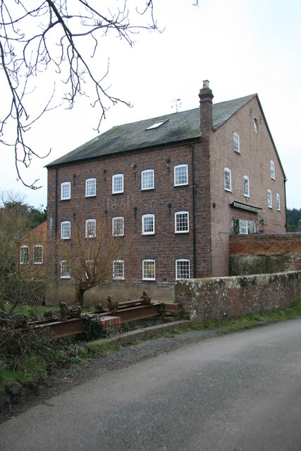
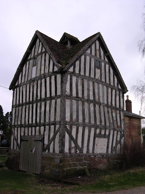
Hawford Dovecote, located in Worcestershire, is a historic heritage site that holds significant architectural and historical value. This well-preserved dovecote is believed to have been constructed in the late 16th or early 17th century and stands as a testament to the region's agricultural past.

The dovecote is a rectangular building, made primarily of brick and timber, with a steeply pitched roof. It features a prominent gabled entrance, which was once used to facilitate the entry and exit of pigeons. Inside, the dovecote boasts over 500 nesting holes, or "dovecotes," which were designed to attract and house pigeons. Such structures were commonly found in the countryside during this period, as pigeons were highly valued for their meat and eggs.

Hawford Dovecote is particularly noteworthy for its architectural details and craftsmanship. The brickwork is intricately laid out in a herringbone pattern, creating a visually appealing facade. The timber framing, with its exposed beams and sturdy construction, adds to the overall charm and historical significance of the structure.

Protected as a Grade II listed building, the dovecote stands as a reminder of Worcestershire's agricultural heritage and is a popular attraction for history enthusiasts and architectural admirers. Visitors can explore the exterior of the building and appreciate its unique design, while also learning about the role that dovecotes played in the local economy during the Tudor period.

Overall, Hawford Dovecote is a treasured heritage site that offers a glimpse into Worcestershire's past and serves as a tangible link to its agricultural and architectural history.

If you have any feedback on the listing, please let us know in the comments section below.

Hawford Dovecote Images

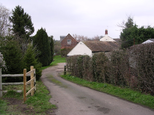
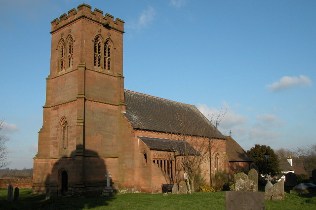
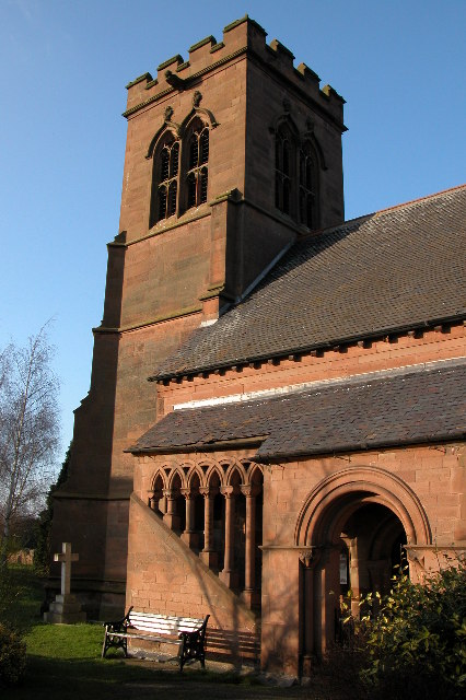
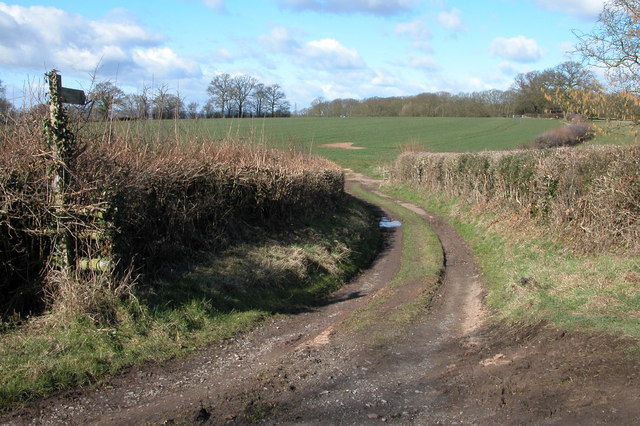
Images are sourced within 2km of 52.244/-2.226 or Grid Reference SO8460. Thanks to Geograph Open Source API. All images are credited.

Droitwich Canal at Porter's Mill The remains of a lock on the Droitwich canal.  To see the same scene almost seven years later see: <a href="https://www.geograph.org.uk/photo/2958161">SO8660 : Lock at Porter's Mill</a>
Droitwich Canal at Porter's Mill
The remains of a lock on the Droitwich canal. To see the same scene almost seven years later see: SO8660 : Lock at Porter's Mill
Droitwich Canal at Porter's Mill Droitwich canal was built by James Brindley and opened in 1771, it was abandoned in 1939.
Droitwich Canal at Porter's Mill
Droitwich canal was built by James Brindley and opened in 1771, it was abandoned in 1939.
Hawford dovecot Hawford dovecote, a National Trust property, close to the A 449 trunk road, north of Worcester
Hawford dovecot
Hawford dovecote, a National Trust property, close to the A 449 trunk road, north of Worcester
Mildenham mill Mildenham mill on the Droitwich canal/River Salwarpe
Mildenham mill
Mildenham mill on the Droitwich canal/River Salwarpe
Droitwich Canal I believe the local council are surveying with a view to reopening.
Droitwich Canal
I believe the local council are surveying with a view to reopening.
St Bartholomew's Church, Grimley
St Bartholomew 's Church, Grimley
Footpath to Knight's Grove Short track providing access to a field
Footpath to Knight's Grove
Short track providing access to a field
Severn flood plain beneath Hawford Wood The trees on the left mark the riverbank , no doubt this is good grazing for this number of sheep.
Severn flood plain beneath Hawford Wood
The trees on the left mark the riverbank , no doubt this is good grazing for this number of sheep.
Park farm a landmark on the left of the A449 heading for Kidderminster A very tidy farm very much on view from the busy dual carriage way north out of Worcester.
Park farm a landmark on the left of the A449 heading for Kidderminster
A very tidy farm very much on view from the busy dual carriage way north out of Worcester.
Church Farm quarry Still extracting gravel in the area this south east of the Top Barn complex of boating and fishing lakes
Church Farm quarry
Still extracting gravel in the area this south east of the Top Barn complex of boating and fishing lakes
The River Salwarpe at floodpoint
Lock 3 on Droitwich Canal This is the last restored lock at the northern end of the canal. there is an adjoining circular overflow weir (q.v.)
Lock 3 on Droitwich Canal
This is the last restored lock at the northern end of the canal. there is an adjoining circular overflow weir (q.v.)
Circular overflow weir by lock 3, Droitwich Canal Brindley was involved with this canal and this is like the circular (tumbling) weirs on the Staffs & Worcs Canal. I believe it was quite a shock when this appeared out of the undergrowth.
Circular overflow weir by lock 3, Droitwich Canal
Brindley was involved with this canal and this is like the circular (tumbling) weirs on the Staffs & Worcs Canal. I believe it was quite a shock when this appeared out of the undergrowth.
Lock 4, Droitwich Canal This section is decidedly disused. There's a nasty bloom on the water. The mild winter has left the canal largely covered by green algae.
Lock 4, Droitwich Canal
This section is decidedly disused. There's a nasty bloom on the water. The mild winter has left the canal largely covered by green algae.
Lock Cottage by lock 5, Droitwich Canal The lock here is pretty derelict.
Lock Cottage by lock 5, Droitwich Canal
The lock here is pretty derelict.
Porter's Mill Now a dwelling. A large water mill with 1861 in the brickwork on the upstream side. Fed from the River Salwarpe.
Porter's Mill
Now a dwelling. A large water mill with 1861 in the brickwork on the upstream side. Fed from the River Salwarpe.
Porter's Mill The upstream side.
Porter's Mill
The upstream side.
Show me another place!

Hawford Dovecote is located at Grid Ref: SO8460 (Lat: 52.244, Lng: -2.226)

Administrative County: Worcestershire

District: Wychavon

Police Authority: West Mercia

What 3 Words

///faded.desk.chair. Near Fernhill Heath, Worcestershire

Nearby Locations

Hawford Dovecote Hawford

Related Wikis

Hawford

Hawford is a hamlet in Worcestershire, England. It falls within two parishes; North Claines and Ombersley and Doverdale in the outer suburbs of Worcester...

A449 road

The A449 is a major road in the United Kingdom. It runs north from junction 24 of the A48 road at Newport in South Wales to Stafford in Staffordshire....

River Salwarpe

The River Salwarpe is a 20.4 miles (32.8 km) long river in Worcestershire, England. It is a left bank tributary of the River Severn, which it joins near...

Grimley, Worcestershire

Grimley is a village and civil parish (grid reference SO8360) in the Malvern Hills District in the county of Worcestershire, England about 3 miles (4...

North Claines

North Claines is a civil parish in Wychavon district, Worcestershire, England, immediately north of the city of Worcester. It includes the settlements...

The Mug House

The Mug House is a traditional public house located in the village of Claines, Worcestershire, England, which dates back to the 15th century. == Overview... ==

Claines

Claines is a small village just to the north of Worcester, in the Worcester district, in the county of Worcestershire, England, on the east bank of the...

River School

The River School is an independent Christian School, affiliated with the Christian Schools Trust. The school is located in Worcester, England, in a large...

Nearby Amenities

Located within 500m of 52.244,-2.226
Hawford
Is In: Worcester
Place: village
Wikidata: Q5684752
Lat/Long: 52.2417321/-2.2264297
Bus Stop
Chatley Turn- A449 South Bound
Bus: yes
Naptan AtcoCode: 2000G502400
Naptan Bearing: S
Naptan CommonName: Chatley Turn- A449 South Bound
Naptan Indicator: Adj
Naptan Landmark: Chatley Turn
Naptan NaptanCode: wocgmptd
Naptan Street: A449
Naptan Verified: no
Public Transport: platform
Source: naptan_import
Lat/Long: 52.2450932/-2.2286927
Bus Stop
A449 North Bound- Chatley Turn
Bus: yes
Naptan AtcoCode: 2000G502409
Naptan Bearing: N
Naptan CommonName: A449 North Bound- Chatley Turn
Naptan Indicator: Opp
Naptan Landmark: Chatley Turn
Naptan NaptanCode: wocdptwp
Naptan Street: A449
Naptan Verified: no
Public Transport: platform
Source: naptan_import
Lat/Long: 52.2455957/-2.2291786
Post Box
Collection Times: Mo-Fr 17:30; Sa 08:30
Operator: Royal Mail
Operator Wikidata: Q638098
Post Box Type: lamp
Ref: WR3 200
Royal Cypher: EIIR
Royal Cypher Wikidata: Q33102113
Lat/Long: 52.2450182/-2.2287078
Power: pole
Lat/Long: 52.247359/-2.222492
Direction: both
Traffic Calming: hump
Lat/Long: 52.2426631/-2.2264164
Historic: milestone
Inscription: A449 Stourport 8 Worcester 4
Marker: stone
Lat/Long: 52.2479009/-2.2292456
Marker: post
Operator: CLH
Operator Old: GPSS
Ref GPSS: 15681
Utility: oil
Lat/Long: 52.2459549/-2.2304323
Marker: aerial
Operator: CLH
Operator Old: GPSS
Ref GPSS: 18260
Utility: oil
Lat/Long: 52.2455242/-2.2303963
Marker: aerial
Operator: CLH
Operator Old: GPSS
Ref: MP 2885
Ref GPSS: 19727
Utility: oil
Lat/Long: 52.241986/-2.231034
Hawford Bank
Location Transition: yes
Power: pole
Transformer: distribution
Voltage Primary: 11000
Lat/Long: 52.2421796/-2.2294736
Hawford South
Power: pole
Transformer: distribution
Voltage Primary: 11000
Lat/Long: 52.2431461/-2.2275679
Location Transition: yes
Power: pole
Lat/Long: 52.244949/-2.2304023
Hawford Inn
Power: pole
Transformer: distribution
Voltage Primary: 11000
Lat/Long: 52.2459893/-2.228563
Location Transition: yes
Power: pole
Lat/Long: 52.2453292/-2.2285053
Power: pole
Lat/Long: 52.2451764/-2.2275102
Power: pole
Lat/Long: 52.2449654/-2.2262509
Hawford Grange
Power: pole
Transformer: distribution
Voltage Primary: 11000
Lat/Long: 52.2448316/-2.2253269
Power: pole
Lat/Long: 52.244669/-2.2244914
Power: pole
Lat/Long: 52.2445121/-2.2235915
Power: pole
Lat/Long: 52.2466676/-2.2224878
Power: pole
Lat/Long: 52.2459754/-2.2224918
Power: pole
Lat/Long: 52.2452807/-2.2224905
Power: pole
Lat/Long: 52.2446066/-2.2223818
Power: pole
Lat/Long: 52.2446837/-2.2214364
Fishing Pools Hawford
Location Transition: yes
Power: pole
Transformer: distribution
Voltage Primary: 11000
Lat/Long: 52.2407922/-2.2218829
Location Transition: yes
Power: pole
Lat/Long: 52.2434487/-2.222577
Power: pole
Lat/Long: 52.2440572/-2.2220036
Power: pole
Lat/Long: 52.2446977/-2.2212875
Power: pole
Lat/Long: 52.2447724/-2.2202213
Power: pole
Lat/Long: 52.2448504/-2.2191685
Power: pole
Lat/Long: 52.2453768/-2.2328129
Power: pole
Lat/Long: 52.2467518/-2.2318091
Power: pole
Lat/Long: 52.2464796/-2.2320539
Power: pole
Lat/Long: 52.2462004/-2.232247
Hawford Meadows South
Power: pole
Transformer: distribution
Voltage Primary: 11000
Lat/Long: 52.2458202/-2.2325259
Power: pole
Lat/Long: 52.2449457/-2.233112
Power: pole
Lat/Long: 52.2449514/-2.2317374
The data included in this document is from www.openstreetmap.org. The data is made available under ODbL.

Have you been to Hawford Dovecote?

Leave your review of Hawford Dovecote below (or comments, questions and feedback).