East Hendred Down

Downs, Moorland in Berkshire Vale of White Horse

England

East Hendred Down

Bridleway heading onto Sheep Down From West Ilsley the bridleway heading onto Sheep Down
Bridleway heading onto Sheep Down Credit: Shaun Ferguson

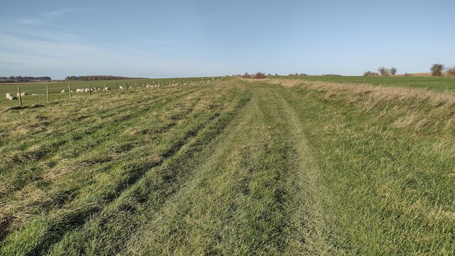
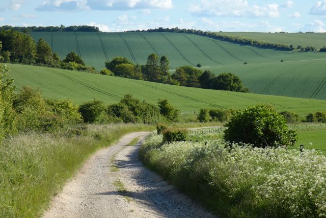
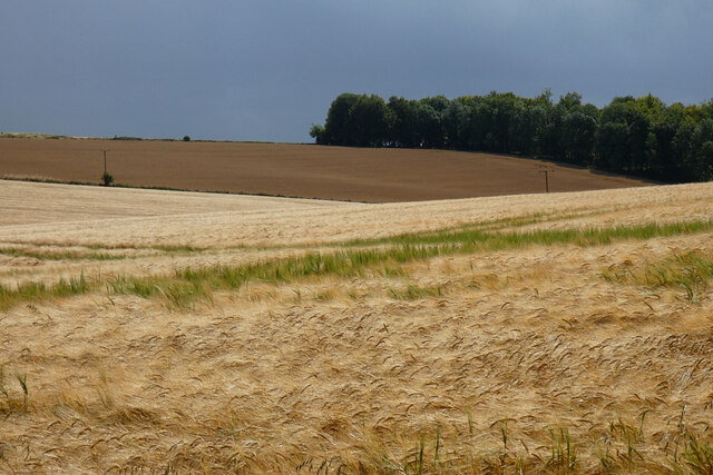
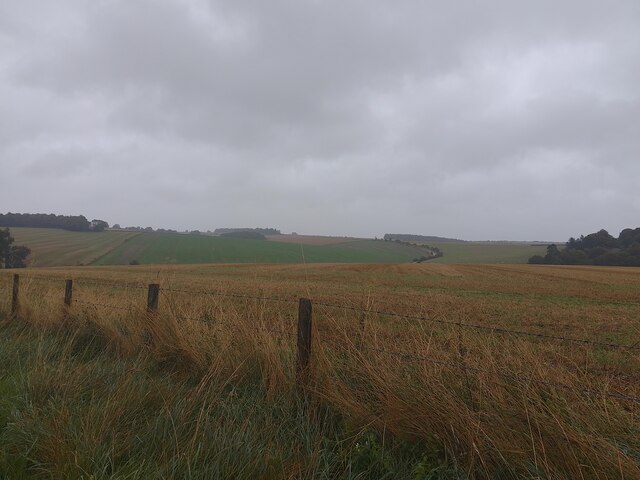
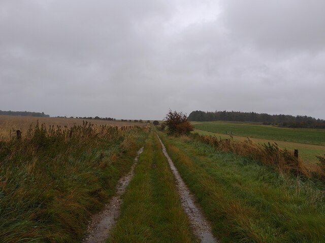
East Hendred Down is a picturesque area located in Berkshire, England. It is part of the larger Berkshire Downs, a range of rolling chalk hills in the southern part of the county. The down is known for its stunning views, diverse wildlife, and rich history.

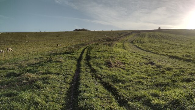
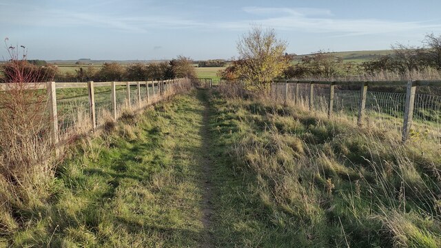
Covering an area of approximately 2 square kilometers, East Hendred Down is characterized by its open grassland, scattered trees, and patches of heather and gorse. The landscape is gently undulating, providing visitors with panoramic vistas of the surrounding countryside.

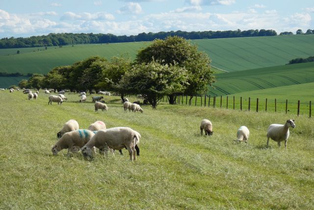
The down is home to a variety of plant and animal species, including rare orchids, butterflies, and birds. The diverse range of habitats, such as grassland, scrub, and woodland, supports a thriving ecosystem. Visitors can enjoy leisurely walks while observing the wildlife and taking in the natural beauty of the area.

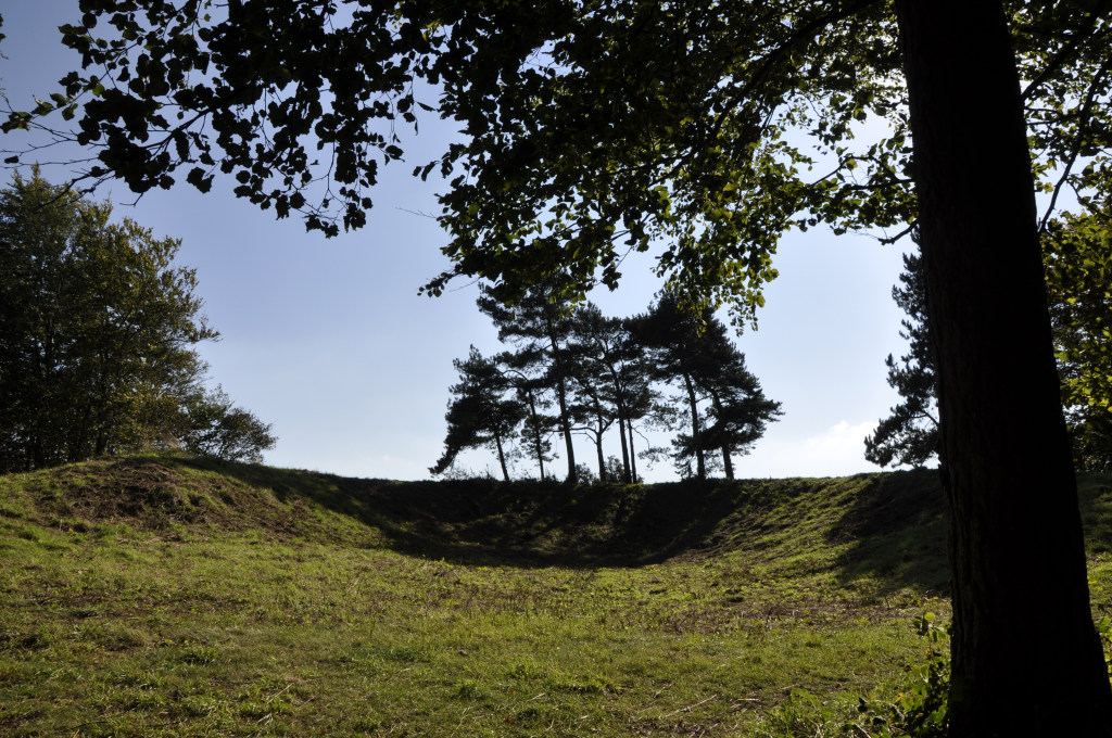
The history of East Hendred Down dates back centuries, with evidence of human activity in the form of ancient barrows and earthworks. The down was once used for grazing livestock, and remnants of ancient field systems can still be seen today. The area has also been a source of flint, and prehistoric tools have been discovered in the vicinity.

East Hendred Down offers a tranquil escape from the hustle and bustle of everyday life, providing visitors with an opportunity to connect with nature and explore the rich cultural heritage of the region. Whether hiking, birdwatching, or simply enjoying the serene surroundings, East Hendred Down offers a memorable experience for nature enthusiasts and history buffs alike.

If you have any feedback on the listing, please let us know in the comments section below.

East Hendred Down Images

Images are sourced within 2km of 51.561816/-1.335242 or Grid Reference SU4684. Thanks to Geograph Open Source API. All images are credited.

Bridleway heading onto Sheep Down From West Ilsley the bridleway heading onto Sheep Down
Bridleway heading onto Sheep Down
From West Ilsley the bridleway heading onto Sheep Down
Bridleway heading up to The Ridgeway From Stileway Road (track) the bridleway heading up East Hendred Down to The Ridgeway
Bridleway heading up to The Ridgeway
From Stileway Road (track) the bridleway heading up East Hendred Down to The Ridgeway
Bridleway joining the Byway From Stileway Road (track) the bridleway joining the byway coming down from The Ridgeway
Bridleway joining the Byway
From Stileway Road (track) the bridleway joining the byway coming down from The Ridgeway
Tree Lined Way Tree lined way (Designated traffic free cycle route) to East Ginge
Tree Lined Way
Tree lined way (Designated traffic free cycle route) to East Ginge
Pasture, West Ilsley
Byway and farmland, West Hendred
Farmland, Ardington Spring barley beside the bridleway at Down Barn.
Farmland, Ardington
Spring barley beside the bridleway at Down Barn.
Farmland and woodland, Ardington Spring barley beside the bridleway descending from the Ridgeway to Betterton.
Farmland and woodland, Ardington
Spring barley beside the bridleway descending from the Ridgeway to Betterton.
Bury Down Ridgeway Car Park The car park to the west of Bury Lane, for access to the Ridgeway. Lots of potholes that fill with water in rain. There is another car park that is slightly smaller to the east of Bury Lane.
Bury Down Ridgeway Car Park
The car park to the west of Bury Lane, for access to the Ridgeway. Lots of potholes that fill with water in rain. There is another car park that is slightly smaller to the east of Bury Lane.
Bury Down Ridgeway Car Park The car park to the east of Bury Lane, for access to the Ridgeway. There is another car park that is slightly larger to the west of Bury Lane, which can be seen in the distance.
Bury Down Ridgeway Car Park
The car park to the east of Bury Lane, for access to the Ridgeway. There is another car park that is slightly larger to the west of Bury Lane, which can be seen in the distance.
Oxfordshire from Berkshire The hill in the distance is in Oxfordshire, the field in the foreground is in Berkshire.
Oxfordshire from Berkshire
The hill in the distance is in Oxfordshire, the field in the foreground is in Berkshire.
Knollhill sheep Sheep on Knollhill, beside Copperage Road and a byway leading towards The Ridgeway. The signs say that The Ridgeway is closed to motor vehicles and that whilst this track is a byway, it is a dead end for motor vehicles as it leads to a restricted byway.
Knollhill sheep
Sheep on Knollhill, beside Copperage Road and a byway leading towards The Ridgeway. The signs say that The Ridgeway is closed to motor vehicles and that whilst this track is a byway, it is a dead end for motor vehicles as it leads to a restricted byway.
Byway towards Johnson's Farm A byway between Copperage Road and an entrance to Johnson's Farm.
Byway towards Johnson's Farm
A byway between Copperage Road and an entrance to Johnson's Farm.
Soggy sheep Sheep not enjoying the rain on Knollhill, in the Berkshire Downs.
Soggy sheep
Sheep not enjoying the rain on Knollhill, in the Berkshire Downs.
Byway towards Johnson's Farm A byway between Copperage Road and an entrance to Johnson's Farm.
Byway towards Johnson's Farm
A byway between Copperage Road and an entrance to Johnson's Farm.
Restricted byway towards Cwichelmeshlaew A restricted byway between a byway near an entrance to Johnson's Farm and Cwichelmeshlaew (alternatively known as Scutchamer Knob, Cuckhamsley Hill, Scotsman's Knob, Beacon Hill or Cwichelm's Barrow): the location where King Edwin of Northumbria killed King Cwichelm of Wessex in 636.
Restricted byway towards Cwichelmeshlaew
A restricted byway between a byway near an entrance to Johnson's Farm and Cwichelmeshlaew (alternatively known as Scutchamer Knob, Cuckhamsley Hill, Scotsman's Knob, Beacon Hill or Cwichelm's Barrow): the location where King Edwin of Northumbria killed King Cwichelm of Wessex in 636.
Show me another place!

East Hendred Down is located at Grid Ref: SU4684 (Lat: 51.561816, Lng: -1.335242)

Administrative County: Oxfordshire

District: Vale of White Horse

Police Authority: Thames Valley

What 3 Words

///digestion.inclined.hardens. Near West Ilsley, Berkshire

Related Wikis

Scutchamer Knob

Scutchamer Knob, also known as Cuckhamsley Hill and occasionally as Scotsman's Knob or Beacon Hill, is an early Iron Age round barrow on the Ridgeway National...

PLUTO reactor

PLUTO was a materials testing nuclear reactor housed at the Atomic Energy Research Establishment, a former Royal Air Force airfield at Harwell, Oxfordshire...

DIDO (nuclear reactor)

DIDO was a materials testing nuclear reactor at the Atomic Energy Research Establishment at Harwell, Oxfordshire in the United Kingdom. It used enriched...

The Ridgeway

The Ridgeway is a ridgeway or ancient trackway described as Britain's oldest road. The section clearly identified as an ancient trackway extends from Wiltshire...

KARMEN

KARMEN (KArlsruhe Rutherford Medium Energy Neutrino experiment), a detector associated with the ISIS synchrotron at the Rutherford Appleton Laboratory...

ENGIN-X

ENGIN-X is the dedicated materials engineering beamline at the ISIS Neutron and Muon Source in the UK. The beamline uses neutron diffraction to determine...

ISIS Neutron and Muon Source

The ISIS Neutron and Muon Source is a pulsed neutron and muon source, established 1984 at the Rutherford Appleton Laboratory of the Science and Technology...

Central Laser Facility

Central Laser Facility (CLF) is a research facility in the UK. It is part of the Rutherford Appleton Laboratory. The facility is dedicated to studying...

Nearby Amenities

Located within 500m of 51.561816,-1.335242
Barrier: bollard
Bicycle: yes
Foot: yes
Horse: yes
Lat/Long: 51.5608508/-1.3342958
Barrier: bollard
Bicycle: yes
Foot: yes
Horse: yes
Lat/Long: 51.5607687/-1.3344838
East Hendred Down
Place: locality
Source: OS_OpenData_StreetView
Source Name: OS_OpenData_StreetView
Lat/Long: 51.5632325/-1.3358434
Information: guidepost
Tourism: information
Lat/Long: 51.5622511/-1.3403293
Bench
Lat/Long: 51.5613138/-1.3381073
The data included in this document is from www.openstreetmap.org. The data is made available under ODbL.

Have you been to East Hendred Down?

Leave your review of East Hendred Down below (or comments, questions and feedback).