Baldersby Park

Downs, Moorland in Yorkshire Harrogate

England

Baldersby Park

Topcliffe, Salmon Hall The benchmark is cut into the north face of Salmon Hall.
Topcliffe, Salmon Hall Credit: Mel Towler

Baldersby Park is a picturesque estate located in the heart of Yorkshire, England. The park is nestled amidst the stunning landscape of the Yorkshire Downs and Moorland, offering visitors breathtaking views and a serene atmosphere. Covering an extensive area, the park is renowned for its natural beauty and diverse range of flora and fauna.

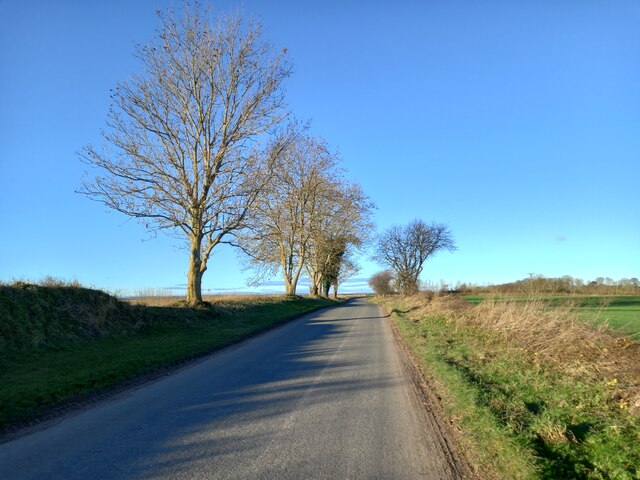
The park boasts rolling hills and expansive meadows, providing ample space for outdoor activities such as hiking, cycling, and picnicking. The Yorkshire Downs, which surround the park, offer stunning panoramic views of the countryside, making it a popular destination for nature enthusiasts and photographers alike.

In addition to its natural splendor, Baldersby Park is also home to a variety of wildlife. Visitors may spot rabbits, foxes, and a wide array of bird species as they explore the park's trails and pathways. The park's diverse ecosystem is carefully maintained to ensure the preservation of its natural habitats.

The park's facilities include well-maintained walking paths, picnic areas, and restroom facilities. There are also designated areas for camping and caravaning, allowing visitors to fully immerse themselves in the tranquility of the park.

Baldersby Park is conveniently located near several charming villages, providing visitors with opportunities to explore the local culture and enjoy traditional Yorkshire hospitality. With its stunning scenery and peaceful ambiance, Baldersby Park is a must-visit destination for those seeking an escape from the hustle and bustle of city life.

If you have any feedback on the listing, please let us know in the comments section below.

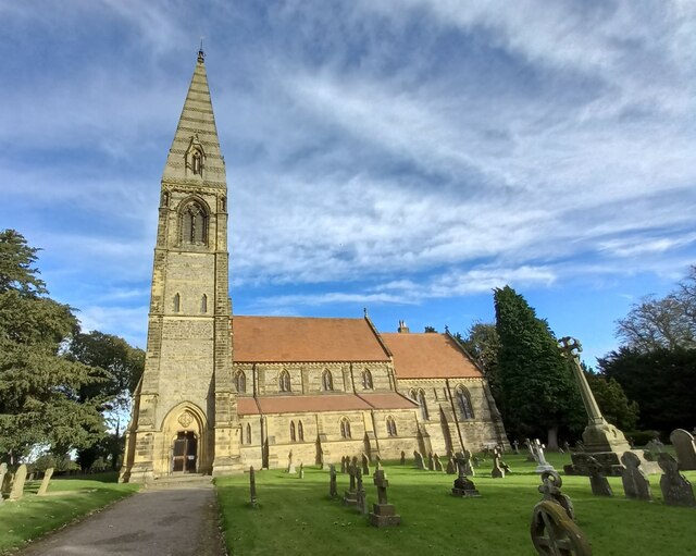
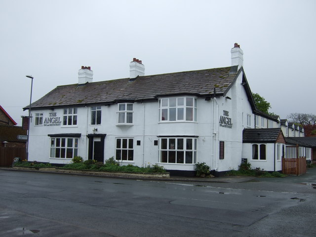
Baldersby Park Images

Images are sourced within 2km of 54.178018/-1.4162921 or Grid Reference SE3875. Thanks to Geograph Open Source API. All images are credited.

Topcliffe, Salmon Hall The benchmark is cut into the north face of Salmon Hall.
Topcliffe, Salmon Hall
The benchmark is cut into the north face of Salmon Hall.
Topcliffe, Salmon Hall There is a benchmark cut into the north facing wall of Salmon Hall.
Topcliffe, Salmon Hall
There is a benchmark cut into the north facing wall of Salmon Hall.
Catton, Catton Lane According to the OS database the gatepost at this field entrance had a benchmark cut into one of the posts. Today wooden gateposts are in place.
Catton, Catton Lane
According to the OS database the gatepost at this field entrance had a benchmark cut into one of the posts. Today wooden gateposts are in place.
Baldersby St James church The benchmark is cut into a south facing wall of the church.
Baldersby St James church
The benchmark is cut into a south facing wall of the church.
Baldersby St James church There is a benchmark cut into the south facing wall of the church. It is located on the first buttress to the right of the church tower, immediately right of the drainpipe.
Baldersby St James church
There is a benchmark cut into the south facing wall of the church. It is located on the first buttress to the right of the church tower, immediately right of the drainpipe.
Rainton, Bay Horse Inn The benchmark is cut into the gable end of the village pub <a title="https://www.geograph.org.uk/photo/7116958" href="https://www.geograph.org.uk/photo/7116958">Link</a>.
Rainton, Bay Horse Inn
The benchmark is cut into the gable end of the village pub Link.
Rainton, Bay Horse Inn There is a benchmark <a title="https://www.geograph.org.uk/photo/7116955" href="https://www.geograph.org.uk/photo/7116955">Link</a> cut into the gable end of the village pub. It is below the Car Park sign attached to the wall.
Rainton, Bay Horse Inn
There is a benchmark Link cut into the gable end of the village pub. It is below the Car Park sign attached to the wall.
Rainton, private house The benchmark is cut into a left hand cornerstone of a private house which has been an agricultural barn.
Rainton, private house
The benchmark is cut into a left hand cornerstone of a private house which has been an agricultural barn.
Rainton, private house There is a benchmark cut into a left hand cornerstone of the private house which has been converted from an agricultural barn. The benchmark is to the left of the drainpipe.
Rainton, private house
There is a benchmark cut into a left hand cornerstone of the private house which has been converted from an agricultural barn. The benchmark is to the left of the drainpipe.
A167 about to join the A168 South of Asenby
A167 about to join the A168
South of Asenby
Rainton, Back Lane
Rainton, Back Lane
Wheat field, Asenby Ripening wheat in a field at Asenby. The tower of St Columba's Church in Topcliffe in the background.
Wheat field, Asenby
Ripening wheat in a field at Asenby. The tower of St Columba's Church in Topcliffe in the background.
Nᴼ 1 Long Street, Topcliffe Though not apparently using the appellation of "<a href="https://www.geograph.org.uk/photo/643756">SE3975 : Old Toll Cottage, Topcliffe</a>" today,
the building was where the Toll Gate served the Boroughbridge & Durham Turnpike Trust in 1853.
Confusingly there is <a href="https://www.geograph.org.uk/photo/5827100">SE4075 : The Toll Booth</a> which was used for courts leet and market tolls.
The base and steps of the Grade II listed Central (market) cross still stand
near the post office <a href="https://www.geograph.org.uk/photo/6068994">SE4075 : Old Central Cross by the A167, Long Street, Topcliffe</a>.

Milestone Society National ID: YN.TOP02
Nᴼ 1 Long Street, Topcliffe
Though not apparently using the appellation of "SE3975 : Old Toll Cottage, Topcliffe" today, the building was where the Toll Gate served the Boroughbridge & Durham Turnpike Trust in 1853. Confusingly there is SE4075 : The Toll Booth which was used for courts leet and market tolls. The base and steps of the Grade II listed Central (market) cross still stand near the post office SE4075 : Old Central Cross by the A167, Long Street, Topcliffe. Milestone Society National ID: YN.TOP02
Wide Howe Lane, Asenby Quiet side road on the fringe of Asenby village.
Wide Howe Lane, Asenby
Quiet side road on the fringe of Asenby village.
The Angel, Topcliffe
The Angel Inn
The Angel Inn
The Angel An examination of photographs taken of the Angel in recent years will reveal some changes, the most notable being in 2013/4 when the inn was bought and thoroughly refurbished following several years of slow decline.  The upgrade has resulted in high quality accommodation and upgraded facilities both inside and out, plus a notable increase in trade.
The Angel
An examination of photographs taken of the Angel in recent years will reveal some changes, the most notable being in 2013/4 when the inn was bought and thoroughly refurbished following several years of slow decline. The upgrade has resulted in high quality accommodation and upgraded facilities both inside and out, plus a notable increase in trade.
Show me another place!

Baldersby Park is located at Grid Ref: SE3875 (Lat: 54.178018, Lng: -1.4162921)

Division: North Riding

Administrative County: North Yorkshire

District: Harrogate

Police Authority: North Yorkshire

What 3 Words

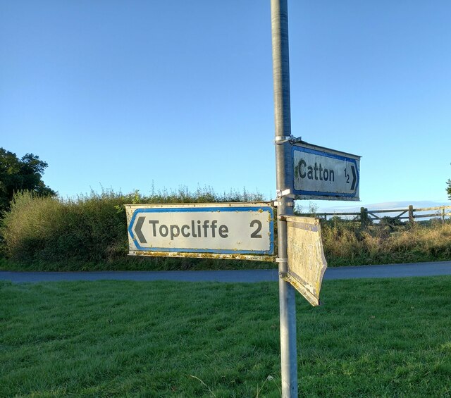
///perfumes.classed.glass. Near Thirsk, North Yorkshire

Related Wikis

Queen Mary's School

Queen Mary's School is a private day and boarding school for girls in Baldersby Park near Topcliffe, between Ripon and Thirsk in North Yorkshire, England...

Rainton

Rainton is a village in the Harrogate borough of North Yorkshire, England. It is situated about 6 miles (9.7 km) north of Boroughbridge, 5 miles (8 km...

Asenby

Asenby is a village and civil parish in the Harrogate district of North Yorkshire, England, with a population of 285 (2001 census), increasing to 311 at...

The Old Parsonage, Baldersby

The Old Parsonage is a historic building in Baldersby St James, a village in North Yorkshire, in England. The house was commissioned by William Dawnay...

Related Videos

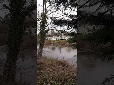
SWALESIDE VIEW DECEMBER 2023.

A VIEW OF THE RIVER SWALE AND SWALESIDE HOLIDAY PARK TOPCLIFFE NORTH YORKSHIRE ON CHRISTMAS DAY ...

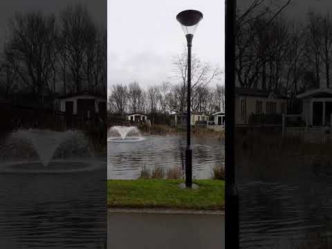
SWALESIDE HOLIDAY HOME PARK ,TOPCLIFFE NORTH YORKSHIRE 2024.

A VIEW OF THE SMALL LAKE AND WATER FEATURE AT SWALESIDE HOLIDAY HOME PARK IN THE PICTURESQUE ...

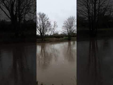
A RIVER RUNS THROUGH IT ! MAN VERSUS NATURE TOPCLIFFE HOLIDAY PARK.

FEBRUARY 2024 AND I'M HOPI G THE RIVER SWALE DOESN'T GET ANY HIGHER!! I FILMED THE WATER LEVEL IN ...

Nearby Amenities

Located within 500m of 54.178018,-1.4162921
Note: FIXME - way continues; survey required
Lat/Long: 54.1765292/-1.4159011
The data included in this document is from www.openstreetmap.org. The data is made available under ODbL.

Have you been to Baldersby Park?

Leave your review of Baldersby Park below (or comments, questions and feedback).