Capp's Lodge Plain

Downs, Moorland in Oxfordshire West Oxfordshire

England

Capp's Lodge Plain

A361 Looking south along the A361 on Shipton Down.
A361 Credit: Ian Capper

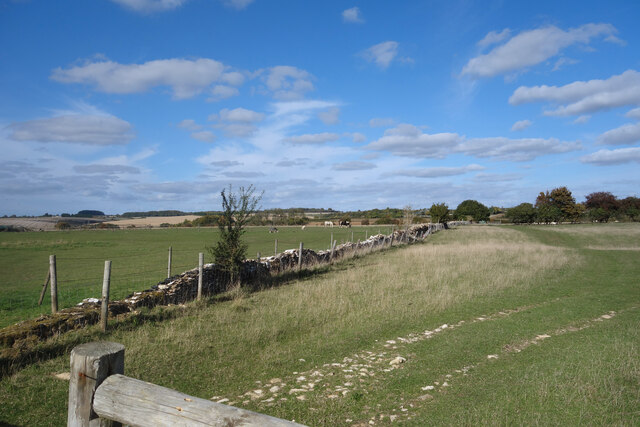
Capp's Lodge Plain is a picturesque area located in Oxfordshire, England. Situated on the outskirts of the county, it is known for its stunning downs and moorland landscape. The plain stretches across a vast expanse, covering an area of approximately 500 acres.

The landscape of Capp's Lodge Plain is characterized by gently rolling hills, covered in lush green grass and scattered with wildflowers. The area is a haven for nature enthusiasts and wildlife lovers, as it is home to a diverse range of flora and fauna. Visitors can spot various species of birds, small mammals, and butterflies fluttering around the meadows.

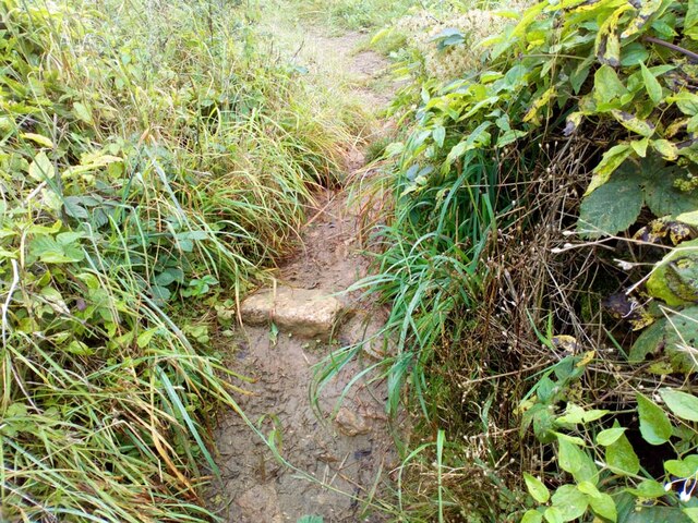
The plain offers breathtaking views of the surrounding countryside, with the distant Oxfordshire hills visible on the horizon. The unspoiled beauty of the area makes it an ideal destination for hiking and walking enthusiasts, who can explore the numerous footpaths and trails that crisscross the plain.

Capp's Lodge Plain is also steeped in history and folklore. It is said to have been a popular meeting place for locals in ancient times, and there are remnants of ancient burial mounds and stone circles that can still be seen today. The area has also been mentioned in several literary works, further adding to its charm and mystique.

In conclusion, Capp's Lodge Plain in Oxfordshire offers a serene and idyllic escape from the hustle and bustle of city life. With its rolling hills, vibrant wildlife, and rich history, it is a must-visit destination for nature lovers and those seeking a tranquil retreat in the heart of the English countryside.

If you have any feedback on the listing, please let us know in the comments section below.

Capp's Lodge Plain Images

Images are sourced within 2km of 51.826506/-1.6088043 or Grid Reference SP2714. Thanks to Geograph Open Source API. All images are credited.

A361 Looking south along the A361 on Shipton Down.
A361
Looking south along the A361 on Shipton Down.
Shipton Down A field alongside the A361 on Shipton Down.
Shipton Down
A field alongside the A361 on Shipton Down.
Shipton Down A field alongside the A361 on Shipton Down.
Shipton Down
A field alongside the A361 on Shipton Down.
Between Swinbrook and Fulbrook Fields and old walls along a country lane.
Between Swinbrook and Fulbrook
Fields and old walls along a country lane.
Berries on the Wall An assortment of plants scramble over a neglected stone wall along a lane near Swinbrook.
Berries on the Wall
An assortment of plants scramble over a neglected stone wall along a lane near Swinbrook.
A Well Fenced Wall Maintaining old dry stone walls is a laborious and expensive business and nowadays is usually only done for cosmetic reasons.
Out in the fields, post and wire fencing is a lot easier. This wall is fenced on both sides.
A Well Fenced Wall
Maintaining old dry stone walls is a laborious and expensive business and nowadays is usually only done for cosmetic reasons. Out in the fields, post and wire fencing is a lot easier. This wall is fenced on both sides.
Beech Grove, Fulbrook Coming into Fulbrook along the road from Swinbrook.
Beech Grove, Fulbrook
Coming into Fulbrook along the road from Swinbrook.
Beech Grove, Fulbrook Coming into Fulbrook along the road from Swinbrook.
Beech Grove, Fulbrook
Coming into Fulbrook along the road from Swinbrook.
Stone Stile, Fulbrook On Oxfordshire footpath 220 1/10 in the Northern churchyard wall looking North. The view South to the village and church is <a href="https://www.geograph.org.uk/photo/7610945">SP2513 : Stone Stile, Fulbrook</a>.
Stone Stile, Fulbrook
On Oxfordshire footpath 220 1/10 in the Northern churchyard wall looking North. The view South to the village and church is SP2513 : Stone Stile, Fulbrook.
Stone Stile, Fulbrook On Oxfordshire footpath 220 1/10 in the Northern churchyard wall looking South to the village. The view North is <a href="https://www.geograph.org.uk/photo/7610944">SP2513 : Stone Stile, Fulbrook</a>.
Stone Stile, Fulbrook
On Oxfordshire footpath 220 1/10 in the Northern churchyard wall looking South to the village. The view North is SP2513 : Stone Stile, Fulbrook.
Stone Stile, Fulbrook On Oxfordshire footpath 220 1/10 looking in from Upper End. The view out is <a href="https://www.geograph.org.uk/photo/7610957">SP2513 : Stone Stile, Fulbrook</a>.
Stone Stile, Fulbrook
On Oxfordshire footpath 220 1/10 looking in from Upper End. The view out is SP2513 : Stone Stile, Fulbrook.
Stone Stile, Fulbrook On Oxfordshire footpath 220 1/10 looking out towards Upper End. The view in is <a href="https://www.geograph.org.uk/photo/7610954">SP2513 : Stone Stile, Fulbrook</a>.
Stone Stile, Fulbrook
On Oxfordshire footpath 220 1/10 looking out towards Upper End. The view in is SP2513 : Stone Stile, Fulbrook.
Stone Stile, Fulbrook A private stile for Fulbrook House, redundant due to the fence in front. The view over the fence is <a href="https://www.geograph.org.uk/photo/7610991">SP2513 : Stone Stile, Fulbrook</a>.
Stone Stile, Fulbrook
A private stile for Fulbrook House, redundant due to the fence in front. The view over the fence is SP2513 : Stone Stile, Fulbrook.
Stone Stile, Fulbrook A private stile for Fulbrook House, redundant due to the fence in front. The view with the fence is <a href="https://www.geograph.org.uk/photo/7610989">SP2513 : Stone Stile, Fulbrook</a>.
Stone Stile, Fulbrook
A private stile for Fulbrook House, redundant due to the fence in front. The view with the fence is SP2513 : Stone Stile, Fulbrook.
Stone Stile, Fulbrook A "Fallen Idle" stile, what is left of a gap in the wall on Oxfordshire footpath 220/7/10 NE of the village.
Stone Stile, Fulbrook
A "Fallen Idle" stile, what is left of a gap in the wall on Oxfordshire footpath 220/7/10 NE of the village.
Fulbrook church
Fulbrook church
Beech Grove Farm, Fulbrook View looking west from the road
Beech Grove Farm, Fulbrook
View looking west from the road
Fulbrook Looking south-west, entering the village on the A361
Fulbrook
Looking south-west, entering the village on the A361
Show me another place!

Capp's Lodge Plain is located at Grid Ref: SP2714 (Lat: 51.826506, Lng: -1.6088043)

Administrative County: Oxfordshire

District: West Oxfordshire

Police Authority: Thames Valley

What 3 Words

///doped.dive.offstage. Near Burford, Oxfordshire
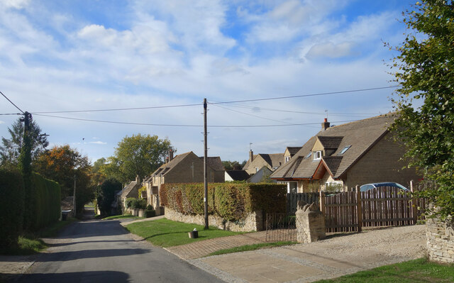
Related Wikis

Fulbrook, Oxfordshire

Fulbrook is a village and civil parish immediately northeast of Burford in West Oxfordshire. The 2011 Census recorded the parish's population as 437....

Swinbrook and Widford

Swinbrook and Widford is a civil parish in West Oxfordshire district, in the county of Oxfordshire, England. It comprises the village of Swinbrook and...

Swinbrook

Swinbrook is a village and former civil parish, now in the parish of Swinbrook and Widford, in the West Oxfordshire district, in the county of Oxfordshire...

Widford, Oxfordshire

Widford is a deserted medieval village on the River Windrush about 1.5 miles (2.4 km) east of Burford in West Oxfordshire. The village was an exclave of...

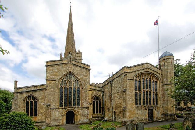
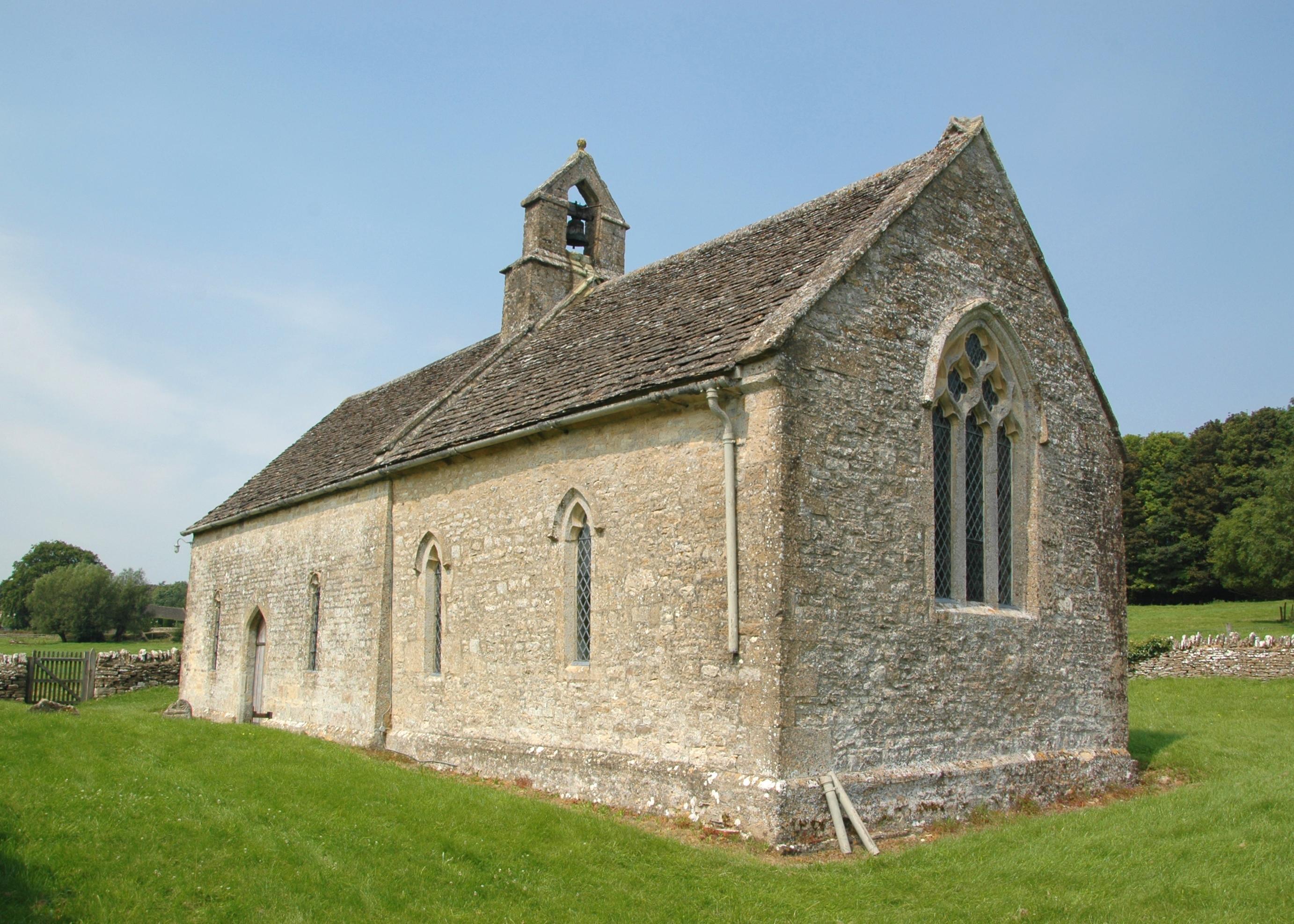
Church of St John the Baptist, Burford

The Anglican Church of St John the Baptist in Burford, Oxfordshire, England is a Grade I listed building.The Church of England parish church is dedicated...

Burford Methodist Church

Burford Methodist Church is a baroque building in the High Street of Burford, Oxfordshire. It was built between about 1715 and 1730 as a private house...
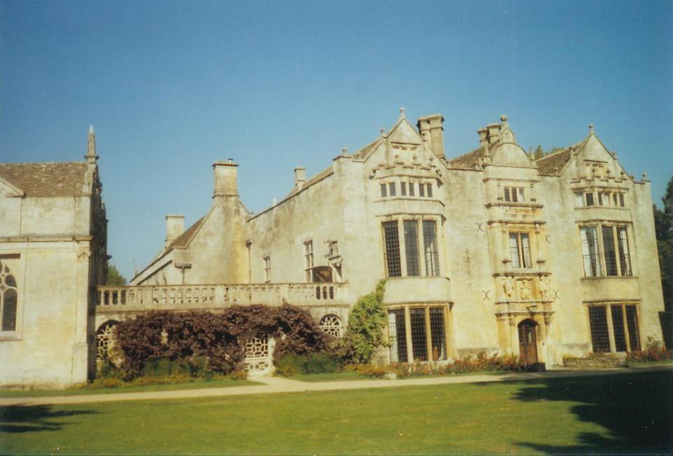
Burford Priory

Burford Priory is a Grade I listed country house and former priory at Burford in West Oxfordshire, England owned by Elisabeth Murdoch, daughter of Rupert...
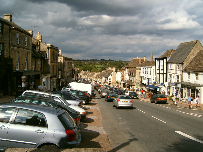
Burford

Burford () is a town on the River Windrush, in the Cotswold hills, in the West Oxfordshire district of Oxfordshire, England. It is often referred to as...

Nearby Amenities

Located within 500m of 51.826506,-1.6088043
Power: pole
Source: Bing
Lat/Long: 51.8296664/-1.6134102
Power: pole
Source: Bing
Lat/Long: 51.8301587/-1.607343
Power: pole
Source: Bing
Lat/Long: 51.8299184/-1.6104195
Power: pole
Source: Bing
Lat/Long: 51.829794/-1.6119589
Power: pole
Source: Bing
Lat/Long: 51.8300393/-1.6088692
Power: pole
Lat/Long: 51.8223537/-1.6101536
Power: pole
Lat/Long: 51.8225397/-1.609129
Power: pole
Lat/Long: 51.823018/-1.6069327
Power: pole
Lat/Long: 51.8235783/-1.6068047
Power: pole
Lat/Long: 51.8224193/-1.6070694
Power: pole
Lat/Long: 51.8222016/-1.6082181
The data included in this document is from www.openstreetmap.org. The data is made available under ODbL.

Have you been to Capp's Lodge Plain?

Leave your review of Capp's Lodge Plain below (or comments, questions and feedback).