Fountains Park

Downs, Moorland in Yorkshire Harrogate

England

Fountains Park

Middycar Bank Looking along the treelined road to Sawley.
Middycar Bank Credit: DS Pugh

Fountains Park is a picturesque estate located in the heart of Yorkshire, England. It is nestled amidst the stunning landscapes of the Yorkshire Downs and Moorland, offering visitors a serene and breathtaking experience. Covering an extensive area of land, the park is home to a variety of natural wonders and historical landmarks.

One of the park's standout features is the majestic Fountains Abbey, a UNESCO World Heritage site. Founded in 1132, the abbey ruins are beautifully preserved, allowing visitors to step back in time and explore the rich history of the area. Adjacent to the abbey is the tranquil Studley Royal Water Garden, a stunning 18th-century landscape garden with elegant lakes, cascades, and impressive vistas.

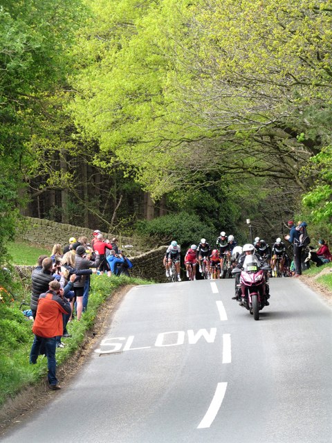
The park is also renowned for its diverse wildlife and nature trails, which attract nature enthusiasts and hikers from all over. Visitors can spot deer, rabbits, and a wide variety of bird species as they wander through the park's lush greenery. The park's extensive network of footpaths and bridleways allows visitors to explore the stunning surroundings at their own pace.

For those seeking a more relaxed experience, the park offers peaceful picnic spots, where visitors can enjoy a leisurely lunch while taking in the stunning views. Additionally, there are several cafes and restaurants within the park, offering a range of delicious local cuisines.

Fountains Park truly caters to all interests, whether it be history, nature, or simply enjoying the tranquility of the Yorkshire countryside. With its captivating beauty and rich heritage, it is no wonder that Fountains Park is a beloved destination for locals and tourists alike.

If you have any feedback on the listing, please let us know in the comments section below.

Fountains Park Images

Images are sourced within 2km of 54.090415/-1.5983085 or Grid Reference SE2666. Thanks to Geograph Open Source API. All images are credited.

Middycar Bank Looking along the treelined road to Sawley.
Middycar Bank
Looking along the treelined road to Sawley.
Farmland near Green Bank Wood Looking across Fountains Park towards The Dean.
Farmland near Green Bank Wood
Looking across Fountains Park towards The Dean.
Rough House From the road to Fountains Abbey.
Rough House
From the road to Fountains Abbey.
How Hill Tower It seems rather odd that the OS map should show this as a church as it has not served that function for several hundred years. Originally built by the monks of nearby Fountains Abbey as a chapel dedicated to St Michael the Archangel sometime before 1346, it became something of a pilgrimage site during the middle ages with a winding pathway leading up the hill which would allow pilgrims views to the abbey and towards both Ripon and York Minsters, the latter being at least 25 miles away. It survived as a chapel for a while after the dissolution, but there's a lack of records after 1570 suggesting that it had fallen out of use.
The current tower, minus some later additions, is the work of John Aislabie who acquired the property around 1717 and rebuilt it as an 'eyecatcher' soon after in 1719, the idea being that it would form the focal point to the view from the proposed new mansion above the NE end of the lake [SE282695 - but never built], with a line of sight along the length of the new canal through the water gardens.   The stone pyramidical roof and four sided cross on the top suggest a Masonic link.  The tower has undergone some further restoration in recent years and is worth visiting for the extensive view in all directions.
How Hill Tower
It seems rather odd that the OS map should show this as a church as it has not served that function for several hundred years. Originally built by the monks of nearby Fountains Abbey as a chapel dedicated to St Michael the Archangel sometime before 1346, it became something of a pilgrimage site during the middle ages with a winding pathway leading up the hill which would allow pilgrims views to the abbey and towards both Ripon and York Minsters, the latter being at least 25 miles away. It survived as a chapel for a while after the dissolution, but there's a lack of records after 1570 suggesting that it had fallen out of use. The current tower, minus some later additions, is the work of John Aislabie who acquired the property around 1717 and rebuilt it as an 'eyecatcher' soon after in 1719, the idea being that it would form the focal point to the view from the proposed new mansion above the NE end of the lake [SE282695 - but never built], with a line of sight along the length of the new canal through the water gardens. The stone pyramidical roof and four sided cross on the top suggest a Masonic link. The tower has undergone some further restoration in recent years and is worth visiting for the extensive view in all directions.
North from How Hill A gap in the trees allows a view towards Abbot Huby's Tower at Fountains Abbey with the spire of St Mary's Church in Studley Park beyond.
North from How Hill
A gap in the trees allows a view towards Abbot Huby's Tower at Fountains Abbey with the spire of St Mary's Church in Studley Park beyond.
North east from How Hill The view towards Ripon, where the Minster is clearly visible near the centre of the photo. In the distance, some 22 miles away is the Hambleton Hill escarpment north of Sutton Bank.
North east from How Hill
The view towards Ripon, where the Minster is clearly visible near the centre of the photo. In the distance, some 22 miles away is the Hambleton Hill escarpment north of Sutton Bank.
East from How Hill The line of trees and hedges in the near distance mark the route of Whitcliffe lane, an ancient route heading towards Ripon and names after the pale limestone cliffs further down the River Skell. The land by Whitcliffe lane was once farmed by Fountains Abbey who had a grange at Morcar.
East from How Hill
The line of trees and hedges in the near distance mark the route of Whitcliffe lane, an ancient route heading towards Ripon and names after the pale limestone cliffs further down the River Skell. The land by Whitcliffe lane was once farmed by Fountains Abbey who had a grange at Morcar.
West from How Hill The view here is across an area known as Fountains Park, which in the medieval period was a hunting park. It is said that Abbot Huby was rather more interested in hunting game than in religious matters. The land rises gradually in this direction towards the east Pennine moors.
West from How Hill
The view here is across an area known as Fountains Park, which in the medieval period was a hunting park. It is said that Abbot Huby was rather more interested in hunting game than in religious matters. The land rises gradually in this direction towards the east Pennine moors.
South east from How Hill Taken from the slopes of How Hill where a permissive path leads down to the road. The view south eastwards is towards Knaresborough where the spire of Holy Trinity Church is just visible on the horizon.
South east from How Hill
Taken from the slopes of How Hill where a permissive path leads down to the road. The view south eastwards is towards Knaresborough where the spire of Holy Trinity Church is just visible on the horizon.
Here comes the peloton The final few miles of stage two of the 'Tour de Yorkshire' of 2017 and the peloton has swept up any breakaway riders from earlier in the day. At this point there is still some 10 miles left before the finish in Harrogate and the riders have just ascended a short but steep bank up from Hebden Gill.
Here comes the peloton
The final few miles of stage two of the 'Tour de Yorkshire' of 2017 and the peloton has swept up any breakaway riders from earlier in the day. At this point there is still some 10 miles left before the finish in Harrogate and the riders have just ascended a short but steep bank up from Hebden Gill.
Tour de Yorkshire 2017 The riders in the peloton reach the top of the short but steep Hebden Gill Bank as they race the final 10 miles or so of stage two from Tadcaster to Harrogate. This race, now into its third year, is becoming ever more popular, both with professional teams and with spectators, an estimated 2.2 million watching the race over some of Yorkshire's most testing roads over the three days.
Tour de Yorkshire 2017
The riders in the peloton reach the top of the short but steep Hebden Gill Bank as they race the final 10 miles or so of stage two from Tadcaster to Harrogate. This race, now into its third year, is becoming ever more popular, both with professional teams and with spectators, an estimated 2.2 million watching the race over some of Yorkshire's most testing roads over the three days.
Field off How Hill Road A cereal crop (wheat or barley? the image is not clear enough to make out which).
Field off How Hill Road
A cereal crop (wheat or barley? the image is not clear enough to make out which).
How Hill Tower There had been a church on this site since c.1200, serving the medieval village of Erlesholt which has now vanished. The present structure, also called the Chapel of Saint Michael de Monte, was built in 1718 (although incorporating medieval remains) and extended later in the century. Whether it was ever used as a chapel, or merely a folly, is a moot point. It is however listed grade 2* (list entry 1293874) and the site is a scheduled ancient monument.
How Hill Tower
There had been a church on this site since c.1200, serving the medieval village of Erlesholt which has now vanished. The present structure, also called the Chapel of Saint Michael de Monte, was built in 1718 (although incorporating medieval remains) and extended later in the century. Whether it was ever used as a chapel, or merely a folly, is a moot point. It is however listed grade 2* (list entry 1293874) and the site is a scheduled ancient monument.
How Hill Tower Other images of the grade II* listed building <span class="nowrap"><a title="https://www.historicengland.org.uk/listing/the-list/list-entry/1293874" rel="nofollow ugc noopener" href="https://www.historicengland.org.uk/listing/the-list/list-entry/1293874">Link</a><img style="margin-left:2px;" alt="External link" title="External link - shift click to open in new window" src="https://s1.geograph.org.uk/img/external.png" width="10" height="10"/></span> (good account of history) appear at <a title="https://www.geograph.org.uk/search.php?i=80270416" href="https://www.geograph.org.uk/search.php?i=80270416">Link</a> . View from Whitcliffe Lane.
How Hill Tower
Other images of the grade II* listed building LinkExternal link (good account of history) appear at Link . View from Whitcliffe Lane.
Monk Wall The medieval deer park pale surrounding Fountains Park is described at <span class="nowrap"><a title="https://www.historicengland.org.uk/listing/the-list/list-entry/1020120" rel="nofollow ugc noopener" href="https://www.historicengland.org.uk/listing/the-list/list-entry/1020120">Link</a><img style="margin-left:2px;" alt="External link" title="External link - shift click to open in new window" src="https://s1.geograph.org.uk/img/external.png" width="10" height="10"/></span> . "It is unusual for such a significant proportion of a monastic park pale to survive". At this point the feature is described as "a wall up to 0.5m high on the roadside with a stone bank 3m to the west". Much less snow across the Monk Wall within Abbey Fall Wood, as you might expect. Taken from Fountains Lane.
Monk Wall
The medieval deer park pale surrounding Fountains Park is described at LinkExternal link . "It is unusual for such a significant proportion of a monastic park pale to survive". At this point the feature is described as "a wall up to 0.5m high on the roadside with a stone bank 3m to the west". Much less snow across the Monk Wall within Abbey Fall Wood, as you might expect. Taken from Fountains Lane.
By Fountains Lane At the south end of Abbey Fall Wood. The wall in the foreground forms part of the line of the Monk Wall, but this short section does not form part of the ancient monument.
By Fountains Lane
At the south end of Abbey Fall Wood. The wall in the foreground forms part of the line of the Monk Wall, but this short section does not form part of the ancient monument.
Snowy fields at Ninevah From footpath 15 86/26/1, which proved unwalkable in ordinary boots just east of here, with standing water as the map hinted - but I'd hoped for a way through. The farm at Ninevah is just off to the right from this snowy scene, which has almost turned out to be in monochrome.
Snowy fields at Ninevah
From footpath 15 86/26/1, which proved unwalkable in ordinary boots just east of here, with standing water as the map hinted - but I'd hoped for a way through. The farm at Ninevah is just off to the right from this snowy scene, which has almost turned out to be in monochrome.
Pond by How Hill Beyond is How Hill Farm, with <a href="https://www.geograph.org.uk/photo/5637570">SE2767 : How Hill Tower</a> in the background. From Fountains Lane.
Pond by How Hill
Beyond is How Hill Farm, with SE2767 : How Hill Tower in the background. From Fountains Lane.
Show me another place!

Fountains Park is located at Grid Ref: SE2666 (Lat: 54.090415, Lng: -1.5983085)

Division: West Riding

Administrative County: North Yorkshire

District: Harrogate

Police Authority: North Yorkshire

What 3 Words

///unsettled.holdings.workloads. Near Ripon, North Yorkshire

Related Wikis

Sawley, North Yorkshire

Sawley is a village and civil parish in the Harrogate district of North Yorkshire, England. It is about 4 miles (6.4 km) west of Ripon. From this position...

Fountains Hall

Fountains Hall is a country house near Ripon in North Yorkshire, England, located within the World Heritage Site at Studley Royal Park which include the...

Fountains Abbey

Fountains Abbey is one of the largest and best preserved ruined Cistercian monasteries in England. It is located approximately 3 miles (5 km) south-west...

Bishop Thornton

Bishop Thornton is a village in the civil parish of Bishop Thornton, Shaw Mills and Warsill, in the Harrogate district of North Yorkshire, England. According...

Markington

Markington is a village in the Harrogate district, in the English county of North Yorkshire. The population of the civil parish (including Markenfield...

Ingerthorpe

Ingerthorpe is a hamlet and former civil parish about 7 miles (11 km) from Harrogate, now in the parish of Markington with Wallerthwaite, in the Harrogate...

Risplith

Risplith is a village in the civil parish of Sawley, in the Harrogate district of North Yorkshire, England. It is about 4 miles (6.4 km) west of Ripon...

Aldfield

Aldfield is a village and civil parish in the former Harrogate district of North Yorkshire, England, about three miles west of Ripon. It is the closest...

Nearby Amenities

Located within 500m of 54.090415,-1.5983085
Power: pole
Lat/Long: 54.0904202/-1.6057634
Power: pole
Lat/Long: 54.091869/-1.605514
The data included in this document is from www.openstreetmap.org. The data is made available under ODbL.

Have you been to Fountains Park?

Leave your review of Fountains Park below (or comments, questions and feedback).